Plouay
| Plouay Ploue | ||
|---|---|---|
| Commune | ||
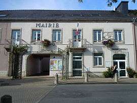 The town hall in Plouay | ||
| ||
 Plouay Location within Brittany region  Plouay | ||
| Coordinates: 47°54′56″N 3°20′02″W / 47.9156°N 3.3339°WCoordinates: 47°54′56″N 3°20′02″W / 47.9156°N 3.3339°W | ||
| Country | France | |
| Region | Brittany | |
| Department | Morbihan | |
| Arrondissement | Lorient | |
| Canton | Guidel | |
| Intercommunality | Lorient Agglomération | |
| Government | ||
| • Mayor (2008—2014) | Jacques Le Nay | |
| Area1 | 67.33 km2 (26.00 sq mi) | |
| Population (1999)2 | 4,759 | |
| • Density | 71/km2 (180/sq mi) | |
| Time zone | UTC+1 (CET) | |
| • Summer (DST) | UTC+2 (CEST) | |
| INSEE/Postal code | 56166 /56240 | |
| Elevation |
13–164 m (43–538 ft) (avg. 83 m or 272 ft) | |
|
1 French Land Register data, which excludes lakes, ponds, glaciers > 1 km2 (0.386 sq mi or 247 acres) and river estuaries. 2 Population without double counting: residents of multiple communes (e.g., students and military personnel) only counted once. | ||
.svg.png)
Plouay (Breton: Ploue) is a commune in the Morbihan department in Brittany in north-western France.
Plouay hosts the GP Ouest-France and the GP de Plouay, annual cycling races (a men's and women's race, respectively). It was also the location of the UCI Road World Championships in 2000. The Tour de France has visited this town three times: in 1998, 2002 and in 2006.
Twin towns
Plouay is twinned with Pershore in England.
Demographics
Inhabitants of Plouay or Ploue are called Plouaysiens in French and Plouead (Ploueiz), Ploueadez (-ed) in Breton.[1]
Breton language
The municipality launched a linguistic plan through Ya d'ar brezhoneg on February the 10th of 2006.
In 2008, 11.56% of the children in Plouay attended Breton-French bilingual classes in primary education.[2]
See also
References
- Mayors of Morbihan Association (in French)
- INSEE commune file
- ↑ Portail géographique de la Bretagne - in French and Breton (accessed 29 July 2010).
- ↑ (in French) Ofis ar Brezhoneg: Enseignement bilingue
External links
| Wikimedia Commons has media related to Plouay. |
- Cultural Heritage (in French)
- Map of Plouay on Michelin (in English)
- Map showing location of Ploue in Breton