Locoal-Mendon
| Locoal-Mendon Lokoal-Mendon | |
|---|---|
| Commune | |
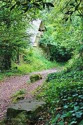 The path of Cadoudal, in Locoal-Mendon | |
 Locoal-Mendon Location within Brittany region  Locoal-Mendon | |
| Coordinates: 47°42′45″N 3°06′14″W / 47.7125°N 3.1039°WCoordinates: 47°42′45″N 3°06′14″W / 47.7125°N 3.1039°W | |
| Country | France |
| Region | Brittany |
| Department | Morbihan |
| Arrondissement | Lorient |
| Canton | Quiberon |
| Intercommunality | Ria d'Étel |
| Government | |
| • Mayor (2008—2014) | Louis Hervé |
| Area1 | 37.50 km2 (14.48 sq mi) |
| Population (1999)2 | 2,182 |
| • Density | 58/km2 (150/sq mi) |
| Time zone | UTC+1 (CET) |
| • Summer (DST) | UTC+2 (CEST) |
| INSEE/Postal code | 56119 /56550 |
| Elevation | 0–42 m (0–138 ft) |
|
1 French Land Register data, which excludes lakes, ponds, glaciers > 1 km2 (0.386 sq mi or 247 acres) and river estuaries. 2 Population without double counting: residents of multiple communes (e.g., students and military personnel) only counted once. | |
Locoal-Mendon (Breton: Lokoal-Mendon) is a commune in the Morbihan department of Brittany in north-western France.
Toponymy
Known as Locus Sancti Guitali in 1037 and Sanctus Gudualus in 1387. From the Breton lok which means hermitage (cf.: Locminé), and Goal which is a name for the Breton saint Gudwal, Gurval or Gutual, eponym also of Gulval. Mendon is derives probably from the Breton men which means rock and don which means deep.
Breton language
In 2008, there was 17,81% of the children attended the bilingual schools in primary education.[1]
See also
References
- ↑ (in French) Ofis ar Brezhoneg: Enseignement bilingue
External links
| Wikimedia Commons has media related to Locoal-Mendon. |
- French Ministry of Culture list for Locoal-Mendon (in French)
- Cultural Heritage (in French)
- Map of Locoal-Mendon on Michelin (in English)
- Mayors of Morbihan Association (in French)
- INSEE commune file
This article is issued from
Wikipedia.
The text is licensed under Creative Commons - Attribution - Sharealike.
Additional terms may apply for the media files.