Saint-Pierre-Quiberon
| Saint-Pierre-Quiberon Sant-Pêr-Kiberen | ||
|---|---|---|
| Commune | ||
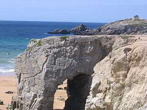 Port Blanc Arch | ||
| ||
 Saint-Pierre-Quiberon Location within Brittany region  Saint-Pierre-Quiberon | ||
| Coordinates: 47°35′15″N 2°59′56″W / 47.5875°N 2.9988°WCoordinates: 47°35′15″N 2°59′56″W / 47.5875°N 2.9988°W | ||
| Country | France | |
| Region | Brittany | |
| Department | Morbihan | |
| Arrondissement | Lorient | |
| Canton | Quiberon | |
| Government | ||
| • Mayor (2008—2014) | Geneviève Marchand | |
| Area1 | 7.54 km2 (2.91 sq mi) | |
| Population (1999)2 | 2,165 | |
| • Density | 290/km2 (740/sq mi) | |
| Time zone | UTC+1 (CET) | |
| • Summer (DST) | UTC+2 (CEST) | |
| INSEE/Postal code | 56234 /56510 | |
| Elevation | 0–26 m (0–85 ft) | |
|
1 French Land Register data, which excludes lakes, ponds, glaciers > 1 km2 (0.386 sq mi or 247 acres) and river estuaries. 2 Population without double counting: residents of multiple communes (e.g., students and military personnel) only counted once. | ||
.svg.png)
Saint-Pierre-Quiberon (Breton: Sant-Pêr-Kiberen) is a commune in the Morbihan department of Brittany in north-western France.
The commune occupies the northern part of the Quiberon peninsula, that it shares with the commune Quiberon.
Monuments
Fort Penthièvre dates from the 19th century.
Transport
Saint-Pierre-Quiberon railway station has a service to Auray, which offers connections to Paris and other places in France.
Demographics
Inhabitants of Saint-Pierre-Quiberon are called in French Saint-Pierrois.
See also
References
- Mayors of Morbihan Association (in French)
- INSEE commune file
External links
| Wikimedia Commons has media related to Saint-Pierre-Quiberon. |
- Official website (in French)
- French Ministry of Culture list for Saint-Pierre-Quiberon (in French)
- Map of Saint-Pierre-Quiberon on Michelin (in English)
This article is issued from
Wikipedia.
The text is licensed under Creative Commons - Attribution - Sharealike.
Additional terms may apply for the media files.