Le Roc-Saint-André
| Le Roc-Saint-André Roz-Sant-Andrev | ||
|---|---|---|
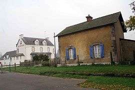 The former Roc-Saint-André-La Chapelle railway station | ||
| ||
 Le Roc-Saint-André Location within Brittany region  Le Roc-Saint-André | ||
| Coordinates: 47°51′55″N 2°26′52″W / 47.8653°N 2.4478°WCoordinates: 47°51′55″N 2°26′52″W / 47.8653°N 2.4478°W | ||
| Country | France | |
| Region | Brittany | |
| Department | Morbihan | |
| Arrondissement | Vannes | |
| Canton | Malestroit | |
| Intercommunality | Val d'Oust et de Lanvaux | |
| Government | ||
| • Mayor (2008—2014) | Joseph Legal | |
| Area1 | 9.93 km2 (3.83 sq mi) | |
| Population (1999)2 | 861 | |
| • Density | 87/km2 (220/sq mi) | |
| Time zone | UTC+1 (CET) | |
| • Summer (DST) | UTC+2 (CEST) | |
| INSEE/Postal code | 56197 /56460 | |
| Elevation | 16–123 m (52–404 ft) | |
|
1 French Land Register data, which excludes lakes, ponds, glaciers > 1 km2 (0.386 sq mi or 247 acres) and river estuaries. 2 Population without double counting: residents of multiple communes (e.g., students and military personnel) only counted once. | ||
.svg.png)
Le Roc-Saint-André (Breton: Roz-Sant-Andrev) is a former commune in the Morbihan department of Brittany in north-western France. On 1 January 2016, it was merged into the new commune Val d'Oust.[1]
Demographics
Inhabitants of Le Roc-Saint-André are called in French Roxédois.
See also
References
- ↑ Arrêté préfectoral 24 December 2015 (in French)
- Mayors of Morbihan Association (in French)
- INSEE commune file
External links
| Wikimedia Commons has media related to Le Roc-Saint-André. |
- Official website (in French)
- French Ministry of Culture list for Le Roc-Saint-André (in French)
- Map of Le Roc-Saint-André on Michelin (in English)
This article is issued from
Wikipedia.
The text is licensed under Creative Commons - Attribution - Sharealike.
Additional terms may apply for the media files.