Larmor-Baden
| Larmor-Baden An Arvor-Baden | ||
|---|---|---|
| Commune | ||
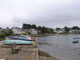 A view of the bay of Port Lagaden | ||
| ||
 Larmor-Baden Location within Brittany region  Larmor-Baden | ||
| Coordinates: 47°35′16″N 2°53′45″W / 47.5878°N 2.8958°WCoordinates: 47°35′16″N 2°53′45″W / 47.5878°N 2.8958°W | ||
| Country | France | |
| Region | Brittany | |
| Department | Morbihan | |
| Arrondissement | Vannes | |
| Canton | Vannes-2 | |
| Intercommunality | Golfe du Morbihan - Vannes Agglomération | |
| Government | ||
| • Mayor (2014–2020) | Denis Bertholom | |
| Area1 | 3.93 km2 (1.52 sq mi) | |
| Population (1999)2 | 954 | |
| • Density | 240/km2 (630/sq mi) | |
| Time zone | UTC+1 (CET) | |
| • Summer (DST) | UTC+2 (CEST) | |
| INSEE/Postal code | 56106 /56870 | |
| Elevation | 0–26 m (0–85 ft) | |
|
1 French Land Register data, which excludes lakes, ponds, glaciers > 1 km2 (0.386 sq mi or 247 acres) and river estuaries. 2 Population without double counting: residents of multiple communes (e.g., students and military personnel) only counted once. | ||
.svg.png)
Larmor-Baden (Breton: An Arvor-Baden) is a commune in the Morbihan department of Brittany in north-western France.
The inhabitants of Larmor-Baden are called in French Larmoriens.
Île de Berder
.jpg)
Île Berder in the Gulf of Morbihan.
Île de Berder (French for "The Island of Berder") is a small island off Larmor-Baden. In reality Berder is not a true island as it is attached to the mainland by submerged land that shows at low tide. The name Berder comes from the Breton word Breudeur, meaning brothers.
The island lies in the Gulf of Morbihan, and has a position relative to other islands:
- south of Port-Blanc
- north of île de la Jument
- west of île aux Moines
- east of île Longue and the mainland (Larmor-Baden).
See also
References
- Mayors of Morbihan Association (in French)
- INSEE commune file
External links
- French Ministry of Culture list for Larmor-Baden (in French)
- Map of Larmor-Baden on Michelin (in English)
| Wikimedia Commons has media related to Larmor-Baden. |
| Authority control |
|---|
This article is issued from
Wikipedia.
The text is licensed under Creative Commons - Attribution - Sharealike.
Additional terms may apply for the media files.