Camoël
| Camoël Kamoel | |
|---|---|
| Commune | |
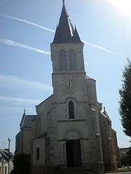 The church in Camoël | |
 Camoël Location within Brittany region  Camoël | |
| Coordinates: 47°28′58″N 2°23′36″W / 47.4828°N 2.3933°WCoordinates: 47°28′58″N 2°23′36″W / 47.4828°N 2.3933°W | |
| Country | France |
| Region | Brittany |
| Department | Morbihan |
| Arrondissement | Vannes |
| Canton | Muzillac |
| Intercommunality | Presqu'île de Guérande-Atlantique |
| Government | |
| • Mayor (2008—2014) | Guy Bertho |
| Area1 | 14.33 km2 (5.53 sq mi) |
| Population (1999)2 | 655 |
| • Density | 46/km2 (120/sq mi) |
| Time zone | UTC+1 (CET) |
| • Summer (DST) | UTC+2 (CEST) |
| INSEE/Postal code | 56030 /56130 |
| Elevation | 0–44 m (0–144 ft) |
|
1 French Land Register data, which excludes lakes, ponds, glaciers > 1 km2 (0.386 sq mi or 247 acres) and river estuaries. 2 Population without double counting: residents of multiple communes (e.g., students and military personnel) only counted once. | |
Camoël (Kamoel in Breton) is a commune in the Morbihan department of Brittany in north-western France.
Demographics
Inhabitants of Camoël are called in French Camoëlais.
See also
References
- Mayors of Morbihan Association (in French)
- INSEE commune file
External links
| Wikimedia Commons has media related to Camoël. |
- Map of Camoël on Michelin (in English)
This article is issued from
Wikipedia.
The text is licensed under Creative Commons - Attribution - Sharealike.
Additional terms may apply for the media files.