Rural Municipality of Pense No. 160
| Pense No. 160, Saskatchewan | |
|---|---|
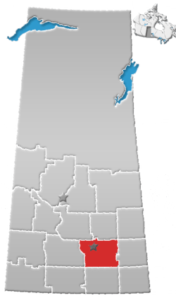
 Pense No. 160, Saskatchewan Location in Saskatchewan | |
| Coordinates: 50°29′35″N 105°08′44″W / 50.49306°N 105.14556°WCoordinates: 50°29′35″N 105°08′44″W / 50.49306°N 105.14556°W | |
| Country | Canada |
| Province | Saskatchewan |
| Local improvement district | 1897 |
| Rural Municipality | January 1, 1913 |
| Area | |
| • Total | 841.48 km2 (324.90 sq mi) |
| Population (2006) | |
| • Total | 490 |
| • Density | 0.6/km2 (2/sq mi) |
| Time zone | UTC-6 (UTC) |
Pense No. 160, Saskatchewan is a rural municipality of 490 rural residents (2006 census) in the southeastern part of Saskatchewan, Canada. The RM was incorporated January 1, 1913.[1] As of 1923, the population rose to 2227 residents.[2] Other localities in the area include Pense, Belle Plaine, Cottonwood, Eastview, Kalium, Keystown, Madrid, Pattee, Schulerville, Stelcam, Stony Beach, Stony Beach Airport[3][4] Within this RM are 600 kilometres (km) of roads of which the Trans Canada Highway is one of the main roads. Nicolle Flats Nature Area (Buffalo Pound Provincial Park) is located here as well.[5] The Burrowing Owl (Athene cunicularia), an endangered animal, makes its home in this area. Bigmouth Buffalo (Ictiobus cyprinellus) is of special concern in this ecoregion.[6]
The first municipal organization within the boundaries of the present municipality was formed in 1897 and consisted of one township Local Improvement Districts (L.I.D.s). Ratepayers decided at annual meetings what needed to be done. An overseer was hired to do the work. Taxes were levied to pay for the work. Ratepayers could pay their taxes by performing day labour.
In 1904 the L.I.D.s were replaced with larger L.I.D.s organized under the L.I.D. Ordinance of 1903. Four townships were included in this L.I.D. One councilor was elected for each township.
On December 13, 1909, L.I.D. Number 160 was organized with the same boundaries as the present municipality (nine townships).
— Pense No. 160[7]
A rural municipality is an administrative district consisting of an elected reeve, councilors, administrator who provide essential services within their area.
A person could work for the municipality and have his earnings put toward the taxes on his land; at one time, money collected in each Division stayed in that Division....The RM has as its responsibilities for many areas: agricultural programs and concerns in general; tax collections for needs of the municipality - road construction and maintenance; protective services - pest control, fire protection, weed control, environmental development, cultural and educational services; medical and veterinary needs and so forth.
— Tecumseh No. 65[8]
Statistics
| ||||||||||||||||||||||
Education
This rural municipality was home to several one room school districts such as Leamington, Rose Park, Eastview, Fairville, Coulee, Stony Beach, Rocky Lake, Sarawak, Bruceville, Wayside, Kenilworth, Cottonwood, Wellington, Broadway, Coventry, Blink Bonny, Wascana and Fosest.[2] These have been replaced by consolidated schools and the larger school divisions of today.
Area statistics
References
- ↑ "MRD Municipal Status Information", Ministry of Municipal Affairs, Government of Saskatchewan, archived from the original (– Scholar search) on 2008-03-25, retrieved 2007-12-29
- 1 2 "Municipality of Pense", Rural Municipality Of Pense No. 160, archived from the original (– Scholar search) on April 24, 2005, retrieved 2007-12-29
- ↑ Saskatchewan Genealogy Association, retrieved 2007-12-29
- ↑ "4706021 - Pense No. 160, geographical codes and localities ,2006", Statistics Canada, Government of Canada, retrieved 2007-12-29
- ↑ "Pense No. 160", Sask biz, Government of Saskatchewan, retrieved 2007-12-29
- ↑ "Saskatchewan Conservation Data Centre - Conservation Database". Saskatchewan Conservation Data Centre. 2007. Retrieved 2007-12-26.
- ↑ Sask Biz, Government of Saskatchewan (2004), Pense No. 160, retrieved 2007-12-27
- ↑ Sask Biz, Government of Saskatchewan (2004), Tecumseh No. 65, retrieved 2007-12-27
- ↑ "2006 Community Profiles". Canada 2006 Census. Statistics Canada. March 30, 2011. Retrieved 2009-02-24.
- ↑ "2001 Community Profiles". Canada 2001 Census. Statistics Canada. February 17, 2012.
- ↑ "Pense No. 160, Saskatchewan, Canada, North America". World Index. Rumbletum.org. 2004. Retrieved 2007-12-26.
External links
- Saskatoon Regional Economic Development Authority - SREDA
- Saskatchewan, Canada, Rand McNally 1924 Indexed Pocket Map Tourists' and Shippers' Guide
- GeoNames Query
- Post Offices and Postmasters - ArchiviaNet - Library and Archives Canada
- Saskatchewan Gen Web - One Room School Project
- Pense No. 160
- Canadian Maps: January 1925 Waghorn's Guide. Post Offices in Man. Sask. Alta. and West Ontario.
- Saskatoon Gen Web
- Map of Pense No. 160 at Statcan
Places adjacent to Rural Municipality of Pense No. 160 | ||||||||||
|---|---|---|---|---|---|---|---|---|---|---|
| ||||||||||