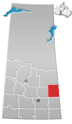
Rural Municipality of Sliding Hills No. 273
Sliding Hills No. 273 (2006 Population 462 ) is a rural municipality in Saskatchewan, Canada encompassing 853.76 square kilometers in area. The rural municipality maintains its office in Mikado, Saskatchewan.[1] The rural municipality in conjunction with the provincial government is in charge of maintenance of highways in its area. As well, the municipality provides policing, fire protection and municipal governance for the rural district, with a reeve as its administrator. Passenger rail service is provided to the community at the Mikado.
Statistics
| Canada census – Rural Municipality of Sliding Hills No. 273 community profile | |||
|---|---|---|---|
| 2006 | |||
| Population: | 462 (-18.2%% from 2001) | ||
| Land area: | 853.76 km2 (329.64 sq mi) | ||
| Population density: | 0.5/km2 (1.3/sq mi) | ||
| Median age: | 51.6 (M: 52.0, F: 51.4) | ||
| Total private dwellings: | 267 | ||
| Median household income: | |||
| References: 2006[2] earlier[3] | |||
Heritage Properties
There are three historical building located within the rural municipality:
- 'Greek Catholic Church of Transfiguration (also called the Dneiper Catholic Church) - Constructed in 1931 in a byzantine cruciform style. The church is of historic significance within the community.[4]
- Holy Assumption St. Mary’s Ukrainian Orthodox Church (also called Holy Assumption of St. Mary and the Boychuk Church) - Constructed in 1902 and officially opened in 1927, the church still hosts an annual service attended by descendants of early immigrants to the area.[5]
- St. Michael’s Ukrainian Orthodox Church - Constructed in 1924, the church includes a separate bell tower and is of historical significance in the community.[6]
References
- ↑ Saskatchewan Municipal Database
- ↑ "2006 Community Profiles". Canada 2006 Census. Statistics Canada. March 30, 2011.
- ↑ "2001 Community Profiles". Canada 2001 Census. Statistics Canada. February 17, 2012.
- ↑ Greek Catholic Church of Transfiguration
- ↑ Holy Assumption St. Mary’s Ukrainian Orthodox Church
- ↑ St. Michael’s Ukrainian Orthodox Church
Coordinates: 51°31′09″N 102°13′06″W / 51.51917°N 102.21833°W
This article is issued from
Wikipedia.
The text is licensed under Creative Commons - Attribution - Sharealike.
Additional terms may apply for the media files.