Francis, Saskatchewan
| Francis, Saskatchewan | |
|---|---|
| Town | |
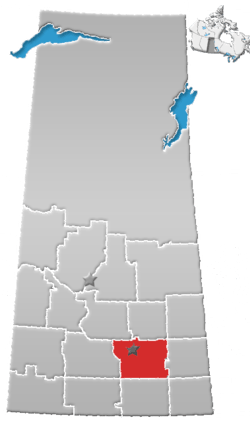
 Location of Francis in Saskatchewan  Francis, Saskatchewan (Canada) | |
| Coordinates: 50°06′06″N 103°51′58″W / 50.1017°N 103.866°W | |
| Country | Canada |
| Province | Saskatchewan |
| Region | Saskatchewan |
| Census division | 6 |
| Rural Municipality | Francis |
| Post office founded | 1904 |
| Government | |
| • Mayor | Ron Roteliuk |
| • Administrator | Melody Koronkiewicz |
| • Governing body | Francis Town Council |
| • MLA Moosomin | Steven Bonk |
| • MP Souris-Moose Mountain | Dr. Robert Kitchen |
| Area | |
| • Total | 0.59 km2 (0.23 sq mi) |
| Population (2011) | |
| • Total | 176 |
| • Density | 297.4/km2 (770/sq mi) |
| Time zone | CST |
| Postal code | S0G 1V0 |
| Area code(s) | 306 |
| Highways | Highway 33 |
| [1][2] | |
Francis is a town in the province of Saskatchewan in Canada. The town is 67 km southeast of Regina and 50 km north of Weyburn at the intersection of Highway 33 and Highway 35.
Demographics
| Canada census – Francis, Saskatchewan community profile | |||
|---|---|---|---|
| 2016 | 2011 | 2006 | |
| Population: | 217 (+23.3% from 2011) | 176 (+18.9% from 2006) | 148 (-14.0% from 2001) |
| Land area: | 0.59 km2 (0.23 sq mi) | 0.59 km2 (0.23 sq mi) | 0.59 km2 (0.23 sq mi) |
| Population density: | 366.7/km2 (950/sq mi) | 297.4/km2 (770/sq mi) | 250.1/km2 (648/sq mi) |
| Median age: | 36.8 (M: 35.5, F: 38.0) | 39.2 (M: 42.0, F: 35.5) | 42.7 (M: 45.7, F: 41.3) |
| Total private dwellings: | 94 | 90 | 71 |
| Median household income: | |||
| References: 2016[3] 2011[4] 2006[5] earlier[6] | |||
See also
References
- ↑ National Archives, Archivia Net. "Post Offices and Postmasters". Retrieved 2014-04-05.
- ↑ Government of Saskatchewan, MRD Home. "Municipal Directory System". Archived from the original on 2016-01-15. Retrieved 2014-04-05.
- ↑ "2016 Community Profiles". Canada 2016 Census. Statistics Canada. February 21, 2017. Retrieved 2018-09-24.
- ↑ "2011 Community Profiles". Canada 2011 Census. Statistics Canada. July 5, 2013. Retrieved 2014-04-05.
- ↑ "2006 Community Profiles". Canada 2006 Census. Statistics Canada. March 30, 2011. Retrieved 2009-02-24.
- ↑ "2001 Community Profiles". Canada 2001 Census. Statistics Canada. February 17, 2012.
External links
Places adjacent to Francis, Saskatchewan | ||||||||||
|---|---|---|---|---|---|---|---|---|---|---|
| ||||||||||
Coordinates: 50°06′06″N 103°51′58″W / 50.1017°N 103.866°W
This article is issued from
Wikipedia.
The text is licensed under Creative Commons - Attribution - Sharealike.
Additional terms may apply for the media files.