White City, Saskatchewan
| White City | |
|---|---|
| Town | |
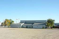 White City Community Centre | |
| Motto(s): Your Way of Life | |
 White City Town of White City in Saskatchewan | |
| Coordinates: 50°26′07″N 104°21′26″W / 50.43528°N 104.35722°W | |
| Country | Canada |
| Province | Saskatchewan |
| Government | |
| • Governing body | White City Town Council |
| Area | |
| • Total | 6.00 km2 (2.32 sq mi) |
| Population (2011) | |
| • Total | 1,894 |
| • Density | 315.6/km2 (817/sq mi) |
| Time zone | UTC-6 (CST) |
| Forward sortation area | S4L |
| Area code(s) | +1-306 |
| [1][2] | |
White City is a commuter town in the White Butte area of the Canadian province of Saskatchewan. White City is 10 kilometres (6 mi) east of Regina on the Trans-Canada Highway. The town is primarily populated by urban professionals and young families who work in Regina. The town's motto is "Your Way of Life"
History
White City began on 80 acres (32 ha) owned by Johnston Lipsett. The community became a hamlet in 1958, a village in 1967 and a town in 2000.
The place was named after White City, London, England when John Kadannek, a local store owner, persuaded Lipsett to name it for the home of his favourite aunt.[3]
Services
White City is serviced with a library and a Canada Post office.
Education
École White City School and Emerald Ridge Elementary School provide education for kindergarten through 8th grade. Students in grades 9 through 12 are bused 10 minutes northeast to Greenall School in Balgonie.
Statistics
| Canada census – White City, Saskatchewan community profile | |||
|---|---|---|---|
| 2016 | 2011 | 2006 | |
| Population: | 3,099 (63.2% from 2011) | 1,894 (70.2% from 2006) | 1,113 (+1.1% from 2001) |
| Land area: | 7.52 km2 (2.90 sq mi) | 6.00 km2 (2.32 sq mi) | 4.64 km2 (1.79 sq mi) |
| Population density: | 412.4/km2 (1,068/sq mi) | 315.6/km2 (817/sq mi) | 240.0/km2 (622/sq mi) |
| Median age: | 35.9 (M: 35.7, F: 36.0) | ||
| Total private dwellings: | 1,036 | 598 | 362 |
| Median household income: | $77,368 | ||
| References: 2016[4] 2011[5] 2006[6] earlier[7] | |||
References
- ↑ National Archives, Archivia Net. "Post Offices and Postmasters". Retrieved 6 September 2009.
- ↑ Government of Saskatchewan, MRD Home. "Municipal Directory System". Retrieved 2014-03-11.
- ↑ Barry, Bill (September 2005). Geographic Names of Saskatchewan. Regina, Saskatchewan: People Places Publishing, Ltd. p. 453. ISBN 1-897010-19-2.
- ↑ "2016 Community Profiles". Canada 2016 Census. Statistics Canada. February 21, 2017.
- ↑ "2011 Community Profiles". Canada 2011 Census. Statistics Canada. July 5, 2013. Retrieved 2012-05-12.
- ↑ "2006 Community Profiles". Canada 2006 Census. Statistics Canada. March 30, 2011. Retrieved 2009-02-24.
- ↑ "2001 Community Profiles". Canada 2001 Census. Statistics Canada. February 17, 2012.
External links
Places adjacent to White City, Saskatchewan | ||||||||||
|---|---|---|---|---|---|---|---|---|---|---|
| ||||||||||
Coordinates: 50°26′07″N 104°21′26″W / 50.43528°N 104.35722°W