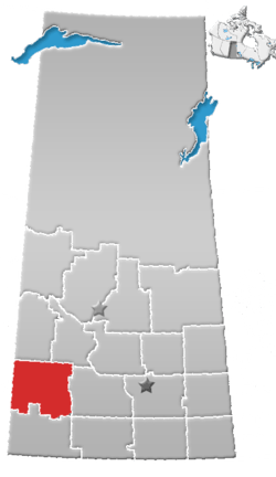
Rural Municipality of Monet No. 257
| Monet No. 257 | |
|---|---|
| Rural municipality | |
 Monet No. 257 | |
| Coordinates: 51°11′49″N 108°00′18″W / 51.197°N 108.005°W | |
| Country | Canada |
| Province | Saskatchewan |
| Seat | Elrose, Saskatchewan |
| Area | |
| • Total | 1,591.75 km2 (614.58 sq mi) |
| Population (2006) | |
| • Total | 479 |
| • Density | 0.30/km2 (0.78/sq mi) |
Monet No. 257 (2006 Population 479) is a rural municipality in south-eastern Saskatchewan, Canada encompassing 1,591.75 square kilometers in area. The seat of the municipality is in Elrose.[1] The rural municipality in conjunction with the provincial government is in charge of maintenance of highways in its area. As well, the municipality provides policing, fire protection and municipal governance for the rural district, with a reeve as its administrator.
Demographics
In 2006, the Monet No. 257 had a population of 479 in 162 dwellings, a -15.1% decrease from 2001. On a surface of 1,591.75 km² it has a density of 0.3 inhabitants/km².[2]
Communities
The following communities are located in this municipality:
Towns
- Elrose - Seat of municipality
Hamlets
- Chipperfield
- Forgan
- Greenan
- Gunnworth
- Hughton
- Lille
- Wartime
Transportation
Attractions
There is one historical site, a regional parks, and a museum located within the rural municipality:
See also
References
External links
- Municipal Affairs: Monet No. 257