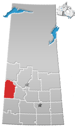
Rural Municipality of Milton No. 292
Milton No. 292, Saskatchewan was first organised as a Local Improvement District named Wirral Improvement District in 1905. Rural Municipality of Milton No. 292 was established on December 11, 1911. It is a rural municipality in west-central Saskatchewan, Canada on the Alberta - Saskatchewan border. Milton No. 292, Saskatchewan operates from Box 70, Marengo, Saskatchewan S0L 2K0. To the south the RM of Mantario No. 262 was disorganized on December 31, 1968. So now an expanded Chesterfield No. 261 is to the south of this R.M.
Statistics
According to the Canada 2001 Census:
- Population: 199
- % Change (1996-2001): - 12.3
- Dwellings: 76
- Area (km²): 655.76
- Density (persons per km²): 0.3
Communities and localities
The following urban municipalities are surrounded by the Rural Municipality:
- none
- none
- Marengo, (seat of municipality)
- none
The following hamlets are located within the Rural Municipality:
- none
- none
- Merid
Saskatchewan Railways and Railway Stations
(historic or current)
Saskatchewan Highways and Roads
- For more information see also List of Saskatchewan provincial highways
- Highway 7—serves Alsask
- Highway 44—serves Alsask
- Highway 317
- Francena Minerals Road, Saskatchewan
- Merid Road, Saskatchewan—comes close to Merid, SK
Footnotes
- ↑ Canadian Maps: January 1925 Waghorn's Guide. Post Offices in Man. Sask. Alta. and West Ontario.
- ↑ Eversoft Streets and Trips
External links
- Our Roots Nos Racines Rural Municipality of Wilton, No. 472, Marshall, Saskatchewan, 1905-1955; 50 years of progress
- Milton RM 292
- MRD - Municipal Status Information - Rural Municipality
- West Central Saskatchewan - Government
- Kindersley Gen Web
- Saskatchewan Genealogy Society Rural Municipality Locator
- Map of Milton No. 292 at Statcan
Coordinates: 51°29′35″N 109°49′28″W / 51.49306°N 109.82444°W