Lipton, Saskatchewan
| Lipton | |
|---|---|
| Village | |
| Village of Lipton | |
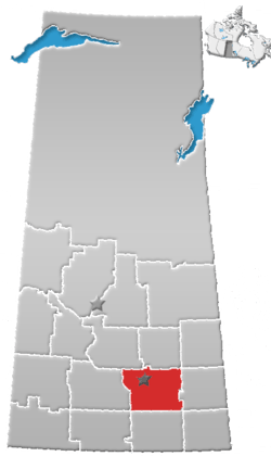
 Location of Lipton in Saskatchewan  Lipton, Saskatchewan (Canada) | |
| Coordinates: 50°59′10″N 104°51′43″W / 50.986°N 104.862°W | |
| Country |
|
| Province |
|
| Region | Southeast |
| Census division | 6 |
| Rural Municipality | Lipton No. 217 |
| Incorporated (Village) | 1905 |
| Government | |
| • Type | Municipal |
| • Governing body | Lipton Village Council |
| • Administrator | Greg Adhemar |
| • MLA | Jim Gamble |
| Area | |
| • Total | 0.75 km2 (0.29 sq mi) |
| Population (2016) | |
| • Total | 345 |
| • Density | 458.7/km2 (1,188/sq mi) |
| Time zone | UTC-6 (CST) |
| Postal code | S0G 3B0 |
| Area code(s) | 306 |
| Highways |
|
| Railways | Canadian Pacific Railway |
| Website | Village of Lipton |
| [1][2][3][4] | |
Lipton is a village in the Rural Municipality of Lipton No. 217, in the province of Saskatchewan, Canada. Lipton had a population of 372 in the 2016 Canada Census, (a -7.3% decrease from 372 in the 2011 Canada Census). The village is located 17 km north of the Town of Fort Qu'Appelle on highway 22.
Demographics
| Canada census – Lipton, Saskatchewan community profile | |||
|---|---|---|---|
| 2016 | 2011 | 2006 | |
| Population: | 345 (-7.3% from 2011) | 372 (8.8% from 2006) | 342 (3.3% from 2001) |
| Land area: | 0.75 km2 (0.29 sq mi) | 0.75 km2 (0.29 sq mi) | 0.75 km2 (0.29 sq mi) |
| Population density: | 458.7/km2 (1,188/sq mi) | 494.6/km2 (1,281/sq mi) | 454.7/km2 (1,178/sq mi) |
| Median age: | 43.7 (M: 43.5, F: 43.8) | 40.0 (M: 39.2, F: 45.0) | 43.3 (M: 40.4, F: 41.1) |
| Total private dwellings: | 173 | 173 | 170 |
| Median household income: | |||
| References: 2016[5] 2011[6] 2006[7] earlier[8] | |||
Climate
| Climate data for Lipton | |||||||||||||
|---|---|---|---|---|---|---|---|---|---|---|---|---|---|
| Month | Jan | Feb | Mar | Apr | May | Jun | Jul | Aug | Sep | Oct | Nov | Dec | Year |
| Record high °C (°F) | 7.5 (45.5) |
9.5 (49.1) |
19.5 (67.1) |
31.7 (89.1) |
39 (102) |
40.5 (104.9) |
38.5 (101.3) |
39.4 (102.9) |
36.1 (97) |
31 (88) |
22.2 (72) |
12.5 (54.5) |
40.5 (104.9) |
| Average high °C (°F) | −11.6 (11.1) |
−7.5 (18.5) |
−0.3 (31.5) |
10.6 (51.1) |
18.4 (65.1) |
22.6 (72.7) |
25 (77) |
24.7 (76.5) |
18.1 (64.6) |
10.7 (51.3) |
−1.3 (29.7) |
−9.1 (15.6) |
8.3 (46.9) |
| Daily mean °C (°F) | −17.1 (1.2) |
−12.8 (9) |
−5.7 (21.7) |
4.1 (39.4) |
11.2 (52.2) |
15.7 (60.3) |
18 (64) |
17.2 (63) |
11.2 (52.2) |
4.5 (40.1) |
−6.1 (21) |
−14.1 (6.6) |
2.2 (36) |
| Average low °C (°F) | −22.5 (−8.5) |
−18.2 (−0.8) |
−11.1 (12) |
−2.5 (27.5) |
4 (39) |
8.8 (47.8) |
10.9 (51.6) |
9.8 (49.6) |
4.2 (39.6) |
−1.9 (28.6) |
−10.8 (12.6) |
−19.1 (−2.4) |
−4 (25) |
| Record low °C (°F) | −46.7 (−52.1) |
−47.2 (−53) |
−41.7 (−43.1) |
−25 (−13) |
−10.6 (12.9) |
−7.2 (19) |
−1.7 (28.9) |
−5.6 (21.9) |
−12.8 (9) |
−23.5 (−10.3) |
−35.5 (−31.9) |
−45 (−49) |
−47.2 (−53) |
| Average precipitation mm (inches) | 24.3 (0.957) |
14.9 (0.587) |
23.9 (0.941) |
26.6 (1.047) |
53.2 (2.094) |
78.2 (3.079) |
68.7 (2.705) |
51.3 (2.02) |
39.3 (1.547) |
25.1 (0.988) |
16.4 (0.646) |
25.4 (1) |
447.2 (17.606) |
| Source: Environment Canada[9] | |||||||||||||
See also
References
- ↑ National Archives, Archivia Net, Post Offices and Postmasters, archived from the original on 6 October 2006
- ↑ Government of Saskatchewan, MRD Home, Municipal Directory System, archived from the original (– Scholar search) on 21 November 2008
- ↑ Canadian Textiles Institute. (2005), CTI Determine your provincial constituency, archived from the original on 11 September 2007
- ↑ Commissioner of Canada Elections, Chief Electoral Officer of Canada (2005), Elections Canada On-line, archived from the original on 21 April 2007
- ↑ "2016 Community Profiles". Canada 2016 Census. Statistics Canada. February 21, 2017. Retrieved 15 March 2017.
- ↑ "2011 Community Profiles". Canada 2011 Census. Statistics Canada. July 5, 2013. Retrieved 11 August 2012.
- ↑ "2006 Community Profiles". Canada 2006 Census. Statistics Canada. March 30, 2011. Retrieved 24 February 2009.
- ↑ "2001 Community Profiles". Canada 2001 Census. Statistics Canada. February 17, 2012.
- ↑ Environment Canada Canadian Climate Normals 1971–2000, accessed 5 August 2010
External links
- Saskatchewan City & Town Maps
- Saskatchewan Gen Web - One Room School Project
- Post Offices and Postmasters - ArchiviaNet - Library and Archives Canada
- Saskatchewan Gen Web Region
- Online Historical Map Digitization Project
- GeoNames Query
- 2001 Community Profiles
- Community Information
Places adjacent to Lipton, Saskatchewan | ||||||||||
|---|---|---|---|---|---|---|---|---|---|---|
| ||||||||||
| Subdivisions | |
|---|---|
| Communities | |
| Cities | |
| Topics |
|
| |
This article is issued from
Wikipedia.
The text is licensed under Creative Commons - Attribution - Sharealike.
Additional terms may apply for the media files.