Abernethy, Saskatchewan
| Abernethy | |
|---|---|
| Village | |
| Village of Abernethy | |
.jpg) Abernethy Church | |
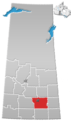
 Abernethy Location of Abernethy in Saskatchewan  Abernethy Abernethy (Canada) | |
| Coordinates: 50°26′38″N 103°15′07″W / 50.444°N 103.252°W | |
| Country | Canada |
| Province | Saskatchewan |
| Region | Southwest |
| Census division | 6 |
| Rural Municipality | Abernethy |
| Established | 1900 |
| Government | |
| • Mayor | Janet Englot |
| • Administrator | Sheree Emmerson |
| • Governing body | Abernethy Village Council |
| Area | |
| • Total | 1.03 km2 (0.40 sq mi) |
| Population (2016)[1] | |
| • Total | 204 |
| • Density | 197.7/km2 (512/sq mi) |
| Time zone | CST |
| Postal code | S0A 0A0 |
| Area code(s) | 306 |
| Highways | Highway 22 |
| Historic Sites | Motherwell Homestead |
| Website | Village of Abernethy |
| [2][3][4][5] | |
Abernethy is a village of 204 people within the Rural Municipality of Abernethy No. 186, Saskatchewan, Canada. The village ranked 4,037th in Canada in terms of population. Located about one hour east of Regina and one hour west of Yorkton. To the south of Abernethy lies the Qu'Appelle Valley in which Katepwa Beach is located.
The current mayor is Janet Englot, and the town council consists of Brian Wilkes, Roy Bearden, Beverley Halford, and Kevin Stryker.
History
Abernethy celebrated its one hundredth anniversary in the summer of 2004 with a centennial celebration held at the same time as the annual agricultural fair.[6]
Historic sites
- Abernethy is home to the Motherwell Homestead, which is a National Historic Site and is the original homestead of Saskatchewan's first minister of agriculture W.R. Motherwell.
- Abernethy and District Memorial Hall is a Municipal Heritage Property, that was constructed in 1921, to commemorate the return of soldiers from World War I. Funds for the hall were raised through local donations in the community. The hall was designed by Storey and Van Egmond of Regina.[7]
- Christ Anglican Church is a Municipal Heritage Property, that was constructed near Abernethy in 1886, and relocated into the village in 1904.[8]
Demographics
In 2006 Abernethy had a population of 197 living in 99.5 dwellings, a -7.5% decrease from 2001. The village has a land area of 1.03 km2 (0.40 sq mi) and a population density of 190.9/km2 (494/sq mi).[9]
| Visible minorities and Aboriginal population | |||
|---|---|---|---|
| Canada 2006 Census | Population | % of Total Population | |
| Visible minority group Source:[10] | South Asian | 0 | 0 |
| Chinese | 0 | 0 | |
| Black | 0 | 0 | |
| Filipino | 0 | 0 | |
| Latin American | 0 | 0 | |
| Southeast Asian | 0 | 0 | |
| Arab | 0 | 0 | |
| West Asian | 0 | 0 | |
| Korean | 0 | 0 | |
| Japanese | 0 | 0 | |
| Mixed visible minority | 0 | 0 | |
| Other visible minority | 10 | 5.4 | |
| Total visible minority population | 10 | 5.4 | |
| Aboriginal group Source:[10] | First Nations | 30 | 16.2 |
| Métis | 45 | 24.3 | |
| Inuit | 0 | 0 | |
| Total Aboriginal population | 75 | 40.5 | |
| White | 100 | 54.1 | |
| Total population | 185 | 100 | |
Industry and commerce
Abernethy is primarily an agricultural community although there are currently several businesses operating in Abernethy. Among them is a CO-OP grocery store, gas bar, and cafe, Canada Post Office, Abernethy Nature Heritage Museum, Tri Way Fertilizer, and two nearby hog barns operated by Hypor International.
Education
School Children are bussed to Lemberg and Neudorf in the east and Balcarres in the west because Abernethy School was closed in 1994 and due to lack of proper maintenance had to be destroyed in the summer of 2005.
Trivia
In the summer of 2005 the movie The Messengers which stars Kristen Stewart, Dylan McDermott, and John Corbett was filmed in the valley south of Abernethy and east of Katepwa.
See also
References
- ↑ "2016 Community Profiles". Statistics Canada. Government of Canada. Retrieved 2017-05-05.
- ↑ National Archives, Archivia Net, Post Offices and Postmasters, archived from the original on 2006-10-06
- ↑ Government of Saskatchewan, MRD Home, Municipal Directory System, archived from the original on 2011-07-06
- ↑ Canadian Textiles Institute. (2005), CTI Determine your provincial constituency, archived from the original on 2007-09-11
- ↑ Commissioner of Canada Elections, Chief Electoral Officer of Canada (2005), Elections Canada On-line, archived from the original on 2007-04-21
- ↑ Dance on the Bridge: A History of Abernethy and Area. Abernethy Heritage Association, 1983. ISBN 978-0-919533-28-8.
- ↑ Abernethy and District Memorial Hall Heritage Property Details Archived July 6, 2011, at the Wayback Machine.
- ↑ Christ Anglican Church Heritage Property Details Archived July 6, 2011, at the Wayback Machine.
- ↑ Statistics Canada, Canada 2006 Census: Abernethy - Community Profile, retrieved 2009-01-12
- 1 2 Community Profiles from the 2006 Census, Statistics Canada - Census Subdivision
External links
- Abernethy Saskatchewan
- Abernethy Agricultural Society
- Regional GenWeb site (Southwest Region)
- 2006 Community Profiles
Places adjacent to Abernethy, Saskatchewan | |
|---|---|
| Subdivisions | |
|---|---|
| Communities | |
| Cities | |
| Topics |
|
| |