Rural Municipality of Craik No. 222
| Craik No. 222 | |
|---|---|
| Rural municipality | |
 Craik No. 222 | |
| Coordinates: 50°51′13″N 105°47′23″W / 50.85361°N 105.78972°WCoordinates: 50°51′13″N 105°47′23″W / 50.85361°N 105.78972°W | |
| Country | Canada |
| Province | Saskatchewan |
| Area | |
| • Total | 883.02 km2 (340.94 sq mi) |
| Population (2011) | |
| • Total | 276 |
| • Density | 0.31/km2 (0.81/sq mi) |
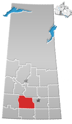
Craik No. 222, Saskatchewan in Canada is located centrally between the cities of Regina and Saskatoon. It is home to the communities of Craik and Aylesbury.
Demographics
In the 2011 Census, Statistics Canada originally reported that the Rural Municipality of Craik No. 222 had a population of 299 living in 118 of its 164 total dwellings, a 3.8% change from its 2006 population of 288.[1] Statistics Canada subsequently amended the 2011 census results to a population of 276 living in 104 of its 146 total dwellings, a -4.2% change from 2006.[2] With a land area of 11.86 km2 (4.58 sq mi), it had a population density of 231.28/km2 (599.0/sq mi) in 2011.[1][2]
According to the Canada 2006 Census:
- Population: 288
- % Change (1996-2001): -11.9
- Dwellings: 126
- Area (km².): 883.02
- Density (persons per km².): 0.3
Communities
These communities are located within the geographical boundaries of Craik No. 222, but are not technically part of the R.M.
References
- 1 2 "Population and dwelling counts, for Canada, provinces and territories, and census subdivisions (municipalities), 2011 and 2006 censuses (Saskatchewan)". Statistics Canada. 2012-02-08. Retrieved 2012-10-14.
- 1 2 "Corrections and updates". Statistics Canada. 2012-09-19. Retrieved 2012-10-14.