Rural Municipality of Big Quill No. 308
| Big Quill No. 308 | |
|---|---|
| Rural municipality | |
 Big Quill No. 308 Location in Saskatchewan | |
| Coordinates: 51°40′40″N 104°20′30″W / 51.67778°N 104.34167°WCoordinates: 51°40′40″N 104°20′30″W / 51.67778°N 104.34167°W[1] | |
| Country | Canada |
| Province | Saskatchewan |
| Census division | Division No. 10, Saskatchewan |
| Incorporated | December 13, 1909 |
| Government | |
| • Reeve | Eugene McSymytz |
| • Councillors | Dale Bolt, Dale Kucey, Howie Linnen, Hart Lowenberger |
| • Administrator | Gail Wolfe |
| Area | |
| • Total | 739.86 km2 (285.66 sq mi) |
| Elevation[2] | 593 m (1,946 ft) |
| Population (2011) | |
| • Total | 587 |
| • Density | 0.79/km2 (2.1/sq mi) |
| Time zone | UTC-6 (Time in Saskatchewan) |
| • Summer (DST) | UTC-6 (Time in Saskatchewan) |
| Postal Code | S0A 4T0 |
| Area code(s) | 306, 639 |
The Rural Municipality of Big Quill No. 308 is a rural municipality in the east central part of Saskatchewan, Canada.[1] It has a population of 587 (2011 census) and was incorporated on December 13, 1909.[3] As of 4 July 2015 the reeve is Eugene McSymytz.[4]
Communities and localities
The following urban municipalities are surrounded by the Rural Municipality of Big Quill No. 308:[5]
- none
- none
The following hamlets are located within the Rural Municipality of Big Quill No. 308:
- none
- none
- Copeland
- Krasne[6]
Statistics
| Canada census – Rural Municipality of Big Quill No. 308 community profile | |||
|---|---|---|---|
| 2011 | 2006 | ||
| Population: | 587 (-7.6% from 2006) | 635 (-10.7% from 2001) | |
| Land area: | 739.86 km2 (285.66 sq mi) | 739.86 km2 (285.66 sq mi) | |
| Population density: | 0.8/km2 (2.1/sq mi) | 0.5/km2 (1.3/sq mi) | |
| Median age: | 50 (M: 49.4, F: 50.6) | N/A (M: N/A, F: N/A) | |
| Total private dwellings: | 288 | 269 | |
| Median household income: | $Not Available | ||
| References: 2011[7] 2006[8] earlier[9] | |||
References
- 1 2 "Big Quill No. 308". Geographical Names Data Base. Natural Resources Canada. Retrieved 2015-07-04.
- ↑ Elevation taken from Google Maps at geographic coordinates given in the Infobox. Accessed 2015-07-04.
- ↑ "MRD Municipal Status Information", Ministry of Municipal Affairs, Government of Saskatchewan, archived from the original on 2008-03-25, retrieved 2008-03-28
- 1 2 "RM of BIG QUILL No. 308". Government of Saskatchewan. Retrieved 2015-07-04.
- ↑ Saskatchewan Genealogy Association, retrieved 2008-03-28
- ↑ "Krasne". Geographical Names Data Base. Natural Resources Canada. Retrieved 2015-07-04.
- ↑ "2011 Community Profiles". Canada 2011 Census. Statistics Canada. July 5, 2013.
- ↑ "2006 Community Profiles". Canada 2006 Census. Statistics Canada. March 30, 2011. Retrieved 2009-02-24.
- ↑ "2001 Community Profiles". Canada 2001 Census. Statistics Canada. February 17, 2012.
| Towns | 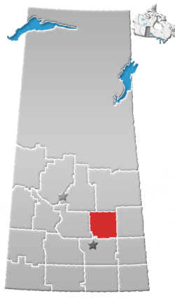 | ||||
|---|---|---|---|---|---|
| Villages | |||||
| Resort villages | |||||
| Rural municipalities | |||||
| Unincorporated communities |
| ||||
- ↑ "MRD Rural Municipality (RM) Boundary maps", Ministry of Municipal Affairs, Government of Saskatchewan, archived from the original on 2008-03-25, retrieved 2008-03-28
This article is issued from
Wikipedia.
The text is licensed under Creative Commons - Attribution - Sharealike.
Additional terms may apply for the media files.