Candiac, Saskatchewan
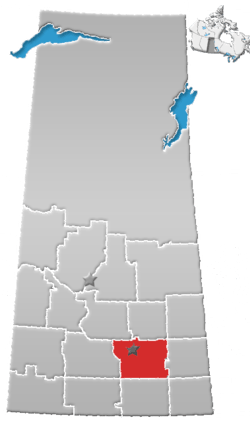
Candiac is an organized hamlet located at the intersection of Highway 48 and Highway 617 in the southeast quadrant of Saskatchewan, Canada. It is directly south of Wolseley, and between Montmartre and Glenavon, approximately one hour's drive southeast of the provincial capital Regina. It is no longer listed as a separate community by Statistics Canada, and is considered part of the Rural Municipality of Montmartre #126. The population within the community's boundary is less than 50. Besides some bush on the northern end of the town, it is surrounded by open fields and pasture.
| Population (2001) - (district of montmartre) | 548 (Statistics Canada) |
| Population (1996) - (district of montmartre) | 574 (Statistics Canada) |
| Area | unknown |
| Postal code | S0G 0N0 |
| Coordinates | 52.2114, -103.2592 |
Primary income of community members is derived from agricultural businesses (farming, ranching).
History
Early settlers in the area during the early 1900s came from east-central Europe, being specifically of German, Polish, and Ukrainian origin. There is a known Polish settlement dated 1896.[1] It has been proposed that the earliest settlement of Ukrainians in Canada was near the town.[2]
At one time, there were two schools that offered education up to grade 12.[3]
Economic Information
Businesses (operating)
Candiac Auction Mart - located at the northeastern corner of the highway intersection
Businesses (closed)
- Grain elevators: none remaining. In the early 1980s both the Saskatchewan Wheat Pool and Cargill operated facilities there.
- Candiac Hotel and Bar
- Canada Post
- General Store
- Schools - dates unknown
Places of interest
Churches - one (Polish Catholic, built in 1913)[4]
Community hall
Location
Places adjacent to Candiac, Saskatchewan | |
|---|---|
See also
References
- ↑ Saskatchewan Timeline 1890-1899, at canadawiki.org
- ↑ In Baba's Trunk, write up of May 2004 conference of Historical Society of Ukrainian Canadian Congress
- ↑ Professor Joseph M. Muchowski, A Tribute, published by Arkat USA, Inc
- ↑ Poles, Religion, from Encyclopedia of Canada's Peoples, published by multiculturalcanada.ca
Sources
External links
Coordinates: 50°12′41″N 103°15′33″W / 50.21139°N 103.25917°W