Earl Grey, Saskatchewan
| Earl Grey | |
|---|---|
| Village | |
| Village of Earl Grey | |
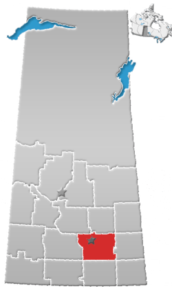
 Earl Grey Location of Earl Grey  Earl Grey Earl Grey (Canada) | |
| Coordinates: 50°56′08″N 104°42′40″W / 50.935556°N 104.711111°WCoordinates: 50°56′08″N 104°42′40″W / 50.935556°N 104.711111°W | |
| Country |
|
| Province |
|
| Region | Central |
| Census division | 6 |
| Rural Municipality | Longlaketon No. 219 |
| Post office Founded | 1905-10-16 |
| Incorporated (Village) | 1906 |
| Government | |
| • Type | Municipal |
| • Governing body | Earl Grey Village Council |
| • Mayor | Debbie Hupka-Butz |
| • Administrator | Courtney Wiers |
| Population (2006) | |
| • Total | 246 |
| • Density | 187.7/km2 (486/sq mi) |
| Time zone | UTC-6 (CST) |
| Postal code | S0G 1J0 |
| Area code(s) | 306 |
| Highways |
|
| Railways |
Canadian Pacific Railway (abandoned) |
Earl Grey is a village within the Rural Municipality of Longlaketon No. 219, in the province of Saskatchewan, Canada. The village is located approximately 66.67 kilometers from the capital, Regina, and had a population of 246 in the 2016 Canada Census, (a 2.9% increase from 239 in the 2011 Canada Census).
The area was first settled in 1901 by Paul Henderson, younger brother of Jack Henderson, hangman of Louis Riel.[1] Subsequent to Paul Henderson's death from exposure in 1903, other settlers followed; in 1906 the village was incorporated and named "Earl Grey" after Albert Grey, 4th Earl Grey, Canada's Governor General at the time.[2]
Currently, the town has two churches (Christ Lutheran Church (ELCIC) and a United Church), one Kingdom Hall of Jehovah's Witnesses, several old-age homes, a hotel, a curling rink, and a veterinary clinic. A small statue of a grain elevator is displayed in the downtown area, a commemorative tribute to the village's once-thriving grain economy.
The public school was downsized to a Kindergarten-Grade 8 school in the 2003-2004 school year, before closing completely in 2007.[3]
Demographics
| Canada census – Earl Grey, Saskatchewan community profile | |||
|---|---|---|---|
| 2016 | 2011 | 2006 | |
| Population: | 246 (+2.9% from 2011) | 239 (-9.5% from 2006) | 264 (-9.6% from 2001) |
| Land area: | 1.31 km2 (0.51 sq mi) | 1.31 km2 (0.51 sq mi) | 1.31 km2 (0.51 sq mi) |
| Population density: | 187.7/km2 (486/sq mi) | 182.4/km2 (472/sq mi) | 201.5/km2 (522/sq mi) |
| Median age: | 51.5 (M: 49.0, F: 54.0) | 48.9 (M: 48.2, F: 50.2) | 44.7 (M: 43.6, F: 45.4) |
| Total private dwellings: | 121 | 125 | 124 |
| Median household income: | $46,242 | ||
| References: 2016[4] 2011[5] 2006[6] earlier[7] | |||
See also
References
- ↑ Black, Norman Fergus (1913). A HISTORY OF SASKATCHEWAN AND THE OLD NORTH WEST.
- ↑ Shortt, Adam & Doughty, Arthur G., editors (1914). Canada and Its Provinces: Volume 19: The Prairie Provinces Part One
- ↑ School Closures - CBC News - Earl Grey School Closuer
- ↑ "2016 Community Profiles". Canada 2016 Census. Statistics Canada. February 21, 2017. Retrieved 2017-03-15.
- ↑ "2011 Community Profiles". Canada 2011 Census. Statistics Canada. July 5, 2013. Retrieved 2012-10-14.
- ↑ "2006 Community Profiles". Canada 2006 Census. Statistics Canada. March 30, 2011. Retrieved 2011-02-20.
- ↑ "2001 Community Profiles". Canada 2001 Census. Statistics Canada. February 17, 2012.
External links
- Official website of the Village of Earl Grey
- Official website of Earl Grey School
- Map of Earl Grey at Statcan
| Subdivisions | |
|---|---|
| Communities | |
| Cities | |
| Topics |
|
| |