Rural Municipality of Spy Hill No. 152
Spy Hill No. 152 (2006 Population 365) is a rural municipality in eastern Saskatchewan, Canada encompassing 679 square kilometers in area. The population density in 2006 was about 0.5 per km2. The rural municipality include the Carlton Trail Regional Park within its boundaries. The rural municipality in conjunction with the provincial government is in charge of maintenance of highways in its area. As well, the municipality provides policing, fire protection and municipal governance for the rural district, with a reeve as its administrator. The rural municipality was established on January 3, 1910 as a Local Improvement District, incorporated on December 11, 1910. [1]
Statistics
| Canada census – Rural Municipality of Spy Hill No. 152 community profile | |||
|---|---|---|---|
| 2006 | |||
| Population: | 365 (–10.8% from 2001) | ||
| Land area: | 679.28 km2 (262.27 sq mi) | ||
| Population density: | 0.5/km2 (1.3/sq mi) | ||
| Median age: | 46.1 (M: 46.0, F: 46.2) | ||
| Total private dwellings: | 170 | ||
| Median household income: | $76,907 | ||
| References: 2006[2] earlier[3] | |||
Heritage properties
There is one heritage building located within the rural municipality:
- Voysey Farmhouse Site, constructed in 1917, is representative of an early farm settlement of the period.[4]
References
- ↑ Sask Biz
- ↑ "2006 Community Profiles". Canada 2006 Census. Statistics Canada. March 30, 2011. Retrieved 2009-02-24.
- ↑ "2001 Community Profiles". Canada 2001 Census. Statistics Canada. February 17, 2012.
- ↑ Voysey Farmhouse Site
| Cities | 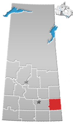 | ||
|---|---|---|---|
| Towns | |||
| Villages | |||
| Resort villages | |||
| Rural municipalities | |||
| First Nations | |||
| Indian reserves | |||
| Unincorporated communities |
| ||
Coordinates: 50°31′00″N 101°45′50″W / 50.51667°N 101.76389°W