Edenwold
| Edenwold | |
|---|---|
| Village | |
| Village of Edenwold | |
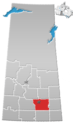
 Location of Edenwold in Saskatchewan  Edenwold (Canada) | |
| Coordinates: 50°37′59″N 104°15′07″W / 50.633°N 104.252°W | |
| Country |
|
| Province |
|
| Region | Southeast |
| Census division | 6 |
| Rural Municipality | Edenwold No. 158 |
| Incorporated (Village) | 1912 |
| Government | |
| • Type | Municipal |
| • Governing body | Edenwold Village Council |
| • Mayor | Dean Josephson |
| • Administrator | Christine Galbraith |
| Area | |
| • Total | 0.68 km2 (0.26 sq mi) |
| Population (2016) | |
| • Total | 233 |
| • Density | 340.3/km2 (881/sq mi) |
| Time zone | UTC-6 (CST) |
| Postal code | S0G 1K0 |
| Area code(s) | 306 |
| Highways |
|
| Railways | Canadian National Railway |
| Website | Village of Edenwold |
| [1][2][3][4] | |
Edenwold is a village within the Rural Municipality of Edenwold No. 158, in the White Butte area of the province of Saskatchewan, Canada. It is located 45 km north of the provincial capital, Regina. The village had a population of 233 in the 2016 Canada Census, (a -2.1% decrease from 238 in the 2011 Canada Census).
Demographics
| Canada census – Edenwold community profile | |||
|---|---|---|---|
| 2016 | 2011 | 2006 | |
| Population: | 233 (-2.1% from 2011) | 238 (-1.7% from 2006) | 242 (7.1% from 2001) |
| Land area: | 0.68 km2 (0.26 sq mi) | 0.68 km2 (0.26 sq mi) | 0.68 km2 (0.26 sq mi) |
| Population density: | 340.3/km2 (881/sq mi) | 347.6/km2 (900/sq mi) | 353.4/km2 (915/sq mi) |
| Median age: | 33.4 (M: 32.3, F: 35.0) | 31.3 (M: 28.8, F: 33.5) | 30.8 (M: 28.5, F: 32.5) |
| Total private dwellings: | 92 | 84 | 81 |
| Median household income: | |||
| References: 2016[5] 2011[6] 2006[7] earlier[8] | |||
See also
References
- ↑ National Archives, Archivia Net, Post Offices and Postmasters, archived from the original on 2006-10-06
- ↑ Government of Saskatchewan, MRD Home, Municipal Directory System, archived from the original on November 21, 2008
- ↑ Canadian Textiles Institute. (2005), CTI Determine your provincial constituency, archived from the original on 2007-09-11
- ↑ Commissioner of Canada Elections, Chief Electoral Officer of Canada (2005), Elections Canada On-line, archived from the original on 2007-04-21
- ↑ "2016 Community Profiles". Canada 2016 Census. Statistics Canada. February 21, 2017. Retrieved 2017-03-15.
- ↑ "2011 Community Profiles". Canada 2011 Census. Statistics Canada. July 5, 2013. Retrieved 2012-10-14.
- ↑ "2006 Community Profiles". Canada 2006 Census. Statistics Canada. March 30, 2011. Retrieved 2009-02-24.
- ↑ "2001 Community Profiles". Canada 2001 Census. Statistics Canada. February 17, 2012.
External links
- Village of Edenwold - Official web-page
Places adjacent to Edenwold | ||||||||||
|---|---|---|---|---|---|---|---|---|---|---|
| ||||||||||
| Subdivisions | |
|---|---|
| Communities | |
| Cities | |
| Topics |
|
| |
Coordinates: 50°37′59″N 104°15′07″W / 50.633°N 104.252°W
This article is issued from
Wikipedia.
The text is licensed under Creative Commons - Attribution - Sharealike.
Additional terms may apply for the media files.