Blountsville, Indiana
| Town of Blountsville, Indiana | |
|---|---|
| Town | |
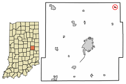 Location of Blountsville in Henry County, Indiana. | |
| Coordinates: 40°03′35″N 85°14′20″W / 40.05972°N 85.23889°WCoordinates: 40°03′35″N 85°14′20″W / 40.05972°N 85.23889°W | |
| Country | United States |
| State | Indiana |
| County | Henry |
| Township | Stoney Creek |
| Area[1] | |
| • Total | 0.11 sq mi (0.29 km2) |
| • Land | 0.11 sq mi (0.29 km2) |
| • Water | 0.00 sq mi (0.00 km2) |
| Elevation[2] | 1,099 ft (335 m) |
| Population (2010)[3] | |
| • Total | 134 |
| • Estimate (2016)[4] | 131 |
| • Density | 1,169.64/sq mi (450.55/km2) |
| Time zone | UTC-5 (EST) |
| • Summer (DST) | UTC-4 (EDT[5]) |
| FIPS code[2][6] | 18-05896 |
| GNIS ID[2][6] | 431210 |
Blountsville is a town in Stoney Creek Township, Henry County, Indiana, United States. The population was 135 at the 2010 census.
History
Blountsville was laid out and platted in 1832, and named for one of its founders, Andrew D. Blount.[7] A post office was established at Blountsville in 1835, and remained in operation until it was discontinued in 1964.[8]
Geography
Blountsville is located at 40°3′35″N 85°14′20″W / 40.05972°N 85.23889°W (40.059611, -85.238840).[9]
According to the 2010 census, Blountsville has a total area of 0.11 square miles (0.28 km2), all land.[10]
Demographics
| Historical population | |||
|---|---|---|---|
| Census | Pop. | %± | |
| 1870 | 178 | — | |
| 1880 | 188 | 5.6% | |
| 1910 | 159 | — | |
| 1920 | 153 | −3.8% | |
| 1930 | 151 | −1.3% | |
| 1940 | 169 | 11.9% | |
| 1950 | 229 | 35.5% | |
| 1960 | 218 | −4.8% | |
| 1970 | 220 | 0.9% | |
| 1980 | 213 | −3.2% | |
| 1990 | 155 | −27.2% | |
| 2000 | 166 | 7.1% | |
| 2010 | 134 | −19.3% | |
| Est. 2016 | 131 | [4] | −2.2% |
| U.S. Decennial Census[11] | |||
2010 census
As of the 2010 census,[3] there were 134 people, 49 households, and 39 families residing in the town. The population density was 1,218.2 inhabitants per square mile (470.3/km2). There were 60 housing units at an average density of 545.5 per square mile (210.6/km2). The racial makeup of the town was 97.0% White and 3.0% from two or more races.
There were 49 households of which 38.8% had children under the age of 18 living with them, 59.2% were married couples living together, 12.2% had a female householder with no husband present, 8.2% had a male householder with no wife present, and 20.4% were non-families. 20.4% of all households were made up of individuals and 8.1% had someone living alone who was 65 years of age or older. The average household size was 2.73 and the average family size was 3.13.
The median age in the town was 38.3 years. 28.4% of residents were under the age of 18; 5.9% were between the ages of 18 and 24; 24.6% were from 25 to 44; 28.4% were from 45 to 64; and 12.7% were 65 years of age or older. The gender makeup of the town was 44.0% male and 56.0% female.
2000 census
As of the 2000 census,[12] there were 166 people, 61 households, and 50 families residing in the town. The population density was 1,372.9 people per square mile (534.1/km²). There were 61 housing units at an average density of 504.5 per square mile (196.3/km²). The racial makeup of the town was 100.00% White.
There were 61 households out of which 34.4% had children under the age of 18 living with them, 72.1% were married couples living together, 6.6% had a female householder with no husband present, and 16.4% were non-families. 14.8% of all households were made up of individuals and 6.6% had someone living alone who was 65 years of age or older. The average household size was 2.72 and the average family size was 2.98.
In the town, the population was spread out with 28.3% under the age of 18, 7.8% from 18 to 24, 25.3% from 25 to 44, 22.3% from 45 to 64, and 16.3% who were 65 years of age or older. The median age was 37 years. For every 100 females, there were 95.3 males. For every 100 females age 18 and over, there were 101.7 males.
The median income for a household in the town was $31,023, and the median income for a family was $31,000. Males had a median income of $32,500 versus $16,250 for females. The per capita income for the town was $11,382. About 10.4% of families and 8.9% of the population were below the poverty line, including none of those under the age of eighteen and 27.8% of those sixty five or over.
Life in the Community
The city was named after Andrew Blount, land-owner.
At one time Blountsville used to have its own school, a grain elevator (sitting along the railroad tracks). (While the railroad line is no longer in existence, the Cardinal Greenway uses the old trail bed as a biking and hiking trail. This trail is paved from Richmond, Indiana to Gaston, Indiana.)
Throughout the decades the community has had numerous churches:
- Blountsville Congregational Christian Church,[13] 7746 E High St, Losantville, IN 47354 (Blountsville, IN)
- Blountsville Presbyterian Church (deeded land September 30, 1840), which later housed:
- Methodist Episcopal Church, 1857 (deeded land November 10, 1856)
- Blountsville Nazarene Church (arsonist burned July 26, 1998)
See also
- Rogersville, Indiana – a nearby village in Stoney Creek township
References
- ↑ "2016 U.S. Gazetteer Files". United States Census Bureau. Retrieved Jul 28, 2017.
- 1 2 3 "Feature ID 431210". Geographic Names Information System. United States Geological Survey. Retrieved June 30, 2014.
- 1 2 "American FactFinder". United States Census Bureau. Retrieved 2012-12-11.
- 1 2 "Population and Housing Unit Estimates". Retrieved June 9, 2017.
- ↑ Blountsville, Indiana Current Local Time. timetemperature.com
- 1 2 "FIPS55 Data: Indiana". FIPS55 Data. United States Geological Survey. February 23, 2006. Archived from the original on June 18, 2006. Retrieved June 30, 2014.
- ↑ Hazzard, George (1906). Hazzard's History of Henry County, Indiana, 1822-1906. G. Hazzard, author and publisher. p. 924.
- ↑ "Henry County". Jim Forte Postal History. Retrieved 2 February 2015.
- ↑ "US Gazetteer files: 2010, 2000, and 1990". United States Census Bureau. 2011-02-12. Retrieved 2011-04-23.
- ↑ "G001 - Geographic Identifiers - 2010 Census Summary File 1". United States Census Bureau. Retrieved 2015-07-13.
- ↑ "Census of Population and Housing". Census.gov. Archived from the original on May 12, 2015. Retrieved June 4, 2015.
- ↑ "American FactFinder". United States Census Bureau. Archived from the original on 2013-09-11. Retrieved 2008-01-31.
- ↑ https://groups.yahoo.com/group/blountsville-reunion
External links
- Other histories:
Municipalities and communities of Henry County, Indiana, United States | ||
|---|---|---|
| City | ||
| Towns | ||
| Townships | ||
| Unincorporated communities | ||
| Footnotes | ‡This populated place also has portions in an adjacent county or counties | |