Spiceland Township, Henry County, Indiana
| Spiceland Township | |
|---|---|
| Township | |
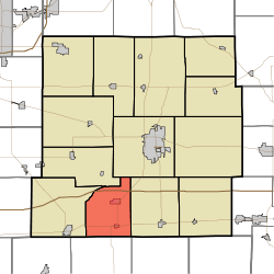 Location in Henry County | |
| Coordinates: 39°49′12″N 85°27′12″W / 39.82000°N 85.45333°WCoordinates: 39°49′12″N 85°27′12″W / 39.82000°N 85.45333°W | |
| Country | United States |
| State | Indiana |
| County | Henry |
| Government | |
| • Type | Indiana township |
| Area | |
| • Total | 22.32 sq mi (57.8 km2) |
| • Land | 22.22 sq mi (57.5 km2) |
| • Water | 0.09 sq mi (0.2 km2) 0.40% |
| Elevation | 1,040 ft (317 m) |
| Population (2010) | |
| • Total | 2,279 |
| • Density | 102.5/sq mi (39.6/km2) |
| GNIS feature ID | 0453862 |
Spiceland Township is one of thirteen townships in Henry County, Indiana, United States. As of the 2010 census, its population was 2,279 and it contained 991 housing units.[1]
Spiceland Township was organized in 1842.[2] It was named from the growth of spice bushes within its borders.[2]
Geography
According to the 2010 census, the township has a total area of 22.32 square miles (57.8 km2), of which 22.22 square miles (57.5 km2) (or 99.55%) is land and 0.09 square miles (0.23 km2) (or 0.40%) is water.[1]
Cities and towns
Unincorporated towns
(This list is based on USGS data and may include former settlements.)
Adjacent townships
- Henry Township (northeast)
- Franklin Township (east)
- Center Township, Rush County (south)
- Wayne Township (west)
- Greensboro Township (northwest)
Major highways
Education
Spiceland Township residents are served by the Spiceland Town-Township Public Library.[3]
References
- 1 2 "Population, Housing Units, Area, and Density: 2010 - County -- County Subdivision and Place -- 2010 Census Summary File 1". United States Census. Retrieved 2013-05-10.
- 1 2 Hazzard, George (1906). Hazzard's History of Henry County, Indiana, 1822-1906. G. Hazzard, author and publisher. p. 964.
- ↑ "Indiana public library directory" (PDF). Indiana State Library. Retrieved 7 March 2018.
External links
Municipalities and communities of Henry County, Indiana, United States | ||
|---|---|---|
| City | ||
| Towns | ||
| Townships | ||
| Unincorporated communities | ||
| Footnotes | ‡This populated place also has portions in an adjacent county or counties | |
This article is issued from
Wikipedia.
The text is licensed under Creative Commons - Attribution - Sharealike.
Additional terms may apply for the media files.