Goliad State Park and Historic Site
| Goliad State Park and Historic Site | |
|---|---|
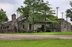 Former custodian's house for Goliad State Park. Built by the Civilian Conservation Corps circa 1936 | |
 Goliad State Park and Historic Site  Goliad State Park and Historic Site | |
| Location | US 183 at San Antonio River, Goliad, Texas |
| Coordinates | 28°39′24″N 97°23′14″W / 28.65667°N 97.38722°WCoordinates: 28°39′24″N 97°23′14″W / 28.65667°N 97.38722°W |
| Area | 188.3 acres (76.2 ha) |
| Established | 1936 |
| Governing body | Texas Parks and Wildlife Department |
|
Goliad State Park Historic District | |
| Area | 250 acres (100 ha) |
| Built | 1931 |
| Architect | Atlee Bernard Ayres, Samuel Phelps Vosper, et al. |
| Architectural style | Colonial Revival, Moderne, NPS Rustic |
| NRHP reference # | 01000258[1] |
| Significant dates | |
| Added to NRHP | March 12, 2001 |
| Designated TSHS | 1936 |
Goliad State Park and Historic Site is a 188.3 acres (76 ha) state park located along the San Antonio River on the southern edge of Goliad, Texas. In addition to recreational facilities the park property includes three historic sites - the reconstructed Mission Nuestra Señora del Espíritu Santo de Zúñiga, the ruins of Mission Nuestra Señora del Rosario and the reconstructed birthplace of Ignacio Zaragoza.[2] The park itself and Mission Nuestra Señora del Espíritu Santo de Zúñiga are included in the Goliad State Park Historic District listed on the National Register of Historic Places on March 12, 2001.
See also
References
- ↑ National Park Service (2010-07-09). "National Register Information System". National Register of Historic Places. National Park Service.
- ↑ "Goliad State Park & Historic Site". Texas Parks and Wildlife Department. Retrieved 9 May 2015.
External links
| Wikimedia Commons has media related to Goliad State Park and Historic Site. |
- Goliad State Park & Historic Site
- The Look of Nature: Designing Texas State Parks During the Great Depression—Goliad


Municipalities and communities of Goliad County, Texas, United States | ||
|---|---|---|
| City | 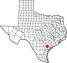 | |
| Unincorporated communities | ||
This article is issued from
Wikipedia.
The text is licensed under Creative Commons - Attribution - Sharealike.
Additional terms may apply for the media files.