Lake Meredith National Recreation Area
| Lake Meredith National Recreation Area | |
|---|---|
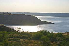 Lake Meredith at sunset | |
  | |
| Location | Potter / Moore / Hutchinson counties, Texas, United States |
| Nearest city | Amarillo, Texas |
| Coordinates | 35°42′53″N 101°33′10″W / 35.71472°N 101.55278°WCoordinates: 35°42′53″N 101°33′10″W / 35.71472°N 101.55278°W |
| Area | 44,978 acres (18,202 ha)[1] |
| Established | November 28, 1990 |
| Visitors | 502,457 (in 2012)[2] |
| Governing body | National Park Service |
| Website | Lake Meredith National Recreation Area |
Lake Meredith National Recreation Area is a United States National Recreation Area located about 30 miles (48 km) north of Amarillo, Texas, in the Texas Panhandle. The main attraction of the recreation area is 10,000-acre (4,000 ha) Lake Meredith, an artificial reservoir created by Sanford Dam on the Canadian River.
Activities at Lake Meredith include boating, fishing, swimming, camping, hiking, and hunting. Five boat launch ramps and one marina provide access to the lake. Park Headquarters are located in Fritch, Texas.
Visitation to Lake Meredith peaked at over 1.94 million in 1984, but with record low water levels visitation fell from 1.08 million in 2009 to 502,457 in 2012.[2]
Alibates Flint Quarries National Monument is located adjacent to Lake Meredith National Recreation Area.
Gallery
| Wikimedia Commons has media related to Lake Meredith National Recreation Area. |
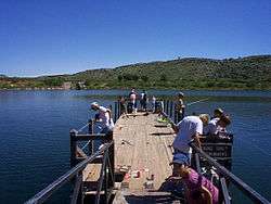 The Small Fry fishing tournament in the Stilling Basin at Lake Meredith
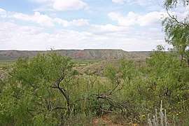 View from Lake Meredith
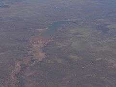 Aerial view
References
- ↑ "Listing of acreage as of December 31, 2011". Land Resource Division, National Park Service. Retrieved 2012-12-26.
- 1 2 "NPS Annual Recreation Visits Report". National Park Service. Retrieved November 4, 2013.
External links