Gladstone, Missouri
| Gladstone, Missouri | |
|---|---|
| City | |
 Location of Gladstone, Missouri | |
| Coordinates: 39°12′42″N 94°33′42″W / 39.21167°N 94.56167°WCoordinates: 39°12′42″N 94°33′42″W / 39.21167°N 94.56167°W | |
| Country | United States |
| State | Missouri |
| County | Clay |
| Area[1] | |
| • Total | 8.06 sq mi (20.88 km2) |
| • Land | 8.05 sq mi (20.85 km2) |
| • Water | 0.01 sq mi (0.03 km2) |
| Elevation | 938 ft (286 m) |
| Population (2010)[2] | |
| • Total | 25,410 |
| • Estimate (2016)[3] | 27,114 |
| • Density | 3,200/sq mi (1,200/km2) |
| Time zone | UTC−6 (Central (CST)) |
| • Summer (DST) | UTC−5 (CDT) |
| ZIP codes | 64100-64199 |
| Area code(s) | 816 |
| FIPS code | 29-27190[4] |
| GNIS feature ID | 0730104[5] |
| Website | City of Gladstone |
Gladstone is a city in Clay County, Missouri, United States and a suburb of Kansas City. The City of Gladstone is located only 10 minutes from downtown Kansas City, and 10 minutes from Kansas City International Airport. As of the 2010 census, the city population was 26,365.
History
The Atkins-Johnson Farmhouse Property was listed on the National Register of Historic Places in 2007.[6]
Government
Under state statute, Gladstone is a city of the third class. It has a council-manager form of government. The City Council consists of five members popularly elected every three years, with staggered terms in office. The mayor presides over council meetings, appoints members to resident boards and commissions, meets with constituents, and signs ordinances, resolutions, contracts, and agreements authorized by the council. The City Manager administers city operations and implements policies set by the City Council.
Geography
Gladstone is located at 39°12′42″N 94°33′42″W / 39.21167°N 94.56167°W (39.211752, -94.561687).[7] According to the United States Census Bureau, the city has a total area of 8.06 square miles (20.88 km2), of which 8.05 square miles (20.85 km2) is land and 0.01 square miles (0.03 km2) is water.[1] The city is connected to nearby North Kansas City and Kansas City proper by Routes 1 and 283 as well as nearby U.S. Route 169, which sits less than one mile from the city's western border. I-29 runs near the city's southernmost tip shortly after its initial break from I-35. A handful of small subdivisions maintain independent municipalities along North Oak Trafficway, a road which is host to much of the area's shopping. The city is rectangular in shape, with the city limits generally extending from NE Englewood Road or NE 55th to NE 78th south to north, and N. Jackson Ave. to N. Broadway east to west. The city boundaries include a panhandle that goes south to NW 44th St. and from NW Briarcliff Ln. to Gladstone Waterworks Rd. from east to west. A portion of the panhandle was de-annexed by Kansas City and annexed by Gladstone in 2005 to bring the Gladstone Water Plant property within the Gladstone city limits.[8]
Demographics
| Historical population | |||
|---|---|---|---|
| Census | Pop. | %± | |
| 1960 | 14,502 | — | |
| 1970 | 23,422 | 61.5% | |
| 1980 | 24,990 | 6.7% | |
| 1990 | 26,243 | 5.0% | |
| 2000 | 26,365 | 0.5% | |
| 2010 | 25,410 | −3.6% | |
| Est. 2016 | 27,114 | [3] | 6.7% |
| U.S. Decennial Census[9] | |||
2010 census
As of the census[2] of 2010, there were 25,410 people, 11,182 households, and 6,859 families residing in the city. The population density was 3,156.5 inhabitants per square mile (1,218.7/km2). There were 12,148 housing units at an average density of 1,509.1 per square mile (582.7/km2). The racial makeup of the city was 85.8% White, 5.2% African American, 0.6% Native American, 1.7% Asian, 0.6% Pacific Islander, 2.6% from other races, and 3.5% from two or more races. Hispanic or Latino of any race were 7.3% of the population.
There were 11,182 households of which 27.1% had children under the age of 18 living with them, 44.5% were married couples living together, 12.3% had a female householder with no husband present, 4.6% had a male householder with no wife present, and 38.7% were non-families. 32.4% of all households were made up of individuals and 12.2% had someone living alone who was 65 years of age or older. The average household size was 2.27 and the average family size was 2.86.
The median age in the city was 41.7 years. 21.3% of residents were under the age of 18; 7.8% were between the ages of 18 and 24; 24.5% were from 25 to 44; 28.7% were from 45 to 64; and 17.6% were 65 years of age or older. The gender makeup of the city was 47.9% male and 52.1% female.
2000 census
As of the census[4] of 2000, there were 26,365 people, 11,484 households, and 7,384 families residing in the city. The population density was 3,297.2 people per square mile (1,272.4/km²). There were 11,919 housing units at an average density of 1,490.6 per square mile (575.2/km²). The racial makeup of the city was 93.25% White, 2.05% African American, 0.52% Native American, 1.26% Asian, 0.14% Pacific Islander, 1.14% from other races, and 1.65% from two or more races. Hispanic or Latino of any race were 3.56% of the population.
There were 11,484 households out of which 25.7% had children under the age of 18 living with them, 51.0% were married couples living together, 10.3% had a female householder with no husband present, and 35.7% were non-families. 29.9% of all households were made up of individuals and 9.1% had someone living alone who was 65 years of age or older. The average household size was 2.27 and the average family size was 2.82.
In the city, the population was spread out with 21.0% under the age of 18, 8.6% from 18 to 24, 28.2% from 25 to 44, 26.4% from 45 to 64, and 15.9% who were 65 years of age or older. The median age was 40 years. For every 100 females, there were 92.5 males. For every 100 females age 18 and over, there were 89.3 males.
The median income for a household in the city was $46,333, and the median income for a family was $55,128. Males had a median income of $40,114 versus $27,429 for females. The per capita income for the city was $25,105. About 3.1% of families and 4.7% of the population were below the poverty line, including 5.6% of those under age 18 and 4.1% of those age 65 or over.
Economy
Top employers
According to the town's 2016 Comprehensive Annual Financial Report,[10] the top employers in the city are:
| # | Employer | # of Employees |
|---|---|---|
| 1 | Wal-Mart | 354 |
| 2 | North Kansas City School District | 335 |
| 3 | Hy-Vee | 280 |
| 4 | City of Gladstone | 196 |
| 5 | Van Chevrolet | 155 |
| 6 | The Home Depot | 117 |
| 7 | McDonald's | 104 |
| 8 | Price Chopper | 66 |
| 9 | Sunsmart Technologies | 48 |
| 10 | QuikTrip | 26 |
Education
Gladstone has a public library, a branch of the Mid-Continent Public Library.[11]
Notable people
- Melana Scantlin, Miss Missouri USA 2002 and Average Joe star
- Jerry Nolte, artist, representative to the Missouri state legislature, and Clay County Presiding Commissioner
- Jason Johnson, former Indianapolis Colts player
References
- 1 2 "US Gazetteer files 2010". United States Census Bureau. Archived from the original on 2012-01-24. Retrieved 2012-07-08.
- 1 2 "American FactFinder". United States Census Bureau. Retrieved 2012-07-08.
- 1 2 "Population and Housing Unit Estimates". Retrieved June 9, 2017.
- 1 2 "American FactFinder". United States Census Bureau. Archived from the original on 2013-09-11. Retrieved 2008-01-31.
- ↑ "US Board on Geographic Names". United States Geological Survey. 2007-10-25. Retrieved 2008-01-31.
- ↑ National Park Service (2010-07-09). "National Register Information System". National Register of Historic Places. National Park Service.
- ↑ "US Gazetteer files: 2010, 2000, and 1990". United States Census Bureau. 2011-02-12. Retrieved 2011-04-23.
- ↑ "Gladstone Water Plant De-annexation". Kansas City, Missouri. Retrieved 2014-05-30.
- ↑ "Census of Population and Housing". Census.gov. Archived from the original on May 12, 2015. Retrieved June 4, 2015.
- ↑ "Gladstone 2015 Comprehensive Annual Financial Report" (PDF). Retrieved February 27, 2017.
- ↑ "Locations". Mid-Continent Public Library. Retrieved 17 March 2018.
External links
Kansas City metropolitan area's cities and counties | ||
|---|---|---|
| Central city |  | |
| Largest cities (over 100,000 in 2000) | ||
| Medium-sized cities (10,000 to 100,000 in 2000) | ||
| Smaller Cities (between 5,000 and 9,900 in 2010) | ||
| Counties | ||

Municipalities and communities of Clay County, Missouri, United States | ||
|---|---|---|
| Cities | 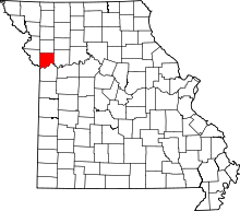 | |
| Villages | ||
| Townships | ||
| Unincorporated communities | ||
| Footnotes | ‡This populated place also has portions in an adjacent county or counties | |