Fischer, Texas
|
Fischer Historic District | |
 Fischer Hall | |
 Fischer Historic District  Fischer Historic District | |
| Location | Roughly bounded by Fischer Store Rd., FM 32, Patriotic & Let's Roll Drs., Fischer, Texas |
|---|---|
| Coordinates | 29°58′43″N 98°15′53″W / 29.97861°N 98.26472°W |
| NRHP reference # | 100001222[1] |
| Added to NRHP | June 29, 2017 |
Fischer is an unincorporated community in Comal County, Texas, United States. The population was 688 at the 2010 census. The community is part of the San Antonio Metropolitan Statistical Area.
Although it is unincorporated, Fischer has a post office, with the ZIP code of 78623.[2]
Fischer has an unofficial mayor. Presently it is Dennis Hubbard.
History
Fischer was founded in 1853 by Hermann and Otto Fischer, German immigrants. They established a self-sufficient rural community based on agriculture and ranching, economic activities that continue in the area. The center of the community is near the 1860s house of Otto Fischer, now a bed and breakfast, and is centered around the Fischer Store and post office. One of the surviving early 20th-century buildings in town includes an old nine-pin bowling alley whose pins are still set by hand.[3] The core of the village, as well as its surrounding landscape and transportation patterns, were listed on the National Register of Historic Places in 2017 as the Fischer Historic District.
Climate
The climate in this area is characterized by hot, humid summers and generally mild to cool winters. According to the Köppen Climate Classification system, Fischer has a humid subtropical climate, abbreviated "Cfa" on climate maps.[4]
Education
Residents are zoned to the Comal Independent School District
Zoned schools:
- Mountain Valley and Rebecca Creek elementaries[5]
- Mountain Valley Middle School[6]
- Canyon Lake High School [7]
See also
References
- ↑ "Weekly List of Actions Taken on Properties: 6/15/2017 through 6/22/2017". National Park Service. June 23, 2017. Retrieved February 6, 2018.
- ↑ Zip Code Lookup
- ↑ "NRHP nomination for Fischer Historic District" (PDF). State of Texas. Retrieved 2017-10-30.
- ↑ Climate Summary for Fischer, Texas
- ↑ "Elementary School Attendance Zones" (Archive). Comal Independent School District. Retrieved on August 28, 2016. Zones: Mountain Valley (Archive) - Rebecca Creek (Archive)
- ↑ "Middle School Attendance Zones" (Archive). Comal Independent School District. Retrieved on August 28, 2016. Mountain Valley Middle zone (Archive)
- ↑ "High School Attendance Zones" (Archive). Comal Independent School District. Retrieved on August 28, 2016.Canyon Lake High HS zone (Archive)
External links
| Wikimedia Commons has media related to Fischer, Texas. |


Municipalities and communities of Comal County, Texas, United States | ||
|---|---|---|
| Cities | 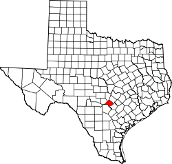 | |
| CDP | ||
| Unincorporated communities | ||
| Ghost town | ||
| Footnotes | ‡This populated place also has portions in an adjacent county or counties | |
Coordinates: 29°58′37″N 98°15′57″W / 29.97694°N 98.26583°W