Windcrest, Texas
| Windcrest, Texas | |
|---|---|
| City | |
| Nickname(s): City of Lights | |
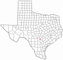 Location of Windcrest, Texas | |
 | |
| Coordinates: 29°30′57″N 98°22′47″W / 29.51583°N 98.37972°WCoordinates: 29°30′57″N 98°22′47″W / 29.51583°N 98.37972°W | |
| Country | United States |
| State | Texas |
| County | Bexar |
| Government | |
| • Type | Council-Manager |
| • City Council |
Mayor Dan Reese Gerd E. Jacobi Jim Shelton James McFall Joan Pedrotti Frank Archuleta |
| • City Manager | Rafael Castillo |
| Area | |
| • Total | 2.16 sq mi (5.59 km2) |
| • Land | 2.15 sq mi (5.58 km2) |
| • Water | 0.004 sq mi (0.01 km2) |
| Elevation | 787 ft (240 m) |
| Population (2010) | |
| • Total | 5,364 |
| • Density | 2,500/sq mi (960/km2) |
| Time zone | UTC-6 (Central (CST)) |
| • Summer (DST) | UTC-5 (CDT) |
| ZIP code | 78239 |
| Area code(s) | 210, 726 (planned) |
| FIPS code | 48-79672[1] |
| GNIS feature ID | 1350289[2] |
| ANSI Code | 2412280[3] |
| Website |
www |
Windcrest is a city in Bexar County, Texas, United States. The population was 5,364 at the 2010 census.[4] It is part of the San Antonio Metropolitan Statistical Area.
Geography
Windcrest is located in northeastern Bexar County. It is bordered to the north, west, and south by the city of San Antonio and to the east by unincorporated neighborhoods in Bexar County. Windcrest is 11 miles (18 km) northeast of downtown San Antonio.
According to the United States Census Bureau, the city has a total area of 2.2 square miles (5.6 km2), of which 0.004 square miles (0.01 km2), or 0.23%, is water.[4]
Demographics
| Historical population | |||
|---|---|---|---|
| Census | Pop. | %± | |
| 1960 | 441 | — | |
| 1970 | 3,371 | 664.4% | |
| 1980 | 5,332 | 58.2% | |
| 1990 | 5,331 | 0.0% | |
| 2000 | 5,105 | −4.2% | |
| 2010 | 5,364 | 5.1% | |
| Est. 2016 | 5,858 | [5] | 9.2% |
| U.S. Decennial Census[6] | |||
As of the census[1] of 2000, there were 5,105 people, 2,232 households, and 1,618 families residing in the city. The population density was 2,808.9 people per square mile (1,083.0/km2). There were 2,297 housing units at an average density of 1,263.9 per square mile (487.3/km2). The racial makeup of the city was 84.00% White, 8.23% African American, 0.31% Native American, 2.10% Asian, 0.20% Pacific Islander, 3.80% from other races, and 1.37% from two or more races. Hispanic or Latino of any race were 14.93% of the population.
There were 2,232 households out of which 16.8% had children under the age of 18 living with them, 62.5% were married couples living together, 8.0% had a female householder with no husband present, and 27.5% were non-families. 24.1% of all households were made up of individuals and 16.2% had someone living alone who was 65 years of age or older. The average household size was 2.23 and the average family size was 2.59.
In the city, the population was spread out with 14.6% under the age of 18, 5.0% from 18 to 24, 15.9% from 25 to 44, 28.0% from 45 to 64, and 36.6% who were 65 years of age or older. The median age was 56 years. For every 100 females, there were 84.3 males. For every 100 females age 18 and over, there were 81.7 males.
The median income for a household in the city was $60,596, and the median income for a family was $69,156. Males had a median income of $38,545 versus $32,457 for females. The per capita income for the city was $30,120. About 4.6% of families and 6.5% of the population were below the poverty line, including 19.7% of those under age 18 and 0.4% of those age 65 or over.
The median home price in Windcrest has steadily increased over the past 6 years. In 2000, the median home cost $115,900, but by 2005 this number has risen to $132,740. The median size of homes in this area is 2,250 square feet (209 m2).
Education
The city is served by North East Independent School District.[7] Windcrest Elementary School in Windcrest,[8] Ed White Middle School in San Antonio,[9] and Roosevelt High School in San Antonio serve the city.[10]
References
- 1 2 "American FactFinder". United States Census Bureau. Retrieved 2008-01-31.
- ↑ "US Board on Geographic Names". United States Geological Survey. 2007-10-25. Retrieved 2008-01-31.
- ↑ "US Gazetteer Files 2016-Places-Texas". US Census. Retrieved 24 January 2017.
- 1 2 "Geographic Identifiers: 2010 Demographic Profile Data (G001): Windcrest city, Texas". U.S. Census Bureau, American Factfinder. Retrieved April 15, 2014.
- ↑ "Population and Housing Unit Estimates". Retrieved June 9, 2017.
- ↑ "Census of Population and Housing". Census.gov. Retrieved June 4, 2015.
- ↑ "Zoning Map of the City of Windcrest." City of Windcrest. Retrieved on March 24, 2010. North Map and South Map
- ↑ "Windcrest Elementary School" Map. North East Independent School District. Retrieved on March 24, 2010.
- ↑ "Ed White Middle School" Map. North East Independent School District. Retrieved on March 24, 2010.
- ↑ "Roosevelt High School" Map. North East Independent School District. Retrieved on March 24, 2010.
External links
- City of Windcrest official website
- Martinez, Melissa. "Windcrest Neighborhood Profile." About.com.
Municipalities and communities of Bexar County, Texas, United States | ||
|---|---|---|
| Cities | 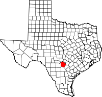 | |
| Towns | ||
| CDPs | ||
| Other unincorporated communities | ||
| Footnotes | ‡This populated place also has portions in an adjacent county or counties | |