Delaware Route 1
| ||||
|---|---|---|---|---|
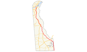 DE 1 highlighted in red | ||||
| Route information | ||||
| Maintained by DelDOT and USACE | ||||
| Length | 103.02 mi[1] (165.79 km) | |||
| Existed | 1974[2] – present | |||
| History | Completed in 2003[3][4] | |||
| Tourist routes |
Washington–Rochambeau Revolutionary Route | |||
| Major junctions | ||||
| South end |
| |||
|
| ||||
| North end |
| |||
| Location | ||||
| Counties | Sussex, Kent, New Castle | |||
| Highway system | ||||
| ||||

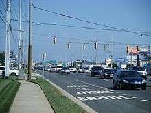
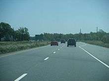
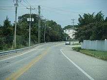
Delaware Route 1 (DE 1) is a 103.02-mile-long (165.79 km) state highway in the U.S. state of Delaware. The route runs from the Maryland border in Fenwick Island, Sussex County, where it continues south into that state as Maryland Route 528 (MD 528), north to an interchange with DE 58 in Christiana, New Castle County, where the road continues north as DE 7. Between Fenwick Island and Dover Air Force Base in Dover, Kent County, DE 1 is a four- to six-lane surface divided highway with occasional interchanges. The route heads north past the Delaware Beaches along the Atlantic Ocean before it runs northwest through rural areas, turning north at Milford to continue to Dover. Upon reaching Dover, DE 1 becomes the Korean War Veterans Memorial Highway, a four- to six-lane freeway that is tolled. Between Dover and Tybouts Corner, DE 1 parallels U.S. Route 13 (US 13), crossing over and featuring interchanges with it multiple times. Past Tybouts Corner, the freeway heads north to Christiana, reaching an interchange with Interstate 95 (I-95) a short distance before its terminus. DE 1 serves as the main north-south state route in Delaware, connecting the Delaware Beaches with the Dover and Wilmington areas.
DE 1 was first designated in the 1970s between Fenwick Island and US 113 in Milford, replacing a portion of DE 14 and following the newly constructed Milford Bypass. DE 14 between Fenwick Island and Milford had been built as a state highway in the 1920s and 1930s and was widened into a divided highway between the 1950s and 1970s. In the 1980s, a limited-access "Relief Route" for US 13 was proposed between Dover and the Wilmington area in order to relieve that route of beach traffic. This relief route would be incorporated into DE 1 in 1988, with the route extended up US 113 between Milford and Dover to connect to the Relief Route. The tolled DE 1 freeway between Dover Air Force Base and Christiana opened in multiple stages between 1991 and 2003, and at a cost of $900 million was the largest public works project in Delaware history. The concurrent US 113 designation north of Milford was removed in 2004. Upgrades continue to be made to DE 1 such as the construction and improvement of interchanges as well as widening portions of the road.
Route description
Fenwick Island to Lewes
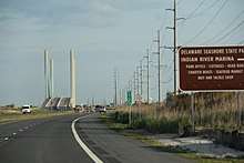
DE 1 begins at the Maryland border in the Delaware Beaches town of Fenwick Island in Sussex County, where the road continues south into the town of Ocean City, Maryland as MD 528. From this point, DE 1 heads north on four-lane divided Coastal Highway. A block after the state line, the route intersects the eastern terminus of DE 54. The road continues north through business areas with some residences a short distance to the west of the Atlantic Ocean. DE 1 passes west of the Bethany-Fenwick Area Chamber of Commerce Information Center as it leaves Fenwick Island and heads into Fenwick Island State Park, running along a narrow strip of land with the Little Assawoman Bay to the west and the Atlantic Ocean to the east. The route passes a small area of residential development before it goes through more of the state park. The road runs through York Beach and enters the town of South Bethany, where it passes through residential areas. DE 1 heads into commercial areas in Middlesex Beach and briefly curves northwest before turning north again and continuing into the town of Bethany Beach, where the road name changes to Delaware Avenue. The route runs past residences and comes to an intersection with DE 26, which heads east into the commercial center of Bethany Beach. The road curves northeast and leaves Bethany Beach as it passes to the east of a Delaware National Guard training site. Continuing north, DE 1 becomes Coastal Highway again and heads past the community of Sussex Shores, running between wooded areas to the west and beachfront homes to the east. Farther north, the route crosses into Delaware Seashore State Park, where it travels along a strip of land between the Indian River Bay to the west and the Atlantic Ocean to the east. DE 1 comes to a right-in/right-out access point to the park before it crosses over the Indian River Inlet on the cable-stayed Indian River Inlet Bridge.[5][6]
Past the bridge, the road passes to the east of a United States Coast Guard station and continues north through more of the state park between the Rehoboth Bay to the west and the Atlantic Ocean to the east. The route travels near the Indian River Life Saving Service Station and two fire control towers from World War II before it leaves Delaware Seashore State Park and enters the town of Dewey Beach. At this point, DE 1 passes homes prior to running through business areas. The route comes to an intersection with the southern terminus of DE 1A, which heads north towards the city of Rehoboth Beach. At this intersection, DE 1 turns northwest away from the Atlantic Ocean and passes through residential areas with some commercial development. The road leaves Dewey Beach and continues to a right-in/right-out interchange with DE 1B, which heads north into Rehoboth Beach. Immediately after, the route crosses over the Lewes and Rehoboth Canal on a high-level, twin span crossing and enters commercial areas. After the bridge, the road has a southbound ramp and a northbound right-in/right-out serving Oyster House Road, which allows U-turns from the southbound direction to the northbound direction, and gains a southbound combined right turn, bus, and bicycle lane.[5][6]
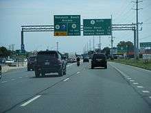
DE 1 intersects the northern terminus of DE 1A, which serves as an access road to Rehoboth Beach, at which point it widens to eight lanes with six travel lanes and a combined right turn, bus, and bicycle lane in each direction. The road passes more businesses and heads to the north of the Rehoboth Beach Park and Ride, a park and ride facility that is accessed by Shuttle Road. Following this, the roadway passes between two sections of the Tanger Outlets Rehoboth Beach outlet mall. Farther northwest, the route passes northeast of the Rehoboth Mall and comes to an intersection with the eastern terminus of DE 24 and the southern terminus of DE 1D in Midway. DE 1 passes to the northeast of another part of the Tanger Outlets as it is lined with more businesses. In Carpenters Corner, the route intersects US 9, which travels northeast to provide access to the city of Lewes, Cape Henlopen State Park, and the Cape May–Lewes Ferry across the Delaware Bay. At this point, DE 1 becomes concurrent with US 9, and the two routes run through woods before curving west past businesses and passing north of the Lewes Transit Center park and ride. In Five Points, US 9 splits from DE 1 by heading west concurrent with DE 404, with access to the northern termini of DE 23 and DE 1D, while US 9 Bus. heads northeast towards Lewes. At this intersection, access from eastbound US 9/DE 404 to northbound DE 1 is provided by a reverse jughandle. Past Five Points, DE 1 narrows back to four lanes and passes southwest of a park and pool lot located at a church before it bypasses Nassau to the southwest, curving northwest to pass over an inactive Delaware Coast Line Railroad line on a bridge.[5][6]
Lewes to Dover Air Force Base
After the bridge over the railroad line, DE 1 leaves the Delaware Beaches area and heads into a mix of farm fields and residential and commercial development, traveling to the northeast of Red Mill Pond. The road heads through the community of Overbrook and passes northeast of Eagle Crest Aerodrome as it continues through more agricultural areas with some residential subdivisions and woods. The route crosses over the Broadkill River and passes to the southwest of a golf course before it comes to a junction with DE 16, which heads west to the town of Milton and east to Broadkill Beach along the Delaware Bay. Following this, DE 1 continues through farmland and woodland to the southwest of the Prime Hook National Wildlife Refuge, reaching an intersection with the northern terminus of DE 5. Immediately after this intersection, the road travels to the east of Waples Pond and runs north-northwest through more agricultural areas. The route curves northwest as it bypasses the community of Argos Corner to the southwest. Past here, DE 1 crosses Cedar Creek and passes near a couple residential subdivisions before intersecting Johnson Road. A short distance later, the road reaches an interchange with the northern terminus of DE 30. After this interchange, the route comes to a northbound exit and southbound entrance with DE 1 Bus., which heads northwest into the city of Milford. At this point, DE 1 curves north and becomes the Milford Bypass, which heads around the eastern part of the city. The route passes between residential development to the west and farmland to the east before turning northwest into wooded areas and coming to a diamond interchange with DE 36.[5][6]
Past this interchange, DE 1 crosses the Mispillion River into Kent County and continues northwest to an intersection with the eastern terminus of DE 14. The road runs between commercial development to the southwest and a wooded residential neighborhood to the northeast, crossing Northeast 10th Street. The route passes near more development before it comes to a southbound exit and northbound entrance with the northern terminus of US 113 and DE 1 Bus. at the northern end of Milford. Past this interchange, DE 1 becomes Bay Road and travels to the east of Tub Mill Pond before it runs through a mix of farmland and residential and commercial development. The route intersects Thompsonville Road at a partial cloverleaf interchange and continues through farmland with some woods and development. The road curves northwest and comes to an interchange with Frederica Road, which heads northwest to the town of Frederica, as it passes southwest of a sports complex that is served by the interchange. DE 1 bends to the north and bypasses Frederica to the east, crossing over the Murderkill River. The route has an interchange with the eastern terminus of DE 12, which heads south into Frederica. The road runs north through agricultural areas, passing to the west of Barratt's Chapel, before it reaches the community of Little Heaven. Here, DE 1 intersects Bowers Beach Road, which travels east to the town of Bowers Beach along the Delaware Bay. The route passes near homes and businesses and reaches an intersection with Clapham Road, which heads northwest towards the town of Magnolia and Rising Sun. Following this, the road runs through farmland with some woods before transitioning from a four-lane divided surface road to a freeway and coming to a right-in/right-out interchange with Trap Shooters Road that provides access to Magnolia. DE 1 crosses over the St. Jones River and continues north to a diamond interchange with the southern terminus of DE 9, at which point it enters the city limits of Dover. At this interchange, the route turns northwest and passes between an asphalt plant to the southwest and the runways of Dover Air Force Base to the northeast, with a southbound right-in/right-out serving the asphalt plant.[5][6]
Dover Air Force Base to Christiana
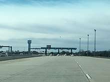
Along the Dover Air Force Base boundary, DE 1 becomes the Korean War Veterans Memorial Highway. The first interchange is a northbound exit and entrance which serves the Commercial Gate of Dover Air Force Base. The freeway passes between the air base golf course to the southwest and various base buildings to the northeast before it reaches a diamond interchange with Old Lebanon Road serving the Main Gate to the northeast and base housing to the southwest. After this, the route continues between base residences and the main part of the base prior to reaching a northbound exit and southbound entrance at the eastern terminus of DE 10 and Bay Road that also serves the North Gate of Dover Air Force Base; the route becomes a toll road at this interchange. DE 1 runs north along the west side of Bay Road before it passes over it, where there is a southbound exit and entrance and a northbound entrance that serves to provide access to DE 10 from southbound DE 1 and to northbound DE 1 from DE 10. Immediately after this is a southbound exit and northbound entrance with the Puncheon Run Connector, which heads west towards US 13. The freeway continues north along the eastern edge of Dover and comes to a southbound exit and northbound entrance at DE 8, which provides access to downtown Dover to the west and the town of Little Creek to the east. Past this interchange, the highway turns northwest through rural areas, crossing the Little River before it comes to the Dover mainline toll plaza. DE 1 passes to the northeast of Dover International Speedway, running between campgrounds belonging to the race track, and comes to a trumpet interchange that provides access to US 13 and Scarborough Road, serving the northern part of Dover. This interchange has a toll plaza on the southbound exit and northbound entrance. Following this interchange, the toll road leaves Dover and continues through wooded areas with some fields and nearby development. The route heads to the east of the town of Cheswold, passing under DE 42 without an interchange, and curves north, crossing the Leipsic River. DE 1 continues thorough rural areas a short distance to the east of US 13 before it reaches the town of Smyrna. Here, the freeway comes to a trumpet interchange serving US 13 at the southern edge of town, with tolls on the southbound exit and northbound entrance. The highway runs to the east of Smyrna with residential development to the west and rural land to the east, passing under DE 6 with no access.[5][6]
DE 1 curves northwest and crosses the Duck Creek into New Castle County, where it heads through farmland with some woods. The road features a virtual weigh station for trucks in the northbound direction, where trucks can be weighed at highway speeds. The route crosses US 13 at an interchange to the north of Smyrna, with access to the Smyrna Rest Area along US 13. The tollway continues northwest through rural areas to the west of US 13, curving north and crossing over the highway once to briefly travel along its east side, where it crosses the Blackbird Creek, prior to another bridge over it to again run to the west of it as it passes to the east of the town of Townsend. DE 1 heads north and closely follows along the west side of US 13 as it runs through more rural areas with residential development to the east. The freeway turns northwest away from US 13 and crosses the Appoquinimink River, passing to the northeast of a residential neighborhood before coming to a diamond interchange with DE 299, which provides access to the town of Middletown to the west and the town of Odessa and US 13 to the east. Past this interchange, DE 1 curves northeast and passes over US 13 again before it turns north and crosses Drawyer Creek. The freeway continues north a short distance to the east of US 13 past residential subdivisions as it comes to a diamond interchange with Pole Bridge Road, which heads west to intersect US 13 and the southern terminus of DE 896 in Boyds Corner. This interchange has tolls on the northbound exit and southbound entrance. After this interchange, DE 1 curves northwest and crosses over US 13, turning north and reaching the Biddles Corner mainline toll plaza, which marks the north end of tolling along DE 1.[5][6]
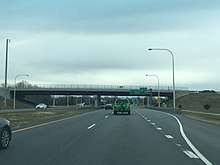
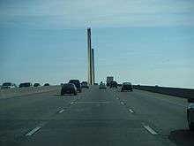
After the toll plaza, DE 1 widens to six lanes and comes to a southbound exit and northbound entrance providing access to US 13 in St. Georges; the southbound exit connects to US 13 by way of Lorewood Grove Road while the northbound entrance consists of a direct ramp from US 13. The freeway turns northwest and crosses the Chesapeake and Delaware Canal and the Michael N. Castle Trail on the north bank of the canal on the cable-stayed Chesapeake and Delaware Canal Bridge. The highway passes through a mix of fields and residential subdivisions and curves north to come to a diverging diamond interchange with US 13 and DE 72 to the west of the city of Delaware City. At this point, US 13 becomes concurrent with DE 1, with the freeway running through farmland and passing over Norfolk Southern's Reybold Running Track railroad line and DE 7 to the west of PBF Energy's Delaware City Refinery. US 13 and DE 1 cross Red Lion Creek and continue concurrent to Tybouts Corner, where DE 1 splits at an interchange to continue as a freeway and US 13 heads northeast as a surface divided highway. Within this interchange is the northern terminus of DE 71, which southbound DE 1 has a direct ramp to. Past Tybouts Corner, DE 1 narrows to four lanes and travels north past residential subdivisions, passing over Norfolk Southern's New Castle Secondary prior to the US 40 interchange in Bear. The highway continues north and reaches an interchange with DE 273 in Christiana. The freeway runs through wooded areas and crosses the Christina River before it comes to an interchange with DE 7 and Mall Road that serves the Christiana Mall to the east of the road. At this point, DE 7 joins DE 1 on the freeway, passing to the west of the mall before coming to a modified cloverleaf interchange with I-95 (Delaware Turnpike) that has flyover ramps from between northbound DE 1/DE 7 and northbound I-95 and between southbound I-95 and southbound DE 1/DE 7. Past I-95, the freeway heads through commercial areas prior to an interchange with DE 58. At this point, DE 1 and the freeway end while DE 7 continues north as a divided surface road.[5][6]
DE 1 serves as a major route connecting northern Delaware to the Delaware Beaches and sees heavy traffic in the summer months. The peak travel periods in the summer are southbound on Friday evenings, Saturday afternoons, and northbound on Sunday afternoons.[7][8][9] DE 1 serves as a primary hurricane evacuation route from the Delaware Beaches and points along the Delaware Bay to inland locations in northern Delaware.[10] The sections of DE 1 between DE 12 in Frederica and Clapham Road in Little Heaven and Trap Shooters Road in Magnolia and DE 9 near Dover Air Force Base are designated as part of the Delaware's Bayshore Byway, a Delaware Byway.[11] The section of DE 1 between the south end of the DE 7 concurrency and the northern terminus at DE 58 in Christiana is part of the Washington–Rochambeau Revolutionary Route, a National Historic Trail.[12] DE 1 has an annual average daily traffic count ranging from a high of 116,110 vehicles at the US 13 interchange north of Smyrna to a low of 10,590 vehicles at the southern boundary of South Bethany.[1] The entire length of DE 1 is part of the National Highway System.[13]
Tolls
As of August 1, 2014, the Delaware Department of Transportation (DelDOT) charges a total of $2 on weekdays ($6 on weekends) for the entire 51-mile (82 km) length of the Korean War Veterans Memorial Highway portion of DE 1, with mainline toll plazas at Dover and Biddles Corner which each charge $1 on weekdays ($3 on weekends). Weekend tolls are in effect from 7:00 pm Friday until 11:00 pm Sunday. In addition, DelDOT charges a $0.50 toll at exit 104 for US 13 in North Dover (southbound off, northbound on) and exit 142 for DE 896 in Boyds Corner (northbound off, southbound on), and a $0.25 toll at exit 114 for US 13 in South Smyrna (southbound off, northbound on). Tolls may be paid with cash or E-ZPass. A discount is available for motorists with E-ZPass exiting northbound and entering southbound at exits 104 and 114 north of the Dover toll plaza as well as entering northbound and exiting southbound at exit 142 south of the Biddles Corner toll plaza. This discount is $0.50 at exits 104 and 142 and $0.25 at exit 114.[14] There is also a frequent user plan in which E-ZPass users who make at least 30 trips in 30 days receive a 50% discount on tolls.[15]
Tolls at the Dover and Biddles Corner mainline toll plazas were originally $1 the whole week.[16] E-ZPass became operational along DE 1 on April 6, 1999.[17] The Biddles Corner mainline toll plaza opened with high-speed E-ZPass lanes in 1999.[18] On May 24, 2004, a dedication ceremony was held marking the completion of construction of high-speed E-ZPass lanes at the Dover mainline toll plaza, with DelDOT secretary Nathan Hayward III and Dover Mayor Stephen Speed in attendance; the lanes opened to traffic on May 27.[19] On October 1, 2007, tolls on weekends at the Dover and Biddles Corner mainline toll plazas were increased to $2 in order to fund statewide transportation projects. Commercial vehicle tolls also increased by $1 on weekdays and $2 on weekends at this time.[16] On August 1, 2014, the weekend tolls at Dover and Biddles Corner increased to $3 in order to again provide funding to transportation projects across the state.[15]
History
South of Dover
The portion of DE 1 between Milford and Little Heaven was initially built as part of the DuPont Highway, a highway that spanned the state from Selbyville to Wilmington. The highway was proposed as a modern road that was part of a philanthropic measure. This roadway was planned to improve travel and bring economic development to Kent and Sussex counties. The DuPont Highway was to be modeled after the great boulevards of Europe and was to have a 200-foot (61 m) wide right-of-way consisting of a 40-foot (12 m) wide roadway for automobiles flanked by dual trolley lines, 30-foot (9.1 m) wide roadways for heavy vehicles, 15-foot (4.6 m) wide unpaved roadways for horses, and sidewalks. Utilities were to be buried underground below the horse roadways. The highway was also to include agricultural experimental stations and monuments for future surveying. Trolley revenues would help pay for the construction of the roadway. After portions of the DuPont Highway were built, these portions were planned to be turned over to the state at no charge.[20]
In 1911, the Coleman DuPont Road, Inc. was established and construction on the highway began.[21] By 1912, construction was interrupted by litigation challenging both the constitutionality of the law establishing the road building corporation and the need for DuPont to acquire such a large right-of-way.[22] DuPont would narrow the proposed right-of-way to 100 feet (30 m) in order to compromise with opponents of the highway in addition to offering landowers whose properties were affected by the highway five times the assessed value of the land five years after the highway was completed.[21] The DuPont Highway would end up being built on a 60-foot (18 m) alignment with a 32-foot (9.8 m) wide roadway. The DuPont Highway north of Milford would be both designed and constructed by Delaware State Highway Department (DSHD).[23] A portion of the road north of Milford and from Frederica to Little Heaven were completed by 1920.[24] The portion of the DuPont Highway from north of Milford to Frederica was under construction in 1920 and completed by 1923, the same year the last section of the entire Selbyville–Wilmington highway was completed near Odessa.[25] When the U.S. Highway System was designated in 1926, this portion of the DuPont Highway became a part of US 113.[26][27]
The portion of DE 1 between Little Heaven and Dover Air Force Base was built as part of a Dover bypass for US 113. This bypass was built atop existing Bay Road north of the present-day DE 9 interchange and on a new alignment south of there.[28] The new highway between Little Heaven and Bay Road would cross the St. Jones River at a site called Barkers Landing. Between December 1931 and the end of 1933, DSHD constructed a causeway across 3,150 feet (960 m) of the marsh on the east bank of the river, a process that required multiple applications of fill dirt and dynamite to create a stable surface for a modern highway.[29] A Scherzer rolling lift bascule bridge was constructed across the St. Jones River in 1934. Bay Road was widened and the new sections of highway were built with 20-foot (6.1 m) wide concrete pavement starting in 1934.[28] US 113 was relocated to the bypass when the new highway opened for Memorial Day in 1935.[30]
US 113 was widened into a divided highway from north of Milford to south of Frederica and around Dover Air Force Base in 1959.[31] A four-lane divided bypass to the east of Frederica was constructed in 1965, with the former alignment of US 113 through Frederica now Frederica Road.[32] US 113 between Frederica and Little Heaven was expanded in 1975.[33][34] US 113 between Little Heaven and Dover Air Force Base was expanded to a divided highway in 1984 and 1985; this project included replacing the two-lane drawbridge over the St. Jones River with a four-lane girder bridge.[35][36]
What would become DE 1 between Milford and Rehoboth Beach was originally a county road by 1920.[24] By 1924, the road was proposed as a state highway between Nassau and Rehoboth Beach.[37] A year later, the state highway was completed between Milford and Cedar Creek and from Nassau to just west of Rehoboth Beach, with the sections between Cedar Creek and Nassau and into Rehoboth Beach under proposal.[38] In 1927, the state highway between Milford and Rehoboth Beach was completed with the construction of a bascule bridge over the Broadkill River.[39][40] In 1931, a state gravel road was extended from Bethany Beach to the Indian River Inlet, providing access to the inlet for recreational purposes.[41] In January 1933, bids were made for construction of a gravel road from Dewey Beach south to the Indian River Inlet as well as for a timber bridge across the inlet, connecting with the gravel road between the Indian River Inlet and Bethany Beach. This gravel road would provide a direct connection between Bethany Beach and Rehoboth Beach and would provide better access to the Atlantic coast for recreation.[42] The Ocean Highway between Bethany Beach and Rehoboth Beach was completed in 1933. In fall of that year, the roadway between Bethany Beach and Indian River Inlet was paved, with recommendations to pave the road north from the Indian River Inlet toward Rehoboth Beach.[29] In 1934, the Ocean Highway between the Indian River Inlet and Rehoboth Beach was paved. The same year, recommendations were made to extend the Ocean Highway south from Bethany Beach to Fenwick Island, where it would lead to a Maryland state highway continuing to Ocean City.[28]
When Delaware designated its state highway system by 1936, the state highway between Milford and Bethany Beach became a part of DE 14, which continued west from Milford to the Maryland border near Burrsville, Maryland.[43] In 1939, a southern extension of DE 14 was built between Bethany Beach and the Maryland border in Fenwick Island as a gravel road.[44][45] In 1940, a swing bridge opened across the Indian River Inlet.[44][46] The same year, work began for a bypass of the route between Dewey Beach and west of Rehoboth Beach, which included a bascule bridge over the Lewes and Rehoboth Canal.[46] In 1942, the Rehoboth Beach bypass for DE 14 was completed.[47][48] In addition, the roadway was paved between Fenwick Island and Bethany Beach by that year.[48] In 1952, a new swing bridge opened across the Indian River Inlet after the previous bridge was destroyed by ice and tides in 1948.[49]
The route was widened into a divided highway between DE 18 (now US 9) in Nassau and Rehoboth Beach in 1954 in order to provide relief to traffic heading to the beaches. Channelized intersections were built at DE 18 and the entrance to Rehoboth Beach.[50][51] As part of this widening, DE 14 was moved to a new alignment to bypass Wescoats Corner, removing a concurrency with DE 18; the bypassed alignment of DE 14 is now US 9 Bus. (which replaced DE 18) and Wescoats Road.[52] In 1965, a new dual bridge was constructed across the Indian River Inlet.[53] By 1966, DE 14A was designated onto the former alignment of DE 14 through Rehoboth Beach.[54] The divided highway portion of DE 14 was extended north to DE 16, which included a bypass of Nassau, and between the Indian River Inlet and South Bethany in 1967. The former alignment of DE 14 through Nassau is now Nassau Road.[55][56] By 1967, a divided bypass of Milford running from DE 14 southeast of Milford to US 113 north of Milford was under proposal.[56] Structural design on the Milford Bypass began in 1968.[57] In 1969, design work began on widening DE 14 into a divided highway between DE 16 and the Milford Bypass.[58] The route was widened into a divided highway between Dewey Beach and the Indian River Inlet the same year.[59][60] In 1971, the divided Miford Bypass between DE 14 southeast of Milford and US 113 north of Milford was completed.[61][62] In 1971, a contract was awarded to widen DE 14 to a divided highway between Fenwick Island and South Bethany.[63] This widening project was completed a year later.[62] In 1973, construction was underway to make DE 14 a divided highway from the Milford Bypass to DE 16, which included a bypass of Argos Corner; this was completed in 1974. The former alignment of DE 14 through Argos Corner is now Argos Corner Road.[64]
In 1974, DE 1 was signed concurrent with DE 14 east of Milford and on the Milford Bypass.[2] Work began in 1975 to widen the portion of DE 14 bypassing Rehoboth Beach, which included a new bridge over the Lewes and Rehoboth Canal.[65] In 1977, DE 14 was truncated to Milford, with DE 1 replacing the route between Fenwick Island and the south end of the Milford Bypass.[66][67] As a result of this, DE 14A was renumbered to DE 1A.[67] A new high-level bridge carrying DE 1 over the Lewes and Rehoboth Canal opened in 1978.[68] By 1981, DE 1 was widened to a divided highway between Dewey Beach and southwest of Rehoboth Beach except for the crossing of the canal.[67] In 1985, the crossing over the Lewes and Rehoboth Canal was dualized with a high-level bridge constructed for northbound traffic.[69] DE 1 was designated along US 113 between Milford and Dover in 1988.[70] In 1991, DelDOT enacted corridor preservation measures on DE 1, including its concurrency with US 113, from Dover Air Force Base to Nassau to prevent excessive development along the corridor so it can gradually be transformed into a freeway.[71] The same year, a jughandle was built between eastbound US 9/DE 404 and northbound DE 1 as part of an reconfiguration of the Five Points intersection that separated the DE 23 and Plantation Road intersection from US 9/DE 404.[72]
In 2004, the concurrent US 113 designation along DE 1 between Milford and Dover Air Force Base was removed.[73][74] Between September 2003 and May 2004, a $5 million improvement project took place on DE 1 between Dewey Beach and the Lewes and Rehoboth Canal bridge that added sidewalks on both sides of the road, median modifications, improvements to pavement, drainage, and intersections, and installed new pedestrian and traffic signals.[75] In 2004, DelDOT began a study on converting the Five Points intersection into an interchange in addition to constructing the Western Parkway.[72] The Western Parkway would have provided a road corridor from DE 1 north of Five Points south to DE 24, running to the west of DE 1. The parkway, which was intended to provide another north-south corridor in the area, would have had partial control of access, featuring intersections with existing roads but no private driveways or access to new development.[76] Alternatives for these projects were presented at public workshops between 2004 and 2008, although the projects were cancelled due to lack of support and financial limitations.[72] On September 11, 2006, work began on a $9.7 million project to widen DE 1 between DE 24 in Midway and US 9 in Five Points by adding a third southbound lane and a multi-use lane in both directions. The project was completed on June 9, 2008.[77]
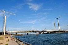
In 2009, work began to replace the steel-girder Indian River Inlet Bridge with a cable-stayed span due to scouring that had occurred to the steel girder bridge.[78][79] The new Indian River Inlet Bridge opened to southbound traffic on January 20, 2012. Delaware Governor Jack Markell, U.S. Senator Tom Carper, and DelDOT Secretary Shailen Bhatt rode in the first car across the bridge.[80] On January 30, 2012, one northbound lane of the new bridge opened.[80][81] All four lanes of the bridge as well as the pedestrian and bicycle walkway opened in spring 2012.[80] Demolition of the 1965 bridge began in spring 2012 and was completed in spring 2013.[81]
In September 2014, a $7.2 million project began for pedestrian improvements to the stretch of DE 1 between the bridge over the Lewes and Rehoboth Canal in Rehoboth Beach and Nassau, which sees heavy pedestrian and bicycle traffic during the summer months. The project added a continuous sidewalk along this segment of road, multiple new crosswalks, and new and improved bus stops. The pedestrian improvement project was completed on June 13, 2016, with Governor Markell, DelDOT secretary Jennifer Cohan, State Representative Peter Schwartzkopf, and State Senator Ernesto Lopez in attendance at a ceremony to mark the completion of the project.[82]
DelDOT has replaced several at-grade intersections along DE 1 south of Dover with grade-separated interchanges in order to improve traffic flow and safety, particularly in the summer months when the route sees heavy beach traffic.[83] On October 27, 2008, construction began on an interchange at DE 9 near Dover Air Force Base, with Governor Ruth Ann Minner in attendance at the groundbreaking ceremony.[84] Construction of the interchange at DE 9 was completed in 2009.[85] In November 2009, construction began for a grade-separated interchange with DE 12 in Frederica; the interchange was completed in June 2011.[86][87] In September 2011, the median crossover at the Wilkins Road intersection near the northern terminus of DE 30 was permanently closed ahead of a project to construct an interchange with DE 30. The median crossover at DE 30 Alt. (Johnson Road) was modified to only allow motorists to turn from northbound DE 30 Alt. to southbound DE 1.[88] In November 2012, construction began on an interchange at DE 30 southeast of Milford. The interchange between DE 1 and DE 30 was completed in July 2014.[89] On January 31, 2015, groundbreaking took place for an interchange at Thompsonville Road north of Milford, with Governor Markell and DelDOT secretary Bhatt in attendance.[90][91] Construction of this interchange involved extending Thompsonville Road west from DE 1 to an intersection with Church Hill Road and Tub Mill Pond Road. The interchange at Thompsonville Road opened in November 2016.[92]
On November 9, 2015, construction began on an interchange at Bowers Beach Road and Clapham Road in Little Heaven, with Governor Markell, DelDOT secretary Cohan, U.S. Senators Carper and Chris Coons, and Speaker of the Delaware House of Representatives Peter Schwartzkopf in attendance at the groundbreaking ceremony. Work on the interchange at Bowers Beach Road and Clapham Road will build service roads on both sides of the route with a bridge carrying DE 1 over Bowers Beach Road; construction is expected to last until 2018.[93][94] On December 20, 2017, the ramps connecting southbound DE 1 and Clapham Road opened.[95] The east service road, called Little Heaven Road, was opened on February 27, 2018 and will serve as the temporary northbound lanes of DE 1 while the bridge over Bowers Beach Road is being built.[94][96] On March 18, 2016, a groundbreaking ceremony took place to build an interchange at Frederica Road south of Frederica, with Governor Markell, Senator Carper, and Kent County Administrator Michael J. Petit de Mange present at the ceremony.[97][98] The Frederica Road interchange south of Frederica opened to traffic on July 10, 2018.[99][100] A ribbon cutting ceremony for this interchange was held on August 10, 2018, with Governor John Carney, Senator Carper, U.S. Representative Lisa Blunt Rochester, and DelDOT secretary Cohan in attendance.[101] On March 26, 2018, a groundbreaking ceremony was held to construct an interchange at DE 14 in Milford; Governor Carney, Senator Carper, U.S. Representative Blunt Rochester, and DelDOT secretary Cohan attended the ceremony.[102] Construction of the interchange at DE 14 in Milford, which will also build a connector road from DE 14 to Northeast 10th Street, is expected to be completed in August 2019.[103]
There are plans to replace two more at-grade intersections along the route with grade separated interchanges. The two intersections to be upgraded to interchanges are DE 16 east of Milton[104] and Minos Conaway Road in Nassau.[105] The proposed interchange at DE 16 is in the semi-final design stage with construction not projected to begin until mid-2020.[104] Project development on the interchange at Minos Conaway Road is slated to begin in 2018 and end in 2022.[105]
There are plans to build a direct ramp from southbound DE 1 to US 9/DE 404 at the DE 1D/DE 23 intersection as part of a reconfiguration of the intersection between US 9/DE 404 and DE 1D/DE 23. This project is currently in the design phase with construction planned to begin in 2024.[72]
Korean War Veterans Memorial Highway
Between 1958 and 1971, studies were conducted for a bypass of the segment of US 13 through Dover along with a connector between Dover and Frederica.[106] The proposed routing began at US 113 and DE 12 north of Frederica and continued northwest to Woodside, where it was planned to cross US 13. From here, the bypass was to run to the west of Dover and head north to its terminus at US 13 north of Cheswold.[107] As part of planning of the Dover Bypass, an archaeological survey had to be conducted along part of the proposed route between 1972 and 1975. By 1976, construction of the Dover Bypass was postponed indefinitely.[108] From 1971 to 1978, a north-south extension of the Delaware Turnpike between Wilmington and Dover was studied.[106] This extension was proposed to run from north of I-95 in Ogletown south to US 13 near Camden. The toll road would head south from Ogletown and cross the Chesapeake and Delaware Canal on the Summit Bridge to reach a connector to US 301 near the Maryland border. From here, the turnpike would bypass Middletown, Clayton, Smyrna, and Dover to the west before coming to US 13. Intermediate interchanges were to be located west of Dover, at DE 6 west of Smyrna, west of Middletown, at DE 896 south of the Summit Bridge, DE 71 north of the Summit Bridge, US 40, and I-95. The north-south extension of the Delaware Turnpike was to have a combination of ramp tolls and mainline toll barriers. Three mainline toll barriers were to be located between I-95 and US 40, between Middletown and Smyrna, and north of Camden. The projected cost of the project in 1972 was $107 million.[109]
In 1983, studies began for a "Relief Route" of US 13 between Dover and Wilmington.[106] The new highway was proposed in order to relieve US 13 of traffic heading to the Delaware Beaches in the summer.[110] The Relief Route for US 13 was planned as a toll road in order to help pay for the cost of the construction of the highway.[111] Prior to the beginning of construction, an archaeological survey was conducted along the proposed route of the freeway in 1986.[112] The same year, plans were unveiled for the route, which would begin at US 113 south of Dover and head north to US 13 in Tybouts Corner. The Relief Route would cross US 13 several times, passing to the east of Dover and Smyrna and to the west of Odessa.[110] The section of DE 1 between Tybouts Corner and Christiana had originally been planned as a relief route for DE 7, a two-lane road that connected US 13 to I-95 that saw a lot of congestion.[113]
In July 1987, construction began on the first segment of the freeway between US 40 in Bear and DE 273 in Christiana.[3][106] In 1988, the US 13 Relief Route was given the DE 1 designation. DE 1 was extended from its northern terminus in Milford to follow US 113 between Milford and Dover and US 13 between Dover and Tybouts Corner.[70][114] Construction on the freeway between US 13 in Tybouts Corner and US 40 in Bear began in March 1988. In August of that year, groundbreaking took place for the section of the DE 1 toll road between Dover and Smyrna. Construction commenced on DE 1 between DE 273 and I-95 in Christiana in August 1990. The first section of the DE 1 freeway opened in August 1991 between US 13 in Tybouts Corner and US 40 in Bear. Three months later, the freeway opened north to DE 273 in Christiana.[106]
In April 1992, groundbreaking took place for the section of DE 1 across the Chesapeake and Delaware Canal.[106] It was decided that the highway would cross the canal on a cable-stayed bridge.[115] The section of DE 1 between DE 273 and I-95 in Christiana opened in April 1993.[106] In August of that year, southbound DE 1 between US 113 at Lafferty Lane in Dover and US 113 south of DE 10 at Dover Air Force Base was opened to traffic. In September 1993, bicyclists were allowed on a section of the under-construction DE 1. The portion of the route bypassing Smyrna was finished in November of that year.[116] The section of the tollway between US 113 at Dover Air Force Base and US 13 south of Smyrna opened on December 21, 1993, with Governor Tom Carper in attendance at the opening ceremony. This section opened with a mainline toll barrier and ramp tolls.[117][118] Following the completion of this section, DE 1 was rerouted off US 113 and US 13 between Dover and Smyrna.[118]
When the portion of DE 1 between Dover and Smyrna opened, road signs, with the exception of speed limit signs, were in metric units in anticipation of the United States converting to the metric system.[119] The section of DE 1 between Dover and Smyrna had exit numbers based on kilometerposts while the section between Tybouts Corner and Christiana originally had exit numbers based on mileposts.[120] In 1997, the exit numbers along the portion of the route between Tybouts Corner and Christiana were changed to reflect kilometerposts.[121]
In December 1995, the section of DE 1 between US 13 in St. Georges and US 13 in Tybouts Corner opened, which included the Chesapeake and Delaware Canal Bridge.[120][122] Prior to the opening of this section, a bridge walk was held over the canal.[122] Following the completion of this segment, DE 1 was rerouted off the surface alignment of US 13 that crossed the St. Georges Bridge.[120] Subsequently, US 13 was rerouted to follow the new DE 1 between the DE 72 interchange and Tybouts Corner.[120][123] Construction of the new DE 1 had severed US 13 south of Tybouts Corner, with part of the former alignment north of the DE 7 intersection becoming a two-lane road while the section south of there became an extended DE 7 to the intersection with US 13 and DE 72.[120] In building DE 1 across the Chesapeake and Delaware Canal, there were initially plans to demolish the aging St. Georges Bridge that carried US 13 over the canal. The plan drew concerns from residents in St. Georges who feared the community would be split in half. The St. Georges Bridge was instead kept and was refurbished. A southbound exit and northbound entrance at US 13 south of the Chesapeake and Delaware Canal Bridge along DE 1 was built as required by federal legislation that gave the state $115 million toward construction of the new canal bridge.[124]
The extension of the DE 1 freeway south through Dover Air Force Base was constructed later than the Dover to Smyrna segment due to the need to coordinate negotiations with the military installation and to allow the base to remediate hazardous material sites, maintain security and access restrictions with construction of a new Main Gate, and reconstruct base housing on the west side of the highway.[106][125] Construction of an interchange at the Dover Air Force Base Main Gate commenced in February 1996.[106] This project resulted in the relocation of the Main Gate further back in order to build the interchange and the overpass linking the Main Gate to base housing. This construction resulted in facilities having to be constructed at the North Gate in order to be able to handle base traffic.[126] In May of that year, groundbreaking took place for the DE 1 toll road between Odessa and St. Georges. The first contract of the Dover Air Force Base Main Gate interchange was completed in December 1998, with the second contract beginning in March 1999.[106] The segment of DE 1 between US 13 south of Odessa and US 13 in St. Georges opened in November 1999.[106][127] DE 1 was subsequently rerouted off US 13 between those two points.[127] DE 7 from I-95 to north of DE 58 became an extension of the DE 1 freeway in 1999 with an interchange built at DE 58 in a $25 million construction project.[128][129]
In March 2000, groundbreaking took place for the final segment of the DE 1 freeway between Smyrna and Odessa. The interchange at the Dover Air Force Base Main Gate was completed in July of that year.[106] The construction of the final segment resulted in a portion of US 13 south of Odessa being shifted further east as DE 1 would be built on top of the road. A service road would serve properties on the southbound side of US 13.[130] In October 2001, northbound US 13 was realigned to the new alignment south of Odessa in order to build DE 1 in that area.[131] In May 2002, US 13 was shifted to a new southbound alignment south of Odessa, with the former portion of the route in that area becoming a service road known as Harris Road.[132][133] On September 5, 2002, a partial interchange opened at DE 8 in Dover, utilizing existing emergency vehicle ramps.[134][135] This interchange was included in the initial plans for the highway but was dropped due to low traffic volumes. As part of building the interchange, DelDOT purchased development rights to adjacent land parcels in order to prevent additional development in the area of the interchange.[135]
On May 19, 2003, Governor Minner cut the ribbon for the final section of the DE 1 toll road between US 13 north of Smyrna and US 13 south of Odessa.[3][4] This section opened to traffic two days later.[3] As a result, DE 1 was moved off US 13 between Smyrna and Odessa.[4] The total cost to build the toll road was $900 million and it was the largest public works project in Delaware history.[136] As part of building DE 1, DelDOT created new wetlands to replace the ones that were lost in construction of the highway.[137] As a result of the completion of the final section, the northbound exit and southbound entrance with US 13 south of Odessa was removed.[4][138]
Traffic congestion at the cloverleaf interchange with I-95 in Christiana led to DelDOT to improve the interchange. The project included adding flyover connecting ramps from northbound DE 1 to northbound I-95 and from southbound I-95 to southbound DE 1 which allowed for easier merging patterns and the elimination of lengthy backups on the former ramp design.[139][140] Construction began in February 2011 with work to replace the bridge over DE 1/DE 7 leading to the Christiana Mall in order to allow room for the flyover ramps;[141] this bridge was completed in March 2012.[142] The ramp from southbound I-95 to southbound DE 1/DE 7 opened on August 27, 2013 and the ramp from northbound DE 1/DE 7 to northbound I-95 opened on October 17, 2013, with a ribbon cutting ceremony attended by Governor Markell and DelDOT secretary Bhatt.[143][144]
DelDOT has plans to widen DE 1 by an additional lane in each direction between the Chesapeake and Delaware Canal Bridge and the DE 273 interchange in Christiana. The project will involve widening bridges and reconfiguring interchanges. Construction is currently delayed due to funding issues.[145] A project began on September 21, 2015 to construct a northbound auxiliary lane between the US 40 and DE 273 interchanges in order to reduce congestion, which was completed shortly before Thanksgiving 2015.[146] On April 29, 2016, Governor Markell, DelDOT secretary Cohan, and local officials attended a groundbreaking ceremony for a $7 million project that rebuilt the DE 72 interchange into a diverging diamond interchange, the first such interchange in Delaware.[147] The diverging diamond interchange configuration was put into place on November 19, 2016.[148]
On April 19, 2017, a virtual weigh station opened along northbound DE 1 south of the interchange with US 13 north of Smyrna. This weigh station allows trucks to be weighed at highway speeds; trucks with possible violations are instructed by signs to exit and follow US 13 north to a weigh station in Blackbird for additional screening and assessment while trucks with no issues are allowed to remain on DE 1. The virtual weigh station was constructed to ensure trucks traveling north through Delaware were being weighed after the completion of DE 1 in 2003 allowed truck traffic to bypass the weigh station along US 13.[149]
Major intersections
| County | Location | mi[1] | km | Old exit [120] | New exit | Destinations | Notes |
|---|---|---|---|---|---|---|---|
| Sussex | Fenwick Island | 0.00 | 0.00 | Maryland state line; southern terminus | |||
| 0.10 | 0.16 | Eastern terminus of DE 54 | |||||
| Bethany Beach | 6.08 | 9.78 | |||||
| | 10.62 | 17.09 | Delaware Seashore State Park South Inlet | Interchange | |||
| Indian River Inlet | Indian River Inlet Bridge | ||||||
| Dewey Beach | 17.17 | 27.63 | Southern terminus of DE 1A | ||||
| Rehoboth Beach | Interchange; southern terminus of DE 1B | ||||||
| Oyster House Road | Interchange; no southbound entrance | ||||||
| 18.93 | 30.46 | Northern terminus of DE 1A; access to Rehoboth Beach-Dewey Beach Chamber of Commerce and Visitors Center; no access from DE 1A to southbound DE 1 | |||||
| Midway | 21.13 | 34.01 | Eastern terminus of DE 24; southern terminus of DE 1D | ||||
| Carpenters Corner | 22.55 | 36.29 | South end of US 9 overlap | ||||
| Five Points | 23.67 | 38.09 | North end of US 9 overlap; northern terminus of DE 23; eastern terminus of DE 404; western terminus of US 9 Bus.; no access from westbound US 9 Bus. to eastbound US 9/southbound DE 1; DE 23/DE 1D signed southbound | ||||
| | 30.46 | 49.02 | |||||
| 32.68 | 52.59 | Northern terminus of DE 5 | |||||
| Milford | Interchange; northbound exit and entrance via Wilkins Road | ||||||
| 39.91 | 64.23 | Northbound exit and southbound entrance; southern terminus of DE 1 Bus. | |||||
| 41.42 | 66.66 | Interchange | |||||
| Kent | Interchange under construction; eastern terminus of DE 14 | ||||||
| Northeast 10th Street – North Milford, Milford High School | |||||||
| 43.96 | 70.75 | Southbound exit and northbound entrance; northern terminus of US 113/DE 1 Bus. | |||||
| | 79 | Thompsonville Road | Interchange | ||||
| Frederica | 48.26 | 77.67 | 83 | Interchange | |||
| 49.89 | 80.29 | 86 | Interchange; eastern terminus of DE 12 | ||||
| Little Heaven | 51.66 | 83.14 | 88 | Bowers Beach Road – Bowers Beach | Interchange under construction | ||
| 52.12 | 83.88 | 88 | Clapham Road – Magnolia, Rising Sun, Moores Lake | Interchange under construction; former US 113 Alt. north | |||
| | South end of freeway | ||||||
| Trap Shooters Road – Magnolia | |||||||
| Dover AFB | 56.22 | 90.48 | 91 | Southern terminus of DE 9; access to Dover AFB Commercial Gate from southbound via U-turn at interchange | |||
| 92 | Dover AFB Commercial Gate | Northbound exit and entrance | |||||
| 57.88 | 93.15 | 93 | Dover AFB Main Gate, Visitors | Access via Old Lebanon Road | |||
| 58.60 | 94.31 | 95 | Northbound exit and southbound entrance; eastern terminus of DE 10; former US 113 north (Bay Road) | ||||
| 59.71 | 96.09 | 95 | Southbound exit and entrance, northbound entrance; access via Bay Road | ||||
| Dover | 97 | Southbound exit and northbound entrance | |||||
| 61.37 | 98.77 | 98 | Southbound exit and northbound entrance; access to Bayhealth Kent General | ||||
| Dover Toll Plaza | |||||||
| 65.24 | 104.99 | 104 | Toll on southbound exit and northbound entrance; access to Dover Downs; Dover Downs signed southbound | ||||
| Smyrna | 71.47 | 115.02 | 114 | Toll on southbound exit and northbound entrance; DE 6/DE 300 signed northbound | |||
| New Castle | 76.17 | 122.58 | 119 | Signed as exits 119A (south) and 119B (north) southbound; North Smyrna signed northbound; DE 6/DE 300, Smyrna, and Rest Area signed southbound | |||
| Odessa | 85.20 | 137.12 | 136 | Townsend signed southbound | |||
| Boyds Corner | 89.12 | 143.42 | 142 | Toll on northbound exit and southbound entrance; access via Pole Bridge Road; St. Georges signed northbound; Boyds Corner signed southbound | |||
| Biddles Corner | Biddles Corner Toll Plaza | ||||||
| St. Georges | Southbound exit and northbound entrance under construction; future northern terminus of US 301 | ||||||
| 148 | Southbound exit and northbound entrance; southbound exit via Lorewood Grove Road | ||||||
| Chesapeake and Delaware Canal | Chesapeake and Delaware Canal Bridge | ||||||
| Wrangle Hill | 94.89 | 152.71 | 152 | South end of US 13 overlap; access to Business District; DE 7 and Newark signed northbound; US 13, St. Georges, and Business District signed southbound | |||
| Tybouts Corner | 97.08 | 156.24 | 96 | 156 | Northbound exit and entrance; north end of US 13 overlap | ||
| Southbound exit and entrance; signed as exits 156A (DE 71) and 156B (US 13) | |||||||
| Bear | 99.28 | 159.78 | 98 | 160 | |||
| Christiana | 101.01 | 162.56 | 99 | 162 | |||
| 101.89 | 163.98 | 100 | 164 | South end of DE 7 overlap; signed as exits 164A (Mall Road) and 164B (DE 7) southbound | |||
| 102.63 | 165.17 | 101 | 165 | Signed as exits 165A (south), 165B (north), and 165C (north flyover ramp); I-295/I-495, New Jersey, and New York signed on northbound flyover ramp; I-95 exit 4 | |||
| 103.02 | 165.79 | 166 | Northern terminus; roadway continues beyond DE 58 as DE 7; access to Christiana Hospital | ||||
1.000 mi = 1.609 km; 1.000 km = 0.621 mi
| |||||||
Special routes
DE 1A
| |
|---|---|
| Location | Dewey Beach–Rehoboth Beach |
| Length | 2.92 mi[1] (4.70 km) |
| Existed | 1974[2]–present |
Delaware Route 1A (DE 1A) is a state highway in Sussex County. The route runs 2.92 mi (4.70 km) from DE 1 in the town of Dewey Beach to another intersection with DE 1 west of the city of Rehoboth Beach. The route provides access to Rehoboth Beach from DE 1, heading north before turning to the west. DE 1A follows King Charles Avenue, Bayard Avenue, 2nd Street (southbound), Christian Street (northbound), and Rehoboth Avenue.[5][150]
What is now DE 1A was originally a part of DE 14 between 1936 and 1942.[43][48] The road was designated DE 14A by 1966.[54] In the 1970s, DE 1A was designated along DE 14A for a few years before DE 14A was decommissioned in favor of DE 1A.[2][66] Between 2002 and 2006, a streetscape project revitalized the Rehoboth Avenue portion of the route and a roundabout was added at the entrance to Rehoboth Beach.[151][152]
DE 1B
| |
|---|---|
| Location | Rehoboth Beach |
| Length | 1.11 mi[1] (1.79 km) |
| Existed | 1974[2]–present |
Delaware Route 1B (DE 1B) is a 1.11-mile (1.79 km) state highway spur of DE 1 that allows access to and from the city of Rehoboth Beach. DE 1B starts at the southern approach to the Lewes and Rehoboth Canal bridge on DE 1, with right-in/right-out ramps providing access to both directions of DE 1. From this point, DE 1B heads southwest from the southbound lanes of DE 1 as two-lane undivided Washington Street, soon turning northwest onto Roosevelt Street. The road curves north and passes under the DE 1 bridge over the canal. The route intersects State Road, which provides access to and from the northbound lanes of DE 1, at which point it heads northeast away from the canal on State Road. DE 1B continues into Rehoboth Beach and passes homes before reaching its terminus at DE 1A. At this intersection, left turns are prohibited from DE 1B to DE 1A northbound.[5][153] DE 1B has an annual average daily traffic count ranging from a high of 2,485 vehicles at the DE 1A intersection to a low of 1,588 vehicles on the connector to northbound DE 1.[1] None of DE 1B is part of the National Highway System.[13]
Major intersections
The entire route is in Rehoboth Beach, Sussex County.
| mi[1] | km | Destinations | Notes | ||
|---|---|---|---|---|---|
| 0.00 | 0.00 | Interchange; southern terminus | |||
| 1.11 | 1.79 | No access from DE 1B to northbound DE 1A; northern terminus | |||
| 1.000 mi = 1.609 km; 1.000 km = 0.621 mi | |||||
DE 1D
| |
|---|---|
| Location | Midway–Five Points |
| Length | 3.3 mi[154] (5.3 km) |
| Existed | 1996[120]–present |
Delaware Route 1D (DE 1D) is an auxiliary route of DE 1 in Sussex County. The route begins at DE 1 in Midway, where it heads southwest concurrent with DE 24 on four-lane divided John J. Williams Highway. The road passes homes and businesses as it transitions into a three-lane road with a center left-turn lane. DE 1D splits from DE 24 by heading northwest onto two-lane undivided Plantation Road concurrent with DE 24 Alt. The road heads through a mix of farmland and residential development. Upon reaching Five Points, the road curves southwest and comes to an intersection with DE 23. At this point, DE 1D ends while the road continues southwest as DE 23 and DE 24 Alt. DE 23 heads north at this point to immediately intersect US 9/DE 404, which head east to provide access to DE 1.[5][154] Plantation Road serves as an alternate to DE 1, which sees heavy traffic in the summer months.[9]
In 1991, the Five Points intersection was reconfigured to separate the DE 23 and Plantation Road intersection from US 9/DE 404, with a short connector road linking US 9/DE 404 to the two roads. In addition, a jughandle was constructed from eastbound US 9/DE 404 to northbound DE 1.[72] DE 1D was designated by 1996.[120] The portion of the route along Plantation Road became concurrent with DE 24 Alt. by 2006.[74] There are plans to reconfigure the intersection between US 9/DE 404 and DE 1D/DE 23 that would realign DE 1D and DE 23 to intersect a longer connector road linking to US 9/DE 404 and build a direct ramp from southbound DE 1 to US 9/DE 404 at the DE 1D/DE 23 intersection. This project is currently in the design phase with construction planned to begin in 2024.[72]
Major intersections
The entire route is in Sussex County.
| Location | mi[154] | km | Destinations | Notes | |
|---|---|---|---|---|---|
| Midway | 0.0 | 0.0 | Southern terminus; south end of DE 24 overlap; eastern terminus of DE 24 | ||
| 0.7 | 1.1 | North end of DE 24 overlap; south end of DE 24 Alt. overlap; eastern terminus of DE 24 Alt. | |||
| Five Points | 3.3 | 5.3 | Northern terminus; north end of DE 24 Alt. overlap | ||
1.000 mi = 1.609 km; 1.000 km = 0.621 mi
| |||||
DE 1 Business
| |
|---|---|
| Location | Milford |
| Length | 3.90 mi[1] (6.28 km) |
| Existed | 1977[66]–present |
| Tourist routes |
|
Delaware Route 1 Business (DE 1 Bus.) is a business route of DE 1 that runs through the city of Milford. DE 1 Bus. starts at a partial interchange with DE 1 southeast of Milford in Sussex County, with access to southbound DE 1 and from northbound DE 1. At this interchange, the business route intersects the northern terminus of DE 30, with access from southbound DE 1 Bus. to DE 30 and access from DE 30 to northbound DE 1 Bus. From this interchange, the route heads northwest into Milford as two-lane undivided Rehoboth Boulevard, passing residential subdivisions. The road continues past homes and some businesses, passing to the east of Marshall Millpond before reaching an intersection with DE 36. DE 1 Bus. curves north before it heads northwest into wooded areas and passes over the Mispillion River on a drawbridge, at which point it enters Kent County. The route heads into business areas and crosses DE 14. The road continues past commercial establishments and turns north onto North Walnut Street. DE 1 Bus. passes to the west of Milford High School and heads north to an intersection with US 113, at which point it becomes concurrent with that route on four-lane divided Dupont Boulevard. US 113 and DE 1 Bus. continue north for a short distance and end at which point the road merges onto northbound DE 1 at a partial interchange at the north end of Milford.[5][155] The section of the route between DE 30 and DE 36 is designated as part of the Delaware's Bayshore Byway, a Delaware Byway.[11] DE 1 Bus. has an annual average daily traffic count ranging from a high of 30,038 vehicles along the US 113 concurrency at the northern border of Milford to a low of 3,863 vehicles at the intersection with US 113 along North Walnut Street.[1] The portion of DE 1 Bus. concurrent with US 113 is part of the National Highway System.[13]
What is now DE 1 Bus. south of DE 36 and along North Walnut Street and US 113 was completed as a state highway by 1925.[38] In 1926, suggestions were made to build a bypass east of Milford connecting DuPont Boulevard (US 113) north of town to the state highway leading southeast to Rehoboth Beach in order to provide a better route to the beaches and reduce traffic congestion in Milford during the summer months.[156] In 1928, plans were made to build the bypass, which included a drawbridge over the Mispillion River.[157] Construction on the drawbridge was underway in 1929.[158] The bypass to the east of Milford, along with the drawbridge, were completed in 1930.[159] When Delaware designated its state highways by 1936, DE 14 was designated along Rehoboth Boulevard south of Northeast Front Street, where the route turned to the west.[43] The divided Milford Bypass to the east of the city was completed in 1971.[61][62] In 1977, DE 1 Bus. was designated onto its current alignment, running concurrent with DE 14 southeast of Northeast Front Street.[66][67] The DE 14 concurrency was removed by 1984 when that route was realigned to follow Northeast Front Street to DE 1.[160]
Major intersections
The entire route is in Milford.
| County | mi[1] | km | Destinations | Notes | |
|---|---|---|---|---|---|
| Sussex | 0.00 | 0.00 | Interchange; access to southbound DE 1 and from northbound DE 1; southern terminus | ||
| Access to DE 30 in southbound direction and from DE 30 in northbound direction; northern terminus of DE 30 | |||||
| 1.79 | 2.88 | ||||
| Kent | |||||
| 3.57 | 5.75 | South end of US 113 overlap | |||
| 3.90 | 6.28 | Interchange; access to northbound DE 1 and from southbound DE 1; northern terminus; northern terminus of US 113 | |||
1.000 mi = 1.609 km; 1.000 km = 0.621 mi
| |||||
See also


References
- 1 2 3 4 5 6 7 8 9 10 Staff (2016). "Traffic Count and Mileage Report: Interstate, Delaware, and US Routes" (PDF). Delaware Department of Transportation. Retrieved December 29, 2017.
- 1 2 3 4 5 Maryland State Highway Administration (1974). Maryland: Official Highway Map (Map). Baltimore: Maryland State Highway Administration.
- 1 2 3 4 Volturo, Drew (May 20, 2003). "Downstate Transportation End of the Road Ribbon cut on last section of Del. 1". Delaware State News. Dover, DE.
- 1 2 3 4 Delaware Department of Transportation (2003). Delaware Official Transportation Map (PDF) (Map). Dover: Delaware Department of Transportation. Retrieved November 24, 2015.
- 1 2 3 4 5 6 7 8 9 10 11 12 Delaware Department of Transportation (2017). Official Travel & Transportation Map (Map). Dover: Delaware Department of Transportation.
- 1 2 3 4 5 6 7 8 Google (November 4, 2014). "overview of Delaware Route 1" (Map). Google Maps. Google. Retrieved November 4, 2014.
- ↑ "Directions to Rehoboth Beach, DE". Rehoboth.com. Retrieved December 19, 2016.
- ↑ "Beach Travel Tips". Visit Delaware. Retrieved December 19, 2016.
- 1 2 Nann Burke, Melissa; Fisher, James (July 3, 2014). "Handling the horde to get to the beach". The News Journal. Wilmington, DE. Retrieved December 20, 2016.
- ↑ Delmarva Peninsula Evacuation Route Map (PDF) (Map). Delaware Department of Transportation. Retrieved March 22, 2017.
- 1 2 "Delaware's Bayshore Byway". Delaware Department of Transportation. Retrieved December 30, 2017.
- ↑ "Washington-Rochambeau Revolutionary Route". Delaware Department of Transportation. Retrieved April 7, 2018.
- 1 2 3 National Highway System: Delaware (PDF) (Map). Federal Highway Administration. 2010. Retrieved February 10, 2012.
- ↑ "State Route 1 Toll Rate Grid". Delaware Department of Transportation. Retrieved March 31, 2012.
- 1 2 "Delaware Route 1 Toll Increases Effective Aug. 1st". Delaware Department of Transportation. July 14, 2014. Retrieved July 16, 2014.
- 1 2 "Tolls, Motor Vehicle Fees Increase October 1". Delaware Department of Transportation. September 27, 2007. Retrieved July 16, 2014.
- ↑ "EZ Pass" (PDF). On the Road (23). Delaware Department of Transportation. Summer 1999. p. 2. Archived from the original (PDF) on February 11, 2005. Retrieved April 5, 2017.
- ↑ "State Route 1 Odessa to the Canal Overview". Internet Archives WayBack Machine. Delaware Department of Transportation. Archived from the original on June 24, 2003. Retrieved February 19, 2018.
- ↑ "Dedication Ceremony Held For Opening Of E-ZPass Express Lanes at the Dover Toll Plaza" (Press release). Delaware Department of Transportation. May 24, 2004. Retrieved February 19, 2018.
- ↑ Milner, pp. 6, 8.
- 1 2 Milner, p. 10.
- ↑ Milner, p. 13.
- ↑ Milner, p. 14.
- 1 2 Delaware State Highway Department (1920). Official Road Map (PDF) (Map). Dover: Delaware State Highway Department. Retrieved November 24, 2015.
- ↑ Milner, p. 16.
- ↑ "Annual Report of the State Highway Department" (PDF) (1925 ed.). Dover, Delaware: Delaware State Highway Department. December 31, 1925: 17. Retrieved January 30, 2014.
- ↑ United States System of Highways Adopted for Uniform Marking by the American Association of State Highway Officials (Map). 1:7,000,000. Cartography by U.S. Geological Survey. Bureau of Public Roads. November 11, 1926. OCLC 32889555. Retrieved April 27, 2009.
- 1 2 3 "Annual Report of the State Highway Department of the State of Delaware" (PDF) (1934 ed.). Dover, DE: Delaware State Highway Department. January 1, 1935: 9, 16, 39. Retrieved October 22, 2014.
- 1 2 "Annual Report of the State Highway Department of the State of Delaware" (PDF) (1933 ed.). Dover, DE: Delaware State Highway Department. January 1, 1934: 27, 40. Retrieved October 22, 2014.
- ↑ "Annual Report of the State Highway Department of the State of Delaware" (PDF) (1935 ed.). Dover, DE: Delaware State Highway Department. January 7, 1936: 28. Retrieved October 22, 2014.
- ↑ Delaware State Highway Department (1959). Official Highway Map of Delaware (PDF) (Map) (1959–1960 ed.). Dover: Delaware State Highway Department. Retrieved November 24, 2015.
- ↑ Delaware State Highway Department (1965). Official Highway Map of Delaware (PDF) (Map). Dover: Delaware State Highway Department. Retrieved November 24, 2015.
- ↑ Milner, p. 18.
- ↑ Delaware Department of Highways and Transportation (1976). Delaware Highways Official Map (PDF) (Map). Dover: Delaware Department of Highways and Transportation. Retrieved November 24, 2015.
- ↑ Delaware Department of Transportation (1985). Official State Highway Map (PDF) (Map). Dover: Delaware Department of Transportation. Retrieved November 24, 2015.
- ↑ Federal Highway Administration (2012). "NBI Structure Number: 10000002007B008". National Bridge Inventory. Federal Highway Administration.
- ↑ Delaware State Highway Department (1924). Official Road Map (PDF) (Map). Dover: Delaware State Highway Department. Retrieved November 24, 2015.
- 1 2 Delaware State Highway Department (1925). Official Road Map (PDF) (Map). Dover: Delaware State Highway Department. Retrieved November 24, 2015.
- ↑ "Annual Report of the State Highway Department" (PDF) (1927 ed.). Dover, Delaware: Delaware State Highway Department. December 31, 1927: 7. Retrieved October 30, 2014.
- ↑ Delaware State Highway Department (1931). Official Road Map of the State of Delaware (PDF) (Map). Dover: Delaware State Highway Department. Retrieved November 24, 2015.
- ↑ "Annual Report of the State Highway Department" (PDF) (1931 ed.). Dover, Delaware: Delaware State Highway Department. December 31, 1931: 38. Retrieved October 30, 2014.
- ↑ "Annual Report of the State Highway Department" (PDF) (1932 ed.). Dover, Delaware: Delaware State Highway Department. December 31, 1932: 37. Retrieved October 30, 2014.
- 1 2 3 Delaware State Highway Department; The National Survey Co. (1936). Official Road Map of the State of Delaware (PDF) (Map) (1936–1937 ed.). Dover: Delaware State Highway Department. Retrieved November 24, 2015.
- 1 2 "Annual Report of the State Highway Department" (PDF) (1939 ed.). Dover, Delaware: Delaware State Highway Department. January 1, 1940: 21. Retrieved October 30, 2014.
- ↑ Delaware State Highway Department (1939). Official Road Map of the State of Delaware (PDF) (Map). Dover: Delaware State Highway Department. Retrieved November 24, 2015.
- 1 2 "Annual Report of the State Highway Department" (PDF) (1940 ed.). Dover, Delaware: Delaware State Highway Department. January 1, 1941: 5, 13. Retrieved October 30, 2014.
- ↑ "Annual Report of the State Highway Department" (PDF) (1941-42 ed.). Dover, Delaware: Delaware State Highway Department. July 1, 1942: 23. Retrieved November 17, 2014.
- 1 2 3 Delaware State Highway Department (1942). Official Road Map of the State of Delaware (PDF) (Map). Dover: Delaware State Highway Department. Retrieved November 24, 2015.
- ↑ O'Shea, Dennis (October 26, 2006). "Replacing Indian River Inlet bridge a vital project". Cape Gazette. p. 7. Retrieved April 17, 2012.
- ↑ "Report of the State Highway Department" (PDF) (1954 ed.). Dover, Delaware: Delaware State Highway Department. July 1, 1954: 12. Retrieved October 31, 2014.
- ↑ "Report of the State Highway Department" (PDF) (1955 ed.). Dover, Delaware: Delaware State Highway Department. July 1, 1955: 21. Retrieved October 31, 2014.
- ↑ Delaware State Highway Department (1954). Official Highway Map of Delaware (PDF) (Map) (1954–1955 ed.). Dover: Delaware State Highway Department. Retrieved November 24, 2015.
- ↑ "1965 Annual Report Delaware State Highway Department" (PDF) (1965 ed.). Dover, Delaware: Delaware State Highway Department. June 30, 1965: 22. Retrieved October 31, 2014.
- 1 2 Delaware State Highway Department (1966). Official Highway Map (PDF) (Map). Dover: Delaware State Highway Department. Retrieved November 24, 2015.
- ↑ "1967 Annual Report Delaware State Highway Department" (PDF) (1967 ed.). Dover, Delaware: Delaware State Highway Department. June 30, 1967: 11. Retrieved October 31, 2014.
- 1 2 Delaware State Highway Department (1967). Official Highway Map (PDF) (Map). Dover: Delaware State Highway Department. Retrieved November 24, 2015.
- ↑ "Annual Report 1968" (PDF) (1968 ed.). Dover, Delaware: Delaware State Highway Department. June 30, 1968: 18. Retrieved October 31, 2014.
- ↑ "Annual Report 1969" (PDF) (1969 ed.). Dover, Delaware: Delaware State Highway Department. June 30, 1969: 18. Retrieved October 31, 2014.
- ↑ Delaware State Highway Department (1969). Official Highway Map (PDF) (Map). Dover: Delaware State Highway Department. Retrieved November 24, 2015.
- ↑ "Delaware State Highway Department Annual Report 1970" (PDF) (1970 ed.). Dover, Delaware: Delaware State Highway Department. June 30, 1970: 15. Retrieved October 31, 2014.
- 1 2 Delaware Department of Highways and Transportation (1971). Delaware Highways Official Map (PDF) (Map). Dover: Delaware Department of Highways and Transportation. Retrieved November 24, 2015.
- 1 2 3 "Annual Report 1972" (PDF) (1972 ed.). Dover, Delaware: Delaware Department of Highways and Transportation. October 15, 1972: 18. Retrieved October 31, 2014.
- ↑ "Annual Report 1971" (PDF) (1971 ed.). Dover, Delaware: Delaware Department of Highways and Transportation. November 15, 1971: 6. Retrieved October 31, 2014.
- ↑ Delaware Department of Highways and Transportation (1973). Delaware Highways Official Map (PDF) (Map). Dover: Delaware Department of Highways and Transportation. Retrieved November 24, 2015.
- ↑ "Annual Report 1975" (PDF) (1975 ed.). Dover, Delaware: Delaware Department of Highways and Transportation. 1975: 14. Retrieved October 31, 2014.
- 1 2 3 4 Maryland State Highway Administration (1977). Maryland: Official Highway Map (Map). Baltimore: Maryland State Highway Administration.
- 1 2 3 4 Delaware Department of Transportation (1981). Delaware Official State Highway Map (PDF) (Map). Dover: Delaware Department of Transportation. Retrieved November 24, 2015.
- ↑ Federal Highway Administration (2012). "NBI Structure Number: 3150S014". National Bridge Inventory. Federal Highway Administration.
- ↑ Federal Highway Administration (2012). "NBI Structure Number: 3150N014". National Bridge Inventory. Federal Highway Administration.
- 1 2 Delaware Department of Transportation (1988). Official State Highway Map (PDF) (Map). Dover: Delaware Department of Transportation. Retrieved November 24, 2015.
- ↑ "SR-1 Corridor-Preservation Project" (PDF). On the Road (1). Dover, DE: Delaware Department of Transportation. Summer 1991. p. 1. Archived from the original (PDF) on September 25, 2006. Retrieved April 4, 2017.
- 1 2 3 4 5 6 "Plantation Road Workshop Display" (PDF). Delaware Department of Transportation. February 15, 2018. Retrieved February 24, 2018.
- ↑ Special Committee on U.S. Route Numbering (October 7, 2003). "Report of the Special Committee on U.S. Route Numbering to the Standing Committee on Highways" (PDF) (Report). Washington, DC: American Association of State Highway and Transportation Officials. Archived (PDF) from the original on October 16, 2017. Retrieved April 15, 2010.
- 1 2 Delaware Department of Transportation (2006). Delaware Official Transportation Map (PDF) (Map). Dover: Delaware Department of Transportation. Retrieved November 24, 2015.
- ↑ "SR1 Sidewalks, Dewey Beach to Canal, Improvements". Delaware Department of Transportation. Archived from the original on January 29, 2006. Retrieved February 19, 2018.
- ↑ "Western Parkway Project Contract # 25-125-01". Delaware Department of Transportation. Archived from the original on August 7, 2007. Retrieved February 24, 2018.
- ↑ "Traffic Alert - Route 1 Expansion Project Complete" (Press release). Delaware Department of Transportation. June 9, 2008. Retrieved October 25, 2014.
- ↑ MacArthur, Ron (August 9, 2007). "DelDOT officials say inlet bridge is safe". Cape Gazette. p. 1. Retrieved April 17, 2012.
- ↑ "Massive Nighttime Concrete Pour Planned For New Indian River Inlet Bridge" (PDF). Delaware Department of Transportation. July 30, 2009. Retrieved April 17, 2012.
- 1 2 3 "Indian River Inlet Bridge Open to Traffic". State of Delaware. January 20, 2012. Retrieved April 17, 2012.
- 1 2 "Indian River Inlet Bridge". Delaware Department of Transportation. Retrieved April 17, 2012.
- ↑ "Pedestrian Improvements to Route 1 (Coastal Highway) Completed" (Press release). Delaware Department of Transportation. June 13, 2016. Retrieved June 14, 2016.
- ↑ Brown, Jeff (September 9, 2015). "Work on Little Heaven intersection to start in October". Dover Post. Retrieved December 20, 2016.
- ↑ "Route 1 and Route 9 Overpass Groundbreaking Event" (Press release). Delaware Department of Transportation. October 27, 2008. Retrieved December 20, 2017.
- ↑ "Traffic Alert - Route 1 & Route 9 Overpass Project Will Require Closure of Route 9 & Kitts Hummock Road" (Press release). Delaware Department of Transportation. September 14, 2009. Retrieved February 8, 2011.
- ↑ "Construction to begin for Route 1, North Frederica Grade Separated Intersection" (Press release). Delaware Department of Transportation. November 23, 2009. Retrieved December 29, 2009.
- ↑ "Traffic Alert: Opening of Route 1, North Frederica Overpass" (Press release). Delaware Department of Transportation. June 24, 2011. Retrieved July 8, 2011.
- ↑ "Route 1 and 30/Wilkins Road Intersection To Close" (Press release). Delaware Department of Transportation. September 6, 2011. Retrieved March 29, 2018.
- ↑ "Routes 1 and 30 Grade Separated Intersection Completed" (Press release). Delaware Department of Transportation. July 25, 2014. Retrieved August 4, 2014.
- ↑ "State Route 1, Thompsonville Grade Separated Intersection". Delaware Department of Transportation. Retrieved March 24, 2012.
- ↑ Anderson, Logan B. (February 1, 2015). "DelDOT breaks ground on new Thompsonville Road Interchange". Delaware State News. Dover, DE. Archived from the original on October 18, 2015. Retrieved July 27, 2015.
- ↑ "SR 1 Thompsonville Grade Separated Intersection - Open to Traffic" (Press release). Delaware Department of Transportation. November 10, 2016. Retrieved November 10, 2016.
- ↑ "DelDOT Breaks Ground On Little Heaven Grade Separated Intersection" (Press release). Delaware Department of Transportation. November 9, 2015. Retrieved November 15, 2015.
- 1 2 "State Route 1, Little Heaven Grade Separated Intersection". Delaware Department of Transportation. Retrieved March 24, 2012.
- ↑ "Traffic Alert - SR 1, Little Heaven Grade Separated Intersection Project -- New Traffic Pattern on SR 1 SB" (Press release). Delaware Department of Transportation. December 19, 2017. Retrieved December 20, 2017.
- ↑ "Traffic Alert - Traffic Switch Will Require Weekday Lane Closure on Route 1" (Press release). Delaware Department of Transportation. February 21, 2018. Retrieved February 27, 2018.
- ↑ Finney, Mike (March 20, 2016). "State officials break ground in South Frederica: Overpass seen as key to area's growth, safety". Dover Post. Retrieved June 8, 2016.
- ↑ "State Route 1, South Frederica Grade Separated Intersection". Delaware Department of Transportation. Retrieved March 24, 2012.
- ↑ "South Frederica GSI to open on Tuesday" (Press release). Delaware Department of Transportation. July 9, 2018. Retrieved July 9, 2018.
- ↑ Lehman, Tom (July 10, 2018). "South Frederica Interchange Opens in Kent County". Salisbury, MD: WBOC-TV. Retrieved July 10, 2018.
- ↑ "Ribbon cut on South Frederica Grade-Separated Intersection" (Press release). Delaware Department of Transportation. August 10, 2018. Retrieved August 10, 2018.
- ↑ "Governor Carney and Officials Break Ground on New Milford Interchange" (Press release). State of Delaware. March 26, 2018. Retrieved March 26, 2018.
- ↑ "SR1, Northeast Front Street Grade Separated Intersection Construction Phasing" (PDF). Delaware Department of Transportation. Retrieved February 23, 2018.
- 1 2 "SR-1 and SR-16 Grade Separated Intersection". Delaware Department of Transportation. Retrieved December 10, 2016.
- 1 2 "SR 1, Minos Conaway Grade Separated Intersection". Delaware Department of Transportation. Retrieved January 10, 2018.
- 1 2 3 4 5 6 7 8 9 10 11 12 "State Route 1 Project Timeline". Internet Archives WayBack Machine. Delaware Department of Transportation. Archived from the original on June 24, 2003. Retrieved October 16, 2014.
- ↑ City of Dover Kent & Sussex Counties, DE (Map). Franklin Maps.
- ↑ Griffith, Daniel R.; Artusy Jr., Richard E. (January 26, 1976). An Assessment of the Prehistoric Archaeological Resources of the Proposed Dover Bypass Corridor, Frederica to Route 100, Kent County, Delaware (PDF) (Report). Delaware Department of State. Retrieved October 17, 2014.
- ↑ Moore, Jim (March 29, 1972). "Ogletown-Dover high speed toll highway backed". The Morning News. Wilmington, DE. p. 1.
- 1 2 Carper, Alison (February 12, 1986). "New Route To Be Built For Del. Beach Traffic". The Philadelphia Inquirer. Retrieved October 19, 2014.
- ↑ Beneke, Dale (December 8, 1985). "Toll-road option entices planners". Delaware State News. Dover, DE.
- ↑ Benenson, Carol A.; Bower, Mark A. (1987). Architectural Investigation U.S. Route 13 Relief Route, Route 7 to U.S. Route 113, New Castle and Kent Counties, Delaware (PDF) (Report). Federal Highway Administration and Delaware Department of Transportation. Retrieved October 17, 2014.
- ↑ "State Route 1 Tybouts Corner to I-95 / Christiana Mall Overview". Internet Archives WayBack Machine. Delaware Department of Transportation. Archived from the original on October 24, 2003. Retrieved October 19, 2014.
- ↑ "Relief Route Designated State Route 1" (PDF). On the Road (1). Delaware Department of Transportation. Summer 1989. p. 2. Archived from the original (PDF) on July 3, 2003. Retrieved October 19, 2014.
- ↑ "New C&D Canal Bridge" (PDF). On the Road (5). Delaware Department of Transportation. Fall 1990. p. 2. Archived from the original (PDF) on February 11, 2005. Retrieved October 18, 2014.
- ↑ "Progress on SR 1 Moves Forward" (PDF). On the Road (14). Delaware Department of Transportation. Fall 1993. p. 1. Archived from the original (PDF) on September 29, 2006. Retrieved November 30, 2016.
- ↑ Staff (December 22, 1993). "People - Features". Delaware State News. Dover, DE.
- 1 2 Delaware Department of Transportation Division of Planning Cartographic Information Section (1994). Delaware Official State Map (PDF) (Map). Dover: Delaware Department of Transportation. Retrieved November 24, 2015.
- ↑ Simpson, Martha (January 3, 1994). "A car passes a sign on the Del. 1 relief route Measuring controversy Metric system on bypass draws mixed emotions". Delaware State News. Dover, DE.
- 1 2 3 4 5 6 7 8 Delaware Department of Transportation Division of Planning Cartographic Information Section (1996). Delaware Official State Map (PDF) (Map). Dover: Delaware Department of Transportation. Retrieved November 24, 2015.
- ↑ Delaware Department of Transportation (1997). Official Transportation Map (PDF) (Map). Dover: Delaware Department of Transportation. Retrieved March 2, 2016.
- 1 2 Kinerney, Butch (December 8, 1995). "Walkers to cross Del. 1 bridge". Delaware State News. Dover, DE.
- ↑ Special Committee on U.S. Route Numbering (April 21, 1996). "Report of the Special Committee on U.S. Route Numbering to the Standing Committee on Highways" (PDF) (Report). Washington, DC: American Association of State Highway and Transportation Officials. Archived (PDF) from the original on October 16, 2017. Retrieved October 17, 2014.
- ↑ "State Route 1 Chesapeake and Delaware Canal Bridge to Tybouts Corner Overview". Internet Archives WayBack Machine. Delaware Department of Transportation. Archived from the original on June 24, 2003. Retrieved October 17, 2014.
- ↑ "Dover Air Force Base Section" (PDF). On the Road (6). Dover, DE: Delaware Department of Transportation. Winter 1991. p. 2. Archived from the original (PDF) on September 25, 2006. Retrieved April 4, 2017.
- ↑ "State Route 1 Dover to Smyrna Overview". Internet Archives WayBack Machine. Delaware Department of Transportation. Archived from the original on January 28, 2004. Retrieved October 18, 2014.
- 1 2 Delaware Department of Transportation (1999). Delaware Official Transportation Map (PDF) (Map). Dover: Delaware Department of Transportation. Retrieved November 24, 2015.
- ↑ "I-95 Corridor Projects". Delaware Department of Transportation. Archived from the original on July 11, 2012. Retrieved October 20, 2014.
- ↑ "JFK Memorial Highway Improvement Program; Churchman's Road/SR 7 Interchange". Delaware Department of Transportation. Archived from the original on July 12, 2012. Retrieved February 19, 2018.
- ↑ "FHWA Grants Final Design Approval" (PDF). On the Road (13). Delaware Department of Transportation. Spring 1993. p. 1. Archived from the original (PDF) on February 11, 2005. Retrieved October 18, 2014.
- ↑ Gopal, Prashant (September 30, 2001). "Traffic will shift onto new U.S. 13" (PDF). The News Journal. Wilmington, DE: Gannett. Archived from the original (PDF) on June 26, 2003. Retrieved October 18, 2014.
- ↑ Volturo, Drew (April 18, 2002). "U.S. 13 to shift in Odessa" (PDF). Delaware State News. Dover, DE. Archived from the original (PDF) on July 2, 2003. Retrieved October 18, 2014.
- ↑ "SR-1 Traffic Switch Moves Forward". Delaware Department of Transportation. May 6, 2002. Archived from the original on August 17, 2003. Retrieved October 19, 2014.
- ↑ "Route 1 & Route 8 Partial Interchange Opens Today". Delaware Department of Transportation. September 5, 2002. Archived from the original on December 9, 2003. Retrieved October 19, 2014.
- 1 2 "Partial Interchange Coming to Dover" (PDF). On the Road (27). Delaware Department of Transportation. Spring 2002. p. 1. Archived from the original (PDF) on February 11, 2005. Retrieved October 18, 2014.
- ↑ "State Route 1 Korean War Veterans Memorial Highway". Internet Archives WayBack Machine. Delaware Department of Transportation. Archived from the original on June 22, 2003. Retrieved October 17, 2014.
- ↑ "DelDOT Builds Wetlands" (PDF). On the Road (3). Delaware Department of Transportation. Spring 1990. p. 1. Archived from the original (PDF) on February 11, 2005. Retrieved October 18, 2014.
- ↑ Delaware Department of Transportation (2001). Delaware Official Transportation Map (PDF) (Map). Dover: Delaware Department of Transportation. Retrieved March 2, 2016.
- ↑ "Major improvements underway to Route 1 and I-95 interchange". Newark Post. December 9, 2011. Retrieved March 24, 2012.
- ↑ "I-95 Corridor Projects – SR1 / I-95 Interchange". Delaware Department of Transportation. Archived from the original on March 12, 2012. Retrieved March 24, 2012.
- ↑ "Christiana Mall Road Bridge to be Rebuilt". Delaware Department of Transportation. February 21, 2011. Archived from the original on May 11, 2011. Retrieved March 24, 2012.
- ↑ "New Christiana Mall Road Bridge open". Newark Post. March 8, 2012. Retrieved March 24, 2012.
- ↑ Chang, David (August 27, 2013). "New Flyover Ramp Provides Easier Commute for Del. Drivers". Philadelphia, PA: WCAU-TV. Retrieved September 18, 2013.
- ↑ "Major Improvements Completed on I-95/SR-1 Interchange". Delaware Department of Transportation. October 17, 2013. Retrieved October 24, 2013.
- ↑ "SR 1 Widening RT 273-Roth Bridge". Delaware Department of Transportation. Retrieved October 25, 2014.
- ↑ "DelDOT to begin the SR 1 Northbound Auxiliary Lane, U.S. Route 40 to SR 273 Project" (Press release). Delaware Department of Transportation. September 11, 2015. Retrieved September 12, 2015.
- ↑ "Start of Construction for Delaware's First Diverging Diamond Interchange Celebrated by State and Local Officials" (Press release). Delaware Department of Transportation. April 29, 2016. Retrieved May 2, 2016.
- ↑ "Traffic Pattern Activiated for the New Diverging Diamond Interchange at State Route 1 and Route 72" (Press release). Delaware Department of Transportation. November 18, 2016. Retrieved November 21, 2016.
- ↑ "SR 1 Virtual Weigh Station Opening - Kent County" (Press release). Delaware Department of Transportation. April 19, 2017. Retrieved April 19, 2017.
- ↑ Google (February 6, 2013). "overview of Delaware Route 1A" (Map). Google Maps. Google. Retrieved February 6, 2013.
- ↑ Spence, Kevin (June 22, 2006). "Rehoboth celebrates completion of Streetscape". Cape Gazette. p. 4. Retrieved February 6, 2013.
- ↑ Lytle, Tara (June 11, 2004). "Roundabout gets a round of criticism". Cape Gazette. p. 1. Retrieved February 6, 2013.
- ↑ Google (November 6, 2014). "overview of Delaware Route 1B" (Map). Google Maps. Google. Retrieved November 6, 2014.
- 1 2 3 Google (December 19, 2013). "overview of Delaware Route 1D" (Map). Google Maps. Google. Retrieved December 19, 2013.
- ↑ Google (November 6, 2014). "overview of Delaware Route 1 Business" (Map). Google Maps. Google. Retrieved November 6, 2014.
- ↑ "Delaware State Highway Department Report" (PDF) (1926 ed.). Dover, Delaware: Delaware State Highway Department. December 31, 1926: 35. Retrieved November 6, 2014.
- ↑ "Annual Report of the State Highway Department" (PDF) (1928 ed.). Dover, Delaware: Delaware State Highway Department. December 31, 1928: 8. Retrieved November 6, 2014.
- ↑ "Annual Report of the State Highway Department of the State of Delaware" (PDF) (1929 ed.). Dover, Delaware: Delaware State Highway Department. December 31, 1929: 13. Retrieved November 6, 2014.
- ↑ "Annual Report of the State Highway Department" (PDF) (1930 ed.). Dover, Delaware: Delaware State Highway Department. December 31, 1930: 8, 10. Retrieved January 30, 2014.
- ↑ Delaware Department of Transportation (1984). Official State Highway Map (PDF) (Map). Dover: Delaware Department of Transportation. Retrieved November 24, 2015.
Work cited
- John Milner Associates, Inc. (July 2005). Historic Context for the DuPont Highway U.S. Route 113: Kent and Sussex County, Delaware (PDF). in association with Whitman, Requardt, Inc. and Rummel, Klepper & Kahl, LLP. Dover, DE: Delaware Department of Transportation. Retrieved January 29, 2014.
External links
Route map:
