Hartly, Delaware
| Hartly, Delaware | |
|---|---|
| Town | |
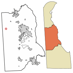 Location of Hartly in Kent County, Delaware. | |
 Hartly Location within the state of Delaware  Hartly Hartly (the US) | |
| Coordinates: 39°10′07″N 75°42′48″W / 39.16861°N 75.71333°WCoordinates: 39°10′07″N 75°42′48″W / 39.16861°N 75.71333°W | |
| Country |
|
| State |
|
| County |
|
| Area[1] | |
| • Total | 0.06 sq mi (0.15 km2) |
| • Land | 0.06 sq mi (0.15 km2) |
| • Water | 0.00 sq mi (0.00 km2) |
| Elevation | 69 ft (21 m) |
| Population (2010) | |
| • Total | 74 |
| • Estimate (2016)[2] | 71 |
| • Density | 1,203.39/sq mi (464.04/km2) |
| Time zone | UTC−5 (Eastern (EST)) |
| • Summer (DST) | UTC−4 (EDT) |
| ZIP code | 19953 |
| Area code(s) | 302 |
| FIPS code | 10-33250 |
| GNIS feature ID | 214061[3] |
Hartly is a town in Kent County, Delaware, United States. It is part of the Dover, Delaware Metropolitan Statistical Area. The population was 74 at the 2010 census, making it the least populous municipality in Delaware.[4]
Geography
Hartly is located at 39°10′07″N 75°42′48″W / 39.1687230°N 75.7132641°W.[5]
According to the United States Census Bureau, the town has a total area of 0.1 square miles (0.26 km2), all of it land.
Demographics
| Historical population | |||
|---|---|---|---|
| Census | Pop. | %± | |
| 1920 | 905 | — | |
| 1930 | 101 | −88.8% | |
| 1940 | 125 | 23.8% | |
| 1950 | 139 | 11.2% | |
| 1960 | 164 | 18.0% | |
| 1970 | 180 | 9.8% | |
| 1980 | 106 | −41.1% | |
| 1990 | 107 | 0.9% | |
| 2000 | 78 | −27.1% | |
| 2010 | 74 | −5.1% | |
| Est. 2016 | 71 | [2] | −4.1% |
| U.S. Decennial Census[6] | |||
As of the census[7] of 2000, there were 78 people, 25 households, and 21 families residing in the town. The population density was 1,345.9 people per square mile (501.9/km²). There were 31 housing units at an average density of 534.9 per square mile (199.5/km²). The racial makeup of the town was 91.03% White, 3.85% African American, 1.28% from other races, and 3.85% from two or more races. Hispanic or Latino of any race were 2.56% of the population.
There were 25 households out of which 60.0% had children under the age of 18 living with them, 52.0% were married couples living together, 24.0% had a female householder with no husband present, and 16.0% were non-families. 4.0% of all households were made up of individuals and none had someone living alone who was 65 years of age or older. The average household size was 3.12 and the average family size was 3.29.
In the town, the population was spread out with 34.6% under the age of 18, 9.0% from 18 to 24, 39.7% from 25 to 44, 14.1% from 45 to 64, and 2.6% who were 65 years of age or older. The median age was 28 years. For every 100 females, there were 81.4 males. For every 100 females age 18 and over, there were 59.4 males.
The median income for a household in the town was $29,375, and the median income for a family was $29,375. Males had a median income of $21,667 versus $24,167 for females. The per capita income for the town was $11,516. There were 14.3% of families and 19.5% of the population living below the poverty line, including 19.2% of under eighteens and none of those over 64.
Infrastructure
Transportation
Hartly is located at the intersection of Delaware Route 11 and Delaware Route 44. DE 11 passes southwest-northeast through the town on Arthursville Road, heading southwest toward the Maryland border and Templeville, Maryland and northeast toward Kenton. DE 44 passes northwest-southeast through the town on Main Street, heading northwest to an intersection with Delaware Route 300 in Everetts Corner that provides access to the Chesapeake Bay Bridge and southeast to an intersection with Delaware Route 8 in Pearsons Corner that provides access to the city of Dover.[8]
Utilities
Delmarva Power, a subsidiary of Exelon, provides electricity to Hartly.[9] Chesapeake Utilities provides natural gas to the town.[10]
1983 F2 tornado
On July 21, 1983, an F2 tornado struck Hartly, causing 2 deaths and 9 injuries.[11] It was the deadliest tornado in Delaware history.[12]
References
- ↑ "2016 U.S. Gazetteer Files". United States Census Bureau. Retrieved Jul 25, 2017.
- 1 2 "Population and Housing Unit Estimates". Retrieved June 9, 2017.
- ↑ "Hartly". Geographic Names Information System. United States Geological Survey.
- ↑ "Archived copy". Archived from the original on 2016-12-31. Retrieved 2013-04-29.
- ↑ "US Gazetteer files: 2010, 2000, and 1990". United States Census Bureau. 2011-02-12. Retrieved 2011-04-23.
- ↑ "Census of Population and Housing". Census.gov. Retrieved June 4, 2015.
- ↑ "American FactFinder". United States Census Bureau. Retrieved 2008-01-31.
- ↑ Delaware Department of Transportation (2017). Official Travel & Transportation Map (Map). Dover: Delaware Department of Transportation.
- ↑ "Service Territory". Delmarva Power. Archived from the original on May 25, 2014. Retrieved August 15, 2017.
- ↑ "Delmarva Service Territory". Chesapeake Utilities. Retrieved August 14, 2017.
- ↑ http://www.tornadohistoryproject.com
- ↑ http://www.tornadoproject.com/alltorns/worstts.htm
Municipalities and communities of Kent County, Delaware, United States | ||
|---|---|---|
| Cities | ||
| Towns | ||
| CDPs | ||
| Unincorporated communities |
| |
| Hundreds | ||
| Footnotes | ‡This populated place also has portions in an adjacent county or counties | |