Felton, Delaware
| Felton, Delaware | |
|---|---|
| Town | |
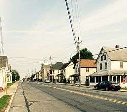 On Main Street in downtown. | |
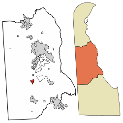 Location of Felton in Kent County, Delaware. | |
 Felton Location within the state of Delaware  Felton Felton (the US) | |
| Coordinates: 39°00′30″N 75°34′41″W / 39.00833°N 75.57806°WCoordinates: 39°00′30″N 75°34′41″W / 39.00833°N 75.57806°W | |
| Country |
|
| State |
|
| County |
|
| Incorporated | February 2, 1861[1] |
| Area[2] | |
| • Total | 0.82 sq mi (2.12 km2) |
| • Land | 0.82 sq mi (2.12 km2) |
| • Water | 0.00 sq mi (0.00 km2) |
| Elevation | 56 ft (17 m) |
| Population (2010) | |
| • Total | 1,298 |
| • Estimate (2016)[3] | 1,408 |
| • Density | 1,723.38/sq mi (665.58/km2) |
| Time zone | UTC−5 (Eastern (EST)) |
| • Summer (DST) | UTC−4 (EDT) |
| ZIP code | 19943 |
| Area code(s) | 302 |
| FIPS code | 10-26620 |
| GNIS feature ID | 215321[4] |
Felton is a town in Kent County, Delaware, United States. It is part of the Dover, Delaware Metropolitan Statistical Area. The population was 1,298 at the 2010 census.[5]
History
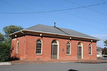
The Coombe Historic District, Thomas B. Coursey House, Felton Historic District, Felton Railroad Station, and Hughes Early Man Sites are listed on the National Register of Historic Places.[6]
Geography
Felton is located at 39°00′30″N 75°34′41″W / 39.00833°N 75.57806°W (39.0084464, -75.5779807).[7]
According to the United States Census Bureau, the town has a total area of 0.6 square miles (1.6 km2), all of it land.
Demographics
| Historical population | |||
|---|---|---|---|
| Census | Pop. | %± | |
| 1870 | 437 | — | |
| 1880 | 383 | −12.4% | |
| 1890 | 403 | 5.2% | |
| 1900 | 400 | −0.7% | |
| 1910 | 451 | 12.8% | |
| 1920 | 771 | 71.0% | |
| 1930 | 463 | −39.9% | |
| 1940 | 442 | −4.5% | |
| 1950 | 453 | 2.5% | |
| 1960 | 423 | −6.6% | |
| 1970 | 495 | 17.0% | |
| 1980 | 547 | 10.5% | |
| 1990 | 683 | 24.9% | |
| 2000 | 784 | 14.8% | |
| 2010 | 1,298 | 65.6% | |
| Est. 2016 | 1,408 | [3] | 8.5% |
| U.S. Decennial Census[8] | |||
As of the census[9] of 2000, there were 784 people, 297 households, and 217 families residing in the town. The population density was 1,268.1 people per square mile (488.2/km²). There were 312 housing units at an average density of 504.6 per square mile (194.3/km²). The racial makeup of the town was 82.53% White, 11.61% African American, 1.02% Native American, 1.28% Asian, 0.89% from other races, and 2.68% from two or more races. Hispanic or Latino of any race were 2.17% of the population.
There were 297 households out of which 42.1% had children under the age of 18 living with them, 48.5% were married couples living together, 18.5% had a female householder with no husband present, and 26.9% were non-families. 20.9% of all households were made up of individuals and 9.4% had someone living alone who was 65 years of age or older. The average household size was 2.63 and the average family size was 3.04.
In the town, the population was spread out with 29.3% under the age of 18, 8.3% from 18 to 24, 36.9% from 25 to 44, 16.7% from 45 to 64, and 8.8% who were 65 years of age or older. The median age was 33 years. For every 100 females, there were 84.5 males. For every 100 females age 18 and over, there were 82.2 males.
The median income for a household in the town was $42,589, and the median income for a family was $44,875. Males had a median income of $32,857 versus $24,375 for females. The per capita income for the town was $17,854. About 9.5% of families and 10.4% of the population were below the poverty line, including 15.2% of those under age 18 and 13.8% of those age 65 or over.
Infrastructure
Transportation
U.S. Route 13 runs north-south through Felton on Dupont Highway, heading north toward Dover and south toward Harrington. Delaware Route 12 runs east-west through Felton on Main Street, heading west toward Greensboro, Maryland and east toward Frederica.[10] DART First State provides bus service to Felton along Route 117, which heads north toward Camden to connect to the local bus routes serving the Dover area and south toward Harrington.[11] The Delmarva Central Railroad's Delmarva Subdivision line passes north-south through Felton.[12]
Utilities
Delmarva Power, a subsidiary of Exelon, provides electricity to Felton.[13] Chesapeake Utilities provides natural gas to the town.[14] The Felton Water Department provides water to Felton, serving 550 homes, multiple businesses, and three schools.[15] Trash and recycling collection in Felton is provided under contract by Waste Management.[16]
Education
Public school students in Felton are served by the Lake Forest School District. Schools include Lake Forest High School as well as Lake Forest North, the elementary school (Grades K-3), and Lake Forest Central, the older elementary school (Grades 4-5). Other schools in the district are located in Harrington and Frederica.
References
- ↑ https://felton.delaware.gov/2014/09/04/hello-world/
- ↑ "2016 U.S. Gazetteer Files". United States Census Bureau. Retrieved Jul 25, 2017.
- 1 2 "Population and Housing Unit Estimates". Retrieved June 9, 2017.
- ↑ "Felton". Geographic Names Information System. United States Geological Survey.
- ↑ "Archived copy". Archived from the original on 2016-12-31. Retrieved 2013-04-29.
- ↑ National Park Service (2010-07-09). "National Register Information System". National Register of Historic Places. National Park Service.
- ↑ "US Gazetteer files: 2010, 2000, and 1990". United States Census Bureau. 2011-02-12. Retrieved 2011-04-23.
- ↑ "Census of Population and Housing". Census.gov. Archived from the original on May 12, 2015. Retrieved June 4, 2015.
- ↑ "American FactFinder". United States Census Bureau. Archived from the original on 2013-09-11. Retrieved 2008-01-31.
- ↑ Delaware Department of Transportation (2017). Official Travel & Transportation Map (Map). Dover: Delaware Department of Transportation.
- ↑ "Kent County Bus System Guide" (PDF). DART First State. Retrieved April 9, 2018.
- ↑ "Delmarva Central Railroad". Carload Express. Retrieved March 27, 2017.
- ↑ "Service Territory". Delmarva Power. Archived from the original on May 25, 2014. Retrieved August 15, 2017.
- ↑ "Delmarva Service Territory". Chesapeake Utilities. Retrieved August 14, 2017.
- ↑ "Water". Felton, Delaware. Retrieved August 30, 2018.
- ↑ "Trash Collection". Felton, Delaware. Retrieved August 30, 2018.
Municipalities and communities of Kent County, Delaware, United States | ||
|---|---|---|
| Cities | ||
| Towns | ||
| CDPs | ||
| Unincorporated communities |
| |
| Hundreds | ||
| Footnotes | ‡This populated place also has portions in an adjacent county or counties | |