Arab al-Samniyya
| Arab al-Samniyya | |
|---|---|
 Arab al-Samniyya | |
| Arabic | عرب السمنية |
| Also spelled | Arab al-Samniya |
| Subdistrict | Acre |
| Coordinates | 33°02′48″N 35°10′50″E / 33.04667°N 35.18056°ECoordinates: 33°02′48″N 35°10′50″E / 33.04667°N 35.18056°E |
| Palestine grid | 165/272 |
| Population | 200[1][2] (1945) |
| Area |
1,872 dunams 1.872 km² |
| Date of depopulation | 31 October 1948 |
| Cause(s) of depopulation | Military assault by Yishuv forces |
| Current localities | Ya'ara[3] |
Arab al-Samniyya (Arabic: عرب السمنية), also known as Khirbat al-Suwwana, was a Palestinian village in the Western Galilee that was captured and depopulated by Israel during the 1948 Arab-Israeli war. It was located in the Acre District of the British Mandate of Palestine, 19.5 km northeast of the city of Acre. In 1945 the, village had a population of 200 Arab and a total land area of 1,872 dunums.
History
The village was situated on a rocky hill near the road linking Ra's al-Naqura with Safad. Its houses were made of stone. A dirt path linked it to the coastal highway and thence to Acre. The villagers cultivated grain, figs, and olives.
In the 1945 statistics it had a population of 200 Muslims,[1] with 1,872 dunams of land.[2] Of this, a total of 174 dunams were allocated to grain crops; 22 dunums were irrigated and planted with orchards.[4][5]
1948 and aftermath
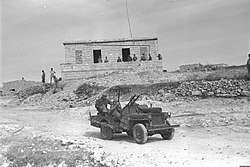
The village was captured by Israel's 7th and Carmeli Brigades on 31 October 1948 during the Israeli Defense Force offensive Operation Hiram. The village was completely destroyed and only building rubble left behind. Following the war the area was incorporated into the State of Israel and the village remained depopulated of its inhabitants. In 1950, the moshav of Ya'ara was established on its land.[3]
See also
References
- 1 2 Department of Statistics, 1945, p. 5
- 1 2 Government of Palestine, Department of Statistics. Village Statistics, April, 1945. Quoted in Hadawi, 1970, p. 41
- 1 2 Khalidi, 1992, p. 6
- ↑ Khalidi, 1992, p. 5
- ↑ Government of Palestine, Department of Statistics. Village Statistics, April, 1945. Quoted in Hadawi, 1970, p. 82
Bibliography
- Department of Statistics (1945). Village Statistics, April, 1945. Government of Palestine.
- Hadawi, S. (1970). Village Statistics of 1945: A Classification of Land and Area ownership in Palestine. Palestine Liberation Organization Research Center.
- Khalidi, W. (1992). All That Remains: The Palestinian Villages Occupied and Depopulated by Israel in 1948. Washington D.C.: Institute for Palestine Studies. ISBN 0-88728-224-5.
- Morris, B. (2004). The Birth of the Palestinian Refugee Problem Revisited. Cambridge University Press. ISBN 978-0-521-00967-6.