Ranvik Glacier
Ranvik Glacier (69°10′S 77°40′E) is a broad glacier flowing into the southern part of Ranvik Bay in the southeast part of Prydz Bay. Mapped by Norwegian cartographers from air photos taken by the Lars Christensen Expedition (1936–37), and named Ranvikbreen (Ranvik Glacier) for its association with Ranvik Bay.
| Ranvik Glacier | |
|---|---|
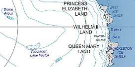 Location of Princess Elizabeth Land | |
 Location of Ranvik Glacier in Antarctica | |
| Location | Princess Elizabeth Land |
| Coordinates | 69°10′S 77°40′E |
| Thickness | unknown |
| Terminus | Prydz Bay |
| Status | unknown |
References


| Types |
| ||||||
|---|---|---|---|---|---|---|---|
| Anatomy |
| ||||||
| Processes | |||||||
| Measurements | |||||||
| Volcanic relations | |||||||
| Landforms |
| ||||||
| |||||||
Glaciers of Princess Elizabeth Land | |
|---|---|
This article is issued from Wikipedia. The text is licensed under Creative Commons - Attribution - Sharealike. Additional terms may apply for the media files.