Browns Glacier
Browns Glacier (68°56′S 78°0′E) is a small glacier 4 nautical miles (7 km) north of Chaos Glacier, flowing westward into the northern extremity of Ranvik Bay. The glacier was charted by Norwegian cartographers from air photographs taken by the Lars Christensen Expedition (1936–37), and was further identified in John H. Roscoe's 1952 study of this area from U.S. Navy Operation Highjump (1946–47) photography. It was named by Roscoe for Lieutenant (j.g.) Eduardo P. Brown, U.S. Navy, photographic officer with the western task group of Operation Highjump.[1]
| Browns Glacier | |
|---|---|
 Location of Princess Elizabeth Land | |
 Location of Browns Glacier in Antarctica | |
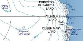
| Location | Princess Elizabeth Land |
| Coordinates | 68°56′S 78°00′E |
| Length | 4 nmi (7 km; 5 mi) |
| Thickness | unknown |
| Terminus | Ranvik Bay |
| Status | unknown |
References
- "Browns Glacier". Geographic Names Information System. United States Geological Survey. Retrieved 2011-09-21.
![]()
| Types |
| ||||||
|---|---|---|---|---|---|---|---|
| Anatomy |
| ||||||
| Processes | |||||||
| Measurements | |||||||
| Volcanic relations | |||||||
| Landforms |
| ||||||
| |||||||
Glaciers of Princess Elizabeth Land | |
|---|---|
This article is issued from Wikipedia. The text is licensed under Creative Commons - Attribution - Sharealike. Additional terms may apply for the media files.