Polarårboken Glacier
Polarårboken Glacier (69°36′S 76°0′E) is a glacier, 3 nautical miles (5.6 km) northeast of Stein Islands, draining westward into the north part of Publications Ice Shelf. Delineated in 1952 by John H. Roscoe from air photos taken by U.S. Navy Operation Highjump (1946–47). Named by Roscoe after Polarårboken, a polar journal published by the Norsk Polarklubb, Oslo, Norway.
| Polarårboken Glacier Glacier | |
|---|---|
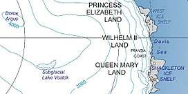 Location of Princess Elizabeth Land | |
 Location of Polarårboken Glacier Glacier in Antarctica | |
| Location | Princess Elizabeth Land |
| Coordinates | 69°36′S 76°00′E |
| Length | 3 nmi (6 km; 3 mi) |
| Thickness | unknown |
| Terminus | Publications Ice Shelf |
| Status | unknown |
References

| Types |
| ||||||
|---|---|---|---|---|---|---|---|
| Anatomy |
| ||||||
| Processes | |||||||
| Measurements | |||||||
| Volcanic relations | |||||||
| Landforms |
| ||||||
| |||||||
Glaciers of Princess Elizabeth Land | |
|---|---|
This article is issued from Wikipedia. The text is licensed under Creative Commons - Attribution - Sharealike. Additional terms may apply for the media files.