National Register of Historic Places listings in Middlesex County, Massachusetts
This is a listing of places in Middlesex County in the U.S. state of Massachusetts that are listed in the National Register of Historic Places. With more than 1,300 listings, the county has more listings than any other county in the United States.
- This National Park Service list is complete through NPS recent listings posted June 26, 2020.[1]
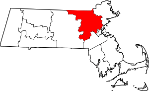
Location of Middlesex County in Massachusetts
Cities and towns listed separately
The following Middlesex County cities and towns have large numbers of sites listed in the National Register of Historic Places. Lists of their sites are on separate pages, linked below.
| Community | Image | First Date listed | Last Date listed | Count |
|---|---|---|---|---|
| Arlington |  |
October 7, 1971 | January 18, 2006 | 64 |
| Cambridge | _-_general_view.JPG) |
October 15, 1966 | January 18, 2006 | 205 |
| Concord |  |
October 15, 1966 | September 12, 2007 | 27 |
| Framingham | 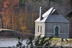 |
January 17, 1975 | January 17, 2017 | 18 |
| Lexington |  |
October 16, 1966 | January 19, 2016 | 17 |
| Lowell | %2C_Lowell%2C_Massachusetts.JPG) |
August 21, 1972 | March 11, 2011 | 41 |
| Marlborough |  |
May 9, 1980 | November 9, 2008 | 17 |
| Medford | October 15, 1966 | November 19, 2009 | 36 | |
| Newton | 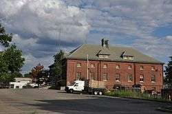 |
June 4, 1973 | December 18, 2009 | 187 |
| Reading |  |
August 19, 1975 | May 30, 1997 | 90 |
| Sherborn | 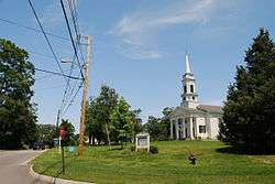 |
January 3, 1986 | March 9, 1990 | 25 |
| Somerville | 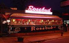 |
May 21, 1975 | November 19, 2009 | 84 |
| Stoneham | 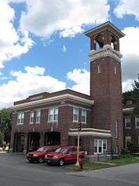 |
April 13, 1984 | May 26, 2005 | 69 |
| Wakefield | 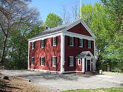 |
October 19, 1987 | April 15, 2014 | 95 |
| Waltham |  |
December 30, 1970 | January 18, 2006 | 109 |
| Weston | 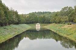 |
September 28, 1972 | September 6, 2006 | 15 |
| Winchester |  |
March 2, 1979 | November 19, 2009 | 68 |
Other municipalities
| [2] | Name on the Register | Image | Date listed[3] | Location | City or town | Description |
|---|---|---|---|---|---|---|
| 1 | 1767 Milestones |  1767 Milestones |
April 7, 1971 (#71000084) |
Between Boston and Springfield along Old Post Rd. 42°21′36″N 71°25′30″W |
Sudbury, Cambridge, Wayland | Includes locations in Suffolk, Norfolk, Worcester, and Hampden counties. |
| 2 | 1790 House |  1790 House |
October 9, 1974 (#74000381) |
827 Main St. 42°30′11″N 71°09′40″W |
Woburn | |
| 3 | Acton Centre Historic District |  Acton Centre Historic District |
March 10, 1983 (#83000780) |
Main St., Wood and Woodbur Lanes, Newton, Concord, and Nagog Hill Rds. 42°29′11″N 71°25′58″W |
Acton | |
| 4 | Acton High School |  Acton High School |
November 22, 2011 (#11000854) |
3 Charter Rd. 42°28′32″N 71°27′20″W |
Acton | 1925 Renaissance Revival-style school building designed by Boston architect John H. Bickford[4] |
| 5 | Ashland Dam and Spillway |  Ashland Dam and Spillway |
January 18, 1990 (#89002289) |
Northern end of the Ashland Reservoir in Ashland State Park 42°14′46″N 71°27′37″W |
Ashland | |
| 6 | Ashland Town House |  Ashland Town House |
March 3, 2004 (#04000120) |
101 Main St. 42°15′40″N 71°27′58″W |
Ashland | |
| 7 | Ayer Main Street Historic District |  Ayer Main Street Historic District |
March 16, 1989 (#88000193) |
Main St. roughly between Park and Columbia Sts. 42°33′34″N 71°35′20″W |
Ayer | |
| 8 | Stephen Bacon House |  Stephen Bacon House |
March 9, 1990 (#90000174) |
105 N. Main St. 42°17′30″N 71°21′24″W |
Natick | |
| 9 | Bacon-Gleason-Blodgett Homestead |  Bacon-Gleason-Blodgett Homestead |
April 14, 1977 (#77000166) |
118 Wilson Rd. 42°30′01″N 71°14′51″W |
Bedford | |
| 10 | Rev. Stephen Badger House |  Rev. Stephen Badger House |
April 1, 1980 (#80000647) |
87 Eliot St. 42°16′11″N 71°19′07″W |
Natick | |
| 11 | Loammi Baldwin Mansion |  Loammi Baldwin Mansion |
October 7, 1971 (#71000090) |
2 Alfred St. 42°30′08″N 71°09′29″W |
Woburn | Home of Col. Loammi Baldwin, engineer of the Middlesex Canal, which the mansion overlooks |
| 12 | Bedford Center Historic District | _Bedford%2C_Massachusetts.JPG) Bedford Center Historic District |
November 17, 1977 (#77000165) |
Irregular pattern along Great Rd. from Bacon to Concord and North Rds.; also roughly the Great Rd. from Bacon Rd., Memorial Park, and Narrow Gauge Trail on the east to North and Concord Rds. on the west 42°29′33″N 71°16′52″W |
Bedford | Second set of boundaries represents a boundary increase of June 13, 2014 |
| 13 | Bedford Depot |  Bedford Depot |
August 21, 2003 (#03000791) |
80 Loomis St. and 120 South Rd. 42°29′09″N 71°16′34″W |
Bedford | |
| 14 | Bedford Veterans Administration Hospital District |  Bedford Veterans Administration Hospital District |
November 28, 2012 (#12000977) |
200 Springs Rd. 42°30′19″N 71°16′15″W |
Bedford | |
| 15 | Beebe Estate |  Beebe Estate |
May 20, 1981 (#81000116) |
235 W. Foster St. 42°27′20″N 71°04′13″W |
Melrose | |
| 16 | Bell Rock Memorial Park |  Bell Rock Memorial Park |
February 9, 2001 (#01000086) |
Bounded by Main, Wigglesworth, Meridan, and Ellis Sts. 42°25′13″N 71°04′04″W |
Malden | |
| 17 | Belmont Railroad Station |  Belmont Railroad Station |
December 4, 1998 (#98001443) |
1 Common St. 42°23′45″N 71°10′36″W |
Belmont | |
| 18 | Bennett-Shattuck House |  Bennett-Shattuck House |
February 22, 2006 (#06000061) |
653 Martins Pond Rd. 42°37′22″N 71°32′05″W |
Groton | |
| 19 | John Bickford House |  John Bickford House |
March 9, 1990 (#90000177) |
235 Elm St. 42°34′38″N 71°04′02″W |
North Reading | |
| 20 | Billerica Mills Historic District |  Billerica Mills Historic District |
November 10, 1983 (#83003996) |
Roughly bounded by Concord River, Treble Cove Terr., Kohlrausch Ave., Indian Rd., Holt Ruggles, and Rogers Sts. 42°35′23″N 71°17′06″W |
Billerica | |
| 21 | Billerica Town Common District |  Billerica Town Common District |
August 14, 1973 (#73000280) |
Bounded by Cummings St., Concord Rd., and Boston Rd. 42°33′22″N 71°16′11″W |
Billerica | |
| 22 | Bogle-Walker House |  Bogle-Walker House |
August 27, 1992 (#92001044) |
55 and 62 Goodman's Rd. 42°21′54″N 71°24′06″W |
Sudbury | Dismantled in 2006[5] |
| 23 | Boutell-Hathorn House |  Boutell-Hathorn House |
October 27, 2004 (#04001210) |
280 Woburn St. 42°33′54″N 71°08′47″W |
Wilmington | |
| 24 | Gov. George S. Boutwell House |  Gov. George S. Boutwell House |
January 5, 2005 (#04001431) |
172 Main St. 42°36′29″N 71°34′17″W |
Groton | |
| 25 | Boxborough Old Town Center |  Boxborough Old Town Center |
December 12, 2006 (#06001122) |
Hill Rd., Middle Rd., Picnic St. 42°29′46″N 71°31′37″W |
Boxborough | |
| 26 | Moses Brewer House |  Moses Brewer House |
March 9, 1990 (#90000184) |
88 Concord Rd. 42°22′03″N 71°24′52″W |
Sudbury | |
| 27 | Daniel Brooks House |  Daniel Brooks House |
October 25, 1973 (#73000293) |
Brooks Rd. E. 42°26′50″N 71°18′35″W |
Lincoln | |
| 28 | Brookside Historic District |  Brookside Historic District |
January 23, 2003 (#02001729) |
1–44 Brookside, 5 Moore Rd., 1–7 Coolidge Ave. 42°36′36″N 71°24′42″W |
Westford | |
| 29 | Brown-Stow House |  Brown-Stow House |
March 9, 1990 (#90000182) |
172 Harvard Rd. 42°26′24″N 71°32′12″W |
Stow | |
| 30 | Abraham Browne House |  Abraham Browne House |
March 9, 1990 (#90000186) |
562 Main St. 42°22′20″N 71°12′03″W |
Watertown | |
| 31 | Buck's Corner Historic District |  Buck's Corner Historic District |
November 21, 2003 (#03001209) |
216 Wildwood St., 580,584,588,590,602,603,604 Woburn St. 42°32′52″N 71°09′05″W |
Wilmington | |
| 32 | Ephraim Buck House |  Ephraim Buck House |
March 9, 1990 (#90000189) |
216 Wildwood St. 42°32′49″N 71°09′06″W |
Wilmington | |
| 33 | Bullard Farm |  Bullard Farm |
May 26, 1995 (#95000710) |
7 Bullard Ln. 42°11′44″N 71°23′17″W |
Holliston | |
| 34 | Isaac Bullard House |  Isaac Bullard House |
March 9, 1990 (#90000171) |
77 Ashland St. 42°13′42″N 71°26′08″W |
Holliston | |
| 35 | Butters-Avery House |  Butters-Avery House |
July 3, 2010 (#10000413) |
165 Chestnut St. 42°31′57″N 71°10′34″W |
Wilmington | |
| 36 | Casey's Diner | 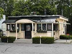 Casey's Diner |
September 22, 1999 (#99001122) |
36 South Ave. 42°17′08″N 71°20′43″W |
Natick | |
| 37 | Cedar Swamp Archeological District |  Cedar Swamp Archeological District |
May 23, 1988 (#88000587) |
Along the border with Westborough in Worcester County[6] 42°15′36″N 71°35′06″W |
Hopkinton | Extends into Westborough in Worcester County |
| 38 | Center School |  Center School |
June 21, 2006 (#06000523) |
13 Bedford St. 42°30′17″N 71°11′46″W |
Burlington | |
| 39 | Charles River Reservation Parkways |  Charles River Reservation Parkways |
January 18, 2006 (#05001530) |
Soldiers Field, Nonantum, Leo Birmingham, Arsenal, Greenough, N. Beacon, Charles River, Norumbega, Recreation 42°21′42″N 71°09′31″W |
Watertown | Extends into Cambridge, Newton, Waltham, and Weston in Middlesex County and into Boston in Suffolk County |
| 40 | Chelmsford Center Historic District | 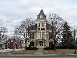 Chelmsford Center Historic District |
February 20, 1980 (#80000646) |
MA 4, MA 110 and MA 27 42°35′53″N 71°21′15″W |
Chelmsford | |
| 41 | Church Street Historic District | 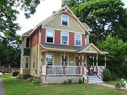 Church Street Historic District |
November 21, 2003 (#03001175) |
72–150 and 117–135 Church St., 4 Central St. 42°33′09″N 71°10′07″W |
Wilmington | |
| 42 | Clark Houses | 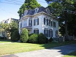 Clark Houses |
February 17, 1978 (#78000453) |
74 and 76 W. Central St. 42°16′56″N 71°21′25″W |
Natick | |
| 43 | Commanding Officer's Quarters, Watertown Arsenal |  Commanding Officer's Quarters, Watertown Arsenal |
October 7, 1976 (#76000279) |
443 Arsenal St. 42°21′37″N 71°09′50″W |
Watertown | |
| 44 | Common Burying Ground at Sandy Bank | 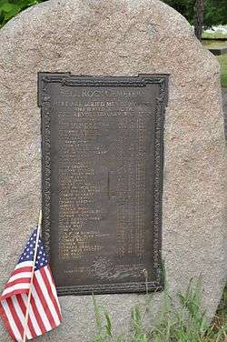 Common Burying Ground at Sandy Bank |
August 27, 1981 (#81000108) |
Green St. 42°25′03″N 71°04′19″W |
Malden | |
| 45 | Community Memorial Hospital | 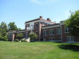 Community Memorial Hospital |
May 14, 2004 (#04000423) |
15 Winthrop Ave. 42°33′40″N 71°34′50″W |
Ayer | |
| 46 | Converse Memorial Building | _-_angle_view.JPG) Converse Memorial Building |
September 5, 1985 (#85002014) |
36 Salem St. 42°25′39″N 71°03′59″W |
Malden | National Historic Landmark |
| 47 | Coolidge School |  Coolidge School |
February 25, 2009 (#09000055) |
319 Arlington St. 42°22′23″N 71°09′27″W |
Watertown | |
| 48 | Allen Crocker Curtis House-Pillar House |  Allen Crocker Curtis House-Pillar House |
September 4, 1986 (#86001787) |
Old Sudbury Road 42°24′04″N 71°19′58″W |
Lincoln | Listed at 26 Quinobequin Rd., Newton; building was reconstructed in 2005 at new location. |
| 49 | Charles A. Daniels School |  Charles A. Daniels School |
January 6, 1987 (#86003562) |
Daniels St. 42°25′44″N 71°03′13″W |
Malden | |
| 50 | Isaac Davis Trail |  Isaac Davis Trail |
April 11, 1972 (#72001347) |
Running E-W between towns of Acton and Concord 42°28′48″N 71°23′57″W |
Acton | |
| 51 | District 7 School |  District 7 School |
January 29, 2008 (#07001487) |
366 Chicopee Row 42°37′54″N 71°32′54″W |
Groton | Owned by the Groton Historical Society. |
| 52 | Dunstable Center Historic District |  Dunstable Center Historic District |
November 5, 2018 (#100003069) |
High, Highland, Main, & Pleasant Sts. 42°40′28″N 71°28′56″W |
Dunstable | |
| 53 | Dunstable Town Hall | Dunstable Town Hall |
May 12, 1999 (#99000557) |
511 Main St. 42°40′35″N 71°29′10″W |
Dunstable | |
| 54 | Dutton–Holden Homestead |  Dutton–Holden Homestead |
March 29, 2001 (#01000307) |
28 Pond St. 42°33′56″N 71°15′52″W |
Billerica | |
| 55 | East Holliston Historic District |  East Holliston Historic District |
June 14, 2002 (#02000636) |
Washington, Baker, Curve, Woodland St., Quail Run 42°12′50″N 71°25′14″W |
Holliston | |
| 56 | Exchange Hall |  Exchange Hall |
June 13, 1986 (#86001327) |
Quimby Sq. on School St. 42°27′39″N 71°27′16″W |
Acton | |
| 57 | Fairview Cemetery |  Fairview Cemetery |
January 12, 2005 (#04001472) |
Main St. 42°35′13″N 71°25′15″W |
Westford | |
| 58 | Farley-Hutchinson-Kimball House |  Farley-Hutchinson-Kimball House |
March 27, 2012 (#12000151) |
461A & 463 North Rd. 42°31′26″N 71°17′07″W |
Bedford | |
| 59 | Faulkner Homestead |  Faulkner Homestead |
December 16, 1971 (#71000080) |
5 High St. 42°27′32″N 71°27′14″W |
Acton | |
| 60 | Fells Connector Parkways, Metropolitan System of Greater Boston | 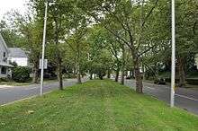 Fells Connector Parkways, Metropolitan System of Greater Boston |
May 9, 2003 (#03000379) |
Fellsway East: E. Border Rd. to Fellsway W.; Fellsway West: Fulton St. to Fellway E.; Fellsway:Fellsway E. to the Wellington Bridge 42°24′54″N 71°05′03″W |
Malden and Medford | |
| 61 | Fellsmere Park Parkways, Metropolitan Park System of Greater Boston |  Fellsmere Park Parkways, Metropolitan Park System of Greater Boston |
May 9, 2003 (#03000381) |
W. Border Rd, Boundary Rd. 42°25′41″N 71°05′12″W |
Malden | |
| 62 | Felton Street School |  Felton Street School |
February 27, 1986 (#86000275) |
20 Felton St. 42°23′33″N 71°34′12″W |
Hudson | |
| 63 | First Burial Ground |  First Burial Ground |
November 13, 2004 (#04001222) |
Park St. near Centre St. 42°28′54″N 71°09′11″W |
Woburn | |
| 64 | First Congregational Church in Woburn |  First Congregational Church in Woburn |
January 6, 1992 (#91001898) |
322 Main St. 42°28′43″N 71°09′09″W |
Woburn | |
| 65 | Fiske House |  Fiske House |
December 9, 1977 (#77000171) |
1 Billerica Rd. 42°35′47″N 71°21′06″W |
Chelmsford Center | |
| 66 | Henry Fletcher House |  Henry Fletcher House |
September 30, 1993 (#93000010) |
224 Concord Rd. 42°33′04″N 71°25′39″W |
Westford | |
| 67 | Flint House |  Flint House |
July 25, 2003 (#03000684) |
28 Lexington Rd. 42°25′44″N 71°17′46″W |
Lincoln | |
| 68 | Forge Village Historic District |  Forge Village Historic District |
May 2, 2002 (#02000430) |
Roughly bounded by Forge Pond, W. Prescott St., Story St., Orchard St., Abbott St., and Pleasant St. 42°34′51″N 71°28′58″W |
Westford | |
| 69 | Fort Devens Historic District |  Fort Devens Historic District |
June 10, 1993 (#93000437) |
Roughly bounded by El Caney St., Antietam St., Sherman Ave., MacArthur Ave. and Buena Vista St. 42°32′46″N 71°36′46″W |
Ayer | Extends into Harvard in Worcester County. |
| 70 | Edmund Fowle House |  Edmund Fowle House |
November 11, 1977 (#77000189) |
26–28 Marshall St. 42°22′06″N 71°10′51″W |
Watertown | |
| 71 | Glenwood Cemetery |  Glenwood Cemetery |
May 12, 2004 (#04000425) |
Northeast of Parker St. and Great Rd. 42°25′28″N 71°26′53″W |
Maynard | |
| 72 | Goodale Homestead |  Goodale Homestead |
January 21, 1975 (#75000260) |
100 Chestnut St. 42°22′46″N 71°30′14″W |
Hudson | |
| 73 | Goodnow Library |  Goodnow Library |
May 22, 2002 (#02000549) |
21 Concord Rd. 42°21′47″N 71°25′02″W |
Sudbury | |
| 74 | Gowing-Sheldon Historic District |  Gowing-Sheldon Historic District |
November 21, 2003 (#03001176) |
642 and 643 Woburn St. 42°32′30″N 71°09′01″W |
Wilmington | |
| 75 | The Grange |  The Grange |
April 18, 1974 (#74000373) |
Codman Rd. 42°25′02″N 71°19′52″W |
Lincoln | Boundary increase (added 1976-05-28): Codman Rd. |
| 76 | Graniteville Historic District |  Graniteville Historic District |
January 17, 2002 (#01001467) |
Broadway, Church, Cross, First, Fourth, N. Main, River School, Second, and Third Sts. 42°35′42″N 71°28′12″W |
Westford | |
| 77 | Gropius House |  Gropius House |
May 16, 2000 (#00000709) |
68 Baker Bridge Rd. 42°25′37″N 71°19′37″W |
Lincoln | National Historic Landmark |
| 78 | Groton High School |  Groton High School |
March 2, 2010 (#10000057) |
145 Main St. 42°36′26″N 71°34′11″W |
Groton | |
| 79 | Groton Inn |  Groton Inn |
August 3, 1976 (#76000241) |
Main St. 42°36′24″N 71°34′07″W |
Groton | Destroyed in a 2011 fire.[7] |
| 80 | Groton Leatherboard Company |  Groton Leatherboard Company |
April 18, 2002 (#02000378) |
6 W. Main St. 42°36′08″N 71°37′39″W |
Groton | Now a senior living facility. |
| 81 | Hapgood House |  Hapgood House |
March 9, 1990 (#90000180) |
76 Treaty Elm Ln. 42°25′14″N 71°30′35″W |
Stow | |
| 82 | Harnden Tavern |  Harnden Tavern |
April 8, 1975 (#75000293) |
430 Salem St. 42°34′46″N 71°08′52″W |
Wilmington | Currently houses the Wilmington Town Museum. |
| 83 | Wilbur Fiske Haven House | 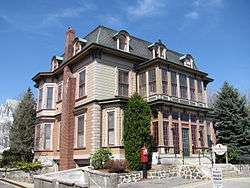 Wilbur Fiske Haven House |
December 17, 1992 (#92001659) |
339 Pleasant St. 42°25′40″N 71°04′35″W |
Malden | |
| 84 | Henry Higginson House |  Henry Higginson House |
May 26, 2005 (#05000468) |
44 Baker Farm Rd. 42°26′03″N 71°19′42″W |
Lincoln | |
| 85 | High Street Historic District |  High Street Historic District |
November 21, 2003 (#03001177) |
Even nos. 8–72 High St. except 20A and 20R, plus nos. 31, 47, 57 and 67. 42°34′21″N 71°09′11″W |
Wilmington | |
| 86 | Hildreth-Robbins House |  Hildreth-Robbins House |
November 29, 2006 (#06001090) |
19 Maple Rd. 42°34′18″N 71°22′48″W |
Chelmsford | |
| 87 | Abraham Hill House |  Abraham Hill House |
March 9, 1990 (#90000164) |
388 Pleasant St. 42°24′10″N 71°10′06″W |
Belmont | |
| 88 | Deacon Samuel Hill House |  Deacon Samuel Hill House |
March 9, 1990 (#90000165) |
33 Riverhurst Rd. 42°32′10″N 71°18′12″W |
Billerica | |
| 89 | Hillside Cemetery |  Hillside Cemetery |
December 6, 2005 (#05001373) |
Depot and Nutting Rds. 42°36′26″N 71°26′40″W |
Westford | |
| 90 | Hoar Tavern |  Hoar Tavern |
July 23, 1973 (#73000301) |
Northeast of Lincoln on MA 2 42°26′08″N 71°16′36″W |
Lincoln | |
| 91 | Thomas Hollis Historic District |  Thomas Hollis Historic District |
October 30, 1989 (#89001786) |
Washington St. from Winter to Highland Sts. 42°11′42″N 71°26′00″W |
Holliston | |
| 92 | Hopestill Bent Tavern |  Hopestill Bent Tavern |
March 9, 1990 (#90000188) |
252 Old Connecticut Path 42°20′30″N 71°22′14″W |
Wayland | |
| 93 | Hopkinton Dam and Spillway |  Hopkinton Dam and Spillway |
January 18, 1990 (#89002288) |
Eastern end of Hopkinton Reservoir in Hopkinton State Park 42°15′25″N 71°30′40″W |
Ashland | |
| 94 | Hopkinton Supply Co. Building |  Hopkinton Supply Co. Building |
March 10, 1983 (#83000810) |
26–28 Main St. 42°13′43″N 71°31′16″W |
Hopkinton | |
| 95 | Jonathan and Simon Hosmer House |  Jonathan and Simon Hosmer House |
May 2, 2002 (#02000432) |
300 Main St. 42°28′36″N 71°27′04″W |
Acton | |
| 96 | Houghton Memorial Building |  Houghton Memorial Building |
March 18, 1991 (#91000242) |
4 Rogers St. 42°32′20″N 71°29′03″W |
Littleton | |
| 97 | Howe School |  Howe School |
June 11, 2002 (#02000634) |
390 Boston Rd. 42°33′43″N 71°16′11″W |
Billerica | |
| 98 | Oliver Hutchins House |  Oliver Hutchins House |
September 5, 1985 (#85002013) |
79 Elm St. 42°33′25″N 71°22′52″W |
Chelmsford | |
| 99 | Hydrant No. 3 House |  Hydrant No. 3 House |
March 6, 2000 (#00000113) |
Washington St. 42°11′00″N 71°26′41″W |
Holliston | Known locally as the Metcalf Pump House. |
| 100 | Jack's Diner | 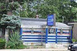 Jack's Diner |
November 22, 2000 (#00001340) |
901 Main St. 42°30′31″N 71°09′39″W |
Woburn | Houses a Thai restaurant in 2011. |
| 101 | Abraham Jaquith House | 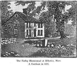 Abraham Jaquith House |
March 14, 1991 (#90000166) |
161 Concord Rd. 42°32′53″N 71°16′50″W |
Billerica | |
| 102 | Robert Jenison House | 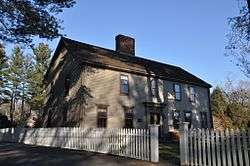 Robert Jenison House |
September 6, 1978 (#78000456) |
1 Frost Road 42°19′21″N 71°20′09″W |
Natick | |
| 103 | John Eliot Historic District |  John Eliot Historic District |
June 23, 1983 (#83000812) |
Eliot, Pleasant, and Auburn Sts. 42°16′20″N 71°18′56″W |
Natick | |
| 104 | Jones Tavern | 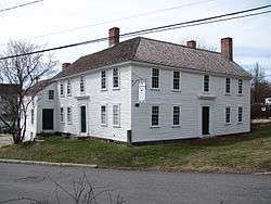 Jones Tavern |
June 13, 1986 (#86001333) |
128 Main St. 42°27′38″N 71°27′21″W |
Acton | |
| 105 | Jonathon Keyes Sr. House |  Jonathon Keyes Sr. House |
December 3, 2019 (#100004051) |
16 Frances Hill Rd. 42°36′10″N 71°24′17″W |
Westford | |
| 105 | David Lane House |  David Lane House |
April 2, 1980 (#80000644) |
137 North Rd. 42°30′08″N 71°17′05″W |
Bedford | House built in 1781 |
| 106 | Job Lane House |  Job Lane House |
May 8, 1973 (#73000278) |
295 North St. 42°30′46″N 71°17′04″W |
Bedford | |
| 107 | Larrabee's Brick Block |  Larrabee's Brick Block |
March 29, 1984 (#84002729) |
500–504 Main St. 42°27′20″N 71°03′57″W |
Melrose | |
| 108 | Lincoln Center Historic District |  Lincoln Center Historic District |
July 18, 1985 (#85001604) |
Bedford, Lincoln, Old Lexington, Sandy Pond, Trapelo, and Weston Rds. 42°25′32″N 71°18′56″W |
Lincoln | |
| 109 | Lynn Fells Parkway, Metropolitan Park System of Greater Boston |  Lynn Fells Parkway, Metropolitan Park System of Greater Boston |
May 9, 2003 (#03000380) |
Lynn Fells Parkway 42°28′05″N 71°02′58″W |
Melrose | Extends into Saugus, Essex County. |
| 110 | Manning Manse |  Manning Manse |
August 11, 1982 (#82001912) |
56 Chelmsford Rd. 42°35′03″N 71°18′07″W |
Billerica | |
| 111 | Marcia Browne Junior High School |  Marcia Browne Junior High School |
November 2, 2000 (#00001273) |
295 Broadway 42°25′59″N 71°02′22″W |
Malden | |
| 112 | McCune Site |  McCune Site |
January 23, 1986 (#86000115) |
Address Restricted |
Lincoln | A prehistoric archaeological site |
| 113 | McLean Hospital National Register District |  McLean Hospital National Register District |
January 23, 2003 (#02001733) |
115 Mill St. 42°23′35″N 71°11′29″W |
Belmont | |
| 114 | Meeting House of the Second Parish in Woburn |  Meeting House of the Second Parish in Woburn |
March 9, 1990 (#90000167) |
12 Lexington St. 42°30′26″N 71°04′39″W |
Burlington | |
| 115 | Melrose Public Library | 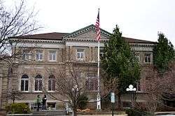 Melrose Public Library |
June 23, 1988 (#88000909) |
63 W. Emerson St. 42°27′33″N 71°04′02″W |
Melrose | |
| 116 | Melrose Town Center Historic District |  Melrose Town Center Historic District |
April 1, 1982 (#82002744) |
Main St. 42°27′26″N 71°03′52″W |
Melrose | Includes town hall, fire station, Coolidge School, and two churches. |
| 117 | Metropolitan State Hospital |  Metropolitan State Hospital |
January 21, 1994 (#93001482) |
475 Trapelo Rd. 42°24′14″N 71°12′40″W |
Belmont | Extends into Waltham and Lexington |
| 118 | Middlesex Canal | _map%2C_1801.jpg) Middlesex Canal |
August 21, 1972 (#72000117) |
Running southeast between the towns of Lowell and Medford 42°33′40″N 71°14′09″W |
Billerica, Chelmsford, Lowell, Wilmington, and Woburn | This listing encompasses only surviving canal fragments between Lowell and Woburn. |
| 119 | Middlesex Canal Historic and Archaeological District |  Middlesex Canal Historic and Archaeological District |
November 19, 2009 (#09000936) |
Numerous locations along the historic route of the Middlesex Canal |
Billerica, Chelmsford, Lowell, Medford, Somerville, Wilmington, Winchester, and Woburn | Extends into northern Boston; this listing encompasses the entire historic route of the canal. |
| 120 | Middlesex Fells Reservation Parkways |  Middlesex Fells Reservation Parkways |
February 4, 2003 (#02001749) |
E. Border Rd., Fellsway E., Fellsway W., Hillcrest Parkway, South St., Pond St., S. Border Rd., Ravine Rd., and Woodland Rd. 42°26′43″N 71°06′10″W |
Malden, Melrose, Medford, Stoneham, and Winchester | |
| 121 | Col. Adelbert Mossman House |  Col. Adelbert Mossman House |
September 30, 1982 (#82001904) |
76 Park St. 42°23′08″N 71°34′30″W |
Hudson | |
| 122 | Natick Center Historic District |  Natick Center Historic District |
December 16, 1977 (#77000186) |
North Ave., Main, Central, and Summer Sts. 42°17′04″N 71°20′53″W |
Natick | |
| 123 | North Acton Cemetery |  North Acton Cemetery |
August 15, 2019 (#100004269) |
Carlisle Rd. & North St. 42°31′25″N 71°24′01″W |
Acton | |
| 124 | North Town Hall |  North Town Hall |
October 13, 2015 (#15000732) |
31 Princeton St. 42°38′15″N 71°22′54″W |
Chelmsford | |
| 125 | Noyes-Parris House |  Noyes-Parris House |
March 9, 1990 (#90000187) |
196 Old Connecticut Path 42°20′56″N 71°21′43″W |
Wayland | |
| 126 | Odd Fellows Building |  Odd Fellows Building |
December 22, 1988 (#87002564) |
442 Main St. 42°25′37″N 71°04′04″W |
Malden | |
| 127 | Old Billerica Road Historic District |  Old Billerica Road Historic District |
July 11, 2007 (#07000681) |
229–301 Old Billerica Rd. 42°28′53″N 71°05′48″W |
Bedford | |
| 128 | Old Burying Ground |  Old Burying Ground |
February 5, 2002 (#01001560) |
King St. near its junction with White St. 42°32′43″N 71°28′44″W |
Littleton | |
| 129 | Old Chelmsford Garrison House Complex |  Old Chelmsford Garrison House Complex |
May 8, 1973 (#73000289) |
105 Garrison Rd. 42°34′42″N 71°23′30″W |
Chelmsford | |
| 130 | Old Town Bridge | .jpg) Old Town Bridge |
May 2, 1975 (#75000292) |
North of Wayland on MA 27 42°22′31″N 71°22′49″W |
Wayland | |
| 131 | Old Town Hall |  Old Town Hall |
February 2, 2005 (#04001574) |
10 Kendal Rd. 42°40′32″N 71°25′29″W |
Tyngsborough | |
| 132 | Christopher Page House |  Christopher Page House |
March 9, 1990 (#90000163) |
2 Meyers Ln. 42°29′47″N 71°15′32″W |
Bedford | |
| 133 | Nathaniel Page House |  Nathaniel Page House |
March 29, 1978 (#78000433) |
89 Page Rd. 42°29′37″N 71°15′48″W |
Bedford | |
| 134 | Parker Village Historic District |  Parker Village Historic District |
December 27, 2002 (#02001613) |
Concord, Carlisle, Old Lowell, and Griffin Rds. 42°32′56″N 71°25′01″W |
Westford | |
| 135 | James Parker House |  James Parker House |
February 25, 1988 (#88000163) |
R.R. 1, Box 30 Center Rd. 42°33′36″N 71°39′32″W |
Shirley | |
| 136 | The Parsonage | .jpg) The Parsonage |
November 11, 1971 (#71000903) |
16 Pleasant St. 42°16′15″N 71°18′54″W |
Natick | National Historic Landmark |
| 137 | Pepperell Center Historic District |  Pepperell Center Historic District |
August 5, 1994 (#94000812) |
Roughly, along Park, Main, Elm, Townsend and Heald Sts. 42°40′01″N 71°35′55″W |
Pepperell | |
| 138 | Pleasant Street Historic District |  Pleasant Street Historic District |
June 12, 1979 (#79000353) |
Irregular Pattern along Pleasant St. 42°23′54″N 71°10′36″W |
Belmont | |
| 139 | Pleasant Street School |  Pleasant Street School |
January 23, 1986 (#86000094) |
Pleasant St. 42°33′51″N 71°35′15″W |
Ayer | |
| 140 | Miles Pratt House |  Miles Pratt House |
May 9, 1985 (#85000980) |
106 Mt. Auburn St. 42°22′03″N 71°10′49″W |
Watertown | |
| 141 | John Proctor House |  John Proctor House |
February 4, 1993 (#93000011) |
218 Concord Rd. 42°33′07″N 71°25′44″W |
Westford | |
| 142 | Rev. Daniel Putnam House |  Rev. Daniel Putnam House |
March 9, 1990 (#90000176) |
27 Bow St. 42°34′27″N 71°04′40″W |
North Reading | |
| 143 | Randall-Hale Homestead |  Randall-Hale Homestead |
March 22, 1996 (#96000277) |
6 Sudbury Rd. 42°24′28″N 71°31′26″W |
Stow | |
| 144 | Red Top | .JPG) Red Top |
November 11, 1971 (#71000911) |
90 Somerset St. 42°24′01″N 71°10′46″W |
Belmont | National Historic Landmark |
| 145 | Reed-Wood Place |  Reed-Wood Place |
September 14, 2000 (#00001071) |
20 Meetinghouse Rd. 42°32′47″N 71°28′20″W |
Littleton | |
| 146 | Reeves Tavern |  Reeves Tavern |
November 15, 2016 (#16000770) |
126 Old Connecticut Path 42°21′07″N 71°21′04″W |
Wayland | |
| 147 | Revere Beach Parkway-Metropolitan Park System of Greater Boston |  Revere Beach Parkway-Metropolitan Park System of Greater Boston |
December 6, 2007 (#07001241) |
Revere Beach Pkwy 42°24′16″N 71°01′49″W |
Everett, Medford, and Chelsea | |
| 148 | George Robbins House |  George Robbins House |
March 9, 1990 (#90000168) |
523 Curve St. 42°33′11″N 71°21′05″W |
Carlisle | |
| 149 | John Robbins House |  John Robbins House |
July 25, 2003 (#03000682) |
144 Great Rd. 42°28′59″N 71°24′57″W |
Acton | |
| 150 | Count Rumford Birthplace |  Count Rumford Birthplace |
May 15, 1975 (#75001942) |
90 Elm St. 42°28′45″N 71°08′50″W |
Woburn | National Historic Landmark |
| 151 | Russian Cemetery |  Russian Cemetery |
November 25, 2005 (#05001324) |
Patten Rd. 42°34′41″N 71°28′17″W |
Westford | |
| 152 | Sabbath Day House |  Sabbath Day House |
August 14, 1973 (#73000285) |
20 Andover Rd. 42°33′39″N 71°16′03″W |
Billerica | |
| 153 | St. Paul's Parish Church |  St. Paul's Parish Church |
September 28, 2001 (#01001199) |
26 Washington St. 42°25′54″N 71°04′37″W |
Malden | |
| 154 | Sandy Pond School |  Sandy Pond School |
May 8, 2017 (#100000971) |
150 Sandy Pond Rd. 42°33′34″N 71°32′27″W |
Ayer | |
| 155 | Shawsheen Cemetery |  Shawsheen Cemetery |
June 12, 2007 (#07000547) |
Great Rd. and Shawsheen Rd. 42°29′08″N 71°15′33″W |
Bedford | |
| 156 | Shirley Center Historic District | 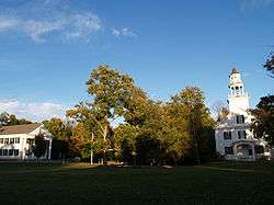 Shirley Center Historic District |
September 1, 1988 (#88001454) |
Brown, Center, Horsepond, Parker, and Whitney Rds. 42°34′18″N 71°39′03″W |
Shirley | |
| 157 | Shirley Shaker Village |  Shirley Shaker Village |
May 24, 1976 (#76000271) |
South of Shirley on Harvard Rd. 42°31′35″N 71°39′06″W |
Shirley | Extends into Lancaster in Worcester County. |
| 158 | Shirley Village Historic District |  Shirley Village Historic District |
January 23, 1992 (#91001958) |
Roughly bounded by Center, Harvard, Leominster and Shaker Rds. 42°32′33″N 71°39′07″W |
Shirley | |
| 159 | Zeb Spaulding House |  Zeb Spaulding House |
March 9, 1990 (#90000169) |
1044 Lowell Rd. 42°33′25″N 71°21′13″W |
Carlisle | |
| 160 | Stone's Bridge |  Stone's Bridge |
January 17, 2017 (#100000527) |
Old Stonebridge Rd. across Sudbury River 42°20′21″N 71°23′42″W |
Wayland | Extends into Framingham |
| 161 | Sudbury Aqueduct Linear District |  Sudbury Aqueduct Linear District |
January 18, 1990 (#89002293) |
Along Sudbury Aqueduct from Farm Pond at Waverly St. (Framingham) to Chestnut Hill Reservoir (Newton) 42°17′33″N 71°18′44″W |
Natick | Extends into Wellesley and Needham in Norfolk County, and Framingham, Newton and Sherborn in Middlesex County. |
| 162 | Sudbury Center Historic District |  Sudbury Center Historic District |
July 14, 1976 (#76000277) |
Concord and Old Sudbury Rds. 42°22′53″N 71°24′18″W |
Sudbury | |
| 163 | Tenney Homestead |  Tenney Homestead |
March 9, 1990 (#90000181) |
156 Taylor Rd. 42°26′51″N 71°30′52″W |
Stow | |
| 164 | Tewksbury State Hospital | 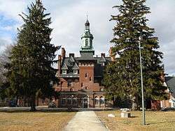 Tewksbury State Hospital |
January 21, 1994 (#93001486) |
Junction of East and Livingston Sts. 42°36′31″N 71°12′43″W |
Tewksbury | |
| 165 | Town Diner |  Town Diner |
September 22, 1999 (#99001127) |
627 Mount Auburn St. 42°22′15″N 71°09′31″W |
Watertown | |
| 166 | Trinity Episcopal Church |  Trinity Episcopal Church |
May 26, 1995 (#95000660) |
131 W. Emerson St. 42°27′34″N 71°04′09″W |
Melrose | |
| 167 | Two Brothers Rocks-Dudley Road Historic District |  Two Brothers Rocks-Dudley Road Historic District |
September 23, 2010 (#10000790) |
Roughly Dudley Rd. between Chestnut Lane and Emery Rd., Bedford and Timbercreek Lane, Billerica, from Massachusetts Route 4 to the Concord River 42°31′00″N 71°17′50″W |
Bedford and Billerica | |
| 168 | Col. Jonathan Tyng House |  Col. Jonathan Tyng House |
August 19, 1977 (#77000188) |
80 Tyng Rd. 42°39′37″N 71°24′28″W |
Tyngsborough | Demolished |
| 169 | Phineas Upham House |  Phineas Upham House |
March 9, 1990 (#90000173) |
255 Upham St. 42°27′29″N 71°03′10″W |
Melrose | |
| 170 | US Post Office-Woburn Center Station | 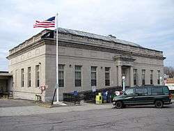 US Post Office-Woburn Center Station |
October 19, 1987 (#86003436) |
1 Abbott St. 42°28′53″N 71°04′09″W |
Woburn | |
| 171 | Waitt Brick Block | 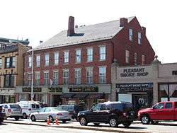 Waitt Brick Block |
November 12, 1982 (#82000492) |
422–424 Main St. 42°25′35″N 71°04′05″W |
Malden | |
| 172 | Walcott-Whitney House |  Walcott-Whitney House |
March 9, 1990 (#90000183) |
137 Tuttle Ln. 42°27′05″N 71°29′10″W |
Stow | |
| 173 | Watertown Arsenal Historic District |  Watertown Arsenal Historic District |
May 14, 1999 (#99000498) |
Arsenal St. 42°21′44″N 71°09′58″W |
Watertown | |
| 174 | Old Watertown High School |  Old Watertown High School |
September 22, 2006 (#06000860) |
341 Mount Auburn St. 42°22′08″N 71°10′13″W |
Watertown | |
| 175 | Wayland Center Historic District |  Wayland Center Historic District |
September 6, 1974 (#74000378) |
Irregular pattern along both sides of U.S. Route 20 and MA 27 42°21′49″N 71°21′35″W |
Wayland | |
| 176 | Wayside Inn Historic District |  Wayside Inn Historic District |
April 23, 1973 (#73000307) |
Old Boston Post Rd. 42°21′28″N 71°28′05″W |
Sudbury | |
| 177 | West School |  West School |
May 17, 2006 (#06000398) |
106 Bedford St. 42°30′22″N 71°13′10″W |
Burlington | |
| 178 | West Schoolhouse |  West Schoolhouse |
February 21, 1990 (#90000144) |
141 Shawsheen Ave. 42°33′22″N 71°11′25″W |
Wilmington | |
| 179 | Westford Center Historic District |  Westford Center Historic District |
August 28, 1998 (#98001105) |
Roughly along Graniteville Rd., Main St., Lincoln St., and Depot St. 42°34′50″N 71°26′19″W |
Westford | |
| 180 | Westford Town Farm |  Westford Town Farm |
March 14, 2008 (#08000167) |
35 Town Farm Rd. 42°35′11″N 71°28′44″W |
Westford | |
| 181 | Westlawn Cemetery |  Westlawn Cemetery |
January 5, 2005 (#04001433) |
Concord Rd. 42°34′16″N 71°28′02″W |
Westford | |
| 182 | Weston Aqueduct Linear District |  Weston Aqueduct Linear District |
January 18, 1990 (#89002274) |
Along the Weston Aqueduct from the Sudbury Reservoir to the Weston Reservoir 42°20′00″N 71°22′32″W |
Wayland | Extends into Southborough, Worcester County and Framingham and Weston in Middlesex County. |
| 183 | Levi Wetherbee Farm |  Levi Wetherbee Farm |
December 12, 2006 (#06001128) |
484 Middle Rd. 42°29′27″N 71°31′23″W |
Boxborough | |
| 184 | Wilmington Centre Village Historic District |  Wilmington Centre Village Historic District |
April 8, 1992 (#92000246) |
Roughly Middlesex Dr. and Church St. from Adams St. to Wildwood Cemetery 42°33′22″N 71°09′52″W |
Wilmington | |
| 185 | Wilson Mill-Old Burlington Road District |  Wilson Mill-Old Burlington Road District |
August 18, 2003 (#03000792) |
Old Burlington Rd. and Wilson Rd. 42°30′04″N 71°14′46″W |
Bedford | |
| 186 | Henry Wilson Shoe Shop |  Henry Wilson Shoe Shop |
August 24, 2000 (#00000955) |
181 W. Central St. 42°16′58″N 71°22′55″W |
Natick | |
| 187 | Woburn Public Library |  Woburn Public Library |
November 13, 1976 (#76000290) |
Pleasant St. 42°28′44″N 71°09′18″W |
Woburn | National Historic Landmark |
| 188 | Winslow School and Littlefield Library |  Winslow School and Littlefield Library |
March 7, 2017 (#100000722) |
250 & 252 Middlesex Rd. 42°40′40″N 71°25′28″W |
Tyngsborough | |
| 189 | Woods End Road Historic District | 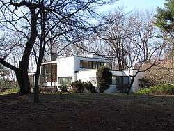 Woods End Road Historic District |
July 8, 1988 (#88000956) |
68 Baker Bridge Rd. and 1, 5, 9, and 10 Woods End Rd. 42°25′36″N 71°19′41″W |
Lincoln | |
| 190 | Wright Cemetery |  Wright Cemetery |
December 6, 2005 (#05001372) |
Groton Rd. 42°36′32″N 71°28′03″W |
Westford | |
| 191 | Francis Wyman House |  Francis Wyman House |
March 17, 1975 (#75000255) |
56 Francis Wyman St. 42°31′06″N 71°13′31″W |
Burlington |
Former listings
| [2] | Name on the Register | Image | Date listed | Date removed | Location | City or town | Summary |
|---|---|---|---|---|---|---|---|
| 1 | Old City Hall | _AND_SOUTH_ELEVATIONS_-_Malden_Town_Hall%2C_Main_and_Pleasant_Streets%2C_Malden%2C_Middlesex_County%2C_MA_HABS_MASS%2C9-MALD%2C2-1.tif.jpg) Old City Hall |
October 8, 1976 (#76002001) | Unknown | Main St. at Pleasant St. 42°25′34″N 71°04′02″W |
Malden | Built 1857, demolished 1979. |
References
| Wikimedia Commons has media related to National Register of Historic Places in Middlesex County, Massachusetts. |
- "National Register of Historic Places: Weekly List Actions". National Park Service, United States Department of the Interior. Retrieved on June 26, 2020.
- Numbers represent an ordering by significant words. Various colorings, defined here, differentiate National Historic Landmarks and historic districts from other NRHP buildings, structures, sites or objects.
- The eight-digit number below each date is the number assigned to each location in the National Register Information System database, which can be viewed by clicking the number.
- "Acton High School, Acton, Approved for Nomination to the National Register of Historic Places" (PDF) (Press release). Secretary of the Commonwealth, Massachusetts. September 19, 2011. Retrieved December 4, 2011.
- "Sudbury Reconnaissance Report: Freedom's Way Landscape Inventory" (PDF). Massachusetts Department of Conservation and Recreation. June 2006. Retrieved November 15, 2013.
- Coordinates derived from the location of Cedar Swamp on USGS topographical maps; the NRIS lists the site as "Address Restricted"
- "Inn fire takes away a piece of history". The Boston Globe. Archived from the original on 2012-05-03.
| Topics |  | ||||||||||||||||
|---|---|---|---|---|---|---|---|---|---|---|---|---|---|---|---|---|---|
| Lists by county | |||||||||||||||||
| Lists by city |
| ||||||||||||||||
| Other lists | |||||||||||||||||
| |||||||||||||||||
Municipalities and communities of Middlesex County, Massachusetts, United States | ||
|---|---|---|
| Cities | | |
| Towns |
| |
| CDPs | ||
| Other villages |
| |
This article is issued from Wikipedia. The text is licensed under Creative Commons - Attribution - Sharealike. Additional terms may apply for the media files.