National Register of Historic Places listings in Fall River, Massachusetts
List of Registered Historic Places in Fall River, Massachusetts, which has been transferred from and is an integral part of National Register of Historic Places listings in Bristol County, Massachusetts
- This National Park Service list is complete through NPS recent listings posted June 26, 2020.[1]
| [2] | Name on the Register[3] | Image | Date listed[4] | Location | City or town | Description |
|---|---|---|---|---|---|---|
| 1 | Academy Building | 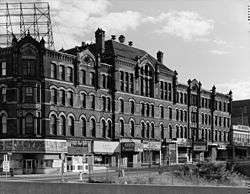 Academy Building |
July 2, 1973 (#73000277) |
S. Main St. 41°42′03″N 71°09′20″W |
Fall River | |
| 2 | Al Mac's Diner-Restaurant |  Al Mac's Diner-Restaurant |
December 20, 1999 (#99001119) |
135 President Ave. 41°42′58″N 71°09′17″W |
Fall River | |
| 3 | Algonquin Printing Co. |  Algonquin Printing Co. |
February 16, 1983 (#83000615) |
Bay St. 41°41′42″N 71°10′40″W |
Fall River | |
| 4 | American Printing Co. and Metacomet Mill | 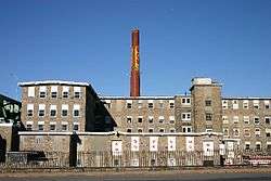 American Printing Co. and Metacomet Mill |
February 16, 1983 (#83000617) |
Anawan St. 41°42′10″N 71°09′42″W |
Fall River | |
| 5 | David M. Anthony House |  David M. Anthony House |
February 16, 1983 (#83000620) |
368 N. Main St. 41°42′25″N 71°09′18″W |
Fall River | |
| 6 | Ashley House |  Ashley House |
February 16, 1983 (#83000621) |
3159 Main St. 41°44′21″N 71°07′49″W |
Fall River | Dismantled July, 1983.[5] |
| 7 | Barnard Mills |  Barnard Mills |
February 16, 1983 (#83000623) |
641-657 Quarry St. 41°41′26″N 71°08′26″W |
Fall River | Includes attached weave shed |
| 8 | Belmont Club/John Young House |  Belmont Club/John Young House |
February 16, 1983 (#83000624) |
34 Franklin St. 41°42′13″N 71°09′17″W |
Fall River | |
| 9 | Barnabus Blossom House | 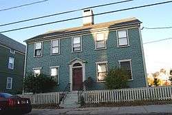 Barnabus Blossom House |
February 16, 1983 (#83000627) |
244 Grove St. 41°42′23″N 71°08′55″W |
Fall River | |
| 10 | Boguslavsky Triple-Deckers |  Boguslavsky Triple-Deckers |
February 16, 1983 (#83000628) |
53-87 Albion St. 41°41′49″N 71°07′59″W |
Fall River | |
| 11 | Borden Flats Light Station | 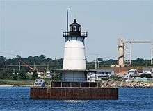 Borden Flats Light Station |
June 15, 1987 (#87001528) |
Taunton River 41°42′18″N 71°10′40″W |
Fall River | |
| 12 | A.J. Borden Building | 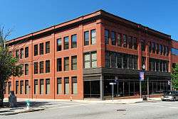 A.J. Borden Building |
February 16, 1983 (#83000629) |
91-111 S. Main St. 41°42′05″N 71°09′30″W |
Fall River | |
| 13 | Ariadne J. and Mary A. Borden House | 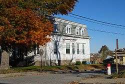 Ariadne J. and Mary A. Borden House |
February 16, 1983 (#83000630) |
92 Globe St. 41°41′22″N 71°10′44″W |
Fall River | |
| 14 | N. B. Borden School |  N. B. Borden School |
February 16, 1983 (#83000631) |
43 Morgan St. 41°41′49″N 71°08′53″W |
Fall River | |
| 15 | Borden-Winslow House | 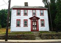 Borden-Winslow House |
February 16, 1983 (#83000632) |
3063 N. Main St. 41°43′34″N 71°08′02″W |
Fall River | |
| 16 | Border City Mill No. 2 | 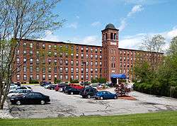 Border City Mill No. 2 |
June 28, 1990 (#90000999) |
One Weaver St. 41°43′40″N 71°08′29″W |
Fall River | Converted into apartments |
| 17 | Brayton Methodist Episcopal Church | 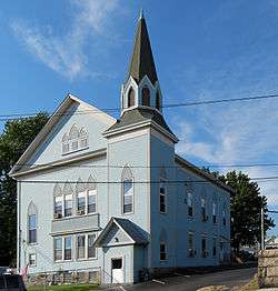 Brayton Methodist Episcopal Church |
February 16, 1983 (#83000635) |
264 Griffin St. 41°41′20″N 71°10′12″W |
Fall River | |
| 18 | Hathaway Brightman House |  Hathaway Brightman House |
February 16, 1983 (#83000637) |
205 Crescent St. 41°44′04″N 71°08′28″W |
Fall River | |
| 19 | Bristol County Superior Court |  Bristol County Superior Court |
February 16, 1983 (#83000638) |
441 N. Main St. 41°42′29″N 71°09′16″W |
Fall River | |
| 20 | Squire William B. Canedy House |  Squire William B. Canedy House |
February 16, 1983 (#83000640) |
2634 N. Main St. 41°42′52″N 71°08′10″W |
Fall River | |
| 21 | Cataract Engine Company No. 3 |  Cataract Engine Company No. 3 |
February 16, 1983 (#83000645) |
116 Rock St. 41°42′12″N 71°09′14″W |
Fall River | |
| 22 | Central Congregational Church | 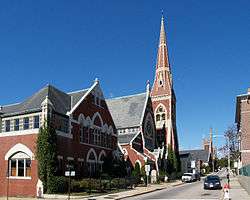 Central Congregational Church |
February 16, 1983 (#83000646) |
100 Rock St. 41°42′10″N 71°09′14″W |
Fall River | Most recently occupied by International Institute of Culinary Arts |
| 23 | Chace Mills |  Chace Mills |
February 16, 1983 (#83000648) |
Lewiston and Salem Sts. 41°41′30″N 71°08′47″W |
Fall River | Weave shed burned in 1999, main mill saved |
| 24 | A. B. Chace Rowhouses | 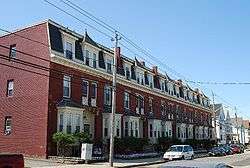 A. B. Chace Rowhouses |
February 16, 1983 (#83000647) |
655-685 Middle St. 41°42′09″N 71°10′00″W |
Fall River | |
| 25 | Oliver Chace's Thread Mill |  Oliver Chace's Thread Mill |
February 16, 1983 (#83000649) |
505 Bay St. 41°41′38″N 71°10′39″W |
Fall River | oldest remaining mill in Fall River; later part of Connanicut Mills |
| 26 | Charlton Mill |  Charlton Mill |
February 16, 1983 (#83000650) |
109 Howe St. 41°40′43″N 71°10′38″W |
Fall River | weave shed demolished |
| 27 | Chase-Hyde Farm |  Chase-Hyde Farm |
February 16, 1983 (#83000651) |
1281-1291 New Boston Rd. 41°43′03″N 71°07′32″W |
Fall River | |
| 28 | Children's Home | 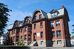 Children's Home |
February 16, 1983 (#83000652) |
427 Robeson St. 41°42′53″N 71°08′39″W |
Fall River | |
| 29 | Church of the Ascension |  Church of the Ascension |
February 16, 1983 (#83000653) |
160 Rock St. 41°42′04″N 71°09′12″W |
Fall River | |
| 30 | William Collins House |  William Collins House |
February 16, 1983 (#83000654) |
3775 N. Main St. 41°43′15″N 71°07′29″W |
Fall River | |
| 31 | William M. Connell School |  William M. Connell School |
February 16, 1983 (#83000655) |
650 Plymouth Ave. 41°42′08″N 71°09′23″W |
Fall River | |
| 32 | Corky Row Historic District | 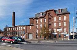 Corky Row Historic District |
June 23, 1983 (#83000656) |
Roughly bounded by Plymouth Ave. I195 and 2nd St. 41°41′43″N 71°09′23″W |
Fall River | Include Davol Mills & Tecumseh Mills |
| 33 | Cornell Mills |  Cornell Mills |
February 16, 1983 (#83000657) |
Alden St. 41°41′03″N 71°08′01″W |
Fall River | |
| 34 | Coughlin School | 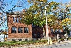 Coughlin School |
February 16, 1983 (#83000658) |
1975 Pleasant St. 41°41′04″N 71°07′42″W |
Fall River | |
| 35 | Crescent Mill |  Crescent Mill |
February 16, 1983 (#83000659) |
30 Front St. 41°41′51″N 71°08′49″W |
Fall River | |
| 36 | Davol School |  Davol School |
February 16, 1983 (#83000661) |
112 Flint St. 41°41′34″N 71°08′09″W |
Fall River | school closed in June 2008, Now owned by the Flint Neighborhood Association |
| 37 | William C. Davol Jr. House | 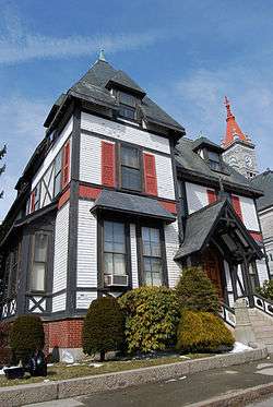 William C. Davol Jr. House |
February 16, 1983 (#83004286) |
252 High St. 41°42′50″N 71°09′10″W |
Fall River | |
| 38 | Downtown Fall River Historic District |  Downtown Fall River Historic District |
February 16, 1983 (#83000662) |
N. and S. Main, Bedford, Granite, Bank, Franklin, and Elm Sts. 41°42′11″N 71°09′21″W |
Fall River | |
| 39 | Durfee Mills | 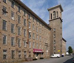 Durfee Mills |
February 16, 1983 (#83000664) |
359-479 Pleasant St. 41°41′54″N 71°08′59″W |
Fall River | largest mill complex in city |
| 40 | B.M.C. Durfee High School | 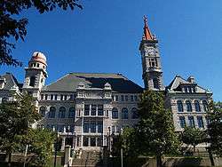 B.M.C. Durfee High School |
June 11, 1981 (#81000109) |
289 Rock St. 41°42′20″N 71°09′08″W |
Fall River | now occupied by Massachusetts Probate Court |
| 41 | John M. Earle House |  John M. Earle House |
February 16, 1983 (#83000665) |
352 Durfee St. 41°42′58″N 71°09′26″W |
Fall River | |
| 42 | Fall River Bleachery |  Fall River Bleachery |
February 16, 1983 (#83000667) |
Jefferson St. 41°40′19″N 71°08′44″W |
Fall River | |
| 43 | Fall River Waterworks |  Fall River Waterworks |
December 7, 1981 (#81000714) |
Bedford St. 41°42′07″N 71°07′09″W |
Fall River | |
| 44 | First Baptist Church |  First Baptist Church |
February 16, 1983 (#83000668) |
200-228 N. Main St. 41°42′18″N 71°09′20″W |
Fall River | |
| 45 | Flint Mills |  Flint Mills |
February 16, 1983 (#83000669) |
Alden St. 41°41′20″N 71°08′13″W |
Fall River | |
| 46 | Foster Spinning Co. | 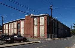 Foster Spinning Co. |
February 16, 1983 (#83000670) |
Cove St. 41°43′27″N 71°08′49″W |
Fall River | |
| 47 | Globe Yarn Mills |  Globe Yarn Mills |
February 16, 1983 (#83000671) |
Globe St. 41°41′20″N 71°10′24″W |
Fall River | |
| 48 | Greany Building | 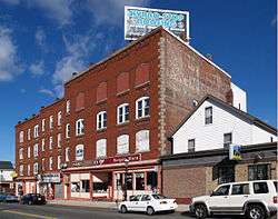 Greany Building |
February 16, 1983 (#83000674) |
1270-1288 Pleasant St. 41°41′31″N 71°08′10″W |
Fall River | |
| 49 | Hargraves Mill No. 1 |  Hargraves Mill No. 1 |
February 16, 1983 (#83000675) |
Quarry St. 41°41′33″N 71°08′25″W |
Fall River | |
| 50 | James D. Hathaway House |  James D. Hathaway House |
February 16, 1983 (#83000676) |
311 Pine St. 41°42′47″N 71°09′15″W |
Fall River | |
| 51 | Highlands Historic District | 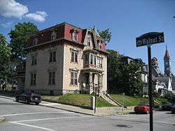 Highlands Historic District |
February 16, 1983 (#83000677) |
Roughly bounded by June, Cherry, and Weetamae Sts., Lincoln, Highland, President, N. Main, and Hood Aves. 41°42′37″N 71°09′00″W |
Fall River | |
| 52 | House at 108-112 Quarry Street |  House at 108-112 Quarry Street |
February 16, 1983 (#83000683) |
108-112 Quarry St. 41°42′23″N 71°08′26″W |
Fall River | |
| 53 | Jesus Marie Convent |  Jesus Marie Convent |
February 16, 1983 (#83000685) |
138 St. Joseph's St. 41°41′27″N 71°07′56″W |
Fall River | |
| 54 | Kennedy Park |  Kennedy Park |
February 16, 1983 (#83000686) |
Bounded by S. Main St., Bradford Ave., Middle, and Bay Sts. 41°41′44″N 71°10′12″W |
Fall River | |
| 55 | King Philip Mills |  King Philip Mills |
February 16, 1983 (#83000687) |
Kilburn St. 41°40′55″N 71°10′21″W |
Fall River | Office building destroyed by fire, January 3, 2012[6] |
| 56 | Lafayette-Durfee House |  Lafayette-Durfee House |
April 15, 1982 (#82004959) |
94 Cherry St. 41°42′21″N 71°09′26″W |
Fall River | |
| 57 | William Lindsey House |  William Lindsey House |
February 16, 1983 (#83000690) |
373 N. Main St. 41°42′59″N 71°09′18″W |
Fall River | |
| 58 | Lower Highlands Historic District |  Lower Highlands Historic District |
January 10, 1984 (#84002171) |
Roughly bounded by Cherry, Main, Winter, and Bank Sts. 41°42′15″N 71°08′58″W |
Fall River | |
| 59 | William M. Manley House |  William M. Manley House |
June 26, 1986 (#86001401) |
610 Cherry St. 41°42′17″N 71°08′54″W |
Fall River | |
| 60 | Massasoit Fire House No. 5 |  Massasoit Fire House No. 5 |
February 16, 1983 (#83000692) |
83 Freedom St. 41°41′22″N 71°10′09″W |
Fall River | |
| 61 | Mechanics Mill |  Mechanics Mill |
February 16, 1983 (#83000693) |
1082 Davol St. 41°43′07″N 71°09′21″W |
Fall River | |
| 62 | Narragansett Mills |  Narragansett Mills |
February 16, 1983 (#83000694) |
1567 N. Main St. 41°43′18″N 71°08′39″W |
Fall River | |
| 63 | North Burial Ground |  North Burial Ground |
February 16, 1983 (#83000695) |
N. Main St. between Brightman and Cory Sts. 41°43′11″N 71°09′00″W |
Fall River | |
| 64 | North Christian Congregational Church |  North Christian Congregational Church |
February 16, 1983 (#83000696) |
3538 N. Main St. 41°44′39″N 71°07′40″W |
Fall River | |
| 65 | Notre Dame School |  Notre Dame School |
February 16, 1983 (#83000697) |
34 St. Joseph's St. 41°41′28″N 71°08′02″W |
Fall River | school closed in June 2008 |
| 66 | Oak Grove Cemetery |  Oak Grove Cemetery |
February 16, 1983 (#83000698) |
765 Prospect St. 41°42′19″N 71°08′14″W |
Fall River | |
| 67 | Osborn House |  Osborn House |
April 4, 1980 (#80000431) |
456 Rock St. 41°42′27″N 71°09′09″W |
Fall River | aka Carr-Osborn Mansion |
| 68 | Osborn Street School | 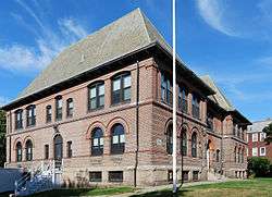 Osborn Street School |
February 16, 1983 (#83000699) |
160 Osborn St. 41°41′33″N 71°10′03″W |
Fall River | |
| 69 | Israel Picard House | 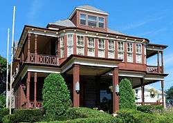 Israel Picard House |
February 16, 1983 (#83000702) |
690 County St. 41°42′06″N 71°07′46″W |
Fall River | |
| 70 | Pilgrim Mills |  Pilgrim Mills |
February 16, 1983 (#83000704) |
847 Pleasant St. 41°41′56″N 71°09′05″W |
Fall River | |
| 71 | Pine Street School |  Pine Street School |
February 16, 1983 (#83000705) |
880 Pine St. 41°42′09″N 71°08′39″W |
Fall River | |
| 72 | Pocasset Firehouse No. 7 | 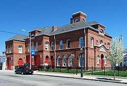 Pocasset Firehouse No. 7 |
February 16, 1983 (#83000706) |
1058 Pleasant St. 41°41′40″N 71°08′19″W |
Fall River | |
| 73 | PT Boat 796 (torpedo boat) | 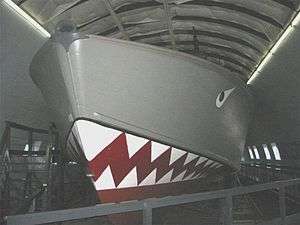 PT Boat 796 (torpedo boat) |
January 14, 1986 (#86000092) |
Battleship Cove 41°42′14″N 71°09′40″W |
Fall River | |
| 74 | Quequechan Club |  Quequechan Club |
February 16, 1983 (#83000708) |
306 N. Main St. 41°42′57″N 71°09′21″W |
Fall River | |
| 75 | Quequechan Valley Mills Historic District |  Quequechan Valley Mills Historic District |
February 16, 1983 (#83000709) |
Quequechan, Jefferson, and Stevens Sts. between I-195 and Denver St. 41°40′59″N 71°08′33″W |
Fall River | |
| 76 | Nathan Read House | 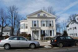 Nathan Read House |
February 16, 1983 (#83000710) |
506 N. Main St. 41°43′05″N 71°09′20″W |
Fall River | |
| 77 | Ruggles Park |  Ruggles Park |
February 16, 1983 (#83000711) |
Bounded by Seabury, Robeson, Pine, and Locust Sts. 41°42′14″N 71°08′46″W |
Fall River | |
| 78 | Sacred Heart School |  Sacred Heart School |
March 9, 1987 (#87000371) |
90 Linden St. 41°42′11″N 71°08′57″W |
Fall River | |
| 79 | Sagamore Mill No. 2 | 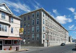 Sagamore Mill No. 2 |
February 16, 1983 (#83000712) |
1822 N. Main St. 41°43′26″N 71°08′39″W |
Fall River | |
| 80 | Sagamore Mills No. 1 and No. 3 |  Sagamore Mills No. 1 and No. 3 |
February 16, 1983 (#83000713) |
Ace St. 41°43′33″N 71°08′43″W |
Fall River | |
| 81 | Sanford Spinning Co. |  Sanford Spinning Co. |
February 16, 1983 (#83000714) |
Globe Mills Ave. 41°41′33″N 71°10′45″W |
Fall River | NRHP listing includes Globe Yarn Mills No. 3 |
| 82 | Santo Christo Church |  Santo Christo Church |
February 16, 1983 (#83000715) |
240 Columbia St. 41°42′01″N 71°09′48″W |
Fall River | |
| 83 | Seaconnett Mills |  Seaconnett Mills |
February 16, 1983 (#83000716) |
E. Warren St. 41°41′00″N 71°08′10″W |
Fall River | |
| 84 | John Mace Smith House |  John Mace Smith House |
February 16, 1983 (#83000717) |
399 N. Main St. 41°42′57″N 71°09′18″W |
Fall River | |
| 85 | St. Anne's Church and Parish Complex |  St. Anne's Church and Parish Complex |
February 16, 1983 (#83000719) |
780 S. Main St. 41°41′38″N 71°09′50″W |
Fall River | |
| 86 | St. Joseph's Church |  St. Joseph's Church |
February 16, 1983 (#83000720) |
1355 N. Main St. 41°43′07″N 71°08′52″W |
Fall River | |
| 87 | St. Joseph's Orphanage |  St. Joseph's Orphanage |
February 16, 1983 (#83000721) |
56 St. Joseph's St. 41°41′30″N 71°08′00″W |
Fall River | |
| 88 | St. Louis Church |  St. Louis Church |
February 16, 1983 (#83000722) |
440 Bradford Ave. 41°41′47″N 71°10′02″W |
Fall River | Demolished in April 2010 |
| 89 | St. Mary's Cathedral and Rectory |  St. Mary's Cathedral and Rectory |
February 16, 1983 (#83000723) |
327 Second St. 41°41′55″N 71°09′28″W |
Fall River | |
| 90 | St. Patrick's Church |  St. Patrick's Church |
February 16, 1983 (#83000724) |
1588 S. Main St. 41°41′08″N 71°10′25″W |
Fall River | now known as Good Shepherd Parish |
| 91 | Stafford Mills |  Stafford Mills |
February 16, 1983 (#83000718) |
County St. 41°41′46″N 71°08′21″W |
Fall River | |
| 92 | Torpedo Boat PT-617 | 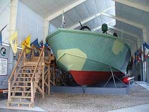 Torpedo Boat PT-617 |
December 20, 1989 (#89002465) |
Battleship Cove 41°42′14″N 71°09′40″W |
Fall River | |
| 93 | Truesdale Hospital |  Truesdale Hospital |
April 15, 1986 (#86000801) |
1820 Highland Ave. 41°43′41″N 71°08′07″W |
Fall River | |
| 94 | U.S.S. Joseph P. Kennedy Jr. (DD-850) | 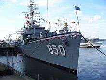 U.S.S. Joseph P. Kennedy Jr. (DD-850) |
September 30, 1976 (#76000231) |
Battleship Cove 41°42′21″N 71°09′47″W |
Fall River | |
| 95 | U.S.S. Lionfish | .jpg) U.S.S. Lionfish |
September 30, 1976 (#76000232) |
Battleship Cove 41°42′20″N 71°09′48″W |
Fall River | |
| 96 | U.S.S. Massachusetts | 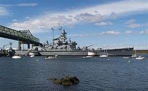 U.S.S. Massachusetts |
September 30, 1976 (#76002269) |
Battleship Cove 41°42′24″N 71°09′48″W |
Fall River | |
| 97 | Union Mills |  Union Mills |
February 16, 1983 (#83000726) |
Pleasant St. 41°41′44″N 71°08′32″W |
Fall River | |
| 98 | The Unitarian Society |  The Unitarian Society |
May 13, 1982 (#82004958) |
309 N. Main St. 41°42′22″N 71°09′17″W |
Fall River | Destroyed by fire in 1983; rebuilt. |
| 99 | Valentine-French House |  Valentine-French House |
February 16, 1983 (#83000727) |
5105 N. Main St. 41°45′36″N 71°06′45″W |
Fall River | |
| 100 | Wampanoag Mills |  Wampanoag Mills |
February 16, 1983 (#83000729) |
Quequechan St. 41°41′20″N 71°08′19″W |
Fall River | |
| 101 | Woman's Club of Fall River | 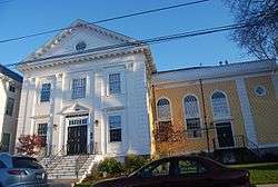 Woman's Club of Fall River |
February 16, 1983 (#83000733) |
1542 Walnut St. 41°42′56″N 71°08′59″W |
Fall River | |
| 102 | Luther Winslow Jr. House | 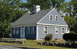 Luther Winslow Jr. House |
February 16, 1983 (#83000732) |
5225 N. Main St. 41°45′37″N 71°06′42″W |
Fall River |
See also
| Wikimedia Commons has media related to National Register of Historic Places in Fall River, Massachusetts. |
References
- "National Register of Historic Places: Weekly List Actions". National Park Service, United States Department of the Interior. Retrieved on June 26, 2020.
- Numbers represent an ordering by significant words. Various colorings, defined here, differentiate National Historic Landmarks and historic districts from other NRHP buildings, structures, sites or objects.
- "National Register Information System". National Register of Historic Places. National Park Service. April 24, 2008.
- The eight-digit number below each date is the number assigned to each location in the National Register Information System database, which can be viewed by clicking the number.
- Giza, Patricia (1984). A Guide Book to Fall River's National Register Properties. Fall River, MA: The City.
- Herald News Article, January 3, 2012

| Topics |  | ||||||||||||||||
|---|---|---|---|---|---|---|---|---|---|---|---|---|---|---|---|---|---|
| Lists by county | |||||||||||||||||
| Lists by city |
| ||||||||||||||||
| Other lists | |||||||||||||||||
| |||||||||||||||||
Boston (capital) | ||
| Topics |
| |
| Society |
| |
| Regions |
| |
| Counties | ||
| Cities |
| |
This article is issued from Wikipedia. The text is licensed under Creative Commons - Attribution - Sharealike. Additional terms may apply for the media files.