National Register of Historic Places listings in Franklin County, Massachusetts
This is a list of the National Register of Historic Places listings in Franklin County, Massachusetts.
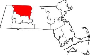
Location of Franklin County in Massachusetts
This is intended to be a complete list of the properties and districts on the National Register of Historic Places in Franklin County, Massachusetts, United States. Latitude and longitude coordinates are provided for many National Register properties and districts; these locations may be seen together in a map.[1]
There are 56 properties and districts listed on the National Register in the county, including 1 National Historic Landmark.
- This National Park Service list is complete through NPS recent listings posted June 26, 2020.[2]
Current listings
| [3] | Name on the Register[4] | Image | Date listed[5] | Location | City or town | Description |
|---|---|---|---|---|---|---|
| 1 | Simeon Alexander Jr. House |  Simeon Alexander Jr. House |
May 28, 1991 (#91000598) |
496 Millers Falls Rd. 42°38′19″N 72°27′55″W |
Northfield | |
| 2 | Alvah Stone Mill | 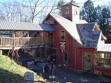 Alvah Stone Mill |
June 30, 1997 (#97000562) |
440 Greenfield Rd. 42°32′16″N 72°32′20″W |
Montague | Now the Bookmill. |
| 3 | Ashfield Plain Historic District |  Ashfield Plain Historic District |
September 20, 1991 (#91001373) |
Roughly along Main and South Sts. and adjacent parts of Buckland and Norton Hill Rds. 42°31′37″N 72°47′17″W |
Ashfield | |
| 4 | Bardwell's Ferry Bridge |  Bardwell's Ferry Bridge |
February 10, 2000 (#00000076) |
Bardwell's Ferry Rd. over the Deerfield River 42°33′20″N 72°40′41″W |
Conway | |
| 5 | Benson's New Block and the Mohawk Chambers | 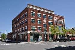 Benson's New Block and the Mohawk Chambers |
March 11, 2014 (#14000046) |
136-138 & 130-134 Main St. & 11 Wells St. 42°35′17″N 72°36′14″W |
Greenfield | |
| 6 | Bernardston Congregational Unitarian Church |  Bernardston Congregational Unitarian Church |
March 18, 1993 (#93000128) |
Junction of Church and Depot Sts. 42°40′14″N 72°33′00″W |
Bernardston | |
| 7 | Bissell Bridge |  Bissell Bridge |
February 26, 2004 (#04000083) |
Heath Rd., MA 8A over Mill Brook 42°37′57″N 72°52′10″W |
Charlemont | |
| 8 | Burkeville Covered Bridge |  Burkeville Covered Bridge |
September 9, 1988 (#88001456) |
Main Poland Rd. over the South River 42°30′28″N 72°42′40″W |
Conway | |
| 9 | Charlemont Village Historic District | 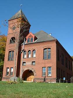 Charlemont Village Historic District |
February 10, 1988 (#87001880) |
MA 2 (Main St.) between South and Harmont Sts. 42°37′40″N 72°52′27″W |
Charlemont | |
| 10 | Colrain Center Historic District |  Colrain Center Historic District |
November 15, 2006 (#06001057) |
Main, Greenfield, and Jacksonville Rds., Streeter Ln., and River and Coburn Sts. 42°40′24″N 72°41′52″W |
Colrain | |
| 11 | Conway Center Historic District | 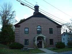 Conway Center Historic District |
September 10, 1999 (#99001043) |
5-38 Academy Hill Rd., 1-59 Elm St., and 8-98 Main St. 42°30′31″N 72°41′50″W |
Conway | |
| 12 | Dedic Site | 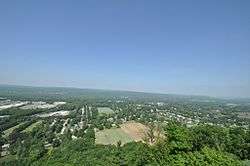 Dedic Site |
July 16, 1980 (#80000504) |
Address Restricted |
Deerfield | Clovis-era paleo-indian site |
| 13 | Deerfield Valley Agricultural Society Fairgrounds |  Deerfield Valley Agricultural Society Fairgrounds |
May 11, 2011 (#11000267) |
Park St. 42°37′51″N 72°52′03″W |
Charlemont | |
| 14 | East Charlemont District School |  East Charlemont District School |
March 7, 2017 (#100000721) |
1811 MA 2 42°37′24″N 72°47′13″W |
Charlemont | |
| 15 | East Hawley Center Historic District |  East Hawley Center Historic District |
July 24, 1992 (#92000951) |
East Hawley, Plainfield, Buckland, and Ashfield Rds. 42°33′48″N 72°52′43″W |
Hawley | |
| 16 | East Leverett Historic District |  East Leverett Historic District |
January 29, 2014 (#13001131) |
Shutesbury, January Hills, Still Corner & Cushman Rds. 42°26′18″N 72°28′58″W |
Leverett | |
| 17 | East Main-High Street Historic District |  East Main-High Street Historic District |
March 16, 1989 (#88002011) |
Roughly bounded by Church, High, E. Main, and Franklin Sts. 42°35′20″N 72°35′49″W |
Greenfield | |
| 18 | Franklin County Fairgrounds |  Franklin County Fairgrounds |
June 15, 2011 (#11000359) |
89 Wisdom Way 42°34′44″N 72°36′42″W |
Greenfield | |
| 19 | Garden Theater Block |  Garden Theater Block |
September 1, 1983 (#83000591) |
353-367 Main St. 42°35′15″N 72°36′01″W |
Greenfield | |
| 20 | Gill Center Historic District | 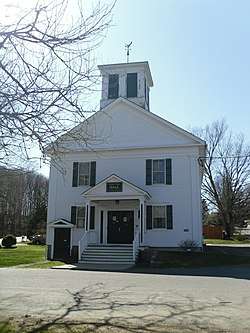 Gill Center Historic District |
November 5, 2018 (#100003068) |
Center, Main, Cross, Boyle, River, & Lyons Hill Rds. 42°38′28″N 72°29′58″W |
Gill | |
| 21 | Maj. Joseph Griswold House |  Maj. Joseph Griswold House |
February 23, 1972 (#72000130) |
Upper St. 42°35′26″N 72°47′39″W |
Buckland | |
| 22 | Heath Center Historic District |  Heath Center Historic District |
October 25, 2007 (#07001103) |
E. and W. Main Sts., 12 and 23 Avery Brook, 8 Taylor Brook, 1-51 Bray, Colrain Stage, 3-16 Ledges, and 15-48 South Rds. 42°40′25″N 72°49′19″W |
Heath | |
| 23 | Hill Cemetery and Parson Hubbard House Historic District |  Hill Cemetery and Parson Hubbard House Historic District |
August 23, 2006 (#06000716) |
Old Village Rd., 72 Old Village Rd. 42°35′54″N 72°41′16″W |
Shelburne | |
| 24 | King Philip's Hill |  King Philip's Hill |
December 16, 1981 (#81000106) |
Old Bernardston Road 42°41′02″N 72°28′35″W |
Northfield | |
| 25 | Leavitt-Hovey House |  Leavitt-Hovey House |
December 22, 1983 (#83003977) |
402 Main St. 42°35′17″N 72°35′58″W |
Greenfield | |
| 26 | Leverett Center Historic District |  Leverett Center Historic District |
December 5, 2008 (#08001127) |
Amherst, Montague, Depot, and Shutesbury Rds. 42°27′05″N 72°30′06″W |
Leverett | |
| 27 | Main Street Historic District |  Main Street Historic District |
October 13, 1988 (#88001908) |
Main St. between Chapman and Hope Sts., also along Bank Row 42°35′13″N 72°36′05″W |
Greenfield | |
| 28 | Mohawk Trail | 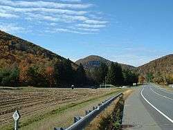 Mohawk Trail |
April 3, 1973 (#73000283) |
Along the bank of the Cold River 42°38′15″N 72°57′13″W |
Charlemont | Extends into Florida and Savoy in Berkshire County |
| 29 | Montague Center Historic District | 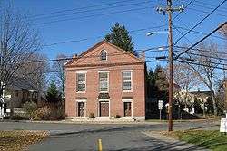 Montague Center Historic District |
November 16, 2001 (#01001236) |
Center, Main, North, School, and Union Sts. 42°32′06″N 72°32′05″W |
Montague | |
| 30 | Moore's Corner Historic District | 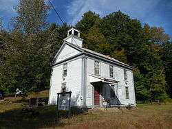 Moore's Corner Historic District |
May 19, 2014 (#14000215) |
North Leverett, Dudleyville, Rattlesnake Gutter & Church Hill Rds. 42°29′40″N 72°28′06″W |
Leverett | |
| 31 | New Salem Common Historic District | 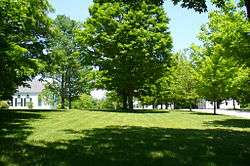 New Salem Common Historic District |
April 12, 1978 (#78000443) |
S. Main St. 42°29′55″N 72°19′54″W |
New Salem | |
| 32 | Newton Street School |  Newton Street School |
October 27, 1988 (#88001907) |
70 Shelburne Rd. 42°35′08″N 72°36′52″W |
Greenfield | |
| 33 | North Leverett Historic District |  North Leverett Historic District |
June 13, 2014 (#14000326) |
North Leverett, Chestnut Hill, Cave Hill, Jackson Hill, Hemenway & Dickinson Rds. 42°30′28″N 72°29′31″W |
Leverett | |
| 34 | Northfield Center Cemetery |  Northfield Center Cemetery |
November 13, 2004 (#04001220) |
Western terminus of Parker Ave. 42°41′41″N 72°27′40″W |
Northfield | |
| 35 | Northfield Main Street Historic District |  Northfield Main Street Historic District |
July 8, 1982 (#82004965) |
Full length of Main St. from Millers Brook to Pauchaug Brook 42°41′50″N 72°27′16″W |
Northfield | |
| 36 | Odd Fellows' Hall | 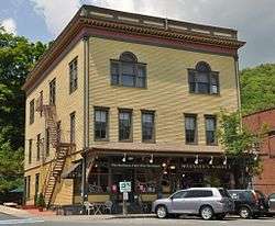 Odd Fellows' Hall |
May 10, 1979 (#79000345) |
1-5 State St. 42°36′13″N 72°44′29″W |
Buckland | In Shelburne Falls village of Buckland. |
| 37 | Old Deerfield Village Historic District | .jpg) Old Deerfield Village Historic District |
October 15, 1966 (#66000774) |
West of U.S. Route 5, bounded by Mill Village Rd., "The Street", Broughton's Pond Rd., and Pogues Hole Rd. 42°33′04″N 72°36′30″W |
Deerfield | |
| 38 | Orange Center Historic District |  Orange Center Historic District |
April 27, 1989 (#89000057) |
Roughly N. and S. Main St. from Prospect St. to River St. 42°35′24″N 72°18′39″W |
Orange | |
| 39 | Pine Street School |  Pine Street School |
March 13, 2002 (#02000156) |
13 Pine St. 42°42′32″N 72°26′50″W |
Northfield | |
| 40 | Powers Institute Historic District |  Powers Institute Historic District |
March 18, 1994 (#93000127) |
Church St. between South and Library Sts. 42°40′16″N 72°33′12″W |
Bernardston | |
| 41 | Riverside Archeological District |  Riverside Archeological District |
July 9, 1975 (#75000256) |
Address Restricted |
Greenfield and Gill | |
| 42 | Riverside Village Historic District |  Riverside Village Historic District |
September 18, 2017 (#100001617) |
0-77 French King Hwy., 0-61 Riverview Dr., 1-9 Grove, 2-9 Myrtle, 8 Meadow, 2-23 Oak, 1-4 Pine & 3-32 Walnut Sts. 42°36′41″N 72°32′52″W |
Gill | |
| 43 | Shelburne Falls Historic District |  Shelburne Falls Historic District |
January 28, 1988 (#87002548) |
Bridge and State Sts. 42°36′11″N 72°44′25″W |
Buckland and Shelburne | Boundary Increase 2010 (listed April 7, 2010): Roughly bounded by Deerfield River, Bridge St., Massachusetts Route 2 and Arms Cemetery |
| 44 | Shelburne Free Public Library |  Shelburne Free Public Library |
July 18, 2016 (#16000453) |
233 Shelburne Center Rd. 42°35′20″N 72°41′19″W |
Shelburne | |
| 45 | Arthur A. Smith Covered Bridge |  Arthur A. Smith Covered Bridge |
February 3, 1983 (#83000592) |
West of Colrain on Lyonsville Rd. 42°40′12″N 72°43′09″W |
Colrain | |
| 46 | South School |  South School |
December 26, 2007 (#07001312) |
6 Schoolhouse Rd. 42°25′11″N 72°26′00″W |
Shutesbury | |
| 47 | Sunderland Center Historic District |  Sunderland Center Historic District |
March 15, 2002 (#02000157) |
Roughly along S. Main St.from Old Amherst Rd. to French's Ferry Rd. 42°27′59″N 72°34′46″W |
Sunderland | |
| 48 | Old Tavern Farm |  Old Tavern Farm |
March 10, 2005 (#05000120) |
817 Colrain Rd. 42°37′20″N 72°38′09″W |
Greenfield | |
| 49 | Turners Falls Historic District |  Turners Falls Historic District |
May 2, 1982 (#82004966) |
Roughly bounded by the Connecticut River, Power Canal, and 9th and L Sts. 42°36′30″N 72°33′23″W |
Montague | Listed as Turner Falls Historic District |
| 50 | US Post Office-Greenfield Main |  US Post Office-Greenfield Main |
December 20, 1985 (#85003224) |
442 Main St. 42°35′15″N 72°35′53″W |
Greenfield | |
| 51 | Weldon Hotel | 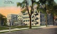 Weldon Hotel |
August 6, 1980 (#80000503) |
54 High St. 42°35′26″N 72°35′44″W |
Greenfield | |
| 52 | Wendell Town Common Historic District | 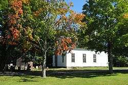 Wendell Town Common Historic District |
May 21, 1992 (#92000580) |
Junction of Depot, Lock's Village, Montague and Morse Village Rds. 42°32′55″N 72°23′51″W |
Wendell | |
| 53 | West Whately Historic District | 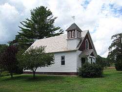 West Whately Historic District |
October 10, 2003 (#03001018) |
Address Restricted[6] 42°26′18″N 72°40′55″W |
Whately | |
| 54 | Whately Center Historic District | 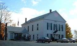 Whately Center Historic District |
September 11, 2003 (#03000920) |
155-215 Chestnut Plain Rd. and 330-348 Haydenville Rd. 42°26′18″N 72°38′09″W |
Whately | |
| 55 | Whitaker-Clary House |  Whitaker-Clary House |
June 18, 1975 (#75000257) |
Elm St. 42°32′26″N 72°18′58″W |
New Salem | Home of the Swift River Historical Society |
| 56 | The Wilder Homestead |  The Wilder Homestead |
January 24, 2011 (#10001178) |
Ashfield Rd. 42°35′59″N 72°46′44″W |
Buckland | About 1/4 mile south of the Upper Road/Ashfield Road junction. |
| 57 | Robert Strong Woodward House and Studio | Robert Strong Woodward House and Studio |
January 11, 2018 (#100001961) |
43 Upper St. 42°35′16″N 72°47′44″W |
Buckland |
See also
| Wikimedia Commons has media related to National Register of Historic Places in Franklin County, Massachusetts. |
References
- The latitude and longitude information provided in this table was derived originally from the National Register Information System, which has been found to be fairly accurate for about 99% of listings. Some locations in this table may have been corrected to current GPS standards.
- "National Register of Historic Places: Weekly List Actions". National Park Service, United States Department of the Interior. Retrieved on June 26, 2020.
- Numbers represent an ordering by significant words. Various colorings, defined here, differentiate National Historic Landmarks and historic districts from other NRHP buildings, structures, sites or objects.
- "National Register Information System". National Register of Historic Places. National Park Service. March 13, 2009.
- The eight-digit number below each date is the number assigned to each location in the National Register Information System database, which can be viewed by clicking the number.
- Coordinates provided are for what appears to be West Whately, at the intersection of Conway, Poplar Hill, and Williamsburg Roads; the NRIS provides no coordinates.
| Topics |  | ||||||||||||||||
|---|---|---|---|---|---|---|---|---|---|---|---|---|---|---|---|---|---|
| Lists by county | |||||||||||||||||
| Lists by city |
| ||||||||||||||||
| Other lists | |||||||||||||||||
| |||||||||||||||||
Municipalities and communities of Franklin County, Massachusetts, United States | ||
|---|---|---|
| City | | |
| Towns | ||
| CDPs | ||
| Other villages | ||
| Ghost town |
| |
This article is issued from Wikipedia. The text is licensed under Creative Commons - Attribution - Sharealike. Additional terms may apply for the media files.