National Register of Historic Places listings in Hampshire County, Massachusetts
This is a list of the National Register of Historic Places listings in Hampshire County, Massachusetts.

Location of Hampshire County in Massachusetts
This is intended to be a complete list of the properties and districts on the National Register of Historic Places in Hampshire County, Massachusetts, United States. Latitude and longitude coordinates are provided for many National Register properties and districts; these locations may be seen together in a map.[1]
There are 81 properties and districts listed on the National Register in the county, including 2 National Historic Landmarks.
- This National Park Service list is complete through NPS recent listings posted June 26, 2020.[2]
Current listings
| [3] | Name on the Register[4] | Image | Date listed[5] | Location | City or town | Description |
|---|---|---|---|---|---|---|
| 1 | Amherst Central Business District | 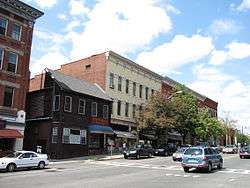 Amherst Central Business District |
December 27, 1991 (#91001859) |
1-79 Main St., 13-31 N. Pleasant St., 1-79 S. Pleasant St., 1-18 Boltwood Ave.; also 30 Boltwood Avenue 42°22′38″N 72°31′13″W |
Amherst | 30 Boltwood reflects a boundary increase of August 24, 2011 |
| 2 | Amherst West Cemetery | 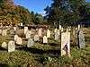 Amherst West Cemetery |
May 26, 2000 (#00000534) |
Triangle St. 42°22′45″N 72°31′07″W |
Amherst | |
| 3 | Baird House | 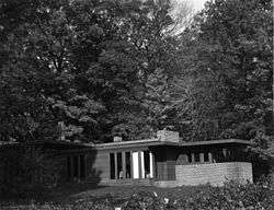 Baird House |
January 3, 1985 (#85000026) |
38 Shays St. 42°21′00″N 72°31′09″W |
Amherst | |
| 4 | Belchertown Center Historic District |  Belchertown Center Historic District |
June 2, 1982 (#82001913) |
Main, Maple, Walnut, Park, and Jabish Sts. 42°16′37″N 72°24′06″W |
Belchertown | |
| 5 | Belchertown State School | 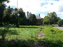 Belchertown State School |
July 19, 1994 (#94000688) |
30 State St. 42°16′28″N 72°25′27″W |
Belchertown | |
| 6 | Bisbee Mill | 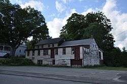 Bisbee Mill |
March 31, 2005 (#05000219) |
66 East St. 42°22′36″N 72°49′09″W |
Chesterfield | |
| 7 | Bradstreet Historic District |  Bradstreet Historic District |
July 17, 1997 (#97000724) |
Roughly bounded by Connecticut R., King St. and Stratis Rd. 42°24′19″N 72°35′26″W |
Hatfield | |
| 8 | William Cullen Bryant Homestead |  William Cullen Bryant Homestead |
October 15, 1966 (#66000136) |
2 mi (3.2 km) from Cummington on a side road 42°28′19″N 72°56′09″W |
Cummington | |
| 9 | Building at 8-22 Graves Avenue | 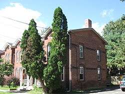 Building at 8-22 Graves Avenue |
November 7, 1985 (#85002784) |
8-22 Graves Ave. 42°19′19″N 72°37′44″W |
Northampton | |
| 10 | Center Cemetery | 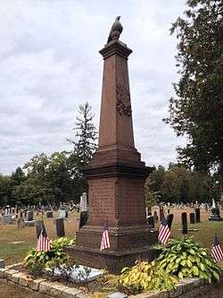 Center Cemetery |
April 16, 2013 (#13000170) |
178 College Hwy. (Route 10) 42°14′06″N 72°43′37″W |
Southampton | |
| 11 | Center Cemetery |  Center Cemetery |
February 26, 2004 (#04000084) |
Sam Hill Rd. 42°23′40″N 72°56′36″W |
Worthington | |
| 12 | Chesterfield Center Historic District |  Chesterfield Center Historic District |
December 11, 2008 (#08001177) |
Main Rd., South St., North Rd., Bagg Rd., Bryant St. 42°23′30″N 72°50′27″W |
Chesterfield | |
| 13 | Church Street Historic District |  Church Street Historic District |
May 23, 1986 (#86001246) |
Church St. between Park Ave. and Highland St. 42°15′57″N 72°13′53″W |
Ware | |
| 14 | Conkey-Stevens House | 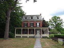 Conkey-Stevens House |
May 10, 1979 (#79000352) |
664 Main St. 42°22′33″N 72°30′20″W |
Amherst | |
| 15 | Calvin Coolidge House | 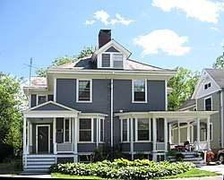 Calvin Coolidge House |
December 12, 1976 (#76000262) |
19-21 Massasoit St. 42°19′29″N 72°38′49″W |
Northampton | |
| 16 | Cushman Village Historic District |  Cushman Village Historic District |
November 5, 1992 (#92001553) |
Roughly bounded by E. Leverett Rd. and Pine, Henry, Bridge and State Sts. 42°25′03″N 72°30′26″W |
Amherst | |
| 17 | Dickinson Historic District |  Dickinson Historic District |
August 16, 1977 (#77000182) |
Kellogg Ave., Main, Gray, and Lessey Sts. 42°22′35″N 72°30′55″W |
Amherst | |
| 18 | Emily Dickinson House |  Emily Dickinson House |
October 15, 1966 (#66000363) |
280 Main St. 42°22′33″N 72°30′52″W |
Amherst | |
| 19 | Dorsey-Jones House |  Dorsey-Jones House |
September 2, 2005 (#05000931) |
191 Nonotuck St. 42°19′52″N 72°40′18″W |
Northampton | Underground Railroad in Massachusetts MPS |
| 20 | East Village Historic District |  East Village Historic District |
July 6, 1986 (#86001408) |
Main, N. and S. East Sts. 42°22′36″N 72°30′04″W |
Amherst | |
| 21 | Elm Street Historic District |  Elm Street Historic District |
December 7, 2000 (#00001481) |
Elm, Sunset, and Scotland Sts., Little Neponset Rd. 42°21′35″N 72°37′00″W |
Hatfield | |
| 22 | First Congregational Church | _20090103_0037.jpg) First Congregational Church |
March 3, 2020 (#100003963) |
1 Church St. 42°15′31″N 72°34′31″W |
South Hadley | |
| 23 | Fort Hill Historic District |  Fort Hill Historic District |
April 7, 1989 (#88000910) |
Roughly South St. from Lyman to Monroe 42°18′43″N 72°38′01″W |
Northampton | |
| 24 | Gate Cemetery |  Gate Cemetery |
July 1, 2009 (#09000470) |
Ireland Street 42°23′34″N 72°53′02″W |
Chesterfield | |
| 25 | Goodwin Memorial African Methodist Episcopal Zion Church |  Goodwin Memorial African Methodist Episcopal Zion Church |
April 28, 2000 (#00000416) |
Woodside Ave. 42°22′15″N 72°31′23″W |
Amherst | |
| 26 | Goshen Town Hall |  Goshen Town Hall |
August 28, 2018 (#100002829) |
42 Main St. 42°26′29″N 72°48′00″W |
Goshen | |
| 27 | Grove Hill Mansion |  Grove Hill Mansion |
August 11, 1982 (#82001910) |
Florence Rd. and Front St. 42°21′11″N 72°41′58″W |
Northampton | |
| 28 | Hadley Center Historic District | 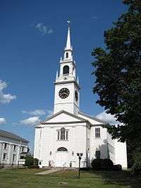 Hadley Center Historic District |
December 2, 1977 (#77000185) |
Middle and Russell Sts. 42°20′28″N 72°35′22″W |
Hadley | |
| 29 | Hatfield Center Historic District |  Hatfield Center Historic District |
July 27, 1994 (#94000737) |
Roughly bounded by the Connecticut and Mill Rivers and Day Ave. 42°21′43″N 72°36′01″W |
Hatfield | |
| 30 | Haydenville Historic District | 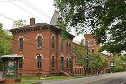 Haydenville Historic District |
March 26, 1976 (#76000273) |
Main and High Sts., and Kingsley Ave. 42°22′31″N 72°42′09″W |
Williamsburg | |
| 31 | Hockanum Rural Historic District |  Hockanum Rural Historic District |
December 30, 1993 (#93001474) |
Area surrounding Hockanum Rd., from Hockanum Cemetery to the NE corner of Skinner State Park 42°17′52″N 72°35′53″W |
Hadley | |
| 32 | Huntington Village Historic District |  Huntington Village Historic District |
September 15, 1999 (#99001080) |
Roughly along E. Main, Main, Russell, Upper Russell and Basket Sts. 42°14′07″N 72°52′54″W |
Huntington | |
| 33 | Ireland Street Cemetery |  Ireland Street Cemetery |
July 1, 2009 (#09000471) |
Ireland Street 42°21′54″N 72°53′03″W |
Chesterfield | |
| 34 | Lincoln-Sunset Historic District |  Lincoln-Sunset Historic District |
February 22, 1993 (#93000008) |
Roughly, Lincoln Ave. from Northampton Rd. to Fearing St. 42°22′33″N 72°31′33″W |
Amherst | |
| 35 | Lockville Historic District | 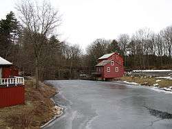 Lockville Historic District |
January 24, 2001 (#00001657) |
College Hwy. 42°12′42″N 72°43′52″W |
Southampton | |
| 36 | Main Street Historic District | 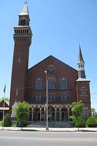 Main Street Historic District |
March 17, 1986 (#86000451) |
Main St. between Northampton and Center Sts. 42°16′11″N 72°40′22″W |
Easthampton | |
| 37 | The Manse | 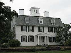 The Manse |
October 14, 1976 (#76000263) |
54 Prospect St. 42°19′20″N 72°38′12″W |
Northampton | |
| 38 | Middlefield-Becket Stone Arch Railroad Bridge District |  Middlefield-Becket Stone Arch Railroad Bridge District |
April 11, 1980 (#80000502) |
Middlefield vicinity 42°18′44″N 73°01′10″W |
Middlefield | |
| 39 | Middlefield Center Historic District | 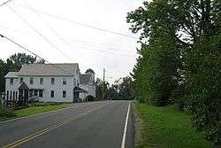 Middlefield Center Historic District |
October 3, 2012 (#12000827) |
138-188 Skyline Trail, & 7 Bell Rd. 42°20′55″N 73°00′55″W |
Middlefield | |
| 40 | Mill-Prospect Street Historic District |  Mill-Prospect Street Historic District |
October 22, 2002 (#02001188) |
Prospect, Chestnut, Bridge, School Sts., Raymond Ave., Prospect Court 42°22′31″N 72°36′47″W |
Hatfield | |
| 41 | Miss Florence Diner | 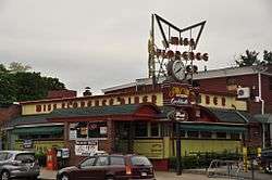 Miss Florence Diner |
September 22, 1999 (#99001123) |
99 Main St. 42°20′07″N 72°40′18″W |
Northampton | |
| 42 | Mountain Rest | 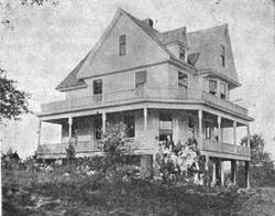 Mountain Rest |
November 10, 1983 (#83003984) |
Wildwood Lane off Spruce Corner Rd. 42°27′36″N 72°50′23″W |
Goshen | An early 19th century missionary retreat camp; converted into condominiums in 1987. |
| 43 | Nashawannuck Mills Historic District |  Nashawannuck Mills Historic District |
February 12, 2015 (#15000001) |
1-15 Cottage St. 42°15′57″N 72°40′02″W |
Easthampton | |
| 44 | North Amherst Center Historic District |  North Amherst Center Historic District |
December 13, 1991 (#91001824) |
1184-1136 N. Pleasant St., 1-39 Pine St., 11-13 Meadow St. 42°24′33″N 72°31′52″W |
Amherst | |
| 45 | North Cemetery | 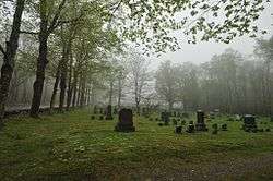 North Cemetery |
March 3, 2004 (#04000121) |
Cold St. 42°25′22″N 72°56′49″W |
Worthington | |
| 46 | North Hadley Historic District |  North Hadley Historic District |
December 30, 1993 (#93001475) |
Roughly, area along River Dr.from Stockwell Rd. to Stockbridge St., including French, Meadow and Mt. Warner Sts. 42°23′23″N 72°34′50″W |
Hadley | |
| 47 | North Hatfield Historic District |  North Hatfield Historic District |
October 30, 1997 (#97000879) |
Roughly along West St. and Depot Rd. Between I-91 and MA 10 42°24′33″N 72°37′26″W |
Hatfield | |
| 48 | Northampton Downtown Historic District |  Northampton Downtown Historic District |
May 17, 1976 (#76000270) |
Roughly bounded by Hampton, Pearl, Strong, Bedford, Elm, MA 66, and railroad tracks 42°19′05″N 72°37′57″W |
Northampton | Boundary increase approved July 3, 1985. |
| 49 | Northampton State Hospital |  Northampton State Hospital |
July 25, 1994 (#94000696) |
1 Prince St. 42°18′45″N 72°39′16″W |
Northampton | Facilities largely demolished in the 2000s. |
| 50 | Northampton Veterans Administration Hospital Historic District |  Northampton Veterans Administration Hospital Historic District |
December 4, 2012 (#12000994) |
421 N. Main St. 42°20′59″N 72°40′54″W |
Northampton | |
| 51 | Old Chapel | 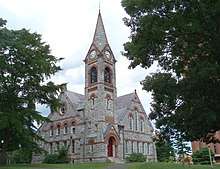 Old Chapel |
May 11, 2015 (#15000211) |
144 Hicks Way 42°23′20″N 72°31′41″W |
Amherst | One of the oldest buildings on the campus of the University of Massachusetts Amherst. |
| 52 | Old Mill Site Historic District |  Old Mill Site Historic District |
June 2, 1982 (#82001911) |
48 and 50 Prospect St. 42°22′16″N 72°35′49″W |
Hatfield | |
| 53 | Otis Company Mill No. 1 | 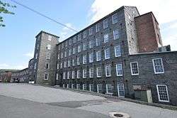 Otis Company Mill No. 1 |
May 2, 1982 (#82001909) |
E. Main St. 42°15′31″N 72°14′20″W |
Ware | |
| 54 | Parsons, Shepherd, and Damon Houses Historic District | 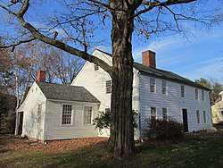 Parsons, Shepherd, and Damon Houses Historic District |
June 6, 2001 (#01000627) |
46, 58 and 66 Bridge St. 42°19′20″N 72°37′35″W |
Northampton | |
| 55 | Pelham Town Hall Historic District |  Pelham Town Hall Historic District |
November 23, 1971 (#71000085) |
Amherst Rd. at the corner of Daniel Shays Hwy. 42°23′32″N 72°24′16″W |
Pelham | |
| 56 | Plainfield Center Historic District |  Plainfield Center Historic District |
July 27, 2015 (#15000468) |
Portions of Church Ln., Broom, Central, Main, Pleasant & Union Sts. 42°30′58″N 72°54′48″W |
Plainfield | |
| 57 | Pomeroy Terrace Historic District | 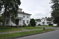 Pomeroy Terrace Historic District |
May 11, 2018 (#100002420) |
Pomeroy Terr., Phillips & Butler Pls., Bixby Ct., Hawley, Hancock, & Bridge Sts. 42°19′13″N 72°37′30″W |
Northampton | |
| 58 | Porter-Phelps-Huntington House | 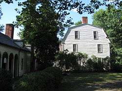 Porter-Phelps-Huntington House |
March 26, 1973 (#73000303) |
130 River Dr. 42°22′19″N 72°35′24″W |
Hadley | |
| 59 | Prospect-Gaylord Historic District |  Prospect-Gaylord Historic District |
February 4, 1993 (#93000007) |
Roughly, Prospect St. from Northampton Rd. to Hallock St. and Gaylord and Amity Sts. W from Prospect toward Lincoln Ave. 42°22′33″N 72°31′22″W |
Amherst | |
| 60 | Ringville Cemetery | 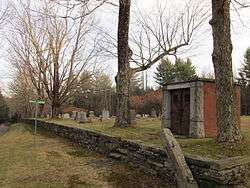 Ringville Cemetery |
February 11, 2004 (#04000024) |
Witt Hill Rd. 42°22′13″N 72°54′56″W |
Worthington | |
| 61 | Ross Farm | 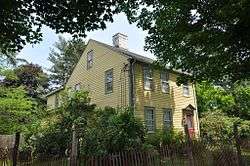 Ross Farm |
January 8, 2008 (#07001360) |
123 Meadow St. 42°20′02″N 72°40′49″W |
Northampton | Underground Railroad in Massachusetts MPS |
| 62 | Smith Alumnae Gymnasium | 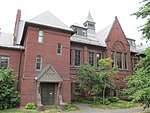 Smith Alumnae Gymnasium |
April 30, 1976 (#76000259) |
Smith College campus Green St. 42°19′01″N 72°38′18″W |
Northampton | |
| 63 | South Amherst Common Historic District | 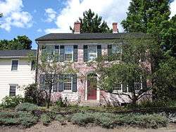 South Amherst Common Historic District |
February 17, 1995 (#95000100) |
445 Shays St., South Amherst Common, 979-1081 S. East St. and 324 Pomeroy Ln. 42°20′29″N 72°30′18″W |
Amherst | |
| 64 | South Hadley Canal Historic District | _map.jpg) South Hadley Canal Historic District |
March 11, 1992 (#92000077) |
Along the historic canal route near the Connecticut River 42°13′15″N 72°36′33″W |
South Hadley | |
| 65 | South Worthington Historic District |  South Worthington Historic District |
September 1, 2005 (#05000935) |
Ireland St., Conwell Rd., Huntington Rd., Thrasher Hill Rd., Higgins Rd. S. Worthington Rd. 42°20′47″N 72°53′36″W |
Worthington and Chesterfield | |
| 66 | Southampton Center Historic District | 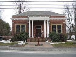 Southampton Center Historic District |
April 4, 1991 (#91000363) |
Roughly, High St. from Fomer Rd. to Maple St., College Hwy. from Clark St. to East St. and East from College to Clark 42°13′25″N 72°43′55″W |
Southampton | |
| 67 | Strong House | 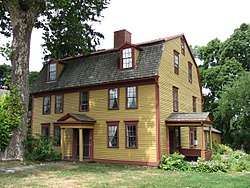 Strong House |
July 5, 1984 (#84002457) |
67 Amity St. 42°22′33″N 72°31′19″W |
Amherst | |
| 68 | The Town Farm | 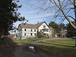 The Town Farm |
September 12, 1996 (#96000950) |
75 Oliver St. 42°16′50″N 72°41′51″W |
Easthampton | |
| 69 | Upper Main Street Historic District | 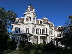 Upper Main Street Historic District |
July 22, 1994 (#94000735) |
Main St. from 83 Main to Cow Bridge, 1-44 King St. and 6-70 North St. 42°23′15″N 72°35′52″W |
Hatfield | |
| 70 | US Post Office-Easthampton Main |  US Post Office-Easthampton Main |
April 1, 1986 (#86000714) |
19 Union St. 42°16′10″N 72°40′19″W |
Easthampton | |
| 71 | US Post Office-South Hadley Main | 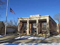 US Post Office-South Hadley Main |
May 28, 1986 (#86001188) |
1 Hadley St. 42°15′30″N 72°34′31″W |
South Hadley | |
| 72 | Walker-Collis House |  Walker-Collis House |
September 30, 1982 (#82001903) |
1 Stadler St. 42°16′21″N 72°24′38″W |
Belchertown | |
| 73 | Ware Center Historic District | 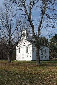 Ware Center Historic District |
May 8, 1986 (#86001013) |
MA 9 and Greenwich Plains Rd. 42°15′40″N 72°16′42″W |
Ware | |
| 74 | Ware Millyard Historic District |  Ware Millyard Historic District |
November 21, 1986 (#86003508) |
Roughly bounded by South St., the Ware River, Upper Dam Complex, Park St., Otis Ave. and Church St. 42°15′33″N 72°14′17″W |
Ware | |
| 75 | Ware Town Hall |  Ware Town Hall |
June 26, 1986 (#86001403) |
Main and West Sts. 42°15′36″N 72°14′35″W |
Ware | |
| 76 | Ware-Hardwick Covered Bridge | 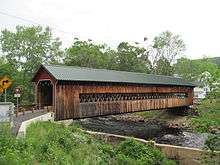 Ware-Hardwick Covered Bridge |
May 8, 1986 (#86001006) |
Old Gilbertville Rd. and Bridge St. 42°18′37″N 72°12′45″W |
Ware | |
| 77 | West Chesterfield Historic District |  West Chesterfield Historic District |
September 25, 2008 (#08000950) |
1-70 Ireland St. and unnumbered lots, 620-669 Main Rd., section of Cummington Rd. 42°24′12″N 72°52′37″W |
Chesterfield | |
| 78 | West Hatfield Historic District | 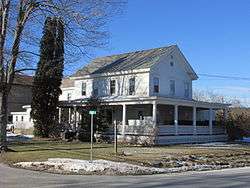 West Hatfield Historic District |
February 24, 2005 (#05000079) |
3-12 Church Ave., 2 Linseed Rd., 23-42 West St. 42°22′19″N 72°38′12″W |
Hatfield | |
| 79 | Westside Historic District |  Westside Historic District |
July 25, 2000 (#00000793) |
Baker and Snell Sts., Northampton Rd., and Hazel Ave. 42°22′00″N 72°31′51″W |
Amherst | |
| 80 | Williamsburg Center Historic District | 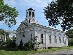 Williamsburg Center Historic District |
June 22, 1980 (#80000506) |
MA 9 42°23′32″N 72°43′49″W |
Williamsburg | |
| 81 | Woodbridge Street Historic District |  Woodbridge Street Historic District |
November 14, 1983 (#83003987) |
3 and 7 Silver St., 25-82 Woodbridge St. 42°15′52″N 72°34′21″W |
South Hadley |
See also
| Wikimedia Commons has media related to National Register of Historic Places in Hampshire County, Massachusetts. |
References
- The latitude and longitude information provided in this table was derived originally from the National Register Information System, which has been found to be fairly accurate for about 99% of listings. Some locations in this table may have been corrected to current GPS standards.
- "National Register of Historic Places: Weekly List Actions". National Park Service, United States Department of the Interior. Retrieved on June 26, 2020.
- Numbers represent an ordering by significant words. Various colorings, defined here, differentiate National Historic Landmarks and historic districts from other NRHP buildings, structures, sites or objects.
- "National Register Information System". National Register of Historic Places. National Park Service. March 13, 2009.
- The eight-digit number below each date is the number assigned to each location in the National Register Information System database, which can be viewed by clicking the number.
| Topics |  | ||||||||||||||||
|---|---|---|---|---|---|---|---|---|---|---|---|---|---|---|---|---|---|
| Lists by county | |||||||||||||||||
| Lists by city |
| ||||||||||||||||
| Other lists | |||||||||||||||||
| |||||||||||||||||
Municipalities and communities of Hampshire County, Massachusetts, United States | ||
|---|---|---|
| Cities | | |
| Towns | ||
| CDPs | ||
| Other villages | ||
| Footnotes | ‡This populated place also has portions in an adjacent county or counties | |
This article is issued from Wikipedia. The text is licensed under Creative Commons - Attribution - Sharealike. Additional terms may apply for the media files.