National Register of Historic Places listings in Norfolk County, Massachusetts
This is a list of properties and historic districts listed on the National Register of Historic Places in Norfolk County, Massachusetts, other than those within the city of Quincy and the towns of Brookline and Milton. Norfolk County contains more than 300 listings, of which the more than 100 are not in the above three communities are listed below. Some listings extend across municipal boundaries, and appear on more than one list.
The locations of National Register properties and districts (at least for all showing latitude and longitude coordinates below) may be seen in a map by clicking on "Map of all coordinates".[1]
- This National Park Service list is complete through NPS recent listings posted June 26, 2020.[2]
Cities and towns listed separately
Due to the number of listings in the county, some cities and towns have their sites listed separately.
| Community | Image | First Date listed | Last Date listed | Count |
|---|---|---|---|---|
| Brookline | 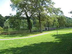 |
October 15, 1966 | January 19, 2006 | 98 |
| Milton | 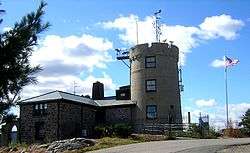 |
November 13, 1966 | May 17, 2018 | 30 |
| Quincy |  |
November 13, 1966 | January 24, 2005 | 109 |
Current listings
| [3] | Name on the Register | Image | Date listed[4] | Location | City or town | Description |
|---|---|---|---|---|---|---|
| 1 | John Adams School | 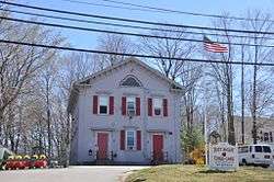 John Adams School |
December 5, 1985 (#85003068) |
16 Church St. 42°13′47″N 70°56′46″W |
Weymouth | |
| 2 | All Souls Church | 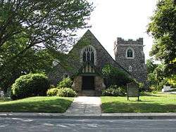 All Souls Church |
July 7, 2015 (#15000389) |
196 Elm St. 42°13′23″N 71°00′02″W |
Braintree | |
| 3 | Ames Schoolhouse | Ames Schoolhouse |
March 31, 1983 (#83004284) |
450 Washington St. 42°14′43″N 71°10′29″W |
Dedham | |
| 4 | Angle Tree Stone | 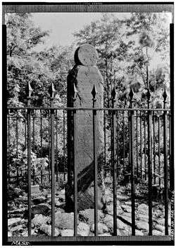 Angle Tree Stone |
January 1, 1976 (#76000228) |
West of North Attleborough off High St. 41°59′06″N 71°21′54″W |
Plainville | |
| 5 | Jonathan Belcher House | 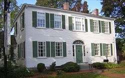 Jonathan Belcher House |
April 30, 1976 (#76000291) |
360 N. Main St. 42°10′09″N 71°02′46″W |
Randolph | |
| 6 | Blue Hills Reservation Parkways-Metropolitan Park System of Greater Boston | 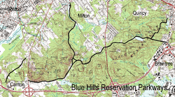 Blue Hills Reservation Parkways-Metropolitan Park System of Greater Boston |
August 11, 2003 (#03000746) |
Parts of Blue Hill Rd., Chickatawbut Rd., Hillside St., Uniquity Rd., Wampatuck Rd., and Green St. 42°13′34″N 71°04′20″W |
Braintree and Canton | Extends into Milton and Quincy; part of the Metropolitan Park System of Greater Boston Multiple Property Submission (MPS) |
| 7 | Borderland Historic District |  Borderland Historic District |
June 16, 1997 (#97000497) |
Massapoag Street 42°04′02″N 71°09′24″W |
Sharon | Coextensive with Borderland State Park, extending into Easton in Bristol County. |
| 8 | Seth Boyden House |  Seth Boyden House |
November 10, 1983 (#83004092) |
135 Oak St. 42°04′22″N 71°13′05″W |
Foxborough | |
| 9 | Brookwood Farm | 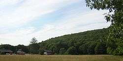 Brookwood Farm |
September 25, 1980 (#80000655) |
Off Blue Hill River Rd. 42°12′34″N 71°06′41″W |
Canton | Extends into Milton |
| 10 | Canton Corner Historic District | 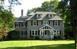 Canton Corner Historic District |
September 9, 2009 (#09000697) |
Roughly Washington St. from Pecunit St. to southwest of Dedham St., and Pleasant St. from Washington St. to Reservoir Rd. 42°10′26″N 71°08′10″W |
Canton | |
| 11 | Canton Viaduct |  Canton Viaduct |
September 20, 1984 (#84002870) |
At the intersection of Neponset St. and Walpole St. 42°09′32″N 71°09′14″W |
Canton | Built in 1835 |
| 12 | Ezra Carpenter House |  Ezra Carpenter House |
January 3, 1985 (#85000029) |
168 South St. 42°03′07″N 71°15′17″W |
Foxborough | |
| 13 | Otis Cary House |  Otis Cary House |
March 13, 1986 (#86000379) |
242 South St. 42°02′42″N 71°15′36″W |
Foxborough | |
| 14 | Benjamin Caryl House | 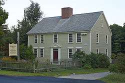 Benjamin Caryl House |
June 2, 2000 (#00000569) |
107 Dedham St. 42°14′53″N 71°16′17″W |
Dover | |
| 15 | Central Square Historic District |  Central Square Historic District |
February 13, 1992 (#92000040) |
Roughly Broad St. from Middle to Putnam Sts. and Middle from Charles to Center Sts. 42°13′00″N 70°56′12″W |
Weymouth | |
| 16 | Lucius Clapp Memorial | 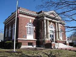 Lucius Clapp Memorial |
August 18, 1992 (#92000998) |
6 Park St. 42°07′27″N 71°06′05″W |
Stoughton | |
| 17 | Cobb's Tavern | 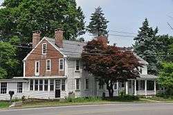 Cobb's Tavern |
August 7, 1974 (#74000383) |
41 Bay Rd. 42°08′14″N 71°08′58″W |
Sharon | |
| 18 | Cohasset Central Cemetery |  Cohasset Central Cemetery |
December 27, 2002 (#02001612) |
N. Main St. and Joy Place 42°14′45″N 70°48′26″W |
Cohasset | |
| 19 | Cohasset Common Historic District | 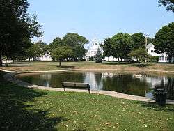 Cohasset Common Historic District |
February 28, 1996 (#96000058) |
Bounded by Highland Ave., N. Main St., William B. Long, Jr., Rd. and Robert E. Jason Rd. 42°14′32″N 70°48′10″W |
Cohasset | |
| 20 | Colburn School – High Street Historic District |  Colburn School – High Street Historic District |
June 9, 2000 (#00000641) |
369–649, 390–680 High St. 42°13′48″N 71°13′17″W |
Westwood | |
| 21 | Fred Holland Day House |  Fred Holland Day House |
April 18, 1977 (#77000191) |
93 Day St. 42°11′35″N 71°12′13″W |
Norwood | |
| 22 | Dean Junior College Historic District | 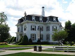 Dean Junior College Historic District |
April 23, 1975 (#75000285) |
Dean College campus 42°05′07″N 71°23′56″W |
Franklin | |
| 23 | Dedham Village Historic District | 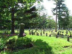 Dedham Village Historic District |
September 6, 2006 (#06000785) |
Roughly bounded by High, Court, Washington, and School Sts., Village Ave., and Chestnut St. 42°14′54″N 71°10′49″W |
Dedham | |
| 24 | Dwight-Derby House |  Dwight-Derby House |
January 17, 2002 (#01001465) |
7 Frairy St. 42°11′16″N 71°18′30″W |
Medfield | |
| 25 | Eaton-Moulton Mill | 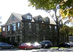 Eaton-Moulton Mill |
May 16, 1976 (#76000294) |
35 Walnut St.[5] 42°19′32″N 71°15′17″W |
Wellesley | |
| 26 | Echo Bridge | 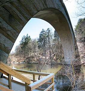 Echo Bridge |
April 9, 1980 (#80000638) |
Spans the Charles River 42°18′53″N 71°13′39″W |
Needham | Extends into Newton in Middlesex County. |
| 27 | Ellice School |  Ellice School |
September 24, 2010 (#10000785) |
185 Pleasant St. 42°08′44″N 71°21′29″W |
Millis | |
| 28 | Elm Bank |  Elm Bank |
July 10, 1987 (#86003565) |
Bounded by the carriage path to the south and by the Charles River to all other sides, off 900 Washington St. 42°16′34″N 71°18′09″W |
Dover | |
| 29 | Elm Park and Isaac Sprague Memorial Tower |  Elm Park and Isaac Sprague Memorial Tower |
June 5, 2007 (#07000511) |
305 Washington St. 42°18′42″N 71°16′31″W |
Wellesley | |
| 30 | Endicott Estate |  Endicott Estate |
March 6, 2002 (#02000128) |
656 East St. 42°14′29″N 71°09′48″W |
Dedham | |
| 31 | Fairbanks House | 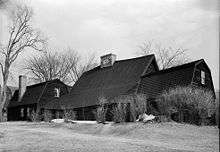 Fairbanks House |
October 15, 1966 (#66000367) |
Eastern Ave. and East St. 42°14′35″N 71°10′05″W |
Dedham | |
| 32 | Fairview Cemetery |  Fairview Cemetery |
September 16, 2009 (#09000717) |
45 Fairview Ave., Boston 42°14′45″N 71°08′18″W |
Dedham | Mostly in Hyde Park, Boston. |
| 33 | D.W. Field Park | 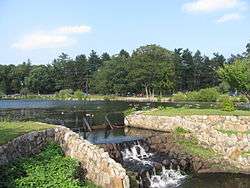 D.W. Field Park |
November 24, 2000 (#00001341) |
Between Pond St. in Avon and Pleasant St. in Brockton 42°06′17″N 71°02′47″W |
Avon | Extends into Brockton in Plymouth County |
| 34 | First Baptist Church of Medfield | 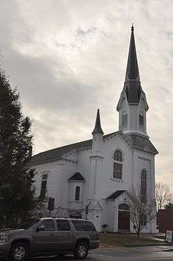 First Baptist Church of Medfield |
September 11, 2003 (#03000921) |
438 Main St. 42°11′13″N 71°18′15″W |
Medfield | |
| 35 | First Parish Unitarian Church | 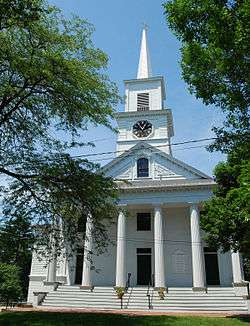 First Parish Unitarian Church |
April 18, 1974 (#74000376) |
North St. 42°11′14″N 71°18′25″W |
Medfield | |
| 36 | Fisher School-High Street Historic District | 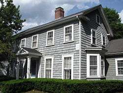 Fisher School-High Street Historic District |
June 30, 2000 (#00000687) |
748-850 and 751-823 High St. 42°13′24″N 71°13′25″W |
Westwood | |
| 37 | Fogg Building |  Fogg Building |
March 10, 1983 (#83000594) |
100-110 Pleasant St. and 6-10 Columbian St. 42°10′28″N 70°57′07″W |
Weymouth | |
| 38 | Fogg Library |  Fogg Library |
June 11, 1981 (#81000113) |
1 Columbian St. 42°10′28″N 70°57′04″W |
Weymouth | |
| 39 | Foxboro Grange Hall |  Foxboro Grange Hall |
April 21, 1983 (#83000595) |
11-15 Bird St. 42°03′56″N 71°15′02″W |
Foxborough | |
| 40 | Foxborough Pumping Station |  Foxborough Pumping Station |
December 6, 2005 (#05001362) |
25 Pumping Station Rd. 42°04′40″N 71°14′18″W |
Foxborough | |
| 41 | Foxborough State Hospital | 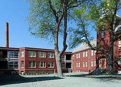 Foxborough State Hospital |
July 19, 1994 (#94000695) |
Junction of Chestnut and Main Sts. 42°04′41″N 71°15′30″W |
Foxborough | part of the Massachusetts State Hospitals And State Schools MPS |
| 42 | Franklin Common Historic District |  Franklin Common Historic District |
March 31, 2005 (#05000218) |
Main, High, Union, and Pleasant Sts. and Church Sq. 42°05′19″N 71°24′05″W |
Franklin | |
| 43 | Front Street Historic District |  Front Street Historic District |
January 10, 2011 (#10001121) |
Roughly bounded by Front, Summer, Kingman, Congress, and Washington Sts. 42°12′39″N 70°57′43″W |
Weymouth | |
| 44 | Fuller Brook Park |  Fuller Brook Park |
May 29, 2013 (#11000307) |
Dover Rd. to Maugus Ave. 42°18′39″N 71°16′26″W |
Wellesley | Linear park following Fuller Brook |
| 45 | Amos Fuller House |  Amos Fuller House |
March 31, 1983 (#83000596) |
220 Nehoiden St. 42°17′07″N 71°14′31″W |
Needham | |
| 46 | Robert Fuller House |  Robert Fuller House |
September 8, 1987 (#87001476) |
3 Burrill Ln. 42°17′37″N 71°15′27″W |
Needham | |
| 47 | Gills Farm Archeological District | October 24, 1983 (#83004093) |
Address Restricted |
Randolph | A Middle Archaic prehistoric site. | |
| 48 | Government Island Historic District | 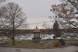 Government Island Historic District |
May 12, 1994 (#94000424) |
Border St. 42°14′17″N 70°47′21″W |
Cohasset | Former site of the mainland station of the Minot's Ledge Light, now a city-owned wharf and park. |
| 49 | Green Hill Site | 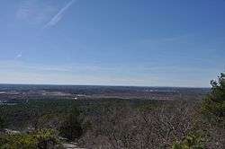 Green Hill Site |
September 25, 1980 (#80000651) |
near the Neponset River |
Canton | A sizable prehistoric site encompassing Middle and Late Archaic remains. Part of the Blue Hills and Neponset River Reservations Multiple Resource Area (MRA). |
| 50 | Emery Grover Building |  Emery Grover Building |
August 20, 1987 (#87001393) |
1330 Highland Ave. 42°16′59″N 71°14′10″W |
Needham | |
| 51 | Josephine M. Hagerty House |  Josephine M. Hagerty House |
June 4, 1997 (#97000529) |
357 Atlantic Ave. 42°15′31″N 70°48′09″W |
Cohasset | |
| 52 | Holbrook Square Historic District | 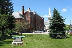 Holbrook Square Historic District |
May 10, 2006 (#06000359) |
Roughly N. Franklin St. from Union St. to Linfield St. 42°09′20″N 71°00′35″W |
Holbrook | |
| 53 | Hunnewell Estates Historic District |  Hunnewell Estates Historic District |
April 14, 1988 (#88000438) |
Washington St. and Pond Rd. 42°16′59″N 71°18′40″W |
Wellesley | H. H. Hunnewell, H. H. Hunnewell Estate |
| 54 | Inness-Fitts House and Studio/Barn |  Inness-Fitts House and Studio/Barn |
March 15, 2002 (#02000153) |
406 Main St. 42°11′16″N 71°18′07″W |
Medfield | |
| 55 | Intermediate Building |  Intermediate Building |
August 27, 1981 (#81000112) |
324 Washington St. 42°18′38″N 71°16′30″W |
Wellesley Hills | |
| 56 | Jefferson School | 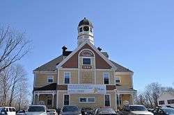 Jefferson School |
May 12, 1981 (#81000114) |
200 Middle St. 42°13′00″N 70°56′15″W |
Weymouth | |
| 57 | Kingsbury-Whitaker House |  Kingsbury-Whitaker House |
July 12, 1990 (#90001080) |
53 Glendoon St. 42°16′54″N 71°14′25″W |
Needham | |
| 58 | Deacon Willard Lewis House |  Deacon Willard Lewis House |
October 29, 1975 (#75000297) |
33 West St. 42°08′42″N 71°15′19″W |
Walpole | |
| 59 | Joshua Lewis House |  Joshua Lewis House |
April 1, 1982 (#82002749) |
178 South St. 42°16′08″N 71°12′49″W |
Needham | |
| 60 | Caleb Lothrop House | 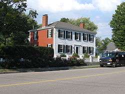 Caleb Lothrop House |
May 3, 1976 (#76000269) |
14 Summer St. 42°14′12″N 70°47′49″W |
Cohasset | |
| 61 | McIntosh Corner Historic District |  McIntosh Corner Historic District |
January 5, 1989 (#88003127) |
Roughly Great Plain and Central Aves. 42°16′52″N 71°15′17″W |
Needham | |
| 62 | Medfield State Hospital |  Medfield State Hospital |
January 21, 1994 (#93001481) |
45 Hospital Rd. 42°12′48″N 71°20′10″W |
Medfield | part of the Massachusetts State Hospitals And State Schools MPS |
| 63 | Medway Village Historic District |  Medway Village Historic District |
December 17, 2008 (#08001191) |
Bounded by former New York and Boston railroad right-of-way, Oakland St., and the Charles River 42°08′30″N 71°23′48″W |
Medway | |
| 64 | Memorial Hall |  Memorial Hall |
April 21, 1983 (#83000597) |
22 South St. 42°03′50″N 71°15′02″W |
Foxborough | |
| 65 | Millis Center Historic District | 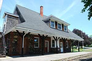 Millis Center Historic District |
September 14, 2007 (#07000944) |
Curve, Daniels, Exchange, Irving, Lavender, Main, and Union Sts. 42°10′03″N 71°21′36″W |
Millis | |
| 66 | Davis Mills House |  Davis Mills House |
April 1, 1982 (#82004418) |
945 Central Ave. 42°17′17″N 71°15′07″W |
Needham | |
| 67 | Amos Morse House |  Amos Morse House |
January 9, 1986 (#86000027) |
77 North St. 42°05′04″N 71°15′29″W |
Foxborough | |
| 68 | Needham Street Bridge | Needham Street Bridge |
September 4, 1986 (#86001852) |
Needham St. at the Charles River 42°18′23″N 71°13′03″W |
Needham | Extends into Newton in Middlesex County; part of the Newton MRA |
| 69 | Needham Town Hall Historic District |  Needham Town Hall Historic District |
November 15, 1990 (#90001756) |
Great Plain Ave. between Highland Ave. and Chapel St. 42°17′20″N 71°14′26″W |
Needham | |
| 70 | Norfolk County Courthouse | 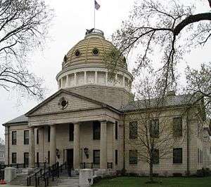 Norfolk County Courthouse |
November 28, 1972 (#72001312) |
650 High St. 42°14′55″N 71°10′36″W |
Dedham | |
| 71 | Norfolk Grange Hall |  Norfolk Grange Hall |
May 25, 1989 (#89000438) |
28 Rockwood Rd. 42°07′20″N 71°19′58″W |
Norfolk | |
| 72 | North Bellingham Cemetery and Oak Hill Cemetery |  North Bellingham Cemetery and Oak Hill Cemetery |
September 25, 2012 (#12000819) |
Hartford Ave. 42°07′01″N 71°27′34″W |
Bellingham | |
| 73 | Norwood Memorial Municipal Building |  Norwood Memorial Municipal Building |
October 10, 1996 (#96001086) |
566 Washington St. 42°11′41″N 71°12′02″W |
Norwood | |
| 74 | Oak Grove Farm |  Oak Grove Farm |
May 4, 2011 (#11000247) |
410 Exchange St. 42°10′52″N 71°21′46″W |
Millis | |
| 75 | Old Barn |  Old Barn |
September 25, 1980 (#80000660) |
Off Blue Hill River Road 42°12′25″N 71°06′40″W |
Canton | |
| 76 | Old South Union Church |  Old South Union Church |
April 1, 1982 (#82004422) |
25 Columbian St. 42°10′30″N 70°57′06″W |
Weymouth | |
| 77 | Original Congregational Church of Wrentham |  Original Congregational Church of Wrentham |
September 22, 2014 (#14000694) |
1 East & 22 Dedham Sts. 42°04′01″N 71°19′39″W |
Wrentham | |
| 78 | John Partridge House |  John Partridge House |
October 15, 1974 (#74000377) |
315 Exchange St. 42°10′34″N 71°21′38″W |
Millis | |
| 79 | Peak House |  Peak House |
September 5, 1975 (#75000288) |
347 Main St. 42°11′23″N 71°17′50″W |
Medfield | |
| 80 | Plimpton-Winter House |  Plimpton-Winter House |
December 5, 1985 (#85003071) |
127 South St. 42°03′53″N 71°19′50″W |
Wrentham | |
| 81 | Pond Street School |  Pond Street School |
February 12, 2010 (#10000004) |
235 Pond St. 42°09′45″N 70°57′36″W |
Weymouth | Also known as the Fulton School, this property has been converted to condominiums. |
| 82 | Pondville Cemetery |  Pondville Cemetery |
April 15, 2014 (#14000158) |
Everett Street 42°05′06″N 71°17′42″W |
Norfolk | |
| 83 | Ponkapoag Camp of Appalachian Mountain Club |  Ponkapoag Camp of Appalachian Mountain Club |
September 25, 1980 (#80000657) |
Randolph 42°11′35″N 71°05′14″W |
Randolph | part of the Blue Hills and Neponset River Reservations MRA |
| 84 | Pratt Historic Building | 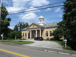 Pratt Historic Building |
September 7, 2006 (#06000816) |
106 S. Main St. 42°14′19″N 70°47′59″W |
Cohasset | |
| 85 | Capt. Josiah Pratt House |  Capt. Josiah Pratt House |
April 21, 1983 (#83000598) |
141 East St. 42°03′48″N 71°12′03″W |
Foxborough | |
| 86 | Prospect Hill Cemetery |  Prospect Hill Cemetery |
March 15, 2006 (#06000129) |
Auburn Rd. 42°09′59″N 71°22′04″W |
Millis | |
| 87 | Rabbit Hill Historic District |  Rabbit Hill Historic District |
April 1, 1988 (#88000224) |
Roughly bounded by Highland, Main, Franklin, and Milford Sts. 42°08′39″N 71°26′02″W |
Medway | |
| 88 | Red Brick School |  Red Brick School |
January 1, 1976 (#76000276) |
2 Lincoln St. 42°05′34″N 71°24′00″W |
Franklin | |
| 89 | Redman Farm House |  Redman Farm House |
September 25, 1980 (#80000664) |
2173 Washington St. 42°11′30″N 71°07′03″W |
Canton | Incorrectly listed at the corner of Washington St. and Homans La. Part of the Blue Hills and Neponset River Reservations MRA. |
| 90 | Roberts School |  Roberts School |
August 30, 2007 (#07000860) |
320 Union St. 42°09′18″N 71°01′25″W |
Holbrook | |
| 91 | Rockwood Road Historic District |  Rockwood Road Historic District |
April 10, 2017 (#100000850) |
Roughly Rockwood Rd. from MBTA tracks to Boardman St. 42°07′20″N 71°19′37″W |
Norfolk | |
| 92 | Roebuck Tavern |  Roebuck Tavern |
May 17, 1984 (#84002878) |
21 Dedham St. 42°04′03″N 71°19′41″W |
Wrentham | |
| 93 | Sea Street Historic District |  Sea Street Historic District |
August 19, 2009 (#09000646) |
Roughly bounded by Bridge, North, and Neck Sts., Crescent Rd., and Pearl and the rear of Standish Sts. 42°14′35″N 70°56′54″W |
Weymouth | |
| 94 | Sharon Historic District |  Sharon Historic District |
August 22, 1975 (#75000296) |
Both sides of N. Main St. from Post Office Sq. to School St. 42°07′28″N 71°10′45″W |
Sharon | |
| 95 | James Smith House |  James Smith House |
August 21, 1986 (#86001845) |
706 Great Plain Ave. 42°16′49″N 71°13′36″W |
Needham | |
| 96 | Stetson Hall |  Stetson Hall |
December 7, 2011 (#11000883) |
6 S. Main St. 42°09′45″N 71°02′29″W |
Randolph | |
| 97 | Stoneholm |  Stoneholm |
April 2, 1980 (#80000648) |
188 Ames St. 42°06′55″N 71°09′57″W |
Sharon | |
| 98 | Stony Brook Reservation Parkways, Metropolitan Park System of Great Boston MPS | Stony Brook Reservation Parkways, Metropolitan Park System of Great Boston MPS |
January 3, 2006 (#05001509) |
Dedham, Enneking, Turtle Pond Parkways, Smith Field, Reservation, W. Border Rds. 42°15′28″N 71°08′32″W |
Dedham | Extends into Boston in Suffolk County |
| 99 | Stoughton Railroad Station |  Stoughton Railroad Station |
January 21, 1974 (#74000384) |
53 Wyman St. 42°07′27″N 71°05′58″W |
Stoughton | |
| 100 | Stoughtonham Furnace Site |  Stoughtonham Furnace Site |
August 16, 1984 (#84002881) |
Address Restricted 42°04′56″N 71°12′44″W |
Sharon, Foxborough | Site of a Revolutionary War-era foundry |
| 101 | Sudbury Aqueduct Linear District |  Sudbury Aqueduct Linear District |
January 18, 1990 (#89002293) |
Along the Sudbury Aqueduct from Farm Pond at Waverly St. (Framingham) to Chestnut Hill Reservoir (Newton) 42°17′33″N 71°18′44″W |
Wellesley, Needham | Extends into Middlesex County. Part of the Water Supply System of Metropolitan Boston MPS. |
| 102 | Sullivan's Corner Historic District |  Sullivan's Corner Historic District |
June 15, 2012 (#12000340) |
Roughly the junction of Main, Needham, & Seekonk Sts. 42°07′14″N 71°18′39″W |
Norfolk | |
| 103 | Thayer Public Library | 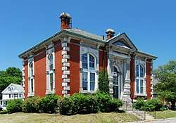 Thayer Public Library |
July 21, 1978 (#78000446) |
2 John F. Kennedy Memorial Dr. 42°12′24″N 71°00′18″W |
Braintree | Current library built in 1999. |
| 104 | Gen. Sylvanus Thayer House |  Gen. Sylvanus Thayer House |
December 3, 1974 (#74000372) |
786 Washington St. 42°12′22″N 71°00′17″W |
Braintree | |
| 105 | Tolman-Gay House |  Tolman-Gay House |
June 1, 1982 (#82004419) |
1196 Central Ave. 42°16′48″N 71°15′03″W |
Needham | |
| 106 | Townsend House |  Townsend House |
April 1, 1982 (#82004420) |
980 Central Ave. 42°17′28″N 71°14′58″W |
Needham | |
| 107 | Stephen Turner House |  Stephen Turner House |
May 10, 1979 (#79002682) |
North of Norfolk at 187 Seekonk St. 42°08′45″N 71°18′32″W |
Norfolk | |
| 108 | Union Station |  Union Station |
April 5, 2016 (#16000139) |
West St. 42°08′43″N 71°15′29″W |
Walpole | |
| 109 | US Post Office-Weymouth Landing |  US Post Office-Weymouth Landing |
May 27, 1986 (#86001186) |
103 Washington St. 42°13′05″N 70°58′02″W |
Weymouth | |
| 110 | Vine Lake Cemetery |  Vine Lake Cemetery |
April 14, 2005 (#05000277) |
Main St. 42°11′10″N 71°18′56″W |
Medfield | |
| 111 | Walpole Town Hall |  Walpole Town Hall |
October 8, 1981 (#81000619) |
Main St. 42°08′45″N 71°15′12″W |
Walpole | |
| 112 | Warelands |  Warelands |
November 10, 1977 (#77000190) |
North of Norfolk at 103 Boardman St. 42°07′51″N 71°19′02″W |
Norfolk | |
| 113 | Washington School |  Washington School |
June 5, 1986 (#86001218) |
8 School St. 42°12′53″N 70°55′19″W |
Weymouth | |
| 114 | Wellesley Congregational Church and Cemetery |  Wellesley Congregational Church and Cemetery |
September 22, 2014 (#14000696) |
2 Central St. 42°17′46″N 71°17′37″W |
Wellesley | |
| 115 | Wellesley Farms Railroad Station |  Wellesley Farms Railroad Station |
February 14, 1986 (#86000259) |
Croton St. extension 42°19′23″N 71°16′21″W |
Wellesley | |
| 116 | Wellesley Hills Branch Library |  Wellesley Hills Branch Library |
June 12, 2007 (#07000546) |
210 Washington St. 42°18′53″N 71°16′17″W |
Wellesley | |
| 117 | Wellesley Town Hall | 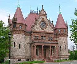 Wellesley Town Hall |
April 30, 1976 (#76000295) |
525 Washington St. 42°17′52″N 71°17′32″W |
Wellesley | |
| 118 | Weymouth Civic District | 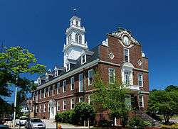 Weymouth Civic District |
March 27, 1992 (#92000146) |
75 Middle St. 42°13′15″N 70°56′23″W |
Weymouth | |
| 119 | Weymouth Meeting House Historic District |  Weymouth Meeting House Historic District |
December 13, 2010 (#10001007) |
Church, East, Green, North, and Norton Sts. 42°13′48″N 70°56′38″W |
Weymouth | |
| 120 | Israel Whitney House |  Israel Whitney House |
February 25, 1988 (#88000160) |
963 Central Ave. 42°17′16″N 71°15′08″W |
Needham | |
| 121 | Charles R. Wilber School |  Charles R. Wilber School |
May 10, 2010 (#10000244) |
75-85 S Main St. 42°07′17″N 71°10′51″W |
Sharon | |
| 122 | Capt. John Wilson House and Bates Ship Chandlery | 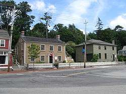 Capt. John Wilson House and Bates Ship Chandlery |
December 27, 2002 (#02001614) |
4 Elm St. 42°14′27″N 70°48′06″W |
Cohasset | |
| 123 | Wrentham State School |  Wrentham State School |
January 21, 1994 (#93001490) |
Junction of Emerald and North Sts. 42°04′58″N 71°19′08″W |
Wrentham | part of the Massachusetts State Hospitals And State Schools MPS |
Former listings
| [3] | Name on the Register | Image | Date listed | Date removed | Location | City or town | Summary |
|---|---|---|---|---|---|---|---|
| 1 | Josiah Ware Tavern | June 19, 1979 (#79000365) | Unknown | Main St. and Rockwood Rd. |
Norfolk |
References
| Wikimedia Commons has media related to National Register of Historic Places in Norfolk County, Massachusetts. |
- The latitude and longitude information provided in this table was derived originally from the National Register Information System, which has been found to be fairly accurate for about 99% of listings. Some locations in this table may have been corrected to current GPS standards.
- "National Register of Historic Places: Weekly List Actions". National Park Service, United States Department of the Interior. Retrieved on June 26, 2020.
- Numbers represent an ordering by significant words. Various colorings, defined here, differentiate National Historic Landmarks and historic districts from other NRHP buildings, structures, sites or objects.
- The eight-digit number below each date is the number assigned to each location in the National Register Information System database, which can be viewed by clicking the number.
- "Weekly list of actions taken on properties: 2/25/13 through 3/01/13". National Park Service. March 8, 2013. Retrieved March 14, 2013.
| Topics |  | ||||||||||||||||
|---|---|---|---|---|---|---|---|---|---|---|---|---|---|---|---|---|---|
| Lists by county | |||||||||||||||||
| Lists by city |
| ||||||||||||||||
| Other lists | |||||||||||||||||
| |||||||||||||||||
Municipalities and communities of Norfolk County, Massachusetts, United States | ||
|---|---|---|
| Cities | 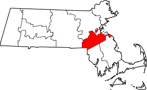 | |
| Towns | ||
| CDPs |
| |
| Other villages | ||
This article is issued from Wikipedia. The text is licensed under Creative Commons - Attribution - Sharealike. Additional terms may apply for the media files.