National Register of Historic Places listings in Stoneham, Massachusetts
This is a list of properties and historic districts in Stoneham, Massachusetts, that are listed on the National Register of Historic Places.

Location of Stoneham in Massachusetts
The locations of National Register properties and districts (at least for all showing latitude and longitude coordinates below) may be seen in an online map by clicking on "Map of all coordinates".[1]
- This National Park Service list is complete through NPS recent listings posted June 19, 2020.[2]
Current listings
| [3] | Name on the Register | Image | Date listed[4] | Location | City or town | Description |
|---|---|---|---|---|---|---|
| 1 | Almshouse | 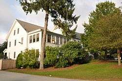 Almshouse |
April 13, 1984 (#84002464) |
136 Elm St. 42°29′30″N 71°05′17″W |
||
| 2 | Padilla Beard House | 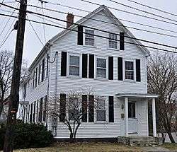 Padilla Beard House |
April 13, 1984 (#84002507) |
18 Maple St. 42°28′43″N 71°06′07″W |
||
| 3 | Boston and Maine Railroad Depot |  Boston and Maine Railroad Depot |
April 13, 1984 (#84002510) |
36 Pine St. 42°28′42″N 71°05′50″W |
||
| 4 | John Bottume House | 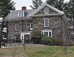 John Bottume House |
April 13, 1984 (#84002513) |
4 Woodland Rd. 42°27′14″N 71°05′30″W |
||
| 5 | C.H. Brown Cottage |  C.H. Brown Cottage |
April 13, 1984 (#84002525) |
34 Wright St. 42°28′44″N 71°06′07″W |
||
| 6 | William Bryant Octagon House | 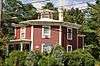 William Bryant Octagon House |
April 13, 1984 (#84002526) |
2 Spring St. 42°28′54″N 71°05′40″W |
||
| 7 | Charles Buck House | 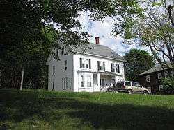 Charles Buck House |
April 13, 1984 (#84002527) |
68 Pleasant St. 42°28′46″N 71°05′36″W |
||
| 8 | Clara Buswell House |  Clara Buswell House |
April 13, 1984 (#84002528) |
481 Main St. 42°28′31″N 71°06′05″W |
||
| 9 | Central Square Historic District |  Central Square Historic District |
January 17, 1990 (#89002277) |
Roughly bounded by Main, Central, Church, Winter and Common Sts. 42°28′51″N 71°05′59″W |
||
| 10 | Samuel Chamberlain House |  Samuel Chamberlain House |
April 13, 1984 (#84002536) |
3 Winthrop St. 42°28′31″N 71°06′10″W |
||
| 11 | Bernard Cogan House | 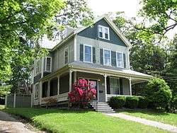 Bernard Cogan House |
April 13, 1984 (#84002546) |
10 Flint Ave. 42°28′59″N 71°06′04″W |
||
| 12 | James Cogan House | 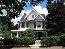 James Cogan House |
April 13, 1984 (#84002550) |
48 Elm St. 42°29′14″N 71°05′50″W |
||
| 13 | Colonial Beacon Gas Station | Colonial Beacon Gas Station |
April 13, 1984 (#84002554) |
474 Main St. 42°28′33″N 71°06′02″W |
||
| 14 | George Cowdrey House | 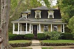 George Cowdrey House |
April 13, 1984 (#84002557) |
42 High St. 42°29′33″N 71°05′41″W |
||
| 15 | Blake Daniels Cottage | 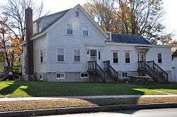 Blake Daniels Cottage |
April 13, 1984 (#84002562) |
111–113 Elm St. 42°29′20″N 71°05′29″W |
||
| 16 | Silas Dean House | 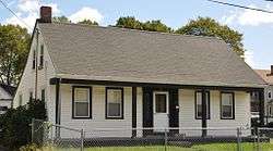 Silas Dean House |
April 13, 1984 (#84002565) |
8 Pine St. 42°28′51″N 71°05′52″W |
||
| 17 | Dow Block | 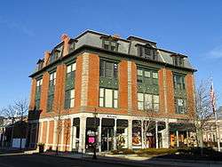 Dow Block |
April 13, 1984 (#84002570) |
Central Square 42°28′45″N 71°06′02″W |
||
| 18 | E. A. Durgin House | 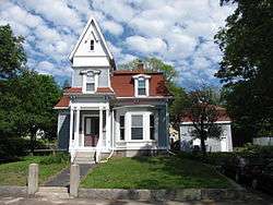 E. A. Durgin House |
April 13, 1984 (#84002572) |
113 Summer St. 42°28′42″N 71°05′40″W |
||
| 19 | Amasa Farrier Boardinghouse | 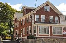 Amasa Farrier Boardinghouse |
April 13, 1984 (#84002601) |
280 Main St. 42°29′01″N 71°06′00″W |
||
| 20 | Amasa Farrier House | 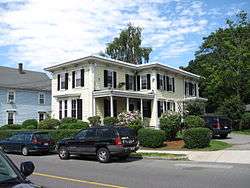 Amasa Farrier House |
April 13, 1984 (#84002605) |
55 Central St. 42°28′53″N 71°05′55″W |
||
| 21 | First Baptist Church | 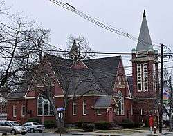 First Baptist Church |
April 13, 1984 (#84002607) |
461 Main St. 42°28′36″N 71°06′03″W |
||
| 22 | First Congregational Church | 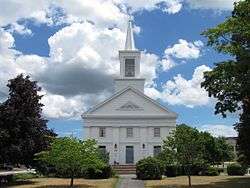 First Congregational Church |
April 13, 1984 (#84002609) |
Main and Church Sts. 42°28′51″N 71°06′00″W |
||
| 23 | First Unitarian Church | 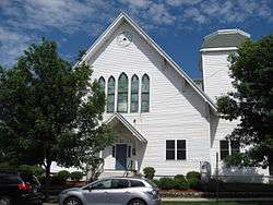 First Unitarian Church |
April 13, 1984 (#84002612) |
Central and Common Sts. 42°28′52″N 71°05′55″W |
||
| 24 | Michael Foley Cottage | 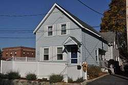 Michael Foley Cottage |
April 13, 1984 (#84002614) |
14 Emerson St. 42°28′47″N 71°05′54″W |
||
| 25 | Walter K. Foster House | 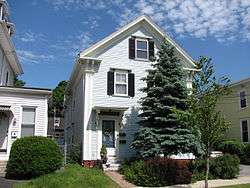 Walter K. Foster House |
April 13, 1984 (#84002616) |
57 Central St. 42°28′54″N 71°05′56″W |
||
| 26 | Enoch Fuller House |  Enoch Fuller House |
April 13, 1984 (#84002619) |
72 Pine St. 42°28′32″N 71°05′55″W |
||
| 27 | William Griffin Fuller House | 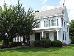 William Griffin Fuller House |
April 13, 1984 (#84002621) |
32 Franklin St. 42°28′43″N 71°05′57″W |
||
| 28 | Charles Gill House | 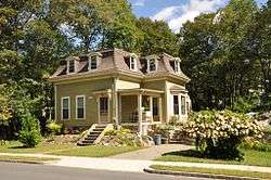 Charles Gill House |
April 13, 1984 (#84002623) |
76 Pleasant St. 42°28′38″N 71°05′35″W |
||
| 29 | Onslow Gilmore House |  Onslow Gilmore House |
April 13, 1984 (#84002625) |
477 Main St. 42°28′32″N 71°06′04″W |
||
| 30 | Jonathan Green House | 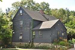 Jonathan Green House |
April 13, 1984 (#84002627) |
63 Perkins St. 42°28′01″N 71°04′50″W |
||
| 31 | Lorenzo D. Hawkins House | 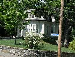 Lorenzo D. Hawkins House |
April 13, 1984 (#84002639) |
1 Cedar Ave. 42°28′48″N 71°06′16″W |
||
| 32 | Benjamin Hibbard Residence | 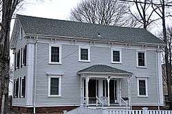 Benjamin Hibbard Residence |
April 13, 1984 (#84002642) |
5–7 Gerry St. 42°28′30″N 71°06′01″W |
||
| 33 | Sidney A. Hill House | 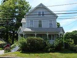 Sidney A. Hill House |
April 13, 1984 (#84002645) |
31 Chestnut St. 42°28′44″N 71°06′16″W |
||
| 34 | House at 269 Green Street |  House at 269 Green Street |
April 13, 1984 (#84002682) |
269 Green St. 42°29′27″N 71°05′05″W |
||
| 35 | House at 6 S. Marble Street |  House at 6 S. Marble Street |
April 13, 1984 (#84002690) |
6 S. Marble St. 42°28′20″N 71°06′20″W |
||
| 36 | House at 114 Marble Street |  House at 114 Marble Street |
April 13, 1984 (#84002661) |
114 Marble St. 42°28′23″N 71°06′22″W |
||
| 37 | House at 19 Tremont Street |  House at 19 Tremont Street |
April 13, 1984 (#84002671) |
19 Tremont St. 42°29′09″N 71°05′49″W |
||
| 38 | House at 107 William Street | 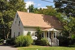 House at 107 William Street |
April 13, 1984 (#84002660) |
107 William St. 42°29′03″N 71°05′56″W |
||
| 39 | House at 391 William Street | 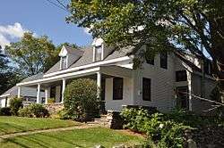 House at 391 William Street |
April 13, 1984 (#84002688) |
391 William St. 42°29′23″N 71°06′39″W |
||
| 40 | Franklin B. Jenkins House | 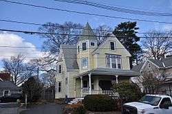 Franklin B. Jenkins House |
April 13, 1984 (#84002702) |
35 Chestnut St. 42°28′44″N 71°06′14″W |
||
| 41 | Franklin B. Jenkins House |  Franklin B. Jenkins House |
April 13, 1984 (#84002699) |
2 Middle St. 42°28′31″N 71°05′59″W |
||
| 42 | John Jones House | 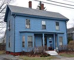 John Jones House |
April 13, 1984 (#84002708) |
1 Winthrop St. 42°28′31″N 71°06′09″W |
||
| 43 | Thomas W. Jones House | 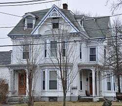 Thomas W. Jones House |
April 13, 1984 (#84002716) |
34 Warren St. 42°28′31″N 71°06′09″W |
||
| 44 | Walter Keene House |  Walter Keene House |
April 13, 1984 (#84002719) |
28 High St. 42°29′23″N 71°05′44″W |
||
| 45 | David Kenney House | 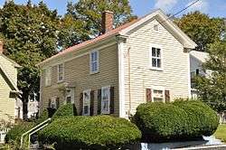 David Kenney House |
April 13, 1984 (#84002725) |
67 Summer St. 42°28′30″N 71°05′42″W |
||
| 46 | Elisha Knight Homestead |  Elisha Knight Homestead |
April 13, 1984 (#84002863) |
170 Franklin St. 42°28′28″N 71°05′10″W |
Listed in error as "Elisha Wright Homestead". | |
| 47 | Newton Lamson House | 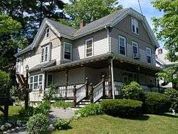 Newton Lamson House |
April 13, 1984 (#84002727) |
33 Chestnut St. 42°28′46″N 71°06′16″W |
||
| 48 | Locke-Baldwin-Kinsley House | 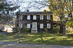 Locke-Baldwin-Kinsley House |
April 13, 1984 (#84002742) |
45 Green St. 42°29′00″N 71°05′24″W |
||
| 49 | T.U. Lyon House | 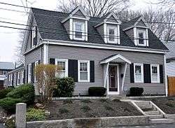 T.U. Lyon House |
April 13, 1984 (#84002743) |
9 Warren St. 42°28′39″N 71°06′07″W |
||
| 50 | Metropolitan District Commission Pumping House |  Metropolitan District Commission Pumping House |
April 13, 1984 (#84002747) |
Woodland Rd. 42°27′21″N 71°05′27″W |
||
| 51 | Middlesex Fells Reservation Parkways |  Middlesex Fells Reservation Parkways |
February 4, 2003 (#02001749) |
E. Border Rd., Fellsway E., Fellsway W., Hillcrest Parkway, South St., Pond St., S. Border Rd., Ravine Rd., and Woodland Rd. 42°26′43″N 71°06′10″W |
Extends into Malden, Medford, Melrose, and Winchester. | |
| 52 | Middlesex Fells Reservoirs Historic District | Middlesex Fells Reservoirs Historic District |
January 18, 1990 (#89002249) |
Roughly bounded by Pond St., Woodland Rd., Interstate 93, and Massachusetts Route 28 42°27′18″N 71°05′43″W |
Roughly the portion of the Middlesex Fells Reservation east of I-93. | |
| 53 | Millard-Souther-Green House | 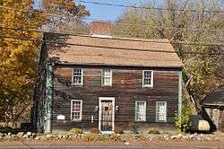 Millard-Souther-Green House |
April 13, 1984 (#84002752) |
218 Green St. 42°29′14″N 71°05′14″W |
||
| 54 | Nobility Hill Historic District |  Nobility Hill Historic District |
February 9, 1990 (#89002328) |
Roughly bounded by Chestnut and Maple Sts. and Cedar Ave. 42°28′46″N 71°06′19″W |
||
| 55 | Oddfellows Building | 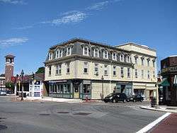 Oddfellows Building |
April 13, 1984 (#84002765) |
Central Square 42°28′51″N 71°05′59″W |
||
| 56 | Old Burying Ground | 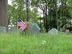 Old Burying Ground |
April 13, 1984 (#84002766) |
Pleasant and William Sts. 42°28′53″N 71°05′48″W |
||
| 57 | Shoe Shop-Doucette Ten Footer | 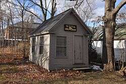 Shoe Shop-Doucette Ten Footer |
April 13, 1984 (#84002821) |
36 William St. 42°28′58″N 71°05′49″W |
On the grounds of the Stoneham Historical Society. | |
| 58 | South School |  South School |
April 13, 1984 (#84002828) |
9–11 Gerry St. 42°28′31″N 71°05′59″W |
||
| 59 | Spot Pond Archeological District | 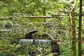 Spot Pond Archeological District |
July 24, 1992 (#92000925) |
Virginia Woods section of Middlesex Fells Reservation 42°27′22″N 71°05′13″W |
||
| 60 | John Steele House |  John Steele House |
April 13, 1984 (#84002829) |
2–4 Montvale St. 42°28′54″N 71°06′04″W |
||
| 61 | Stoneham Firestation | 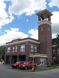 Stoneham Firestation |
April 13, 1984 (#84002831) |
Central and Emerson Sts. 42°28′46″N 71°05′59″W |
||
| 62 | Stoneham Public Library | 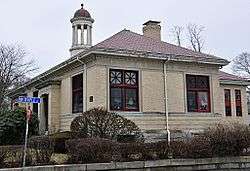 Stoneham Public Library |
April 13, 1984 (#84002832) |
Main and Maple Sts. 42°28′39″N 71°06′04″W |
||
| 63 | Warren Sweetser House |  Warren Sweetser House |
May 26, 2005 (#05000466) |
90 Franklin St. 42°28′39″N 71°05′48″W |
||
| 64 | Jesse Tay House |  Jesse Tay House |
April 13, 1984 (#84002834) |
51 Elm St. 42°29′13″N 71°05′48″W |
||
| 65 | R.P. Turnbull House |  R.P. Turnbull House |
April 13, 1984 (#84002839) |
6 Pine St. 42°28′53″N 71°05′52″W |
||
| 66 | Caleb Wiley House |  Caleb Wiley House |
April 13, 1984 (#84002848) |
125 North St. 42°29′54″N 71°06′27″W |
||
| 67 | Micah Williams House |  Micah Williams House |
April 13, 1984 (#84002851) |
342 William St. 42°29′21″N 71°06′28″W |
||
| 68 | Williams-Linscott House |  Williams-Linscott House |
April 13, 1984 (#84002853) |
357 William St. 42°29′21″N 71°06′29″W |
Demolished; architectural parts preserved. | |
| 69 | Charles Wood House |  Charles Wood House |
April 13, 1984 (#84002860) |
34 Chestnut St. 42°28′46″N 71°06′12″W |
References
| Wikimedia Commons has media related to National Register of Historic Places in Stoneham, Massachusetts. |
- The latitude and longitude information provided in this table was derived originally from the National Register Information System, which has been found to be fairly accurate for about 99% of listings. Some locations in this table may have been corrected to current GPS standards.
- "National Register of Historic Places: Weekly List Actions". National Park Service, United States Department of the Interior. Retrieved on June 19, 2020.
- Numbers represent an ordering by significant words. Various colorings, defined here, differentiate National Historic Landmarks and historic districts from other NRHP buildings, structures, sites or objects.
- The eight-digit number below each date is the number assigned to each location in the National Register Information System database, which can be viewed by clicking the number.
| Topics |  | ||||||||||||||||
|---|---|---|---|---|---|---|---|---|---|---|---|---|---|---|---|---|---|
| Lists by county | |||||||||||||||||
| Lists by city |
| ||||||||||||||||
| Other lists | |||||||||||||||||
| |||||||||||||||||
This article is issued from Wikipedia. The text is licensed under Creative Commons - Attribution - Sharealike. Additional terms may apply for the media files.