National Register of Historic Places listings in Salem, Massachusetts
This is a list of the National Register of Historic Places listings in Salem, Massachusetts.
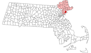
Location of Salem in Massachusetts
This is intended to be a complete list of the properties and districts on the National Register of Historic Places in Salem, Massachusetts, United States. The locations of National Register properties and districts for which the latitude and longitude coordinates are included below, may be seen in an online map.[1]
Essex County, of which Salem is a part, is the location of more than 450 properties and districts listed on the National Register, including 25 National Historic Landmarks. Salem itself is the location of 46 of these properties and districts, including 8 National Historic Landmarks.[2]
- This National Park Service list is complete through NPS recent listings posted June 19, 2020.[3]
Current listings
| [4] | Name on the Register[2] | Image | Date listed[5] | Location | Description |
|---|---|---|---|---|---|
| 1 | Baker's Island Light Station |  Baker's Island Light Station |
November 21, 1976 (#76000289) |
East of Salem on Baker's Island 42°32′11″N 70°47′11″W |
|
| 2 | Nathaniel Bowditch House | 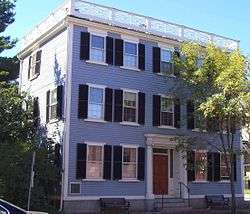 Nathaniel Bowditch House |
October 15, 1966 (#66000135) |
North St. 42°31′18″N 70°53′58″W |
|
| 3 | Bowker Place | 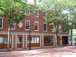 Bowker Place |
July 29, 1983 (#83000573) |
144-156 Essex St. 42°31′19″N 70°53′35″W |
|
| 4 | Bridge Street Neck Historic District | 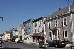 Bridge Street Neck Historic District |
July 19, 2002 (#02000790) |
Bridge St. and side streets between March/Osgood Sts., and Howard/Webb Sts. 42°31′48″N 70°53′19″W |
|
| 5 | Charter Street Historic District | 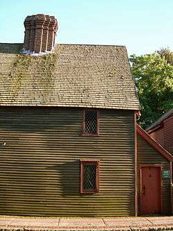 Charter Street Historic District |
March 10, 1975 (#75000294) |
Bounded by Liberty, Derby, Central, and Charter Sts. 42°31′13″N 70°53′34″W |
|
| 6 | Chestnut Street District |  Chestnut Street District |
August 28, 1973 (#73000312) |
Bounded roughly by Broad, Flint, Federal, and Summer Sts.; also roughly bounded by Bridge, Lynn, Beckford, and River Sts. 42°31′13″N 70°54′08″W |
Second set of addresses represent a boundary increase approved October 4, 1978. |
| 7 | Rufus Choate House |  Rufus Choate House |
November 12, 1982 (#82000481) |
14 Lynde St. 42°31′21″N 70°53′48″W |
|
| 8 | City Hall | 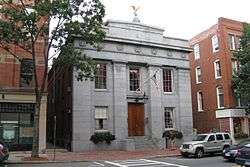 City Hall |
April 3, 1973 (#73000316) |
93 Washington St. 42°31′19″N 70°53′45″W |
|
| 9 | Crombie Street District | 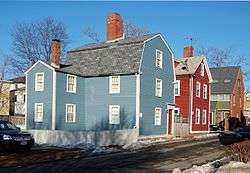 Crombie Street District |
September 16, 1983 (#83000575) |
7-15 and 16-18 Crombie St., and 13 Barton St. 42°31′14″N 70°53′52″W |
|
| 10 | Derby Waterfront District | 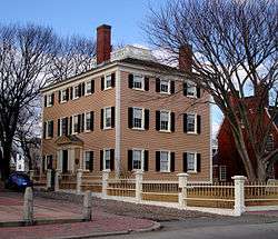 Derby Waterfront District |
May 17, 1976 (#76000297) |
Derby St. from Herbert St. to Block House Sq., waterfront streets between Kosciusko and Blaney Sts. 42°31′18″N 70°53′06″W |
|
| 11 | Derby Wharf Light Station | 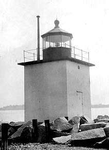 Derby Wharf Light Station |
June 15, 1987 (#87001466) |
Derby Wharf 42°30′52″N 70°53′04″W |
|
| 12 | Downtown Salem District | 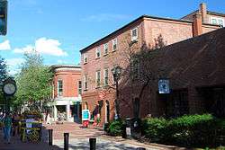 Downtown Salem District |
December 4, 1972 (#72000149) |
Derby Sq. and 215-231 Essex, 121-145 Washington, and 6-34 Front Sts.; also roughly bounded by Church, Central, New Derby, and Washington Sts. 42°31′16″N 70°53′45″W |
Originally listed as the Old Town Hall Historic District; new name and boundaries represent a boundary increase of October 18, 1983 |
| 13 | Essex Institute Historic District |  Essex Institute Historic District |
June 22, 1972 (#72000147) |
134-132, 128, 126 Essex St. and 13 Washington Sq., W. 42°31′20″N 70°53′33″W |
|
| 14 | Federal Street District |  Federal Street District |
May 17, 1976 (#76000299) |
32 Federal St.; also roughly bounded by Bridge, Washington, Federal, and Summer Sts. 42°31′22″N 70°53′52″W |
Originally listed as the Essex County Court Buildings; new name and boundaries represent a boundary increase of September 16, 1983 |
| 15 | Joseph Fenno House-Woman's Friend Society | 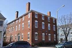 Joseph Fenno House-Woman's Friend Society |
September 17, 2008 (#08000906) |
12-14 Hawthorne Boulevard 42°31′18″N 70°53′25″W |
|
| 16 | First Universalist Church |  First Universalist Church |
July 29, 1983 (#83000577) |
6 Rust St. 42°31′26″N 70°53′44″W |
|
| 17 | Fort Lee |  Fort Lee |
April 14, 1994 (#94000285) |
Fort Ave. 42°31′55″N 70°52′28″W |
|
| 18 | Fort Pickering |  Fort Pickering |
February 8, 1973 (#73000320) |
Winter Island 42°31′36″N 70°54′02″W |
|
| 19 | Gardiner-Pingree House | .jpg) Gardiner-Pingree House |
December 30, 1970 (#70000541) |
128 Essex St. 42°31′21″N 70°53′31″W |
|
| 20 | Gedney and Cox Houses |  Gedney and Cox Houses |
October 1, 1974 (#74000389) |
21 High St. 42°31′06″N 70°53′53″W |
|
| 21 | Greenlawn Cemetery |  Greenlawn Cemetery |
July 27, 2015 (#15000467) |
57 Orne St. 42°31′58″N 70°54′15″W |
|
| 22 | Hamilton Hall | 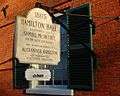 Hamilton Hall |
December 30, 1970 (#70000543) |
9 Cambridge St. 42°31′10″N 70°53′58″W |
|
| 23 | House of the Seven Gables Historic District | _-_Salem%2C_Massachusetts.jpg) House of the Seven Gables Historic District |
May 8, 1973 (#73000323) |
54 Turner St. at Derby and Hardy Sts. 42°31′18″N 70°53′22″W |
|
| 24 | Bessie Monroe House |  Bessie Monroe House |
July 29, 1983 (#83000580) |
7 Ash St. 42°31′25″N 70°53′43″W |
|
| 25 | William Murray House |  William Murray House |
March 9, 1990 (#90000257) |
39 Essex St. 42°31′24″N 70°53′10″W |
|
| 26 | North Street Fire Station | 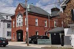 North Street Fire Station |
March 6, 2013 (#13000050) |
142 North St. 42°31′42″N 70°54′10″W |
In 1881, the North Street Fire Station was built.. |
| 27 | Peabody Museum of Salem | 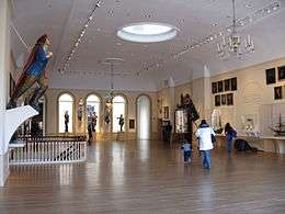 Peabody Museum of Salem |
October 15, 1966 (#66000783) |
161 Essex St. 42°31′18″N 70°53′36″W |
This listing is for the East India Marine Hall, now a portion of the Peabody Essex Museum. |
| 28 | John P. Peabody House |  John P. Peabody House |
July 29, 1983 (#83000581) |
15 Summer St. 42°31′13″N 70°53′56″W |
|
| 29 | Peirce-Nichols House |  Peirce-Nichols House |
November 24, 1968 (#68000041) |
80 Federal St. 42°31′22″N 70°54′00″W |
Owned by the Peabody Essex Museum. |
| 30 | Point Neighborhood Historic District |  Point Neighborhood Historic District |
December 2, 2014 (#14000972) |
Roughly bounded by Peabody, Congress, Chase & Lafayette Sts. 42°31′00″N 70°53′29″W |
|
| 31 | St. Nicholas Orthodox Church and Rectory |  St. Nicholas Orthodox Church and Rectory |
February 18, 1994 (#93000346) |
64-66 Forrester St. 42°31′32″N 70°53′07″W |
|
| 32 | Salem Common Historic District | 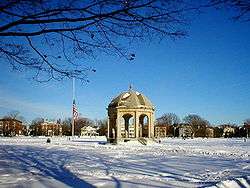 Salem Common Historic District |
May 12, 1976 (#76000303) |
Bounded roughly by St. Peter's, Bridge, and Derby Sts. and Collins Cove 42°31′22″N 70°53′28″W |
|
| 33 | Salem Diner | 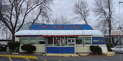 Salem Diner |
September 22, 1999 (#99001118) |
70½ Loring Ave. 42°30′04″N 70°53′47″W |
|
| 34 | Salem Laundry | 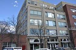 Salem Laundry |
July 29, 1983 (#83000583) |
55 Lafayette St. 42°31′12″N 70°53′38″W |
Misspelled as "Landry" on the National Register |
| 35 | Salem Maritime National Historic Site |  Salem Maritime National Historic Site |
October 15, 1966 (#66000048) |
Derby St. 42°31′09″N 70°53′10″W |
|
| 36 | Salem Willows Historic District |  Salem Willows Historic District |
March 25, 1994 (#94000265) |
Roughly Columbus, Bay View, Beach and Fort Aves. 42°31′57″N 70°52′06″W |
|
| 37 | Shepard Block |  Shepard Block |
July 29, 1983 (#83000584) |
298-304 Essex St. 42°31′17″N 70°53′57″W |
|
| 38 | Joseph Story House | 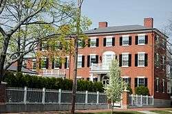 Joseph Story House |
November 7, 1973 (#73001952) |
26 Winter St. 42°31′29″N 70°53′27″W |
|
| 39 | US Post Office-Salem Main | 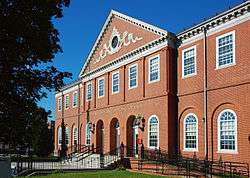 US Post Office-Salem Main |
June 4, 1986 (#86001211) |
2 Margin St. 42°31′10″N 70°53′47″W |
|
| 40 | John Ward House | 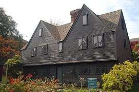 John Ward House |
November 24, 1968 (#68000045) |
132 Essex St. 42°31′22″N 70°53′36″W |
|
| 41 | Joshua Ward House |  Joshua Ward House |
February 8, 1978 (#78000481) |
148 Washington St. 42°31′13″N 70°53′48″W |
|
| 42 | Wesley Methodist Church | 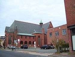 Wesley Methodist Church |
July 29, 1983 (#83000588) |
8 North St. 42°31′19″N 70°53′56″W |
|
| 43 | West Cogswell House | .jpg) West Cogswell House |
July 29, 1983 (#83000589) |
5-9 Summer St. 42°31′15″N 70°53′56″W |
|
| 44 | Winter Island Historic District and Archeological District | _Light_MA.JPG) Winter Island Historic District and Archeological District |
April 14, 1994 (#94000335) |
Winter Island 42°31′42″N 70°52′09″W |
|
| 45 | Thomas March Woodbridge House |  Thomas March Woodbridge House |
March 31, 1975 (#75000304) |
48 Bridge St. 42°31′58″N 70°53′21″W |
|
| 46 | YMCA | 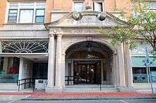 YMCA |
July 29, 1983 (#83000590) |
284-296 Essex St. 42°31′17″N 70°53′55″W |
See also
| Wikimedia Commons has media related to National Register of Historic Places in Salem, Massachusetts. |
References
- The latitude and longitude information provided in this table was derived originally from the National Register Information System, which has been found to be fairly accurate for about 99% of listings. Some locations in this table may have been corrected to current GPS standards.
- "National Register Information System". National Register of Historic Places. National Park Service. April 24, 2008.
- "National Register of Historic Places: Weekly List Actions". National Park Service, United States Department of the Interior. Retrieved on June 19, 2020.
- Numbers represent an ordering by significant words. Various colorings, defined here, differentiate National Historic Landmarks and historic districts from other NRHP buildings, structures, sites or objects.
- The eight-digit number below each date is the number assigned to each location in the National Register Information System database, which can be viewed by clicking the number.
| Topics |  | ||||||||||||||||
|---|---|---|---|---|---|---|---|---|---|---|---|---|---|---|---|---|---|
| Lists by county | |||||||||||||||||
| Lists by city |
| ||||||||||||||||
| Other lists | |||||||||||||||||
| |||||||||||||||||
This article is issued from Wikipedia. The text is licensed under Creative Commons - Attribution - Sharealike. Additional terms may apply for the media files.