National Register of Historic Places listings in Plymouth County, Massachusetts
This is a list of the National Register of Historic Places listings in Plymouth County, Massachusetts.

Location of Plymouth County in Massachusetts
This is intended to be a complete list of the properties and districts on the National Register of Historic Places in Plymouth County, Massachusetts, United States. The locations of National Register properties and districts for which the latitude and longitude coordinates are included below, may be seen in a map.[1]
There are 136 properties and districts listed on the National Register in the county, including 5 National Historic Landmarks.
- This National Park Service list is complete through NPS recent listings posted June 19, 2020.[2]
Current listings
| [3] | Name on the Register[4] | Image | Date listed[5] | Location | City or town | Description |
|---|---|---|---|---|---|---|
| 1 | Frederic C. Adams Public Library |  Frederic C. Adams Public Library |
June 6, 2001 (#01000625) |
33 Summer St. 41°59′45″N 70°43′48″W |
Kingston | |
| 2 | John and Priscilla Alden Family Sites |  John and Priscilla Alden Family Sites |
December 14, 1978 (#78000476) |
105 Alden St. 42°02′42″N 70°41′09″W |
Duxbury | |
| 3 | Bartlett–Russell–Hedge House |  Bartlett–Russell–Hedge House |
April 30, 1976 (#76001614) |
32 Court St. 41°57′27″N 70°40′02″W |
Plymouth | |
| 4 | Bethel African Methodist Episcopal Church and Parsonage | 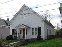 Bethel African Methodist Episcopal Church and Parsonage |
March 19, 2007 (#07000168) |
6 Sever St. 41°57′25″N 70°40′08″W |
Plymouth | |
| 5 | Bird Island Light | .jpg) Bird Island Light |
September 28, 1987 (#87002030) |
Sippican Harbor 41°40′07″N 70°43′04″W |
Marion | |
| 6 | Boston Harbor Islands Archeological District | 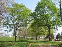 Boston Harbor Islands Archeological District |
December 21, 1985 (#85003323) |
Locations in and around Boston Harbor 42°19′07″N 70°56′45″W |
Hingham, Hull | Extends into Quincy and Weymouth in Norfolk County and Boston and Winthrop in Suffolk County |
| 7 | Bradford House | 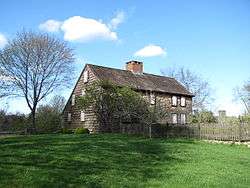 Bradford House |
March 15, 2006 (#06000128) |
50 Landing Rd. 41°59′17″N 70°43′27″W |
Kingston | |
| 8 | Captain Daniel Bradford House |  Captain Daniel Bradford House |
February 20, 1986 (#86000301) |
251 Harrison St. 42°02′21″N 70°41′08″W |
Duxbury | |
| 9 | Capt. Gamaliel Bradford House |  Capt. Gamaliel Bradford House |
February 17, 1978 (#78001402) |
West of Duxbury at 942 Tremont St. 42°02′18″N 70°41′22″W |
Duxbury | |
| 10 | Capt. Gershom Bradford House |  Capt. Gershom Bradford House |
February 8, 1978 (#78001403) |
West of Duxbury at 931 Tremont St. 42°02′16″N 70°41′21″W |
Duxbury | |
| 11 | Bradford–Union Street Historic District |  Bradford–Union Street Historic District |
November 10, 1983 (#83004094) |
Bradford, Union, Emerald, Water Cure, and Freedom Sts. 41°57′19″N 70°39′38″W |
Plymouth | |
| 12 | Bridgewater Iron Works |  Bridgewater Iron Works |
February 28, 2002 (#01000087) |
High Street 42°00′11″N 70°58′54″W |
Bridgewater | |
| 13 | Brockton City Hall | 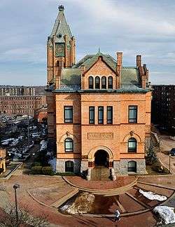 Brockton City Hall |
March 26, 1976 (#76000296) |
45 School St. 42°04′56″N 71°01′07″W |
Brockton | |
| 14 | Brockton Edison Electric Illuminating Company Power Station |  Brockton Edison Electric Illuminating Company Power Station |
September 17, 1987 (#87000874) |
70 School St. 42°05′00″N 70°59′46″W |
Brockton | |
| 15 | Bryant–Cushing House |  Bryant–Cushing House |
March 26, 1976 (#76001613) |
768 Main St. 42°09′35″N 70°47′14″W |
Norwell | |
| 16 | Camp Kiwanee Historic District |  Camp Kiwanee Historic District |
February 24, 2005 (#05000081) |
1 Camp Kiwanee Rd. 42°03′34″N 70°50′50″W |
Hanson | |
| 17 | Cardinal Cushing Center Historic District |  Cardinal Cushing Center Historic District |
August 10, 2018 (#100002782) |
369 Washington St. 42°07′01″N 70°49′13″W |
Hanover | |
| 18 | Central Fire Station | 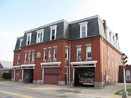 Central Fire Station |
July 25, 1977 (#77000193) |
40 Pleasant St. 42°05′06″N 71°01′17″W |
Brockton | |
| 19 | Centre and Montello Streets Historic District |  Centre and Montello Streets Historic District |
June 15, 2015 (#15000352) |
43–51, 53–61, 63–77, 91–93 Centre & 95, 124–126 Montello Sts. 42°05′02″N 71°01′03″W |
Brockton | |
| 20 | Thomas Chubbuck Jr. House |  Thomas Chubbuck Jr. House |
August 7, 1992 (#92000954) |
1191 Main St. 42°10′37″N 70°53′09″W |
Hingham | |
| 21 | Clifford–Warren House |  Clifford–Warren House |
April 8, 1980 (#80000666) |
East of Plymouth at 3 Clifford Rd. 41°56′20″N 70°37′04″W |
Plymouth | |
| 22 | Cole's Hill |  Cole's Hill |
October 15, 1966 (#66000142) |
Carver St. 41°57′27″N 70°39′46″W |
Plymouth | |
| 23 | Commonwealth Shoe and Leather Co. | 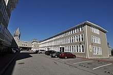 Commonwealth Shoe and Leather Co. |
May 13, 2014 (#14000271) |
7 Marble Street 42°04′50″N 70°55′57″W |
Whitman | |
| 24 | Conant's Hill Site | 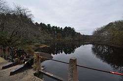 Conant's Hill Site |
November 25, 1983 (#09000091) |
End of Station St., ½ mile south of Main St.[6] 41°45′51″N 70°43′51″W |
Wareham | |
| 25 | Cove Street Historic District |  Cove Street Historic District |
May 28, 2019 (#100003964) |
22-66 Cove St. & 56 Old Cove Rd. 42°02′59″N 70°40′18″W |
Duxbury | |
| 26 | Curtis Building |  Curtis Building |
April 15, 1982 (#82004424) |
105–109 Main St. 42°04′59″N 71°01′15″W |
Brockton | |
| 27 | Cushing Homestead | 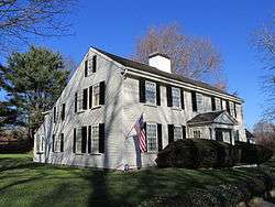 Cushing Homestead |
June 4, 1973 (#73000326) |
210 East Street 42°14′25″N 70°51′45″W |
Hingham | |
| 28 | Dr. Edgar Everett Dean House |  Dr. Edgar Everett Dean House |
May 5, 1978 (#78000471) |
81 Green St. 42°05′05″N 71°01′22″W |
Brockton | |
| 29 | District 7 School House |  District 7 School House |
August 11, 2005 (#05000876) |
565 Main St. 42°02′25″N 70°51′46″W |
Hanson | |
| 30 | Duxbury Pier Light |  Duxbury Pier Light |
June 4, 2014 (#14000287) |
Mouth of Duxbury Bay at Plymouth Bay, 5.1 mi. NNE. of Plymouth Rock 41°59′15″N 70°38′55″W |
Plymouth | |
| 31 | East Bridgewater Common Historic District |  East Bridgewater Common Historic District |
May 12, 1999 (#99000559) |
Central and Plymouth Sts, and Morse Ave. 42°01′47″N 70°57′09″W |
East Bridgewater | |
| 32 | East Rochester Church and Cemetery Historic District |  East Rochester Church and Cemetery Historic District |
January 9, 2008 (#07001361) |
355 County Rd. 41°47′05″N 70°46′39″W |
Rochester | |
| 33 | Emerson Shoe Company |  Emerson Shoe Company |
June 1, 2018 (#100002542) |
51 Maple St. 42°07′28″N 70°55′15″W |
Rockland | |
| 34 | D.W. Field Park |  D.W. Field Park |
November 24, 2000 (#00001341) |
Between Pond St., Avon St., and Pleasant St. 42°06′17″N 71°02′47″W |
Brockton | Extends into Avon in Norfolk County |
| 35 | First Baptist Church of Scituate |  First Baptist Church of Scituate |
July 27, 2015 (#15000469) |
656 & 660 Country Way 42°12′58″N 70°46′37″W |
Scituate | |
| 36 | First Parish Church |  First Parish Church |
July 21, 1978 (#78001404) |
Southwest of Duxbury at Tremont and Depot Sts. 42°02′06″N 70°41′33″W |
Duxbury | |
| 37 | First Parish Church of Plymouth |  First Parish Church of Plymouth |
December 2, 2014 (#14000973) |
19 Town Sq. 41°57′20″N 70°39′54″W |
Plymouth | |
| 38 | First Trinitarian Congregational Church | 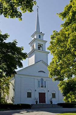 First Trinitarian Congregational Church |
September 12, 2002 (#02001037) |
381 Country Way 42°12′00″N 70°45′37″W |
Scituate | |
| 39 | Forest Avenue School |  Forest Avenue School |
July 15, 1982 (#82004425) |
Memorial Drive 42°04′11″N 71°02′27″W |
Brockton | |
| 40 | Franklin Block |  Franklin Block |
February 21, 1989 (#89000042) |
1102–1110 Main St. 42°03′49″N 71°00′57″W |
Brockton | |
| 41 | Goldthwaite Block |  Goldthwaite Block |
April 15, 1982 (#82004427) |
99–103 Main St. 42°05′00″N 71°01′12″W |
Brockton | |
| 42 | Grand Army of the Republic Hall |  Grand Army of the Republic Hall |
May 16, 1997 (#97000438) |
34 School St. 42°07′36″N 70°54′52″W |
Rockland | |
| 43 | Hanover Center Historic District |  Hanover Center Historic District |
May 9, 1996 (#96000476) |
Roughly Silver St. from Lantern Ln. to Hanover St. 42°07′06″N 70°50′40″W |
Hanover | |
| 44 | Harlow Old Fort House | 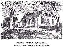 Harlow Old Fort House |
December 27, 1974 (#74001762) |
119 Sandwich St. 41°57′07″N 70°39′26″W |
Plymouth | |
| 45 | Sgt. William Harlow Family Homestead |  Sgt. William Harlow Family Homestead |
April 15, 1982 (#82004434) |
8 Winter St. 41°57′06″N 70°39′15″W |
Plymouth | |
| 46 | Hatch Homestead and Mill Historic District |  Hatch Homestead and Mill Historic District |
September 11, 2009 (#09000698) |
385 Union St.. 42°07′21″N 70°46′12″W |
Marshfield | |
| 47 | Hillside |  Hillside |
September 18, 1975 (#75001626) |
230 Summer St. 41°56′54″N 70°40′48″W |
Plymouth | |
| 48 | Howard Block |  Howard Block |
April 15, 1982 (#82004969) |
93–97 Main St. 42°05′01″N 71°01′11″W |
Brockton | |
| 49 | Howard Home for Aged Men |  Howard Home for Aged Men |
December 20, 2016 (#16000871) |
940 Belmont St. 42°03′56″N 71°03′11″W |
Brockton | Building 60 of the Brockton VA complex |
| 50 | Jabez Howland House |  Jabez Howland House |
October 9, 1974 (#74002032) |
33 Sandwich St. 41°57′16″N 70°39′47″W |
Plymouth | |
| 51 | Hull Shore Drive, Nantasket Avenue, Metropolitan Park System of Greater Boston MPS | 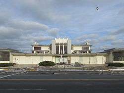 Hull Shore Drive, Nantasket Avenue, Metropolitan Park System of Greater Boston MPS |
January 21, 2004 (#03001470) |
Hull Shore Dr., Nantasket Ave. 42°16′20″N 70°51′39″W |
Hull | |
| 52 | Island Grove Park National Register District |  Island Grove Park National Register District |
March 6, 2002 (#02000127) |
Park Ave. 42°06′46″N 70°51′40″W |
Abington | |
| 53 | Capt. Benjamin James House |  Capt. Benjamin James House |
November 29, 1983 (#83004095) |
301 Driftway 42°10′37″N 70°44′35″W |
Scituate | |
| 54 | King Caesar House |  King Caesar House |
March 29, 1978 (#78000477) |
King Caesar Rd. 42°02′43″N 70°39′52″W |
Duxbury | |
| 55 | Gardner J. Kingman House |  Gardner J. Kingman House |
July 25, 1977 (#77000196) |
309 Main St. 42°04′45″N 71°01′15″W |
Brockton | |
| 56 | Kingston Center Historic District |  Kingston Center Historic District |
October 4, 2002 (#02001085) |
Main and Green Sts 41°59′42″N 70°44′00″W |
Kingston | |
| 57 | Lawson Tower | 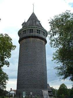 Lawson Tower |
September 28, 1976 (#76001963) |
Off First Parish Rd. 42°12′01″N 70°45′21″W |
Scituate | |
| 58 | Leonard, Shaw & Dean Shoe Factory |  Leonard, Shaw & Dean Shoe Factory |
August 3, 2018 (#100002733) |
151 Peirce St. 41°53′45″N 70°54′44″W |
Middleborough | |
| 59 | Lincoln Historic District |  Lincoln Historic District |
January 7, 1991 (#90001728) |
Roughly North and South Sts. from West to Water Sts., Main St. south to Garrison Rd., and Lincoln St. and Fearing Rd. north to Miles 42°14′23″N 70°53′27″W |
Hingham | |
| 60 | Gen. Benjamin Lincoln House | .jpg) Gen. Benjamin Lincoln House |
November 28, 1972 (#72001303) |
181 North St. 42°14′35″N 70°53′35″W |
Hingham | |
| 61 | Lower Union Street Historic District |  Lower Union Street Historic District |
April 7, 1989 (#89000219) |
Union St. from Water St. to Market St. 42°07′38″N 70°54′57″W |
Rockland | |
| 62 | Lyman Block |  Lyman Block |
April 15, 1982 (#82004430) |
83–91 Main St. 42°05′01″N 71°01′15″W |
Brockton | |
| 63 | Marshfield Hills Historic District |  Marshfield Hills Historic District |
December 18, 2009 (#09001096) |
Bow, Highland, Main, Old Main, Pleasant, and Prospect Sts., Glen 42°08′45″N 70°44′23″W |
Marshfield | |
| 64 | William H. McElwain School | 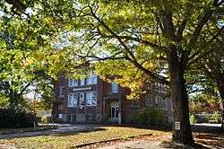 William H. McElwain School |
January 14, 2013 (#12001170) |
250 Main St. 41°59′44″N 70°58′53″W |
Bridgewater | |
| 65 | Men of Kent Cemetery |  Men of Kent Cemetery |
June 25, 2013 (#13000442) |
Meeting House Lane 42°11′12″N 70°43′44″W |
Scituate | |
| 66 | Middleborough Center Historic District | 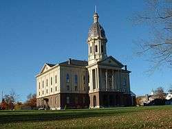 Middleborough Center Historic District |
June 15, 2000 (#00000685) |
Roughly bounded by Conraill RR, Frank, Pierce, School, North Sts., Nemasket R., and East Grove St. 41°53′32″N 70°54′43″W |
Middleborough | |
| 67 | Middleborough Waterworks |  Middleborough Waterworks |
March 2, 1990 (#90000129) |
E. Grove St. at the Nemasket River and Wareham St. at Barden Hill Rd. 41°53′11″N 70°53′46″W |
Middleborough | |
| 68 | Minot's Ledge Light | 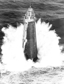 Minot's Ledge Light |
June 15, 1987 (#87001489) |
Minot's Ledge 42°16′04″N 70°45′38″W |
Scituate | |
| 69 | Muttock Historic and Archeological District |  Muttock Historic and Archeological District |
May 18, 2000 (#00000504) |
Oliver Mills Park 41°54′26″N 70°54′50″W |
Middleborough | Ruins of millworks first established by Peter Oliver. |
| 70 | Myles Standish Burial Ground | 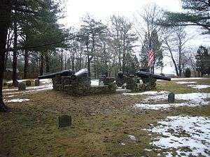 Myles Standish Burial Ground |
May 26, 2015 (#15000261) |
Chestnut St. 42°01′30″N 70°41′15″W |
Duxbury | |
| 71 | National Monument to the Forefathers |  National Monument to the Forefathers |
August 30, 1974 (#74002033) |
Allerton St. 41°57′36″N 70°40′36″W |
Plymouth | |
| 72 | Ned Point Light |  Ned Point Light |
June 15, 1987 (#87001488) |
Ned Point Rd. 41°38′53″N 70°46′16″W |
Mattapoisett | |
| 73 | New England Telephone and Telegraph Engineering Office |  New England Telephone and Telegraph Engineering Office |
December 3, 2019 (#100004052) |
47 Pleasant St. 42°05′08″N 71°01′16″W |
Brockton | |
| 74 | North Abington Depot | 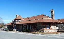 North Abington Depot |
May 13, 1976 (#76001612) |
Railroad St. 42°07′45″N 70°56′32″W |
Abington | |
| 75 | North Rochester Congregational Church |  North Rochester Congregational Church |
March 21, 2008 (#07001400) |
289 North Ave. 41°46′57″N 70°53′39″W |
Rochester | |
| 76 | Norwell Village Area Historic District |  Norwell Village Area Historic District |
June 2, 1982 (#82004432) |
MA 123 42°09′41″N 70°47′28″W |
Norwell | |
| 77 | Old Burial Hill |  Old Burial Hill |
August 7, 2013 (#13000582) |
Church, School & S. Russell Sts. 41°57′22″N 70°39′58″W |
Plymouth | |
| 78 | Old County Courthouse |  Old County Courthouse |
February 23, 1972 (#72001297) |
Leyden and Market Sts. 41°57′20″N 70°39′53″W |
Plymouth | |
| 79 | Old Post Office Building |  Old Post Office Building |
March 8, 1978 (#78000474) |
Crescent St. 42°04′51″N 71°01′10″W |
Brockton | |
| 80 | Old Ship Meetinghouse | 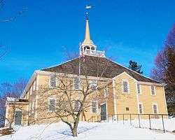 Old Ship Meetinghouse |
October 15, 1966 (#66000777) |
Main St. 42°14′28″N 70°53′16″W |
Hingham | |
| 81 | Old Shipbuilder's Historic District |  Old Shipbuilder's Historic District |
August 21, 1986 (#86001899) |
Both sides of Washington St. from Powder Point Ave. to north of South Duxbury 42°02′17″N 70°40′31″W |
Duxbury | |
| 82 | Moses Packard House |  Moses Packard House |
February 17, 1978 (#78000475) |
647 Main St. 42°04′20″N 71°01′11″W |
Brockton | |
| 83 | Paragon Park Carousel | 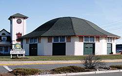 Paragon Park Carousel |
September 14, 1999 (#99001081) |
1 Wharf Ave. 42°16′12″N 70°51′26″W |
Hull | |
| 84 | Parting Ways Archeological District |  Parting Ways Archeological District |
March 19, 1979 (#79000367) |
Plympton Road[7] 41°56′44″N 70°44′00″W |
Plymouth | |
| 85 | Pembroke Friends Meetinghouse |  Pembroke Friends Meetinghouse |
September 6, 2006 (#06000786) |
Washington St. and Schoosett St. 42°06′17″N 70°48′18″W |
Pembroke | |
| 86 | Phoenix Building | 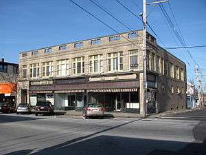 Phoenix Building |
April 7, 1989 (#89000220) |
315–321 Union St. 42°08′16″N 70°54′59″W |
Rockland | |
| 87 | Peter Pierce Store |  Peter Pierce Store |
April 30, 1976 (#76001611) |
N. Main and Jackson Sts. 41°53′35″N 70°54′28″W |
Middleborough | Now the police station. |
| 88 | Pilgrim Hall |  Pilgrim Hall |
April 11, 1972 (#72001298) |
75 Court St. 41°57′32″N 70°40′05″W |
Plymouth | |
| 89 | Pillsbury Summer House |  Pillsbury Summer House |
November 27, 2004 (#04001257) |
45 Old Cove Rd. 42°03′04″N 70°40′15″W |
Duxbury | |
| 90 | Pinewoods Camp | 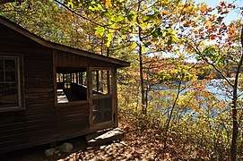 Pinewoods Camp |
December 16, 2009 (#09001151) |
80 Cornish Field Rd. 41°51′17″N 70°36′16″W |
Plymouth | |
| 91 | Plymouth Antiquarian House |  Plymouth Antiquarian House |
December 27, 1974 (#74002034) |
126 Water St. 41°57′37″N 70°40′04″W |
Plymouth | |
| 92 | Plymouth Light Station | 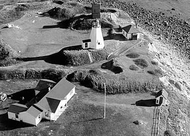 Plymouth Light Station |
March 8, 1977 (#77000655) |
Southeast of Duxbury at Gurnet Point 42°00′12″N 70°36′04″W |
Plymouth | |
| 93 | Plymouth Post Office Building |  Plymouth Post Office Building |
October 23, 1986 (#86002926) |
5 Main St. 41°57′21″N 70°39′50″W |
Plymouth | |
| 94 | Plymouth Rock |  Plymouth Rock |
July 1, 1970 (#70000680) |
Water St. 41°57′29″N 70°39′45″W |
Plymouth | |
| 95 | Plymouth Village Historic District |  Plymouth Village Historic District |
June 2, 1982 (#82004435) |
Roughly bounded by Water, Main, and Brewster Sts. 41°57′26″N 70°39′49″W |
Plymouth | |
| 96 | Plympton Village Historic District |  Plympton Village Historic District |
March 7, 2007 (#07000120) |
Main St., Elm St., Parsonage Rd., Mayflower Rd. 41°57′11″N 70°48′51″W |
Plympton | |
| 97 | Point Allerton Lifesaving Station | .jpg) Point Allerton Lifesaving Station |
June 11, 1981 (#81000110) |
Nantasket Ave. 42°18′20″N 70°54′01″W |
Hull | |
| 98 | H.R. Reed House | December 2, 2019 (#100004738) |
46 Water St. 41°41′58″N 70°45′24″W |
Marion | ||
| 99 | Rockland Almshouse |  Rockland Almshouse |
April 28, 1983 (#83000600) |
198 Spring St. 42°06′52″N 70°54′45″W |
Rockland | Now the North River Collaborative. |
| 100 | Rockland High School |  Rockland High School |
March 23, 1989 (#89000217) |
394 Union St. 42°08′56″N 70°55′05″W |
Rockland | |
| 101 | Rockland Memorial Library |  Rockland Memorial Library |
March 23, 1989 (#89000221) |
382 Union St. 42°08′20″N 70°55′04″W |
Rockland | |
| 102 | Rockland Trust Company |  Rockland Trust Company |
April 7, 1989 (#89000218) |
288 Union St. 42°08′10″N 70°54′59″W |
Rockland | |
| 103 | Sachem Rock Farm |  Sachem Rock Farm |
December 11, 2006 (#06001129) |
355 Plymouth St. 42°01′06″N 70°57′06″W |
East Bridgewater | |
| 104 | Scituate Light |  Scituate Light |
June 15, 1987 (#87001490) |
Cedar Pt. 42°12′07″N 70°42′55″W |
Scituate | |
| 105 | William Sever House |  William Sever House |
March 7, 2019 (#100003469) |
2 Linden St. 41°59′33″N 70°43′31″W |
Kingston | |
| 106 | Snow Fountain and Clock |  Snow Fountain and Clock |
July 25, 1977 (#77000197) |
N. Main and E. Main Sts. 42°05′45″N 71°01′11″W |
Brockton | |
| 107 | South Hingham Historic District |  South Hingham Historic District |
July 24, 1998 (#98000838) |
Roughly along Main St. from Cushing St. to Tower Brook Rd. 42°12′40″N 70°53′06″W |
Hingham | |
| 108 | South Middleborough Historic District |  South Middleborough Historic District |
June 19, 2009 (#09000438) |
Locust, Spruce, and Wareham Sts. 41°49′27″N 70°49′38″W |
Middleborough | |
| 109 | South Street Historic District |  South Street Historic District |
October 6, 1983 (#83004096) |
Roughly South St. from Main St. to Warren Ave. 42°03′47″N 71°01′11″W |
Brockton | |
| 110 | Richard Sparrow House |  Richard Sparrow House |
October 9, 1974 (#74002035) |
42 Summer St. 41°57′15″N 70°39′54″W |
Plymouth | |
| 111 | Alexander Standish House |  Alexander Standish House |
July 12, 1978 (#78001407) |
341 Standish St. 42°00′30″N 70°40′45″W |
Duxbury | |
| 112 | Stetson House |  Stetson House |
September 7, 1979 (#79000366) |
Hanover St. 42°06′58″N 70°50′39″W |
Hanover | |
| 113 | Stetson–Ford House |  Stetson–Ford House |
March 9, 1998 (#98000120) |
2 Meadow Farms Way 42°07′18″N 70°47′05″W |
Norwell | |
| 114 | The Tack Factory |  The Tack Factory |
December 3, 1980 (#80000472) |
Southwest of Norwell at 49 Tiffany Rd. 42°07′21″N 70°48′33″W |
Norwell | Demolished by fire in 1983.[8] |
| 115 | Tarkiln School |  Tarkiln School |
August 26, 2009 (#09000647) |
245 Summer Street 42°02′09″N 70°44′27″W |
Duxbury | Misspelled "Tarklin" in the National Register. |
| 116 | Telegraph Hill | 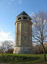 Telegraph Hill |
July 12, 1976 (#76000953) |
Farina Road 42°18′15″N 70°54′16″W |
Hull | |
| 117 | Third Meetinghouse |  Third Meetinghouse |
January 2, 1976 (#76000956) |
1 Fairhaven Rd. 41°39′43″N 70°49′13″W |
Mattapoisett | |
| 118 | Thomas–Webster Estate |  Thomas–Webster Estate |
April 5, 1993 (#93000206) |
238 Webster St. 42°04′46″N 70°40′46″W |
Marshfield | |
| 119 | Tom Thumb House |  Tom Thumb House |
April 16, 1993 (#93000298) |
351 Plymouth St. 41°55′16″N 70°55′08″W |
Middleborough | |
| 120 | Tobey Homestead |  Tobey Homestead |
June 5, 1986 (#86001219) |
Main St. and Sandwich Rd. 41°45′24″N 70°42′51″W |
Wareham | |
| 121 | Town Brook Historic and Archeological District |  Town Brook Historic and Archeological District |
October 12, 1995 (#95001176) |
Address restricted 41°57′01″N 70°40′08″W |
Plymouth | |
| 122 | Town Hall |  Town Hall |
October 22, 1976 (#76000955) |
Bedford St. 41°50′45″N 70°57′02″W |
Lakeville | |
| 123 | Tremont Nail Factory District | 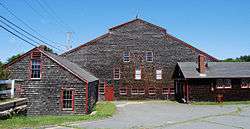 Tremont Nail Factory District |
October 22, 1976 (#76001964) |
21 Elm St. 41°45′59″N 70°43′20″W |
Wareham | |
| 124 | US Post Office–Middleborough Main |  US Post Office–Middleborough Main |
October 19, 1987 (#87001774) |
90 Center St. 41°53′33″N 70°54′40″W |
Middleborough | |
| 125 | WPA Field House and Pump Station | 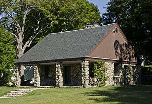 WPA Field House and Pump Station |
May 29, 2009 (#09000355) |
7-19 Henry Turner Bailey Rd. 42°13′06″N 70°47′16″W |
Scituate | |
| 126 | Wampanoag Royal Cemetery |  Wampanoag Royal Cemetery |
November 11, 1975 (#75001625) |
Bedford Street 41°47′43″N 70°54′45″W |
Lakeville | |
| 127 | Wampanucket Site | 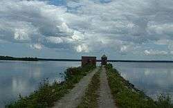 Wampanucket Site |
June 4, 1973 (#73001596) |
near Assawompset Pond[9] |
Middleborough | Paleo-Indian site |
| 128 | War Memorial Park | 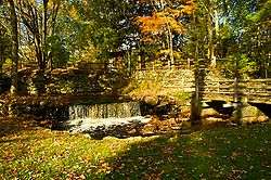 War Memorial Park |
May 21, 2008 (#08000445) |
River St. 42°09′46″N 71°00′31″W |
West Bridgewater | |
| 129 | C.P. Washburn Grain Mill |  C.P. Washburn Grain Mill |
April 8, 1980 (#80000667) |
Central and Cambridge Sts. 41°53′37″N 70°55′10″W |
Middleborough | Demolished.[10] |
| 130 | Daniel Webster Law Office and Library | .jpg) Daniel Webster Law Office and Library |
May 30, 1974 (#74002053) |
Careswell and Webster Sts. 42°04′18″N 70°40′26″W |
Marshfield | |
| 131 | Whitman Park |  Whitman Park |
March 18, 2004 (#04000187) |
Park, Maple, Whitman, and Hayden Aves. 42°04′59″N 70°55′06″W |
Whitman | |
| 132 | Winslow Cemetery |  Winslow Cemetery |
January 2, 2018 (#100001219) |
Winslow Cemetery Rd. 42°05′09″N 70°40′49″W |
Marshfield | |
| 133 | Isaac Winslow House |  Isaac Winslow House |
August 15, 2000 (#00000872) |
634 Careswell St. 42°04′18″N 70°40′23″W |
Marshfield | |
| 134 | WITCH (catboat) |  WITCH (catboat) |
June 18, 2008 (#08000533) |
35 Lydia Island Rd. 41°44′04″N 70°39′45″W |
Wareham | |
| 135 | Woodworth House |  Woodworth House |
April 9, 1996 (#96000317) |
47 Old Oaken Bucket Rd. 42°10′39″N 70°45′23″W |
Scituate | |
| 136 | Wright Memorial Library |  Wright Memorial Library |
July 11, 2007 (#07000680) |
147 St. George St. 42°02′55″N 70°40′48″W |
Duxbury |
Former listings
| [3] | Name on the Register | Image | Date listed | Date removed | Location | City or town | Summary |
|---|---|---|---|---|---|---|---|
| 1 | Bixby Block–Home Bank Building | March 29, 1978 (#80004071) | February 7, 1980 | 106 Main St. |
Brockton | Destroyed by fire January 1980 |
See also
| Wikimedia Commons has media related to National Register of Historic Places in Plymouth County, Massachusetts. |
References
- The latitude and longitude information provided in this table was derived originally from the National Register Information System, which has been found to be fairly accurate for about 99% of listings. Some locations in this table may have been corrected to current GPS standards.
- "National Register of Historic Places: Weekly List Actions". National Park Service, United States Department of the Interior. Retrieved on June 19, 2020.
- Numbers represent an ordering by significant words. Various colorings, defined here, differentiate National Historic Landmarks and historic districts from other NRHP buildings, structures, sites or objects.
- "National Register Information System". National Register of Historic Places. National Park Service. April 24, 2008.
- The eight-digit number below each date is the number assigned to each location in the National Register Information System database, which can be viewed by clicking the number.
- Wildlands Trust: Conant Hill Preserve Archived 2013-10-17 at the Wayback Machine
- Parting Ways Museum: History
- "MACRIS inventory record for The Tack Factory". Commonwealth of Massachusetts. Retrieved 2013-01-08.
- Taunton River Stewardship Plan
- "Cultural Inventory Record for Washburn Grain Mill". Commonwealth of Massachusetts. Retrieved 2013-10-16.
| Topics |  | ||||||||||||||||
|---|---|---|---|---|---|---|---|---|---|---|---|---|---|---|---|---|---|
| Lists by county | |||||||||||||||||
| Lists by city |
| ||||||||||||||||
| Other lists | |||||||||||||||||
| |||||||||||||||||
This article is issued from Wikipedia. The text is licensed under Creative Commons - Attribution - Sharealike. Additional terms may apply for the media files.