National Register of Historic Places listings in northwestern Worcester, Massachusetts
There are 105 properties and historic districts on the National Register of Historic Places in Worcester, Massachusetts, west of I-190 and the north-south section of I-290 and north of Massachusetts Route 122, which are listed here. Two listings overlap into other parts of Worcester: one of the 1767 Milestones is located in eastern Worcester, and the Blackstone Canal Historic District traverses all three sections of the city.
The locations of National Register properties and districts (at least for all showing latitude and longitude coordinates below) may be seen in an online map by clicking on "Map of all coordinates".[1]
- This National Park Service list is complete through NPS recent listings posted June 19, 2020.[2]
Current listings
| [3] | Name on the Register[4] | Image | Date listed[5] | Location | Description |
|---|---|---|---|---|---|
| 1 | 1767 Milestones | 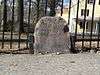 1767 Milestones |
November 15, 1973 (#71000084) |
Locations between Boston and Springfield along the old Upper Boston Post Road. 42°16′23″N 71°48′02″W |
Milestone 48 is in northwestern Worcester; Milestone 47 is in eastern Worcester. |
| 2 | Abbott Street School |  Abbott Street School |
March 5, 1980 (#80000595) |
36 Abbott St. 42°15′46″N 71°49′19″W |
|
| 3 | Elwood Adams Store |  Elwood Adams Store |
March 5, 1980 (#80000584) |
156 Main St. 42°16′06″N 71°48′04″W |
|
| 4 | Charles Allen House |  Charles Allen House |
March 5, 1980 (#80000579) |
65 Elm St. 42°15′56″N 71°48′33″W |
|
| 5 | American Antiquarian Society |  American Antiquarian Society |
November 24, 1968 (#68000018) |
185 Salisbury St. 42°16′38″N 71°48′39″W |
|
| 6 | Armsby Block |  Armsby Block |
March 5, 1980 (#80000598) |
144-148 Main St. 42°16′07″N 71°48′05″W |
|
| 7 | Ash Street School | 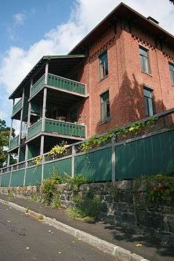 Ash Street School |
March 5, 1980 (#80000542) |
Ash St. 42°15′24″N 71°47′56″W |
|
| 8 | Babcock Block |  Babcock Block |
March 5, 1980 (#80000611) |
596 Main St. 42°15′37″N 71°48′18″W |
|
| 9 | Bancroft Hotel | 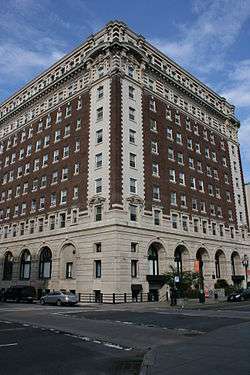 Bancroft Hotel |
March 5, 1980 (#80000614) |
50 Franklin St. 42°15′41″N 71°48′06″W |
|
| 10 | Bancroft Tower |  Bancroft Tower |
March 5, 1980 (#80000524) |
Bancroft Tower Rd. 42°16′56″N 71°49′28″W |
|
| 11 | Emory Bannister House |  Emory Bannister House |
March 5, 1980 (#80000569) |
3 Harvard St. 42°16′01″N 71°48′13″W |
Building demolished. Now parking lot for Unum. |
| 12 | Blackstone Canal Historic District |  Blackstone Canal Historic District |
August 15, 1995 (#95001004) |
The historic route of the Blackstone Canal in Massachusetts 42°08′39″N 71°40′36″W |
Listing extends into other parts of Worcester, as well as Sutton, Grafton, Millbury, Northbridge, Uxbridge, Millville, Blackstone; the Rhode Island section of the canal is the subject of a separate listing (#91001536). |
| 13 | Bliss Building | 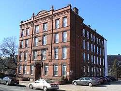 Bliss Building |
March 5, 1980 (#80000497) |
26 Old Lincoln St. 42°16′22″N 71°47′54″W |
|
| 14 | Osgood Bradley Building | 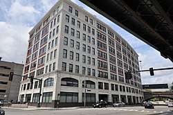 Osgood Bradley Building |
March 5, 2018 (#100002161) |
18 Grafton St. 42°15′38″N 71°47′38″W |
|
| 15 | John Brooks House | 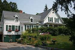 John Brooks House |
March 5, 1980 (#80000516) |
12 Nelson Pl. 42°17′48″N 71°49′11″W |
|
| 16 | Cathedral of St. Paul | 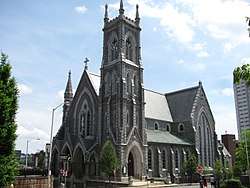 Cathedral of St. Paul |
March 5, 1980 (#80000604) |
38 Chatham St. 42°15′42″N 71°48′17″W |
|
| 17 | Chadwick Square Diner | Chadwick Square Diner |
November 26, 2003 (#03001206) |
95 rear Prescott St. 42°16′39″N 71°48′06″W |
|
| 18 | Charles Chamberlain House |  Charles Chamberlain House |
March 5, 1980 (#80000596) |
372 Pleasant St. 42°15′48″N 71°48′56″W |
The Charles Chamberlain House was demolished in 1984.[6] It was incorrectly listed on the National Register at 373 Pleasant Street. |
| 19 | Chamberlain-Flagg House |  Chamberlain-Flagg House |
March 5, 1980 (#80000519) |
2 Brookshire Dr. 42°17′04″N 71°50′02″W |
|
| 20 | George Cobb House |  George Cobb House |
March 5, 1980 (#80000571) |
24 William St. 42°16′02″N 71°48′23″W |
|
| 21 | Colton's Block |  Colton's Block |
March 5, 1980 (#80000610) |
588 Main St. 42°15′38″N 71°48′17″W |
|
| 22 | Samuel Copeland House |  Samuel Copeland House |
March 5, 1980 (#80000563) |
31 Harvard St. 42°16′10″N 71°48′10″W |
|
| 23 | Crompton Loom Works |  Crompton Loom Works |
March 5, 1980 (#80000541) |
132-142 Green St. 42°15′23″N 71°47′53″W |
|
| 24 | Isaac Davis House | 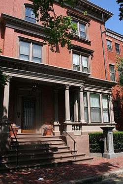 Isaac Davis House |
March 5, 1980 (#80000578) |
1 Oak St. 42°15′56″N 71°48′31″W |
|
| 25 | Joseph Davis House |  Joseph Davis House |
March 5, 1980 (#80000574) |
41 Elm St. 42°15′55″N 71°48′23″W |
|
| 26 | Frank L. and Mabel H. Dean House |  Frank L. and Mabel H. Dean House |
December 5, 2002 (#02001471) |
10 Cedar St. 42°15′59″N 71°47′48″W |
|
| 27 | Francis Dewey House |  Francis Dewey House |
March 5, 1980 (#80000580) |
71 Elm St. 42°15′56″N 71°48′35″W |
|
| 28 | Dodge Block and Sawyer Building, Bancroft Trust Building |  Dodge Block and Sawyer Building, Bancroft Trust Building |
March 15, 2002 (#02000155) |
60 Franklin St. 42°15′41″N 71°48′06″W |
|
| 29 | Helen Dodge Three-Decker |  Helen Dodge Three-Decker |
February 9, 1990 (#89002427) |
570 Pleasant St. 42°15′53″N 71°49′21″W |
|
| 30 | Thomas F. Doran Three-Decker |  Thomas F. Doran Three-Decker |
February 9, 1990 (#89002406) |
27 John St. 42°16′05″N 71°48′23″W |
|
| 31 | Elvira Drew Three-Decker |  Elvira Drew Three-Decker |
February 9, 1990 (#89002384) |
42 Abbott St. 42°15′44″N 71°49′19″W |
|
| 32 | Duprey Building |  Duprey Building |
September 5, 2019 (#100004336) |
16 Norwich St. 42°15′51″N 71°48′03″W |
|
| 33 | Elm Park |  Elm Park |
July 1, 1970 (#70000096) |
Elm Park 42°16′03″N 71°49′13″W |
|
| 34 | Elm Street Historic District |  Elm Street Historic District |
February 9, 1990 (#89002374) |
132-148 Elm St. 42°15′57″N 71°49′02″W |
|
| 35 | English High School | 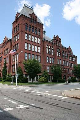 English High School |
March 5, 1980 (#80000601) |
20 Irving St. 42°15′45″N 71°48′26″W |
|
| 36 | Enterprise Building |  Enterprise Building |
March 5, 1980 (#80000608) |
540 Main St. 42°15′40″N 71°48′15″W |
|
| 37 | William Trowbridge Forbes House | 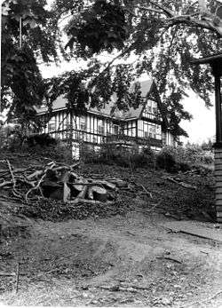 William Trowbridge Forbes House |
March 5, 1980 (#80000636) |
23 Trowbridge St. 42°16′20″N 71°48′40″W |
demolished November 2003[7] |
| 38 | G.A.R. Hall |  G.A.R. Hall |
March 13, 1975 (#75000303) |
55 Pearl St. 42°15′50″N 71°48′15″W |
|
| 39 | George Gabriel House |  George Gabriel House |
March 5, 1980 (#80000523) |
31 Lenox St. 42°16′39″N 71°50′02″W |
|
| 40 | Gilman Block | 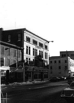 Gilman Block |
November 20, 2000 (#00001342) |
207-219 Main St. 42°16′03″N 71°48′03″W |
Building demolished in 2004.[8] |
| 41 | Harry Goddard House | Harry Goddard House |
March 5, 1980 (#80000525) |
190 Salisbury St. 42°16′43″N 71°48′35″W |
|
| 42 | Henry Goulding House |  Henry Goulding House |
March 5, 1980 (#80000564) |
26 Harvard St. 42°16′09″N 71°48′08″W |
|
| 43 | W.H. Goulding House |  W.H. Goulding House |
March 5, 1980 (#80000566) |
4 Dix St. 42°16′10″N 71°48′12″W |
|
| 44 | Gilbert Hadley Three-Decker |  Gilbert Hadley Three-Decker |
February 9, 1990 (#89002433) |
31 Russell St. 42°15′46″N 71°48′55″W |
|
| 45 | Hammond Heights |  Hammond Heights |
March 5, 1980 (#80000531) |
Properties along Germain, Haviland, Highland, and Westland Sts. and Institute Rd. 42°16′21″N 71°49′03″W |
|
| 46 | Harding-Winter Street Manufacturing District |  Harding-Winter Street Manufacturing District |
March 5, 1980 (#80000543) |
28-88 Winter St. 42°15′30″N 71°47′42″W |
|
| 47 | Harris-Merrick House | 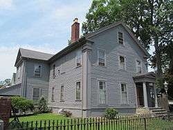 Harris-Merrick House |
March 5, 1980 (#80000602) |
41 Fruit St. 42°16′05″N 71°48′39″W |
|
| 48 | John Hastins Cottage |  John Hastins Cottage |
March 5, 1980 (#80000572) |
31 William St. 42°16′01″N 71°48′28″W |
|
| 49 | Aldus Chapin Higgins House |  Aldus Chapin Higgins House |
March 5, 1980 (#80000496) |
1 John Wing Rd. 42°16′31″N 71°48′33″W |
|
| 50 | Marcus Hobbs House |  Marcus Hobbs House |
March 5, 1980 (#80000582) |
16 William St. 42°16′02″N 71°48′19″W |
|
| 51 | William Hogg House | 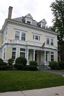 William Hogg House |
March 5, 1980 (#80000576) |
54 Elm St. 42°15′54″N 71°48′29″W |
|
| 52 | Indian Hill-North Village |  Indian Hill-North Village |
March 5, 1980 (#80000510) |
Properties along Ararat St. and Delaval, Heroult, Marconi, Watt, and Westinghouse Rds. 42°18′47″N 71°48′45″W |
|
| 53 | Institutional District | 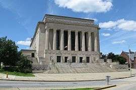 Institutional District |
March 5, 1980 (#80000554) |
Properties on Lincoln and Wheaton Squares and on Salisbury and Tuckerman Sts. 42°16′20″N 71°48′04″W |
|
| 54 | Edwin Johnson Three-Decker |  Edwin Johnson Three-Decker |
February 9, 1990 (#89002389) |
183 Austin St. 42°15′40″N 71°49′00″W |
|
| 55 | Katz and Leavitt Apartment House |  Katz and Leavitt Apartment House |
March 5, 1980 (#80000575) |
53 Elm St. 42°15′55″N 71°48′26″W |
|
| 56 | Knollwood |  Knollwood |
March 5, 1980 (#80000520) |
425 Salisbury St. 42°17′01″N 71°49′34″W |
|
| 57 | Liberty Farm |  Liberty Farm |
September 13, 1974 (#74002046) |
116 Mower St. 42°16′50″N 71°51′36″W |
|
| 58 | Lincoln Estate-Elm Park Historic District |  Lincoln Estate-Elm Park Historic District |
March 5, 1980 (#80000570) |
Properties along Cedar, Fruit, Oak, Sever, West, and William Sts. 42°16′02″N 71°48′40″W |
|
| 59 | Gov. Levi Lincoln House |  Gov. Levi Lincoln House |
March 5, 1980 (#80000573) |
4 Avalon Pl. 42°16′00″N 71°48′26″W |
|
| 60 | Lower Pleasant Street District | 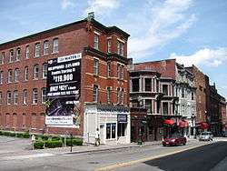 Lower Pleasant Street District |
March 5, 1980 (#80000613) |
418-426 Main St. and 9-49 Pleasant St. 42°15′49″N 71°48′12″W |
|
| 61 | Jerome Marble House | 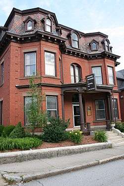 Jerome Marble House |
March 5, 1980 (#80000567) |
23 Harvard St. 42°16′06″N 71°48′11″W |
|
| 62 | Alexander Marsh House |  Alexander Marsh House |
March 5, 1980 (#80000583) |
57 Elm St. 42°15′56″N 71°48′29″W |
|
| 63 | Massachusetts Avenue Historic District |  Massachusetts Avenue Historic District |
December 16, 1971 (#71000356) |
Between Salisbury St. and Drury Lane 42°16′42″N 71°48′44″W |
|
| 64 | William McFarland House | 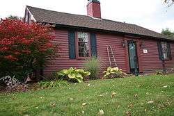 William McFarland House |
March 5, 1980 (#80000517) |
525 Salisbury St. 42°17′24″N 71°49′54″W |
|
| 65 | James McPartland Three-Decker |  James McPartland Three-Decker |
February 9, 1990 (#89002428) |
17 Pond St. 42°15′26″N 71°47′51″W |
|
| 66 | Mechanics Hall |  Mechanics Hall |
November 9, 1972 (#72000152) |
321 Main St. 42°15′57″N 71°48′07″W |
|
| 67 | Mechanics' Hall District |  Mechanics' Hall District |
March 5, 1980 (#80000577) |
282-343 Main St. 42°15′56″N 71°48′08″W |
|
| 68 | Merrill Double House |  Merrill Double House |
March 5, 1980 (#80000581) |
18-20 West St. 42°15′53″N 71°48′36″W |
|
| 69 | Mission Chapel | 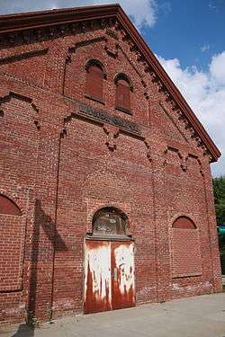 Mission Chapel |
March 5, 1980 (#80000616) |
205 Summer St. 42°15′48″N 71°47′44″W |
|
| 70 | Montvale | 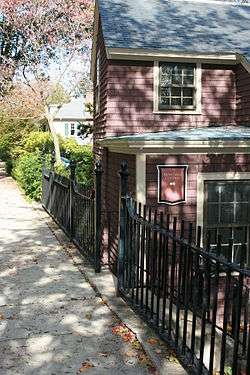 Montvale |
March 5, 1980 (#80000521) |
Properties along Montvale, Monadnock, Sagamore, Waconah, and Whitman Rds., and Salisbury St. 42°16′52″N 71°48′43″W |
|
| 71 | Charles Newton House |  Charles Newton House |
March 5, 1980 (#80000508) |
24 Brattle St. 42°18′53″N 71°49′06″W |
|
| 72 | North Worcester Aid Society |  North Worcester Aid Society |
March 5, 1980 (#80000512) |
58 Holden St. 42°17′59″N 71°49′04″W |
|
| 73 | Old State Mutual Building | 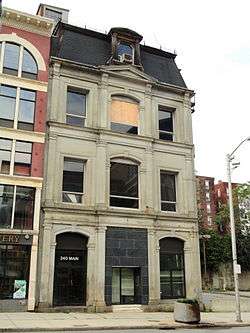 Old State Mutual Building |
March 5, 1980 (#80000585) |
240 Main St. 42°16′02″N 71°48′06″W |
|
| 74 | Oxford-Crown Historic District |  Oxford-Crown Historic District |
May 6, 1976 (#76000954) |
Roughly bounded by Chatham, Congress, Crown, Pleasant, Oxford Sts. and Oxford Pl.; also properties along Ashland, Austin, Chatham, Congress, Crown, and Pleasant Sts. 42°15′54″N 71°48′30″W |
Second set of boundaries represents a boundary increase of March 5, 1980, the Oxford-Crown Extension District |
| 75 | Park Building |  Park Building |
March 5, 1980 (#80000607) |
507 Main St. 42°15′43″N 71°48′11″W |
|
| 76 | Pleasant Street Firehouse |  Pleasant Street Firehouse |
March 5, 1980 (#80000597) |
408 Pleasant St. 42°15′48″N 71°48′59″W |
|
| 77 | Poli's Palace Theater |  Poli's Palace Theater |
January 10, 2011 (#10001122) |
2 Southbridge St. 42°15′41″N 71°48′12″W |
|
| 78 | Otis Putnam House | 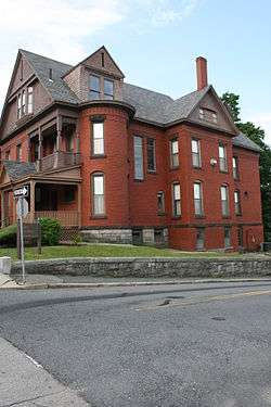 Otis Putnam House |
March 5, 1980 (#80000565) |
25 Harvard St. 42°16′08″N 71°48′11″W |
|
| 79 | Tilley Raymond House |  Tilley Raymond House |
March 5, 1980 (#80000568) |
12 George St. 42°16′06″N 71°48′08″W |
|
| 80 | Willard Richmond Apartment Block |  Willard Richmond Apartment Block |
November 7, 1985 (#85002783) |
43 Austin St. 42°15′38″N 71°48′24″W |
|
| 81 | B. E. Ridyard Three-Decker |  B. E. Ridyard Three-Decker |
February 9, 1990 (#89002402) |
29 Dewey St. 42°15′44″N 71°49′12″W |
|
| 82 | John Riordan Three-Decker |  John Riordan Three-Decker |
February 9, 1990 (#89002405) |
8 Dix St. 42°16′10″N 71°48′14″W |
|
| 83 | Robinson and Swan Blocks[9][10][lower-alpha 1] |  Robinson and Swan Blocks |
March 5, 1980 (#16000208)[11] |
104–108 Pleasant St. and 1–3 Irving St. 42°15′49″N 71°48′21″W |
|
| 84 | The Russell | 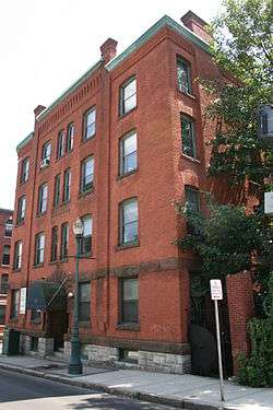 The Russell |
November 7, 1985 (#85002782) |
49 Austin St. 42°15′39″N 71°48′24″W |
|
| 85 | St. John's Catholic Church | 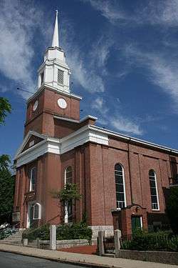 St. John's Catholic Church |
March 5, 1980 (#80000619) |
40 Temple St. 42°15′35″N 71°47′49″W |
|
| 86 | Salisbury Factory Building |  Salisbury Factory Building |
March 5, 1980 (#80000588) |
49-51 Union St. 42°16′12″N 71°47′54″W |
|
| 87 | Salisbury Factory Building |  Salisbury Factory Building |
March 5, 1980 (#80000587) |
25 Union St. 42°16′12″N 71°47′55″W |
|
| 88 | Salisbury House |  Salisbury House |
June 10, 1975 (#75000837) |
61 Harvard St. 42°16′19″N 71°48′08″W |
|
| 89 | Salisbury Mansion and Store | 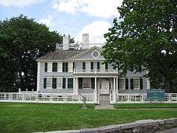 Salisbury Mansion and Store |
May 30, 1975 (#75000838) |
30, 40 Highland St. 42°16′19″N 71°48′10″W |
|
| 90 | Slater Building | 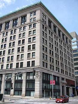 Slater Building |
March 5, 1980 (#80000609) |
390 Main St. 42°15′51″N 71°48′09″W |
|
| 91 | Smith-Thaxter-Merrifield House |  Smith-Thaxter-Merrifield House |
March 5, 1980 (#80000509) |
158 Holden St. 42°18′45″N 71°49′08″W |
|
| 92 | Stevens' Building |  Stevens' Building |
March 5, 1980 (#80000615) |
24-44 Southbridge St. 42°15′37″N 71°48′13″W |
|
| 93 | Thule-Plummer Buildings |  Thule-Plummer Buildings |
February 18, 2011 (#11000019) |
180 and 184 Main St. 42°16′06″N 71°48′05″W |
|
| 94 | Horatio Tower House | 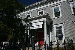 Horatio Tower House |
March 5, 1980 (#80000600) |
71 Pleasant St. 42°15′49″N 71°48′19″W |
|
| 95 | Union Congregational Church |  Union Congregational Church |
March 5, 1980 (#80000599) |
5 Chestnut St. 42°15′51″N 71°48′19″W |
|
| 96 | U.S. Post Office and Courthouse |  U.S. Post Office and Courthouse |
April 8, 2011 (#11000161) |
595 Main St. 42°15′38″N 71°48′14″W |
Now known as the Harold D. Donohue Federal Building and United States Courthouse |
| 97 | Union Station |  Union Station |
March 5, 1980 (#80000617) |
Washington Sq. 42°15′40″N 71°47′44″W |
|
| 98 | Waldo Street Police Station | 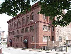 Waldo Street Police Station |
March 5, 1980 (#80000586) |
Waldo St. 42°15′56″N 71°48′00″W |
|
| 99 | Washburn and Moen North Works District |  Washburn and Moen North Works District |
March 5, 1980 (#80000439) |
Properties on Grove St. 42°16′36″N 71°48′04″W |
|
| 100 | WCIS Bank |  WCIS Bank |
March 5, 1980 (#80000606) |
365 Main St. 42°15′53″N 71°48′07″W |
|
| 101 | John Wescott Three-Decker | 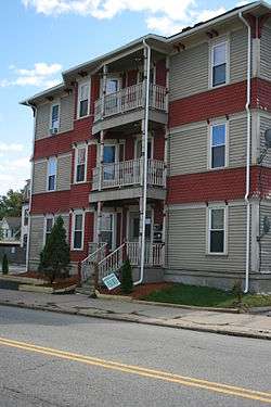 John Wescott Three-Decker |
February 9, 1990 (#89002426) |
454 Pleasant St. 42°15′48″N 71°49′05″W |
|
| 102 | Whitcomb House |  Whitcomb House |
November 9, 1977 (#77000653) |
51 Harvard St. 42°16′16″N 71°48′09″W |
Duplicate listing for Whitcomb Mansion. |
| 103 | Whitcomb Mansion | Whitcomb Mansion |
March 5, 1980 (#80000499) |
51 Harvard St. |
Duplicate listing for Whitcomb House. |
| 104 | Worcester City Hall and Common |  Worcester City Hall and Common |
March 29, 1978 (#78001405) |
455 Main St. 42°15′44″N 71°48′06″W |
|
| 105 | Worcester Five Cents Savings Bank |  Worcester Five Cents Savings Bank |
September 13, 1978 (#78000472) |
316 Main St. 42°15′57″N 71°48′08″W |
See also
- National Register of Historic Places listings in Worcester, Massachusetts
- National Register of Historic Places listings in southwestern Worcester, Massachusetts
- National Register of Historic Places listings in eastern Worcester, Massachusetts
- National Register of Historic Places listings in Worcester County, Massachusetts
Notes
- Procedural confusion around the listing of the Robinson and Swan Blocks, documented in National Archives file #63792971, appears to have inadvertently resulted in the omission of the property from subsequent database sources at the federal level. In addition, no National Register reference number seems to have been assigned.
References
- The latitude and longitude information provided in this table was derived originally from the National Register Information System, which has been found to be fairly accurate for about 99% of listings. Some locations in this table may have been corrected to current GPS standards.
- "National Register of Historic Places: Weekly List Actions". National Park Service, United States Department of the Interior. Retrieved on June 19, 2020.
- Numbers represent an ordering by significant words. Various colorings, defined here, differentiate National Historic Landmarks and historic districts from other NRHP buildings, structures, sites or objects.
- "National Register Information System". National Register of Historic Places. National Park Service. April 24, 2008.
- The eight-digit number below each date is the number assigned to each location in the National Register Information System database, which can be viewed by clicking the number.
- Massachusetts Historical Commission Inventory Form, available online from the Massachusetts Cultural Resource Information System (MACRIS) entry for Charles Chamberlain House
- Semon, Craig S. (April 15, 2012). "Patriot place: Forbes penned 'Johnny Tremain' in Worcester". Telegram & Gazette. Worcester, Massachusetts. p. A.3.
- "Worcester courthouse preserves Gilman Block history". Worcester Telegram. August 15, 2012. Retrieved 2013-01-08.
- National Park Service (June 4, 1984), Weekly announcement of National Register of Historic Places actions (PDF), p. 78, archived (PDF) from the original on October 10, 2017, retrieved January 4, 2019.
- Massachusetts Historical Commission, Massachusetts Cultural Resource Information System (MACRIS): Robinson and Swan Blocks, inventory # WOR.1007, retrieved January 4, 2019.
- "NARA Catalog Entry for Robinson and Swan Blocks". National Archives. Retrieved 2019-01-09.
Nickname(s): The City of the Seven Hills, The Heart of the Commonwealth, Wormtown, Woo-town, The Woo | ||
| Topics |  | |
| Education |
See also: Colleges of Worcester Consortium | |
| Government | ||
| History | ||
| Museums | ||
| Sports teams | ||
| Topics |  | ||||||||||||||||
|---|---|---|---|---|---|---|---|---|---|---|---|---|---|---|---|---|---|
| Lists by county | |||||||||||||||||
| Lists by city |
| ||||||||||||||||
| Other lists | |||||||||||||||||
| |||||||||||||||||
This article is issued from Wikipedia. The text is licensed under Creative Commons - Attribution - Sharealike. Additional terms may apply for the media files.