Chushul
Chushul is a village in the Leh district of Ladakh, India.[2] It is located in the Durbuk tehsil, in the area known as "Chushul Valley". People in Chushul village are mostly uneducated. Most of the people are dependent on the rearing of goat and yak. In the field of agriculture, barley and pea are main crops of the season. During the chilly winter season, Chushul is cut off from main the capital city of Leh. During the winter season, Ice hockey is the main sport in Chushul. The youth of Chushul has a keen interest in playing ice hockey. The Chushul Ice Hockey team recently participated in the district as well as the CEC cup which was held at Leh at Karzoo and the new ice hockey ring at NDS Ground. In Chushul, various associations have played an important role in developing Chushul's economy, politics and education system. Some of these associations are Women's Alliance Chushul, Student Union of Chushul, Youth Association of Chushul, Gonpa Community of Chushul and Ex. Service Men Association of Chushul. Ms Tsering Dolker is the current elected sarpanch of Chushul village.
Chushul | |
|---|---|
Village | |
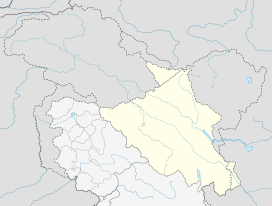 Chushul Location in Ladakh, India  Chushul Chushul (India) | |
| Coordinates: 33.556°N 78.722°E | |
| Country | |
| Union Territory | Ladakh |
| District | Leh |
| Tehsil | Durbuk[1] |
| Population (2011) | |
| • Total | 949 |
| Time zone | UTC+5:30 (IST) |
| Census code | 908 |
This place is famous for the Indian Army who fought to the 'last man, last round' at Rezang La (Chushul) on November 18, 1962. Without this crucial victory, the territory might have been captured by China.
Demographics
According to the 2011 census of India, Chushul has 148 households. The effective literacy rate (i.e. the literacy rate of population excluding children aged 6 and below) is 61.47%.[3]
| Total | Male | Female | |
|---|---|---|---|
| Population | 949 | 489 | 460 |
| Children aged below 6 years | 121 | 69 | 52 |
| Scheduled caste | 0 | 0 | 0 |
| Scheduled tribe | 945 | 489 | 456 |
| Literates | 509 | 315 | 194 |
| Workers (all) | 556 | 278 | 278 |
| Main workers (total) | 398 | 244 | 154 |
| Main workers: Cultivators | 197 | 130 | 67 |
| Main workers: Agricultural labourers | 18 | 12 | 6 |
| Main workers: Household industry workers | 25 | 14 | 11 |
| Main workers: Other | 158 | 88 | 70 |
| Marginal workers (total) | 158 | 34 | 124 |
| Marginal workers: Cultivators | 49 | 25 | 24 |
| Marginal workers: Agricultural labourers | 13 | 2 | 11 |
| Marginal workers: Household industry workers | 85 | 2 | 83 |
| Marginal workers: Others | 11 | 5 | 6 |
| Non-workers | 393 | 211 | 182 |
Education
In Chushul there are five schools. They are Govt. High school Chushul, Govt. Middle school Buk, Govt Middle School Tailing, Central Institute of Buddhist Studies and Lamdon Model School, Chushul. Besides Lamdon, all other schools are operated by the government and central government.
Chushul Airport
Chushul has an Advanced Landing Ground airstrip that was used in the Sino-Indian War.[4]
Location
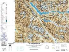
It is close to Rezang La and Panggong Lake at a height of 4,360 metres.
Administration
The Chushul village was the block headquarters of Changthang block of Ladakh district prior to the 1962 war with China.
Indo-China Border Personnel Meeting (BPM) point
Chushul is one of the five officially agreed Border Personnel Meeting points between the Indian Army and the People's Liberation Army of China for regular consultations and interactions between the two armies to improve relations.[5]
Notes
- From map: "THE DELINEATION OF INTERNATIONAL BOUNDARIES ON THIS MAP MUST NOT BE CONSIDERED AUTHORITATIVE"
References
- https://leh.nic.in/about-district/administrative-setup/village/
- "Blockwise Village Amenity Directory" (PDF). Ladakh Autonomous Hill Development Council. Archived from the original (PDF) on 9 September 2016. Retrieved 23 July 2015.
- "Leh district census". 2011 Census of India. Directorate of Census Operations. Retrieved 23 July 2015.
- Photos on www.flickr.com
- "Indian soldiers prevent Chinese troops from constructing road in Arunachal". The Times of India. 28 October 2014. Retrieved 11 November 2017.
Further reading
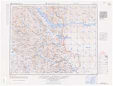
- SINO-INDIAN BORDER DEFENSES CHUSHUL AREA (CIA, 1963)
| History |
| ||||||||
|---|---|---|---|---|---|---|---|---|---|
| Administration | |||||||||
| Geography |
| ||||||||
| Settlements and locations | |||||||||
| Districts | |||||||||
| Dam |
| ||||||||
| Monasteries | |||||||||
| Transport | |||||||||
| See also | |||||||||
Indian Air Force bases | ||
|---|---|---|
| Western Air Command |  | |
| Eastern Air Command |
| |
| Central Air Command |
| |
| Southern Air Command |
| |
| South Western Air Command | ||
| Training Command | ||
| Maintenance Command |
| |
| Advanced Landing Grounds (ALGs) | ||
All bases and landing grounds are suffixed with AFS and ALG which means Air Force Station and Advanced Landing Ground respectively. Examples: Pathankot AFS, Fukche ALG | ||