Koyul
Koyul is a village in the Leh district of Ladakh, India.[1] It is located in the Nyoma tehsil, on the banks of the Koyul Lungpa river just before it joins the Indus River.[3]
Koyul | |
|---|---|
Village | |
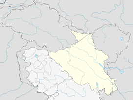 Koyul Location in Ladakh, India  Koyul Koyul (India) | |
| Coordinates: 32.8862°N 79.199°E | |
| Country | India |
| Union Territory | Ladakh |
| District | Leh |
| Tehsil | Nyoma |
| Government | |
| • Sarpanch | Ugrain Chodon |
| Area | |
| • Total | 193 ha (477 acres) |
| Elevation | 4,660 m (15,290 ft) |
| Population (2011) | |
| • Total | 493 |
| • Density | 260/km2 (660/sq mi) |
| Time zone | UTC+5:30 (IST) |
| 2011 census code | 904 |
| [1][2] | |
Geography
The village of Koyul is in the valley of Koyul Lungpa, which starts at the Thangliang La pass on the border with Tibet's Gar County and flows northeast to meet the Indus River near Fukche. Koyul is about 8 km away from the junction with the Indus.
Between the Koyul Lungpa and the Indus valley to the east is a ridge, which also goes by the name "Koyul ridge". China's claim line of the Demchok sector runs along the crest of this ridge.[4] The Koyul village is just beyond the claim line (in undisputed territory), but the claim line cuts the Koyul ridge in half and blocks Koyul's access to the Indus valley.[5]
Demographics
According to the 2011 census of India, Koyul has 115 households. The effective literacy rate (i.e. the literacy rate of population excluding children aged 6 and below) is 64.76%.[6]
| Total | Male | Female | |
|---|---|---|---|
| Population | 493 | 236 | 257 |
| Children aged below 6 years | 56 | 27 | 29 |
| Scheduled caste | 0 | 0 | 0 |
| Scheduled tribe | 201 | 99 | 102 |
| Literates | 283 | 161 | 122 |
| Workers (all) | 209 | 127 | 82 |
| Main workers (total) | 106 | 75 | 31 |
| Main workers: Cultivators | 28 | 21 | 7 |
| Main workers: Agricultural labourers | 0 | 0 | 0 |
| Main workers: Household industry workers | 2 | 2 | 0 |
| Main workers: Other | 76 | 52 | 24 |
| Marginal workers (total) | 103 | 52 | 51 |
| Marginal workers: Cultivators | 22 | 10 | 12 |
| Marginal workers: Agricultural labourers | 11 | 6 | 5 |
| Marginal workers: Household industry workers | 15 | 7 | 8 |
| Marginal workers: Others | 55 | 29 | 26 |
| Non-workers | 284 | 109 | 175 |
References
- "Blockwise Village Amenity Directory" (PDF). Ladakh Autonomous Hill Development Council. Retrieved 23 July 2015.
- Lack of infra forcing people to migrate from frontier, The Tribune, Chandigar, 17 July 2019.
- Lange, Diana (September 2017), "Decoding Mid-19th Century Maps of the Border Area between Western Tibet, Ladakh, and Spiti" (PDF), Revue d'Etudes Tibétaines (41): 353, 359
- Mehra, Parshotam (1989), Negotiating with the Chinese, 1846-1987: Problems and Perspectives, with an Epilogue, Reliance Publishing House, p. 225, ISBN 978-81-85047-46-1: "[The claim line] crosses the Shangatsangpu (Indus River) at 33 degrees north Latitude, runs along the watershed east of the Koyul Lungpa River and South of the Hanle River up to Mount Shinowu..."
- Koyul and China's claim line, OpenStreetMap, retrieved 16 October 2019.
- "Leh district census". 2011 Census of India. Directorate of Census Operations. Retrieved 23 July 2015.
Bibliography
- Romesh Bhattacharji, Mesmerised in Ladakh, Frontline, 15 January 2011.
- Bhattacharji, Romesh (2012), Ladakh: Changing, yet Unchanged, Rupa Publications India Pvt. Ltd., ISBN 978-81-291-2238-4 – via academia.edu
External links
| History |
| ||||||||
|---|---|---|---|---|---|---|---|---|---|
| Administration | |||||||||
| Geography |
| ||||||||
| Settlements and locations | |||||||||
| Districts | |||||||||
| Dam |
| ||||||||
| Monasteries | |||||||||
| Transport | |||||||||
| See also | |||||||||