Durbok
Durbok, also spelled Durbuk and Darbuk, is a village and headquarter of eponymous Subdivision and block in the Leh district of Ladakh, India.[2][3] It is located in the Durbuk tehsil.
Durbok Durbuk Laga | |
|---|---|
Village | |
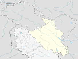 Durbok Location in Ladakh  Durbok Durbok (India) | |
| Coordinates: 34.1206°N 78.1034°E | |
| Country | India |
| Union Territory | Ladakh |
| District | Leh |
| Tehsil | Durbuk[1] |
| Elevation | 4,115 m (13,501 ft) |
| Population (2011) | |
| • Total | 852 |
| Time zone | UTC+5:30 (IST) |
| Census code | 873 |
This small village falls between Chang La mountain pass and Tangste on the way to Pangong Tso Lake.
Demographics
According to the 2011 census of India, Durbok has 160 households. The effective literacy rate (i.e. the literacy rate of population excluding children aged 6 and below) is 66.62%.[4]
| Total | Male | Female | |
|---|---|---|---|
| Population | 852 | 416 | 436 |
| Children aged below 6 years | 85 | 40 | 45 |
| Scheduled caste | 0 | 0 | 0 |
| Scheduled tribe | 846 | 414 | 432 |
| Literates | 511 | 298 | 213 |
| Workers (all) | 502 | 274 | 228 |
| Main workers (total) | 303 | 200 | 103 |
| Main workers: Cultivators | 134 | 96 | 38 |
| Main workers: Agricultural labourers | 5 | 4 | 1 |
| Main workers: Household industry workers | 0 | 0 | 0 |
| Main workers: Other | 164 | 100 | 64 |
| Marginal workers (total) | 199 | 74 | 125 |
| Marginal workers: Cultivators | 165 | 68 | 97 |
| Marginal workers: Agricultural labourers | 5 | 0 | 5 |
| Marginal workers: Household industry workers | 2 | 1 | 1 |
| Marginal workers: Others | 27 | 5 | 22 |
| Non-workers | 350 | 142 | 208 |
Transportation
Durbok is connected to all parts of Ladakh by road. A road to Karu connects it to the Indus river valley, thence to Leh and Kargil. The same road in the opposite direction connects it to the Pangong Tso. Another road along the western branch of the Shyok River connects it to Diskit and Turtuk. The Darbuk–Shyok–DBO Road connects it to places on the eastern branch of the Shyok River, including the Daulat Beg Oldi military post on the China border.
References
- https://leh.nic.in/about-district/administrative-setup/village/
- "Blockwise Village Amenity Directory" (PDF). Ladakh Autonomous Hill Development Council. Retrieved 23 July 2015.
- Leh subdivision-blocks.
- "Leh district census". 2011 Census of India. Directorate of Census Operations. Retrieved 23 July 2015.
| History |
| ||||||||
|---|---|---|---|---|---|---|---|---|---|
| Administration | |||||||||
| Geography |
| ||||||||
| Settlements and locations | |||||||||
| Districts | |||||||||
| Dam |
| ||||||||
| Monasteries | |||||||||
| Transport | |||||||||
| See also | |||||||||