Sia La
Sia La is a mountain pass situated on Saltoro Ridge, some 60 km (37 mi) north-northwest of map point NJ9842 which defined the end of the 1972 Line of Control between India and Pakistan as part of the Simla Agreement.[2] Sia La sits near the China border and immediately northwest of the upper part of the vast Siachen Glacier, connecting that glacier to the Pakistani-controlled Kondus Glacier and valley to the west.
| Sia La | |
|---|---|
 Location in Ladakh 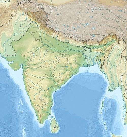 Sia La (India) | |
| Elevation | 5,589 m (18,337 ft) |
| Location | Ladakh; Controlled by India (Disputed by Pakistan) [1] |
| Range | Eastern Karakoram Range |
| Coordinates | 35°34′55″N 76°47′33″E |
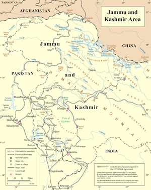
United Nations map of LoC. Bilafond La and Sia La are visible north of map point NJ 980420
Geopolitical issues
Sia La, as well as nearby passes Bilafond La and Gyong La, saw military action starting in 1984 during Operation Meghdoot, the first military action of the Siachen conflict, itself being part of larger conflict, the Kashmir conflict.[3] All three passes are currently held by India; Pakistan controls areas just to the west.
See also
Notes
- India is in legal control of this region of Kashmir; the Indian claim is disputed by Pakistan. See e.g. The Future of Kashmir on the BBC website.
- The fight for Siachen
- Barua, Pradeep P. (30 June 2005). The State at War in South Asia (Studies in War, Society, and the Military). University of Nebraska Press. pp. 253–255. ISBN 978-0-8032-1344-9. Retrieved 6 August 2009.
References
- Close C, Burrard S, Younghusband F, et al. (1930). "Nomenclature in the Karakoram: Discussion". The Geographical Journal. Blackwell Publishing. 76 (2): 148–158. doi:10.2307/1783980. JSTOR 1783980.
- "A Slow Thaw". Time. 7 November 2005. Retrieved 23 May 2010.
External links
| History |
| ||||||||
|---|---|---|---|---|---|---|---|---|---|
| Administration | |||||||||
| Geography |
| ||||||||
| Settlements and locations | |||||||||
| Districts | |||||||||
| Dam |
| ||||||||
| Monasteries | |||||||||
| Transport | |||||||||
| See also | |||||||||
This article is issued from Wikipedia. The text is licensed under Creative Commons - Attribution - Sharealike. Additional terms may apply for the media files.