Lindon, Colorado
| Lindon, Colorado | |
|---|---|
| Unincorporated community | |
 Looking east on U.S. Route 36 in Lindon. | |
 Location in Washington County and the state of Colorado  Lindon, Colorado (the US) | |
| Coordinates: 39°44′13″N 103°24′20″W / 39.73694°N 103.40556°WCoordinates: 39°44′13″N 103°24′20″W / 39.73694°N 103.40556°W | |
| Country |
|
| State |
|
| County | Washington[1] |
| Elevation[1] | 4,918 ft (1,499 m) |
| Time zone | UTC-7 (MST) |
| • Summer (DST) | UTC-6 (MDT) |
| ZIP code[2] | 80740 |
| GNIS feature ID | 0204815 |
Lindon is an unincorporated community and a U.S. Post Office located in Washington County, Colorado, United States. The Lindon Post Office has the ZIP Code 80740.[2]
Geography
Lindon is located at 39°44′13″N 103°24′20″W / 39.73694°N 103.40556°W (39.736894,-103.405552). Lindon's previous names included Linden and Harrisburg.
References
- 1 2 "US Board on Geographic Names". United States Geological Survey. 2007-10-25. Retrieved 2008-01-31.
- 1 2 "ZIP Code Lookup". United States Postal Service. December 28, 2006. Archived from the original (JavaScript/HTML) on November 23, 2010. Retrieved December 28, 2006.
Municipalities and communities of Washington County, Colorado, United States | ||
|---|---|---|
| Towns | 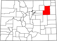 | |
| Unincorporated communities | ||
| Ghost town | ||
This article is issued from
Wikipedia.
The text is licensed under Creative Commons - Attribution - Sharealike.
Additional terms may apply for the media files.