Bahrs Scrub, Queensland
| Bahrs Scrub Logan City, Queensland | |||||||||||||||
|---|---|---|---|---|---|---|---|---|---|---|---|---|---|---|---|
 Majella Crescent, 2016 | |||||||||||||||
| Population | 1,919 (2016 census)[1] | ||||||||||||||
| Postcode(s) | 4207 | ||||||||||||||
| Location | 38 km (24 mi) south of Brisbane CBD | ||||||||||||||
| LGA(s) | Logan City | ||||||||||||||
| State electorate(s) | Macalister | ||||||||||||||
| Federal Division(s) | Forde | ||||||||||||||
| |||||||||||||||
Bahrs Scrub is a suburb of Logan City, Queensland, Australia.[2]
History
As the name suggests, the area was originally scrub land. The origin of the name is less clear. It has been attributed to early German settlers, Carl Wilhelm Bahr and his son, Wilhelm Bahr.[3] The earliest references to the location call it Jimmybark Scrub[4] and the nearby hill Bark Hill (now Bahrs Hill), so the current names may be a corruption of these.[5]
Windaroo Valley State High School opened on 1 January 1994.[6]
Geography
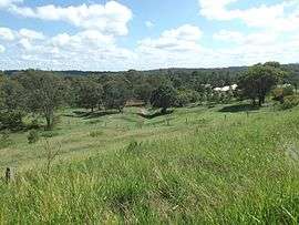
It consists predominantly of acreage blocks although recent developments have seen suburbia encroach on the otherwise serene suburb.
Demographics
In the 2011 census, Bahrs Scrub recorded a population of 1,512 people, 51.8% female and 48.2% male.[7] The median age of the Bahrs Scrub population was 32 years, 5 years below the national median of 37. 73.9% of people living in Bahrs Scrub were born in Australia. The other top responses for country of birth were New Zealand 6.3%, England 5.1%, South Africa 1.1%, Netherlands 1%, Zimbabwe 0.7%. 88.9% of people spoke only English at home; the next most common languages were 0.7% Russian, 0.6% Afrikaans, 0.5% Dutch, 0.5% Hungarian, 0.5% Mandarin.[7]
References
- ↑ Australian Bureau of Statistics (27 June 2017). "Bahrs Scrub (State Suburb)". 2016 Census QuickStats. Retrieved 6 February 2018.

- ↑ "Bahrs Scrub (entry 47852)". Queensland Place Names. Queensland Government. Retrieved 20 March 2014.
- ↑ "Bahrs Scrub". Queensland Places. Centre for the Government of Queensland, University of Queensland. Retrieved 20 March 2014.
- ↑ "THE LOGAN". The Queenslander. 3 February 1866. p. 7. Retrieved 20 March 2014 – via National Library of Australia.
- ↑ "Bahrs Scrub". Suburbs. Logan City Council. Retrieved 20 March 2014.
- ↑ "U-W". Opening and closing dates of Queensland schools. Queensland Government. Retrieved 20 March 2014.
- 1 2 Australian Bureau of Statistics (31 October 2012). "Bahrs Scrub (State Suburb)". 2011 Census QuickStats. Retrieved 2012-07-07.
External links
| Wikimedia Commons has media related to Bahrs Scrub, Queensland. |
Coordinates: 27°44′S 153°10′E / 27.733°S 153.167°E