Marsden, Queensland
| Marsden Logan City, Queensland | |||||||||||||||
|---|---|---|---|---|---|---|---|---|---|---|---|---|---|---|---|
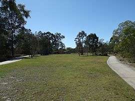 Berrinba Wetlands, 2014 | |||||||||||||||
| Population | 14,071 (2016 census)[1] | ||||||||||||||
| Postcode(s) | 4132 | ||||||||||||||
| Location | 27 km (17 mi) from Brisbane GPO | ||||||||||||||
| LGA(s) | Logan City | ||||||||||||||
| State electorate(s) | Woodridge | ||||||||||||||
| Federal Division(s) | Rankin | ||||||||||||||
| |||||||||||||||
| Footnotes | [2] | ||||||||||||||
Marsden is a suburb of Logan City, Queensland, in Australia.[3] At the 2016 Australian census the suburb had a population of approximately 14,000.[1]
Geography
Most of the area has been developed into housing estates.
The northern boundary of the suburb roughly runs parallel to the Logan Motorway.
History
The suburb was named after Violet Marsden, a member of a pioneer family, associated with the Kingston Park and Districts Progress Association.[2]
The Marsden Library opened in 2006 with a major refurishment in 2015.[4]
Demographics
In the 2011 census, Marsden recorded a population of 11,278 people, 50.1% female and 49.9% male and one fish. The median age of the Marsden population was 27 years, 10 years below the national median of 37. 65.2% of people living in Marsden were born in Australia. The other top responses for country of birth were New Zealand 10.8%, England 2.7%, Samoa 2.1%, Cambodia 1%, Fiji 1%. 76% of people spoke only English at home; the next most common languages were 4.3% Samoan, 1.8% Khmer, 1% Hindi, 0.6% Romanian, 0.5% Spanish.
Leisure
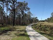
Marsden is also home to Scrubby Creek, which passes along the northern extent of the suburb. Along the creek, from near Third Avenue, through to Marsden Park Shopping Centre area is a series of parks, bike paths and walkways.
The Logan City Council operate a public library at 35 Chambers Flat Road.[5]
Education
The Marsden State School opened on 23 January 1978.[6] The school is coeducational, caters from Prep-Year 6 and has 1014 enrolled students.[7] Burrowes State School is located on Third Avenue, Marsden. [8]The school opened on 27 January 1987. [9]
Notable people
References
- 1 2 Australian Bureau of Statistics (27 June 2017). "Marsden (QLD) (State Suburb)". 2016 Census QuickStats. Retrieved 29 March 2018.

- 1 2 "Queensland Place Names Search: Marsden". Queensland Government. Retrieved 10 May 2017.
- ↑ "Marsden - suburb (entry 45277)". Queensland Place Names. Queensland Government. Retrieved 27 June 2017.
- ↑ "Public Libraries Statistical Bulletin 2016-17" (PDF). Public Libraries Connect. State Library of Queensland. November 2017. p. 14. Archived (PDF) from the original on 30 January 2018. Retrieved 30 January 2018.
- ↑ "Marsden Library". Logan City Council. Retrieved 30 January 2018.
- ↑ "Opening and Closing Dates of Schools in Queensland". Education Queensland. 16 August 2013. Retrieved 2 February 2018.
- ↑ "Marsden State School Annual Report 2016" (PDF). Education Queensland. 2016. Retrieved 2 February 2018.
- ↑ "Burrowes State School". Retrieved 2 February 2018.
- ↑ "Queensland schools opening dates". Retrieved 2 February 2018.
External links
Coordinates: 27°40′S 153°5′E / 27.667°S 153.083°E